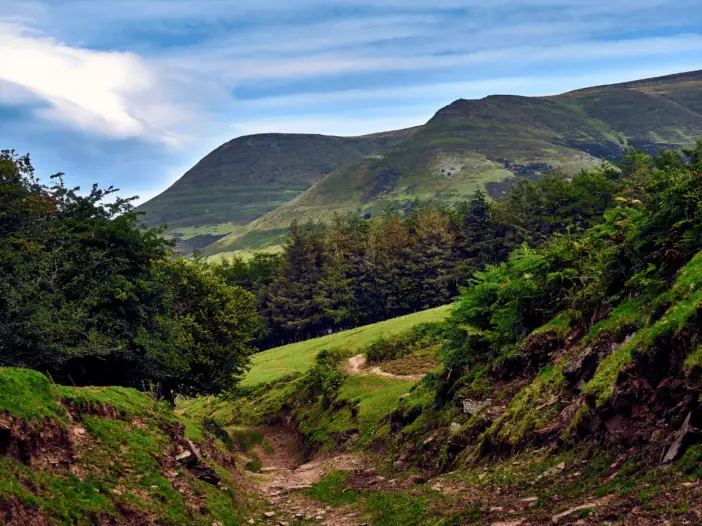
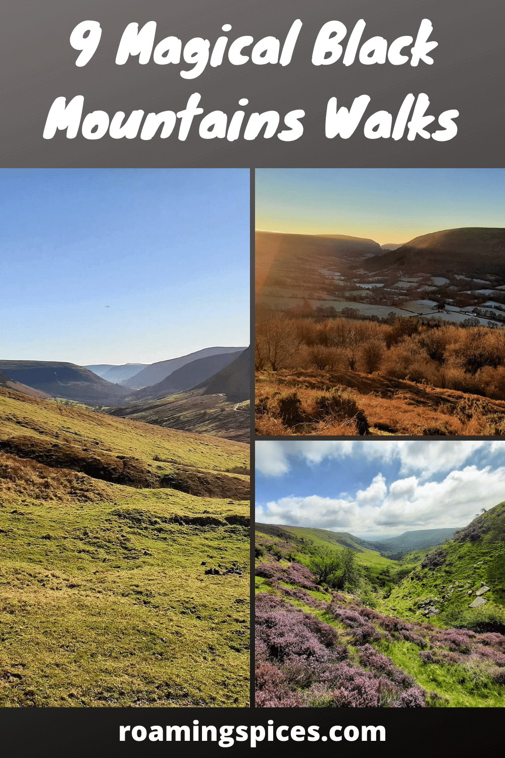
Black Mountains, Brecon Beacons National Park
A selection of incredible Black Mountains walks gives you the opportunity to experience the wonders of this easternmost range of the Brecon Beacons National Park in the best possible way
Walks in the Black Mountains
Many things help define a great hike, and we all probably have slightly differing opinions as to what these are. But we think it is fair to say that common themes draw us all to the outdoors to experience an excellent hiking adventure.
These include but are not limited to hills/mountains, rivers, flora & fauna. Thankfully, there is a bountiful supply for those looking to enjoy one of the many magical Black Mountains walks.
However, before delving into the multitude of Black Mountains walking routes available, we feel it prudent to highlight some helpful information about this mountain range for those looking to visit.
Where are the Black Mountains?
The Black Mountains (Welsh: Y Mynyddoedd Duon) are a group of hills located within the counties of Powys and Monmouthshire in southeastern Wales. They lie almost entirely within the boundaries of the Brecon Beacons National Park but extend a short distance across the Wales/England border into Herefordshire.
The Black Mountains are the easternmost of the four mountain ranges that comprise the Brecon Beacons National Park. The other three are the Brecon Beacons, Fforest Fawr Massif and the Black Mountain range. If you think this is unclear, Black Mountain and Black Hill are also in the Black Mountains.
As a general rule of thumb, the Black Mountains can be roughly described as the hills located within the area of a triangle created by the towns of Abergavenny in the southeast, Hay-on-Wye in the north and the village of Llangors (Llangorse) in the west.
Selection of Black Mountains Walks
1. Skirrid Circular Walk
- Distance: 3.4 miles (5.5km)
- Difficulty: Moderate
- Time: 2 hours (approx)
- Map: OS Explorer Map OL13: Brecon Beacons National Park (Eastern Area)
- Starting Grid reference: SO 328 164
- Parking: The Skirrid car park is situated just off the B4521 (Old Ross Road) just 1.5 miles (2.4 km) east of Abergavenny on the left-hand side – Full address: Llanddewi Skirrid, Abergavenny, NP7 8AP
Situated in the southeastern corner of the Black Mountains, the Skirrid is a great hill to climb if you are on the lookout for a walk that is not too challenging, doesn’t take too long, offers some top rewards and is an all-round super introduction to the Black Mountains.
This may be just a short hike, but it also offers superb variety. The initial section of the walk takes you up through the idyllic Caer Wood and Pant Skirrid Wood.
The next section flattens out and leads you along the western flank of the hill, with the occasional break in the foliage to offer beautiful views of the Gavenny Valley and Sugarloaf Mountain.
Then comes the tough bit, the steep ascent to the summit up the northern ridge. Thankfully the climb is short, but the views from the top are spectacular.
Check out our trail review of the Skirrid Walk.
______________________________
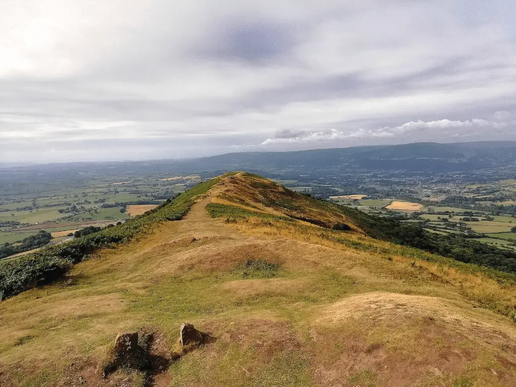
2. Mynydd Llangorse Walk
- Distance: 2.98 miles (4.8 km)
- Difficulty: Moderate
- Time: 2 hours (approx)
- Map: OS Explorer Map OL13: Brecon Beacons National Park (Eastern Area)
- Starting Grid reference: SO 147 267.
- Parking: An excellent place to park is the Llangorse Multi Activity Centre, a couple of kilometres outside Llangorse – postcode LD3 7UH.
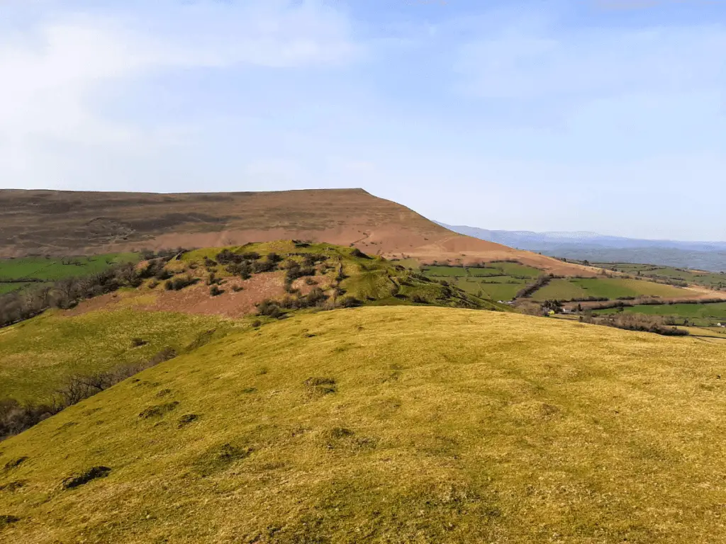
Llangorse Mountain is situated on the western edge of the Black Mountains, offering a short walk that is moderately challenging but highly rewarding. Once the initial ascent is behind you, stroll the summit plateau and absorb the stunning scenery surrounding you.
From the Llangorse Multi Activity Centre, head due east across a couple of fields. From this point, the ascent steepens considerably.
Once you reach the large summit plateau, take some time to get some air back in your lungs and soak in the wonderful views out to the west/southwest across Llangorse Lake and the peaks of the central Brecon Beacons.
Take the obvious trail across the plateau to the south leading you to the summit trig point. From here, retrace your steps along the same route, this time enjoying the views to the east across the multiple peaks of the Black Mountains.
Check out our trail review of the Mynydd Llangorse walk.
______________________________
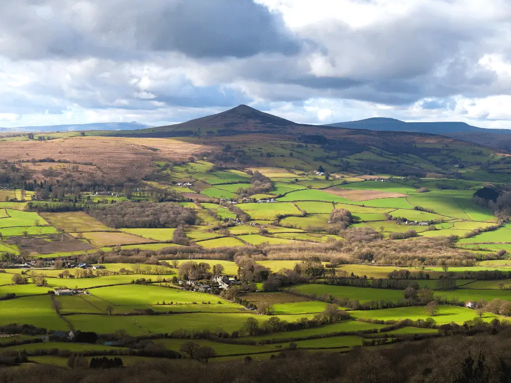
3. Sugarloaf Mountain Walk
- Distance: 4 miles (6.4km)
- Difficulty: Moderate
- Time: 3-4 hours
- Map: OS Explorer Map OL13: Brecon Beacons National Park (Eastern Area)
- Starting Grid reference: SO 268 166.
- Parking: Use Llanwenarth car park for this one – postcode NP7 7LA
Sugarloaf Mountain is as instantly recognisable as Venus is to a night sky! Its distinctive conical outline is unmistakable, creating a common misconception that it is an extinct volcano.
Sugarloaf is one of the more popular Black Mountains walks in the southern section of the range, so arriving early, especially on weekends, is a must!
There are many routes to the top of Sugarloaf, but the one we opted for commences at the Llanwenarth car park. The trail initially heads east across open moorland before entering the beautiful, mystical oak woodland, Deri Fach, at its southern end.
At the far end of the wood, the trail breaks out on to open hillside, and the steep climb to the summit of Sugarloaf commences.
Once at the top, the rewards of your efforts are plain to see with breathtaking 360-degree views across South Wales, the Brecon Beacons and the Bristol Channel into southwest England.
Check out our trail review of the Sugarloaf Mountain walk.
______________________________
4. Waun Fach Walk (via the Dragon’s Back)
- Walk distance: 7.70 miles (12.4 km)
- Difficulty: Moderate/Challenging.
- Time: 4 – 4.5 hours.
- Map: OS Explorer Map OL13: Brecon Beacons National Park (Eastern Area)
- Starting Grid reference: SO 173 296.
- Parking: Car park at The Dragons Back Pub & Bunkhouse. This is located on the A479 in the village of Pengenffordd between Talgarth and Crickhowell, in the northeast section of the Brecon Beacons National Park. There is a modest £2 fee to park for the day.
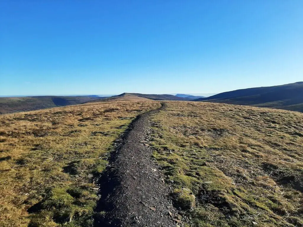
If you are looking for a challenging and exhilarating hike to the highest peak in the Black Mountains, the Waun Fach circular walk via the Dragon’s Back is the one for you!
Enjoy a succession of breathtaking views across the peaks of the Black Mountains, Brecon Beacons and the verdant valleys on this highly rewarding hike.
The first part of the walk exposes you to a bit of history as the trail leads you up to the 450-metre summit of Castell Dinas. Here once stood a Norman Castle and Iron Age hill fort, the remains of which are still visible today.
It’s then on to the Dragon’s Back, the narrow ridge that ascends steeply over 3 km to the main summit plateau. From here, the trail swings to the south and climbs gently to the summit of Waun Fach.
You may be happy to hear that the return portion of the hike is all downhill, so you can focus your energy on the beautiful vistas surrounding you.
Check out our trail review of the Waun Fach walk.
______________________________
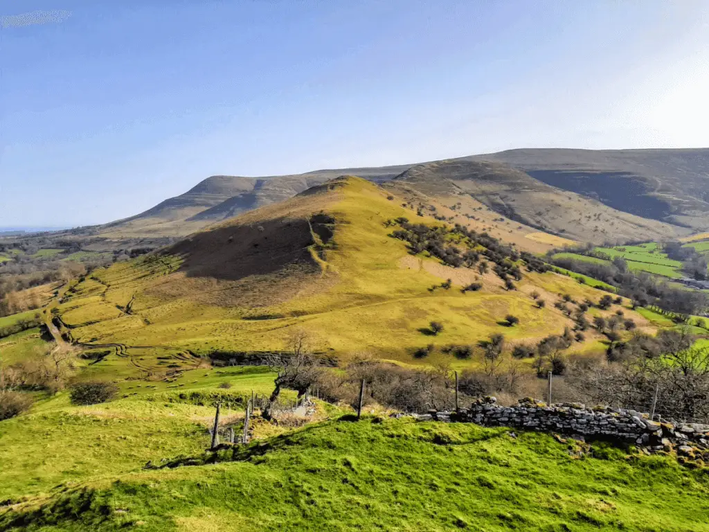
5. Pen Cerrig Calch Walk (Plus Table Mountain & Pen Allt Mawr)
- Walk distance: 11.25 miles (18.1 km)
- Difficulty: Challenging.
- Time: 5 – 6 hours.
- Map: OS Explorer Map OL13: Brecon Beacons National Park (Eastern Area)
- Starting Grid reference: SO216185.
- Parking: Crickhowell High School car park. This is located just off New Road in Crickhowell. This is only available on weekends.
Enjoy the challenging 18 km Pen Cerrig Calch walk, also taking in the summits of Table Mountain (Crug Hywel) & Pen Allt Mawr.
Starting from the picturesque town of Crickhowell, nestling in the beautiful Usk Valley, the first stage of this epic hike leads you to the distinctive flat-topped Table Mountain, the former home of an Iron-Age hill fort.
It’s then on to the 701-metre summit of Pen Cerrig Calch, before the long northerly flattish stretch to Pen Allt Mawr, along the plateau’s westerly ridge. From here, you will experience splendid views across many of the peaks of the Black Mountains, including Llangorse Mountain, Mynydd Troed and Waun Fach.
The return section hugs the opposite ridge as you return to Pen Cerrig Calch before returning to the start point.
This is one of the more challenging Black Mountains walks. However, it can be abbreviated by making a round trip to Table Mountain or Pen Cerrig Calch.
Check out our trail review of the Pen Cerrig Calch walk.
______________________________
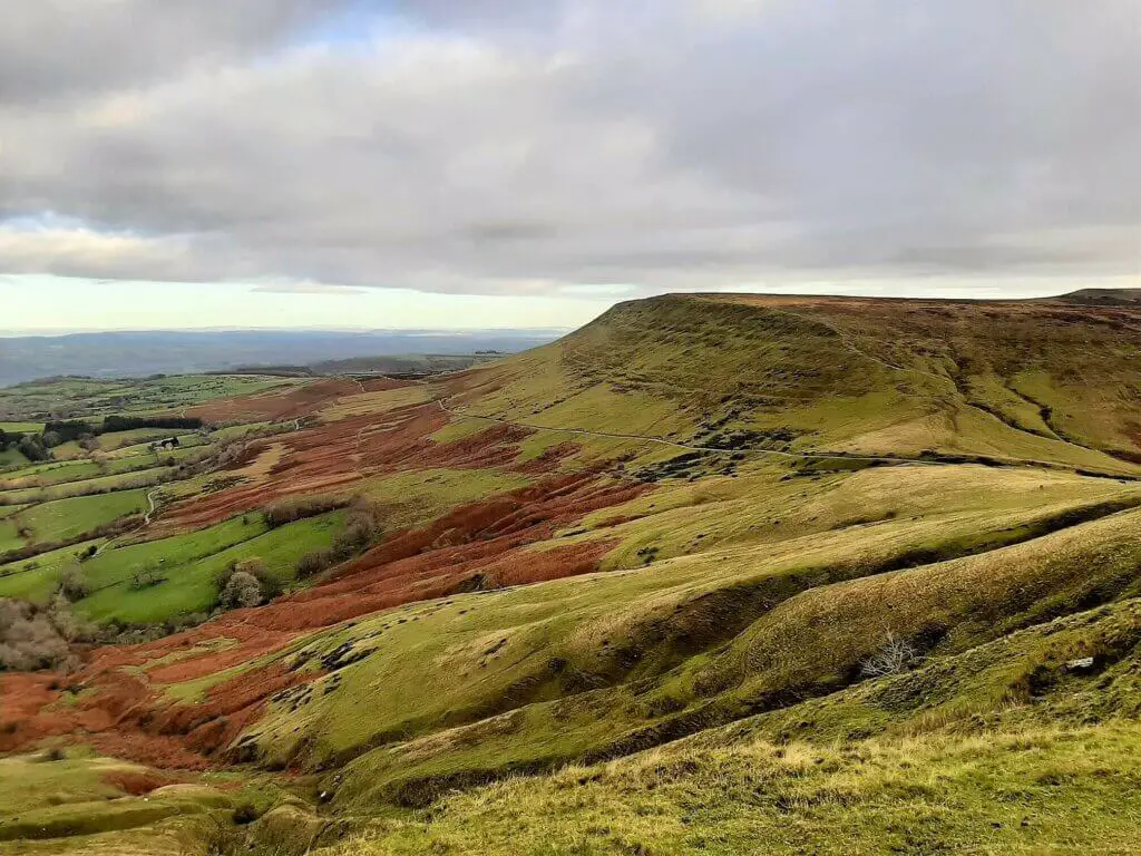
6. Hay Bluff Walk
- Walk distance: 5.65 miles (9.1 km)
- Difficulty: Moderate.
- Time: 3 – 3.5 hours.
- Map: OS Explorer Map OL13: Brecon Beacons National Park (Eastern Area)
- Starting Grid reference: SO239373.
- Parking: Hay Bluff Car Park. Located a short distance to the northwest of the Hay Bluff escarpment.
Located at the northern edge of the Black Mountains, the Hay Bluff circular walk takes in the rugged peaks of Hay Bluff, Twmpa, and Gospel Pass, Wales’ highest road pass.
This location was used in filming the opening scenes of “An American Werewolf in London”. So be sure to avoid it when it’s dark and foggy!
It’s up the steep escarpment to the summit plateau of Hay Bluff, the only genuinely taxing section of the hike. From here, the westerly and south-westerly views across the Brecon Beacons National Park are phenomenal and far-reaching.
The southwesterly trail leads you along the ridge before gradually descending into Gospel Pass. From here, it’s a reasonably sedate climb to the summit of Twmpa.
You then drop back into the valley before returning to the car park via a small picturesque country road.
Check out our trail review of the Hay Bluff Walk.
______________________________
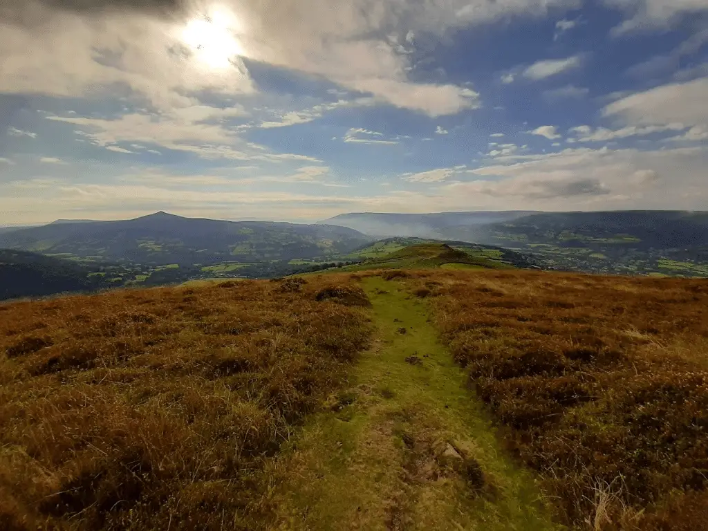
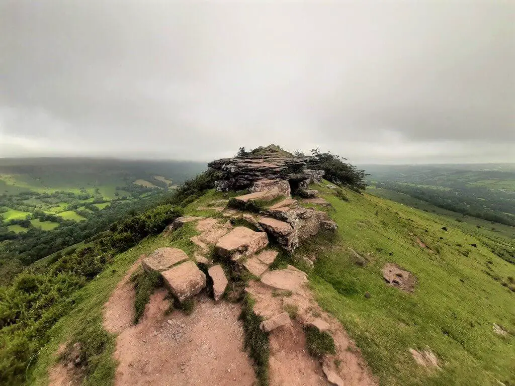
7. Black Hill Walk
- Walk distance: 4.91 miles (7.9 km)
- Difficulty: Moderate.
- Time: 2.5 – 3 hours.
- Map: OS Explorer Map OL13: Brecon Beacons National Park (Eastern Area)
- Starting Grid reference: SO288328.
- Parking: Black Hill car park. Located at the start point of the walk.
Of all the Black Mountains walks listed here, this is the only one located entirely outside Wales and within the English county of Herefordshire.
This exhilarating ridge walk, known locally as the Cat’s Back, is situated in the northeastern corner of the Black Mountains, a short distance across the Olchon Valley from the Welsh border.
The ridge is narrow, affording dramatic views (subject to weather) into the verdant Olchon Valley to the west and across the sprawling Herefordshire countryside to the east.
Shortly after reaching the summit of Black Hill and enjoying the northern views towards the Wye Valley, the trail sweeps back into the Olchon Valley.
Now you can witness this idyllic valley, blanketed by various colourful ferns and heather and flanked by the dramatic valley sides.
Check out our trail review of the Black Hill Walk.
______________________________
8. Vale of Ewyas Horseshoe Walk
- Distance: 17.47 miles (28.1 km)
- Difficulty: Challenging
- Time: 8-9 hours
- Map: OS Explorer Map OL13: Brecon Beacons National Park (Eastern Area)
- Starting Grid reference: SO288278
- Parking: Llanthony Priory – postcode (nearest) – NP7 7NN
If you would like to witness the rugged beauty of the Black Mountains whilst experiencing a challenging full-day hike, the Vale of Ewyas horseshoe walk is certainly one to consider.
The walk starts alongside the well-preserved ruins of Llanthony Priory in the idyllic, steep-sided Vale of Ewyas.
The first section of the walk leads you up to Hatterrall Ridge, where you intercept the long-distance Offa’s Dyke Path, heading northwest.
This ridge forms the boundary between England and Wales, with the English county of Herefordshire to the east and the Brecon Beacons National Park of Wales to the west.
Upon reaching the summit of Hay Bluff, it’s time to absorb some of the beautiful views on offer from the edge of its steep escarpment, northern stretches of the Brecon Beacons National Park and the Wye Valley.
The trail crosses the head of the Ewyas Valley into Gospel Pass, Wales’ highest road pass, before climbing once more to the peaks of Twmpa and Rhos Dirion.
Here, the trail switches back to the southeast and follows the ridge down the opposite side of the Ewyas Valley, crossing the peaks of Chwarel y Fan and Bal Mawr.
Upon reaching the stone marker for the Beacons Way, the trail leads you steeply back into the valley, and Llanthony Priory comes into sight once more.
This is a very long and exposed hike, so picking the right weather for this walk is essential. Grab yourself a nice day, and you will be in for a real treat with views that will last long in your memory!
Check out our trail review of the Vale of Ewyas horseshoe walk.
______________________________
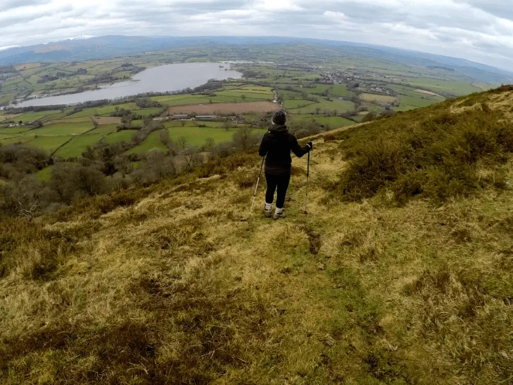
9. Mynydd Troed Walk
- Distance: 5.46 miles (8.8 km)
- Difficulty: Moderate
- Time: 3.5 – 4 hours
- Map: OS Explorer Map OL13: Brecon Beacons National Park (Eastern Area)
- Starting Grid reference: SO173296
- Parking: Dragon’s Back car park – postcode (nearest) – LD3 0EP
A hike to the summit of Mynydd Troed is an absolute pleasure, especially if you are looking for a stunning variety of vistas. The ascent to the top may be a little lung-busting, but once there, you will instantly be happy you put in the effort.
To the east, you have the Rhiangoll Valley rising to the peaks of the central Black Mountains. A few miles to the southwest is the glistening Llangorse Lake, with the distant Pen-y-Fan clear to see on a good day.
Marvel in these incredible views as you head southeast along the sedate summit ridge before backtracking to the Trig Point and breaking down the western slopes.
Soak in the beautiful westerly views as you drop steeply into the valley separating Mynydd Troed from Mynydd Llangorse. Incidentally, here is another small parking area should you wish to commence your walk from this location.
From here, the trail swings around the mountain’s northern base, ultimately linking up with the path on which you arrived.
Check out our trail review of the Mynydd Troed Walk.
______________________________
What other Black Mountains Activities are there?
If walking is not your thing, you will be happy to hear that there are plenty of other Black Mountains activities to satisfy the outdoor enthusiast.
Camping
If you love the outdoors, then a spot of Black Mountains camping could be what you are looking for. With several highly rated campsites in and around the Black Mountains, you will indeed find a location to explore the exquisite countryside that awaits. Here are some of those camping spots:
- Cwmdu Campsite
- Gilfach Camping
- Llanthony Campsite
- Llanthony Treats
- Newcourt Farm Campsite
- The Rising Sun, Camping & Caravan Site
______________________________
Horse Riding & Pony Trekking
If you prefer to explore on horseback, you will find numerous opportunities in and around the Black Mountains. So, whether you are looking for a day’s pony trekking, horse riding lessons or horse riding holidays, you will find an organisation that can cater to your needs. Here is a selection of highly rated companies worth checking out:
- Ellesmere Riding & Trekking Centre
- Grange Pony Trekking
- Llangorse Multi Activity Centre
- Trans Wales Trails Horse Riding
- Tregoyd Mountain Riders
- Triley Fields Equestrian Centre
______________________________
Mountain Biking
Another exhilarating activity available to you is mountain biking, and there is no better place to enjoy this pastime than the Black Mountains Bike Park.
Located just 5 miles north of Abergavenny in the range’s southeastern corner, this is one of the UK’s most exciting downhill & freeride centres. Enjoy the ultimate mountain biking experience whilst absorbing the supreme natural beauty of the Black Mountains.
______________________________
Gliding
Fancy seeing the beauty of the Black Mountains from a whole new perspective? Well, why not head to the Black Mountains gliding club tucked away in the northeastern section of the Black Mountains.
Here you can enjoy a gliding experience or take it further and learn to fly a glider!
______________________________
Black Mountains Walks – Summary
Whether you are visiting to enjoy the Black Mountains walks or one of the many other wonderful outdoor activities, the overwhelming beauty of the area will undoubtedly hypnotise you.
If you are anything like us, once you visit the Black Mountains, you will almost certainly find it difficult to stay away!
Like Our Article? Please Pin it!
Leave a Reply