Black Mountains, Monmouthshire
The Skirrid Mountain walk is moderately challenging, takes you through beautiful woods and onto open mountainside, then spoils you with spectacular wide-ranging views for miles over the surrounding countryside
Skirrid Circular Walk Route – Introduction
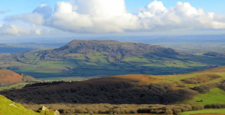
“Skirrid hill”, “Skirrid Mountain”, “Skirrid Fawr”, Ysgyryd Fawr (Welsh) or simply “The Skirrid” are five common name variations given to this unusually shaped mountain located on the eastern edge of the Black Mountains, in Monmouthshire, Wales.
I had never even heard of the Skirrid until the end of 2017 when I witnessed its odd shape for the first time while climbing Sugarloaf Mountain, just 6 km to the west. I remember sitting at the summit of Sugarloaf gazing at the intriguing Skirrid Mountain and mentally adding it to my hiking adventure list.
With Didem visiting family in Turkey during August 2018, I decided to undertake the Skirrid Mountain walk early on a Saturday morning with the hope of having the mountain pretty much to myself.
Skirrid Directions – How to get there
The Skirrid car park is situated just off the B4521 (Old Ross Road) just 1.5 miles (2.4 km) east of Abergavenny on the left-hand side. The full address including the Skirrid car park postcode is:
Llanddewi Skirrid, Abergavenny, NP7 8AP
Car Park Grid Ref: SO328164
The Skirrid Mountain car park was improved significantly in 2016, courtesy of the National Trust. There is now parking available for 50 vehicles plus an additional overflow grassed area for a further 25.
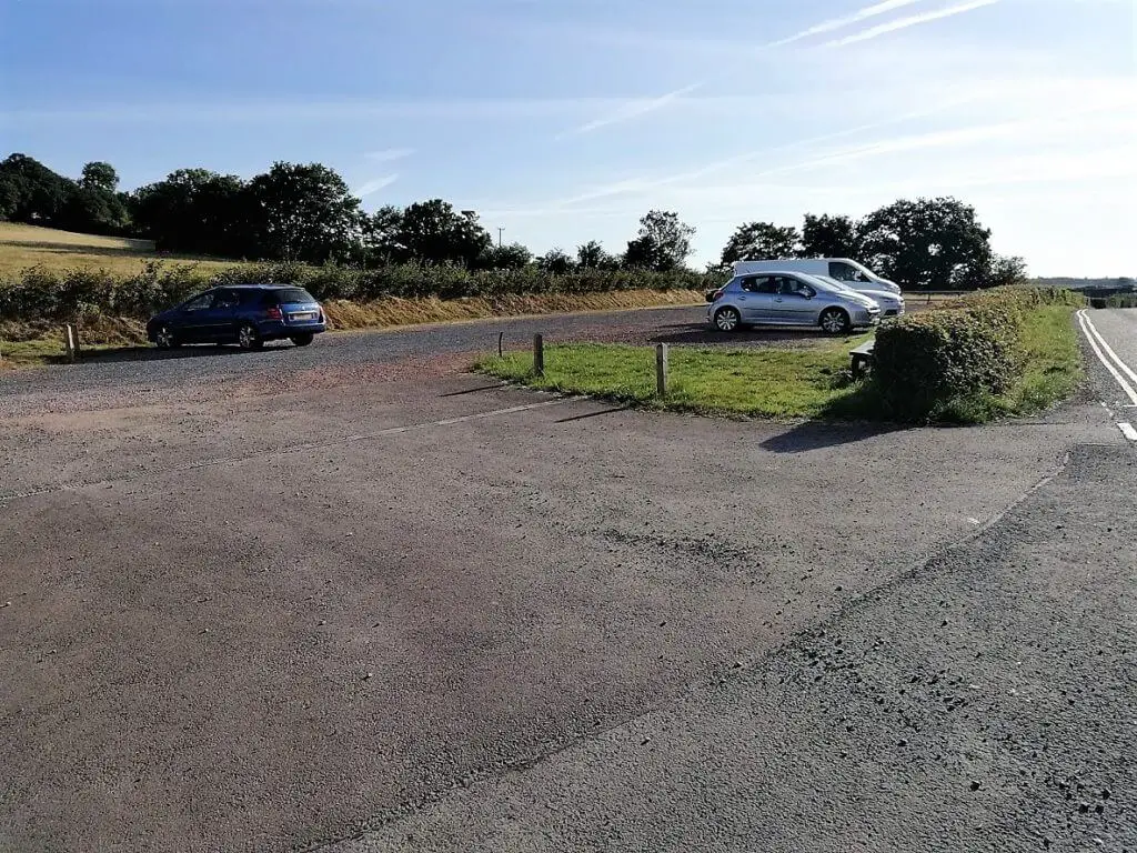
Parking here is subject to pay and display and the Skirrid car park charges are £3 for cars and £6 for camper vans and minibuses. Please Note: these are the published 2016 rates and may have changed since. If the rates have changed, please advise in the comment box below this article.
Skirrid Walking Route – Step by Step
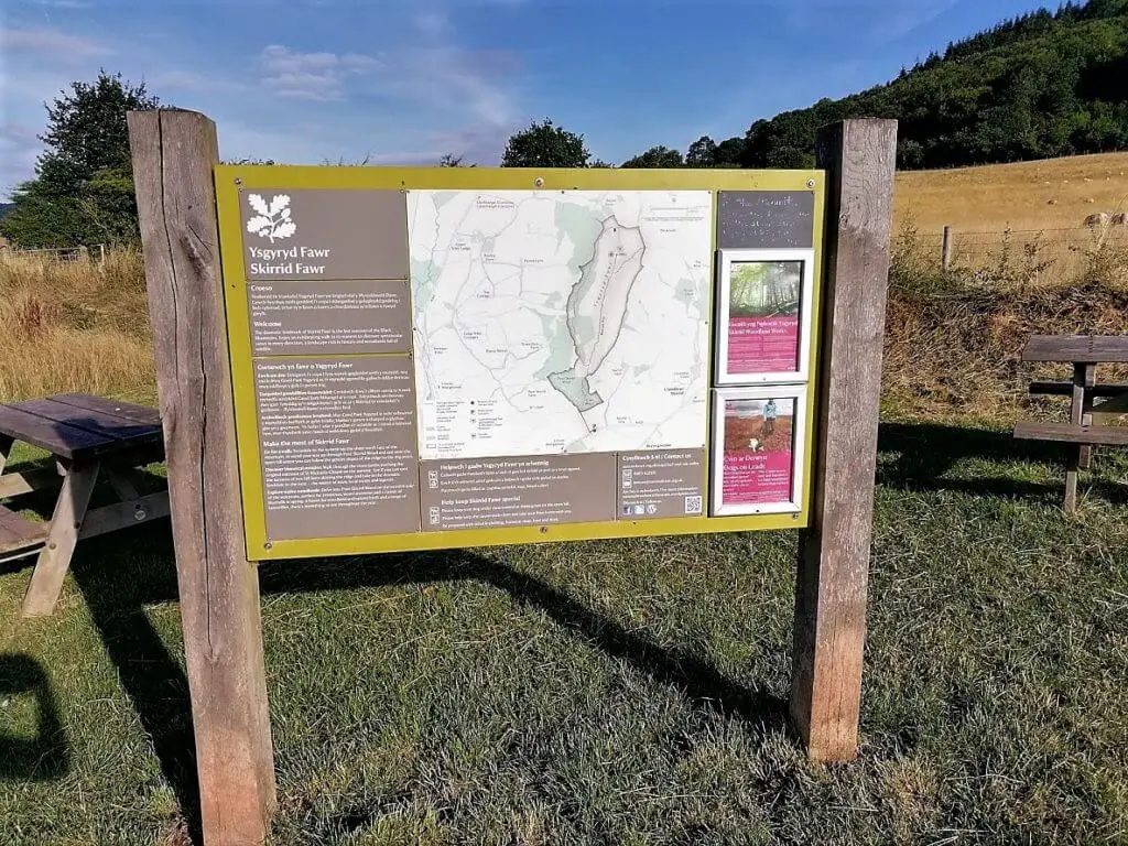
The Skirrid walk starts at the western end of the Skirrid parking area and is highlighted by a large National Trust information board that is well worth reading prior to setting off.
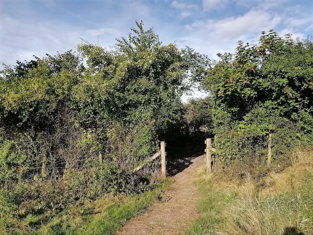
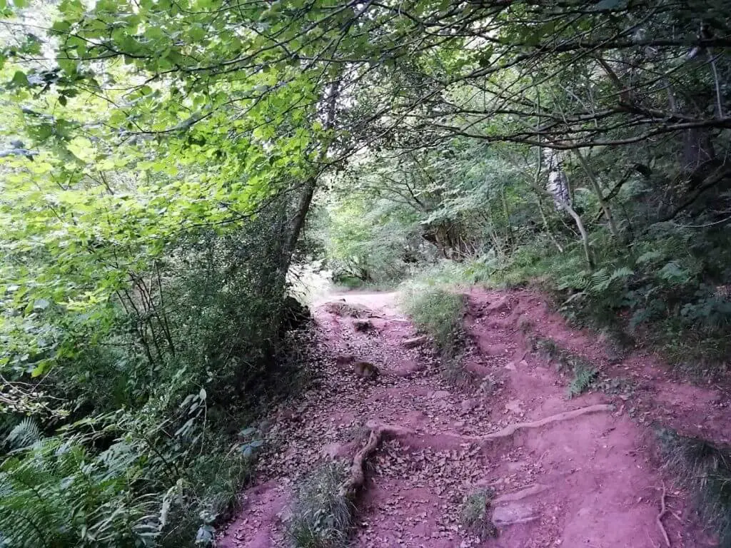
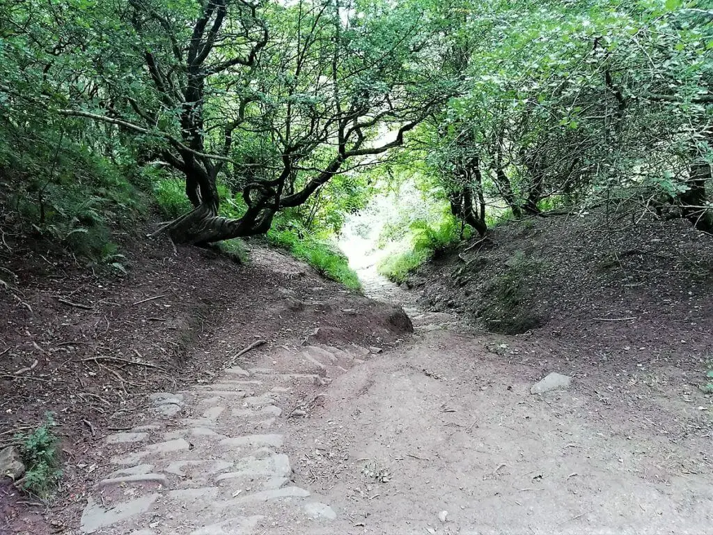
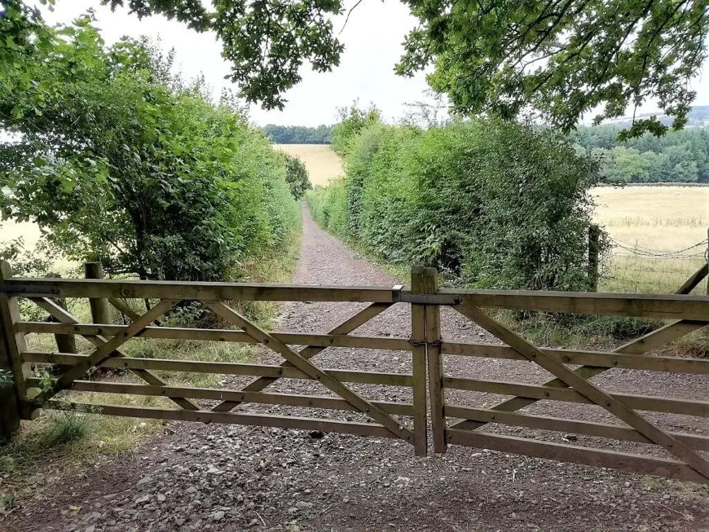
Head through the gap in the hedge a short distance past the information board, turn right and follow the narrow stone/gravel path until you reach a gate at the edge of woodland. Go through the gate and follow the path to the right and into Caer Wood.
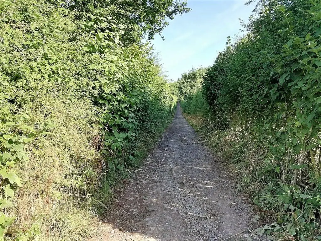
Continue to follow the well-made dirt path up through the woods. Although this section of the Skirrid Mountain walk is not excessively steep, you will experience a moderate climb for the next 15-20 minutes by which time you should be breathing fairly heavily.
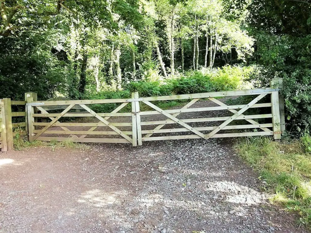
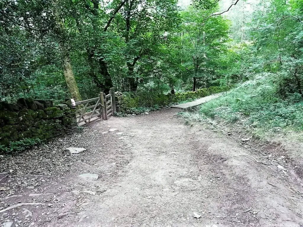
You will then reach another wooden gate. Once you have passed through this gate, you can choose to take one of two Skirrid Mountain walks. Turn left and continue on the Skirrid circular walk (the one that I did) or head right and take the easy Skirrid walk option. This is a more gradual climb to the summit but you do go up and back using the same trail.
Following the Skirrid Mountain Contours
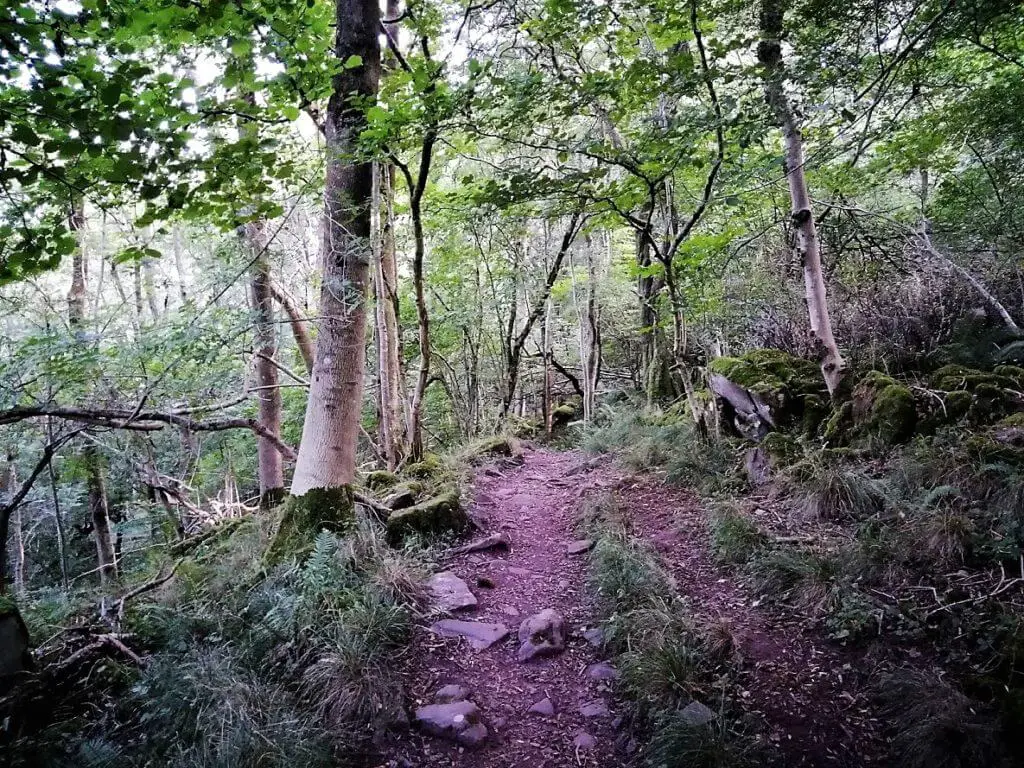
Having turned left, the path now becomes relatively flat as it follows the contours around the western side of the Skirrid and through the upper section of Pant Skirrid Wood.
“Looking for your next hiking challenge in the vicinity? Check out Blorenge Mountain across the Usk valley”
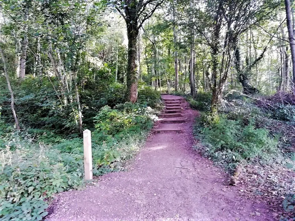
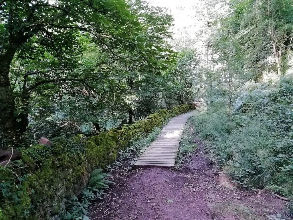
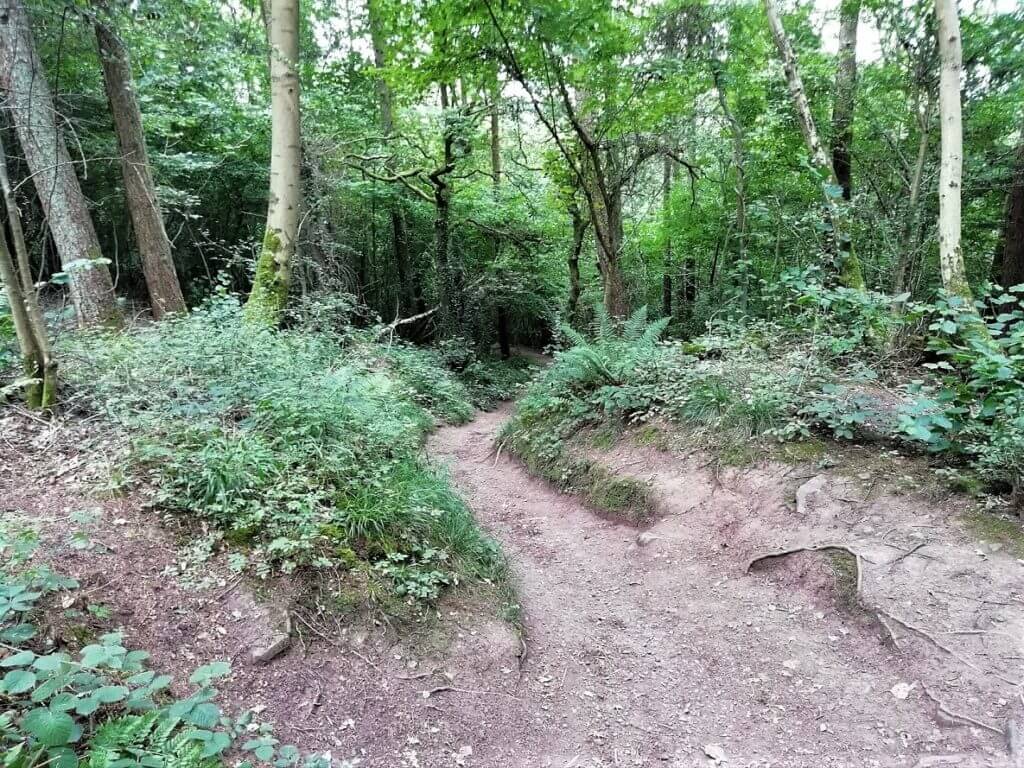
At first, the path is a wooden walkway that runs alongside a stone wall to your left. This soon turns into a typical dirt path that winds its way through charming rugged woodland.
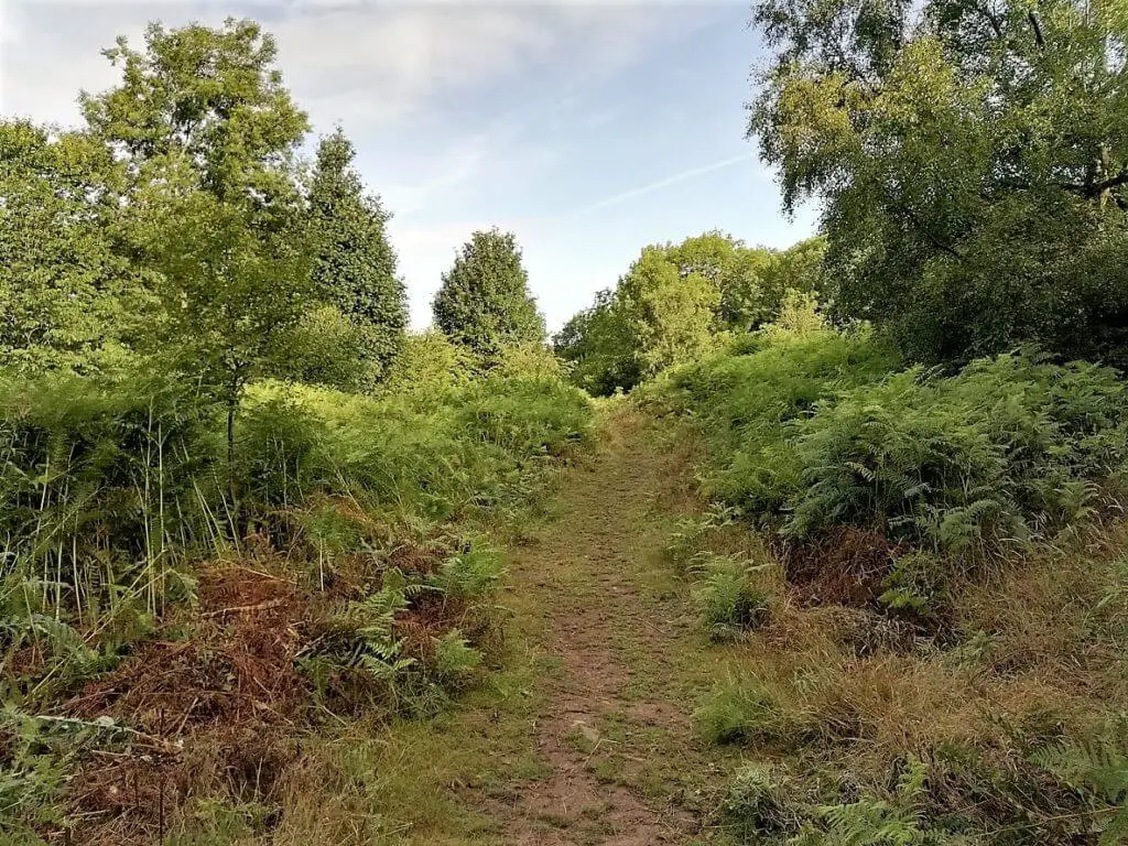
One minute you are walking under a lush verdant canopy on a muddy path and the next minute the canopy disappears and thick banks of ferns adorn the banks of the now grassy path.
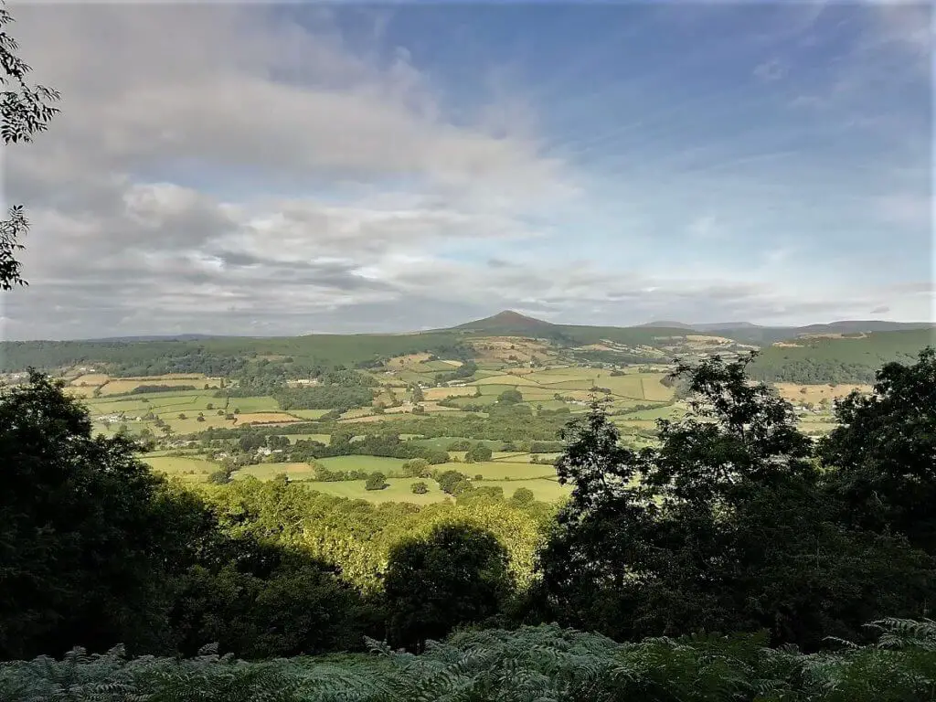
Every now and again, a gap will appear in the woods to your left exposing you to the wonderful green patchwork that are the fields of the Gavenny Valley to the west, beyond which sits the unmistakable Sugarloaf Mountain.
Did you know? The Skirrid to Sugarloaf distance is approximately 6 km (3.73 miles) summit to summit.
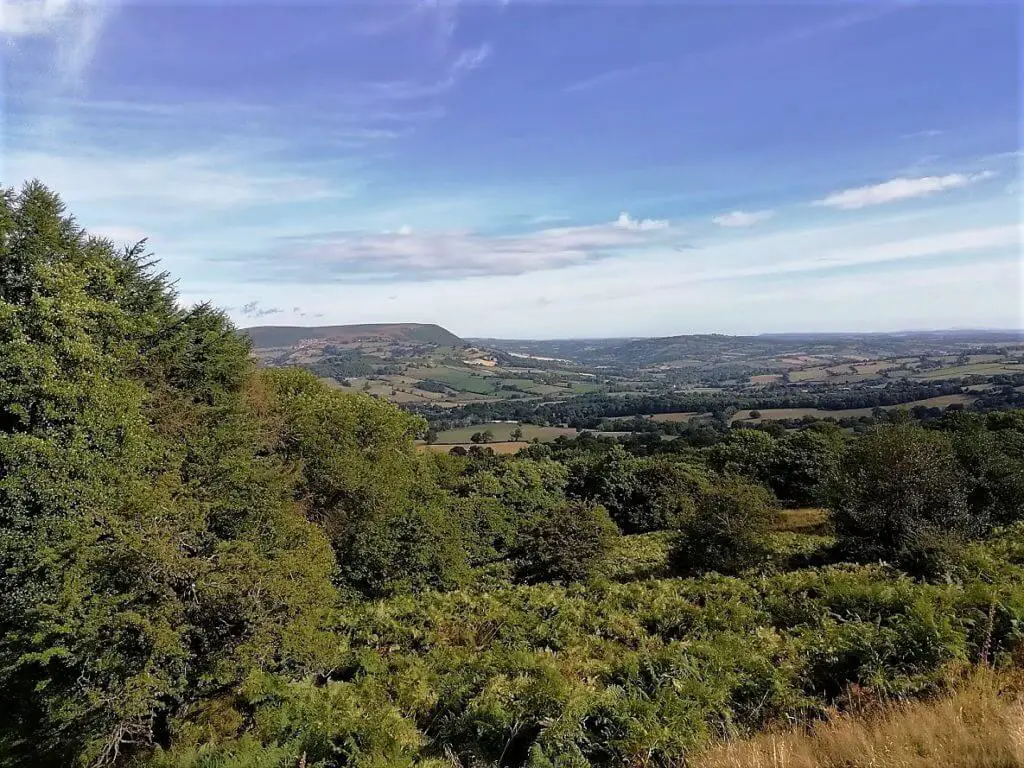
As you continue along the path, the woods gradually recede and you will catch sight of the steep, craggy western upper slopes of the Skirrid for the first time. A little further along the path and the wonderful sweeping views to the north open up, including the eastern edge of the Black Mountains.
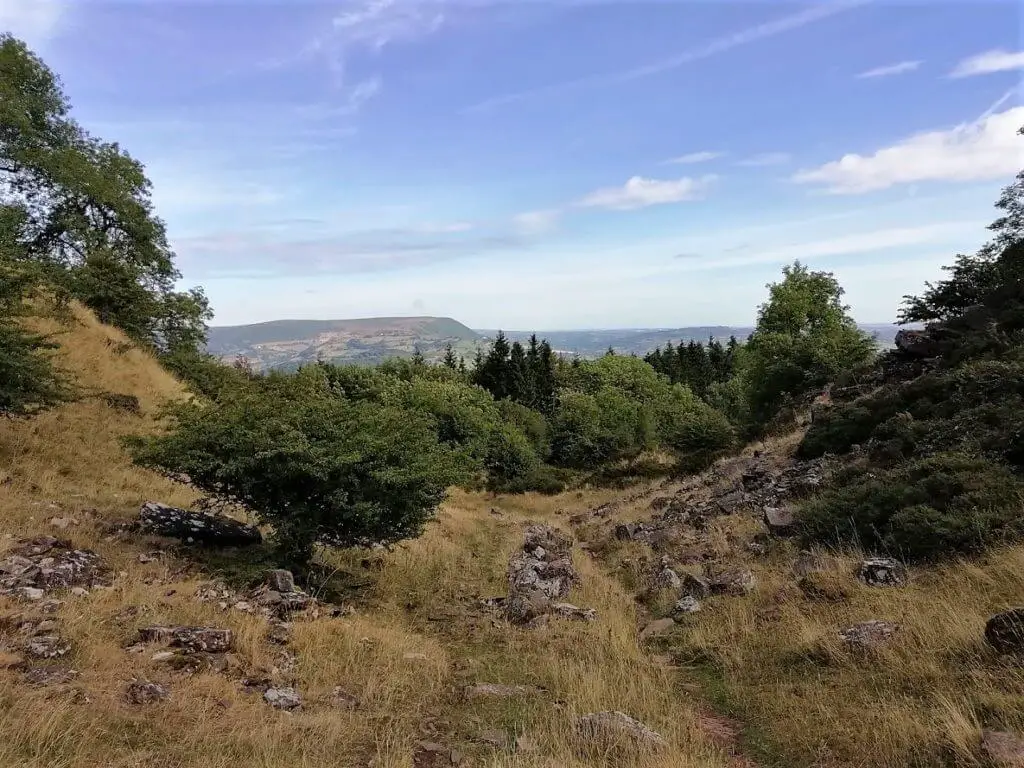
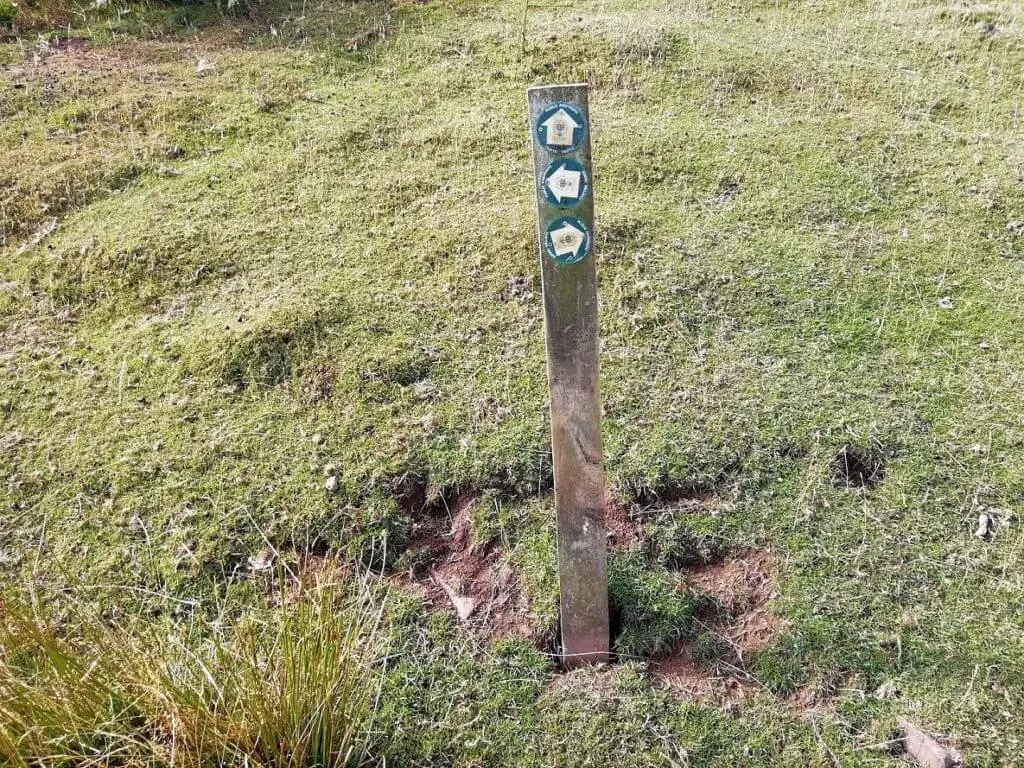
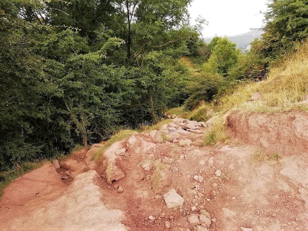
The path gradually winds its way around the very steep northern slopes of the Skirrid. Once you reach the wooden waymarker it is time to climb Skirrid the hard way!
Skirrid Mountain Walk – The steep climb to the summit!
Having spent the last 30 minutes or so enjoying the relatively flat path that follows the mountain’s contours, it is now time for the short but very steep climb to the top of the Skirrid.
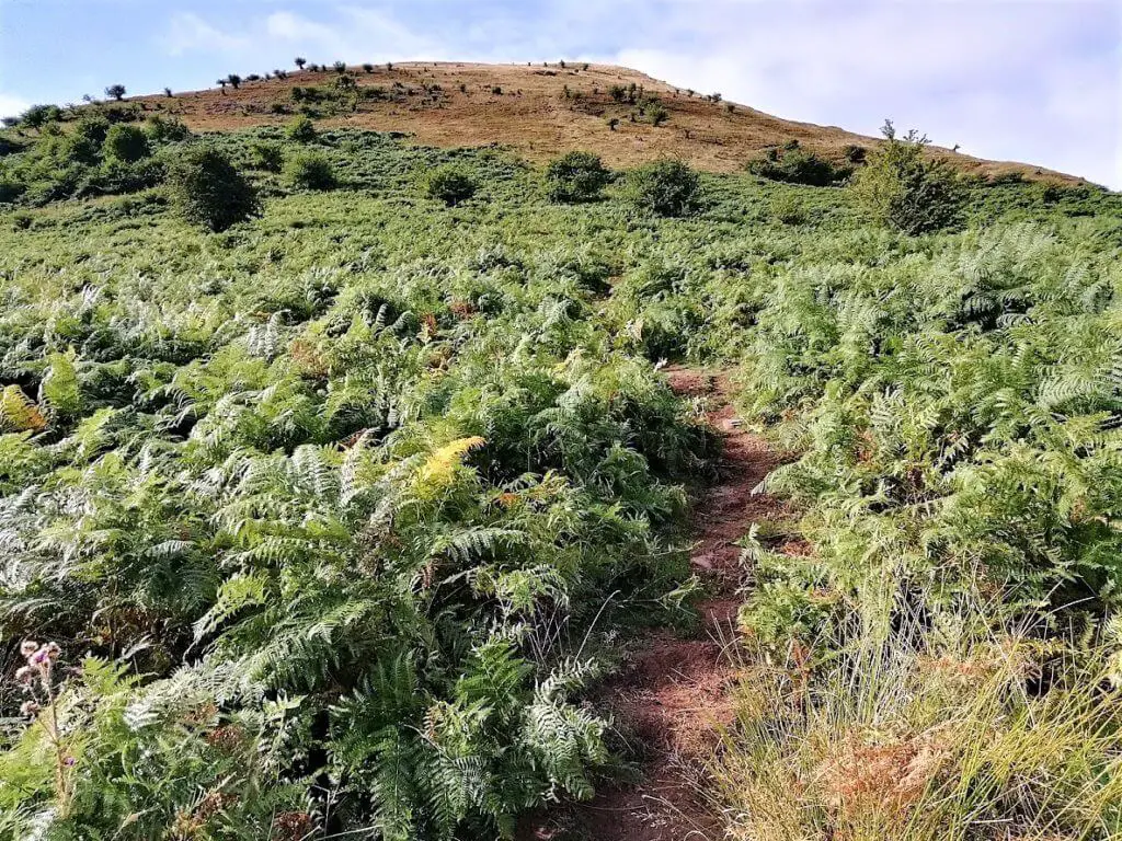
Near the wooden waypoint marker, you will take the path that runs directly up the mountainside, through the field of ferns that adorn the lower half of the slope. The ferns then give way to an even steeper grassy slope.
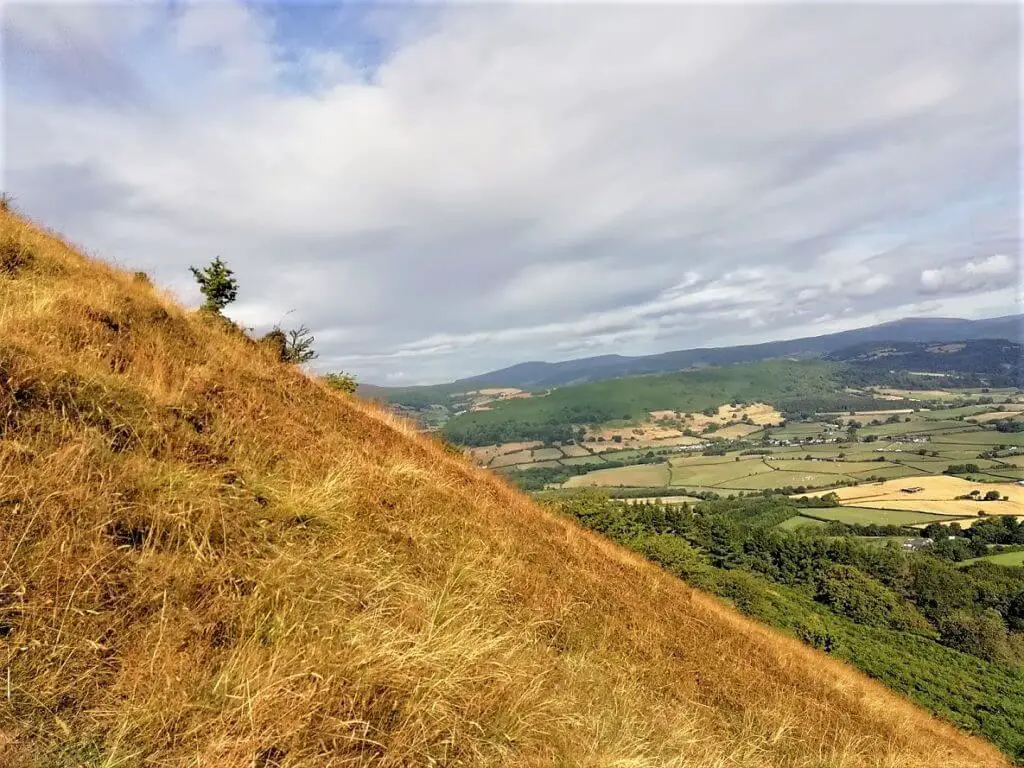
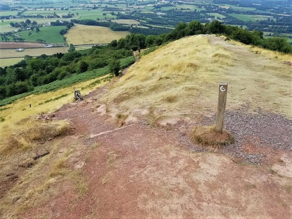
After 15-20 minutes of heart pumping, thigh aching effort the trig point at the Skirrid’s summit will come into sight. And what a relief that is!
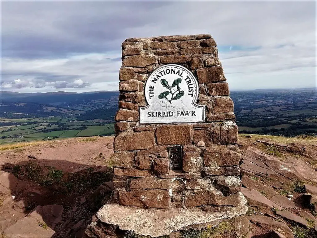
Skirrid Mountain Walk – Take time to enjoy the spectacular summit views
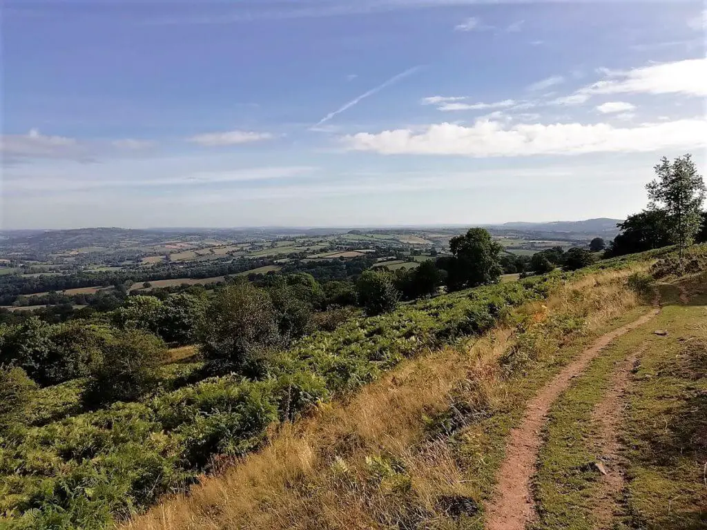
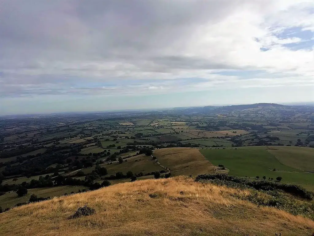
The Skirrid is isolated from the main Black Mountains range by the Gavenny Valley. Although it is smaller than many of its closest neighbours at 486 metres high, Skirrid Mountain rises dramatically out of the landscape, offering stunning vistas whichever way you turn.
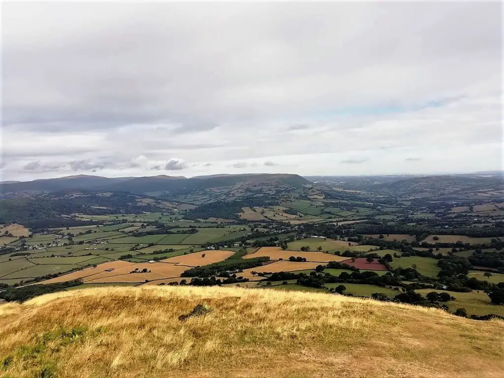
Did you know? It is possible to see the Bristol Channel to the south, the Brecon Beacons and Black Mountains to the west, Herefordshire to the north and the Forest of Dean to the east
National Trust Skirrid Walk – Heading home
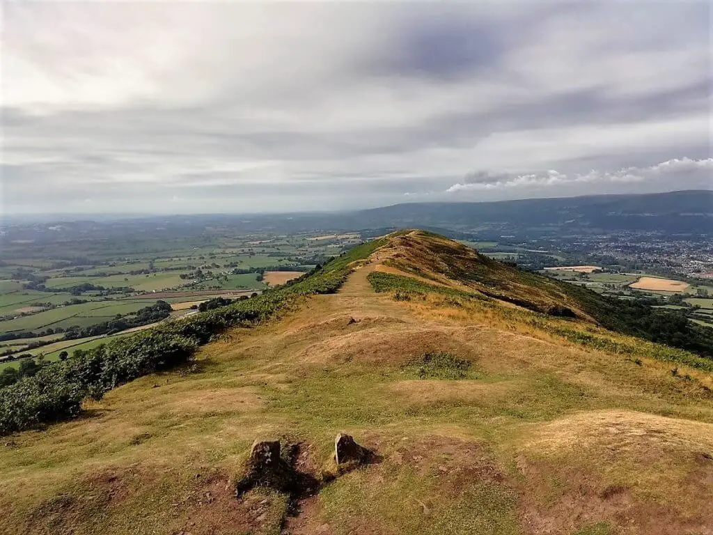
Having recovered from the climb and enjoyed the wide-ranging views, it’s time to head south down the spine of the mountain. The track descends gently and the town of Abergavenny is clear to see just off to your right.
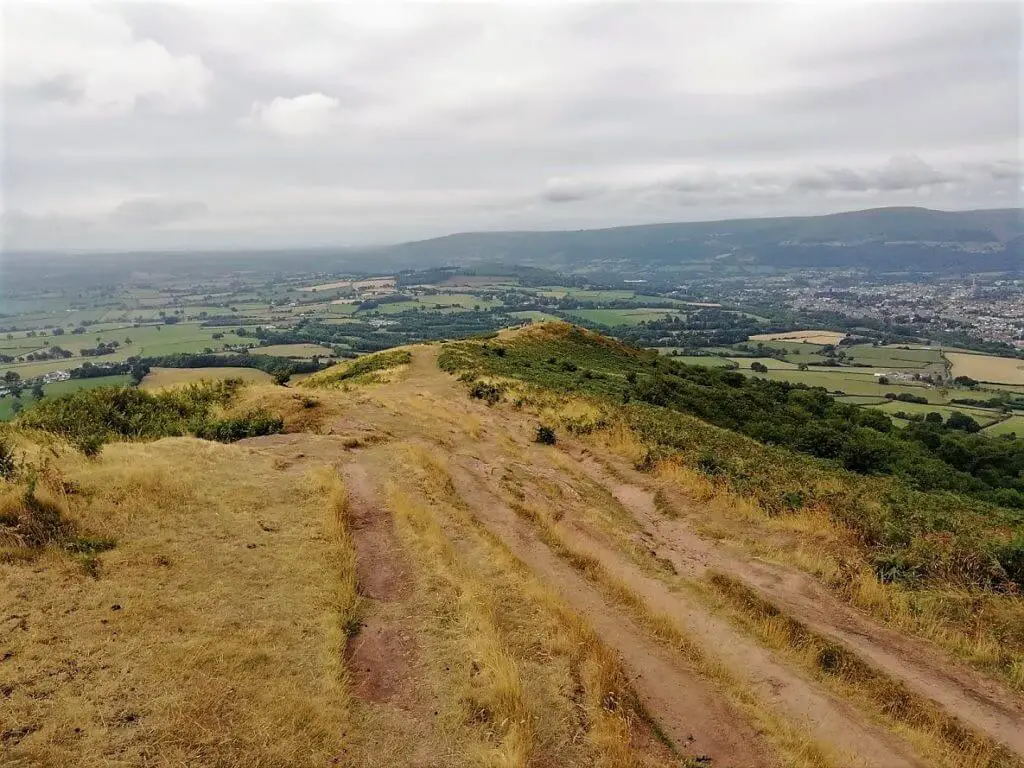
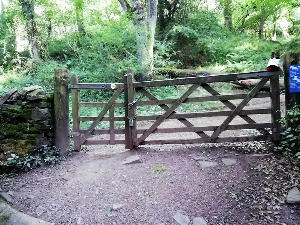
Continue to follow this path until you reach a wooden waypoint marker. Take the path off to the left and down into Caer Wood once more. The path is clear and easy to follow and before long you will rejoin the path on which your started your Skirrid Mountain walk.
The final stretch leads you back through the woods (thankfully downhill this time) and within 10-15 minutes you will arrive back at the National Trust car park.
Skirrid Mountain Facts and Information
How long does it take to walk up the Skirrid?
The circular walk that I opted for took approximately 2 hours (up and back). If you choose to hike Skirrid Mountain using the more popular and gentler route, I think this can be completed in less than 2 hours.
How far is the Skirrid Mountain walk?
The Skirrid circular walk route, measured by the ViewRanger App was 3.39 miles (5.46 km)
How hard is the Skirrid Mountain walk?
In my opinion, the circular walk, in general, is only moderately challenging. The stretch up through Caer Wood at the beginning is fairly steep and will get your heart beating but the ascent of the northern slope to the summit is short but very steep! Apart from these two stages, the walk is very comfortable.
Skirrid Meaning
The Skirrid definition comes from the mountain’s Welsh name, Ysgyryd Fawr – Ysgyryd meaning ‘shake’ or ‘tremble’ and Fawr meaning ‘large’. It is not difficult to see where the name probably came from, with the massive landslide clearly visible on the mountain’s northern slopes.
Why is the Skirrid sometimes referred to as the Holy Mountain or Sacred Hill?
There are two possible reasons as to why the Skirrid is referred to locally as the Holy Mountain or Sacred Hill.
Firstly, the Chapel of St. Michael used to sit at the summit of the Skirrid and it is said that Roman Catholics used it following the Reformation. Remains of the Chapel can still be seen today.
Secondly, according to legend, the huge landslide from which the Skirrid almost certainly gained its name, occurred at the moment when Jesus was crucified and was caused by either a lightning strike or earthquake.
Skirrid Mountain Inn – Ghosts and Legends
During my research for the writing of this post, the Skirrid Mountain Inn kept cropping up. Having delved into the detail, I felt that this local pub was definitely worthy of a mention.
Located in the village of Llanfihangel Crucorney, just a couple of Kilometres off the northern edge of Skirrid Mountain, this pub certainly has had a couple of big claims made about it.
Firstly, it is claimed to be one of the oldest pubs in Wales and there are a number of popular legends regarding the Skirrid Inn’s history. Owain Glyndŵr, a Welsh ruler in the 13th century, is said to have assembled his forces in the pub’s courtyard prior to raiding local settlements, supportive of Henry IV. It is reputed that the first floor of the inn was used as a Courtroom where criminals were put on trial and then hanged.
The Skirrid Mountain Inn is also considered to be one of the UK’s most haunted pubs as it is claimed that victims of executions at the pub still make appearances today. Although the stories surrounding the pub are unverified and undocumented, a reputation for these ghostly goings on have been featured on TV’s entertainment-only “Extreme Ghost Stories” and “Most Haunted” with Yvette Fielding.
Let’s forget about the history, ghosts and legends for one minute. Perhaps you are just looking for a drink and a bite to eat following your Skirrid Mountain walk. Let me first add that I can not yet personally vouch for this pub as I am yet to visit it. However, I can highlight what others have said about their visits.
A great way of checking out plenty of Skirrid Inn reviews is by heading over to the Skirrid Mountain Inn TripAdvisor page. Not only will you find out what others are saying about the Skirrid Inn menu, but about the visit to the pub in general.
If you fancy giving it a try, here is the full address:
Skirrid Mountain Inn, Llanvihangel Crucorney NP7 8DH, Wales
For contact details visit: Skirrid Mountain Inn website
Skirrid Mountain Walk – My Thoughts
This short hike offers so much in my opinion. A walk through beautiful woods, a couple of challenging climbs ending up with utterly breathtaking views in every direction.
If you want the mountain to yourself, or at least not overrun with people, I strongly suggest that you arrive early, especially if planning either of the Skirrid hikes on a weekend. I arrived at 08:00 on a Saturday and there were already a few cars in the car park.
Have You Climbed Skirrid Mountain?
If you have we would really like to hear about your experience. Tell us about your visit to the Skirrid in the comment box below.
Want to hear what others are saying about their visits to the Skirrid? Check out the Skirrid Mountain TripAdvisor page.
If you would like to find out a little more detail about the Skirrid, check out the Skirrid Wikipedia page.
Like Our Article? Please Pin it!
The car park now seems to charge by the hour. I paid £2 for 2 hours and completed the circular walk in 2 hours 20 minutes.
Hi John, thanks for the update on car parking charges at the Skirrid. It is appreciated and also useful for fellow hikers heading there. I hope you enjoyed your walk. Best wishes, Gavin
I did this walk today after a few days of heavy rain! I’ve never seen so much mud! It was a bit of fun to start but eventually it was a bit tiresome! Couldn’t really appreciate the scenery because so much effort went in to navigating the muddy paths. I’m a confident walker but I found the final climb of the route you described a bit of a challenge given the wet ground and no definitive path!
Hi Carol, with all the rain we have had lately, I can well imagine that many hiking trails are rather muddy underfoot. All credit to you for still attempting the north slope of the Skirrid, especially owing to the conditions. It was tough enough when completely dry! Better luck on your next hiking endeavour. Best wishes, Gavin