Black Mountains, Brecon Beacons National Park
The Vale of Ewyas horseshoe walk leads you through the rugged, wondrous beauty of the Black Mountains whilst offering a real challenge on this epic 17-mile ridge trail
Llanthony Priory Circular Walk
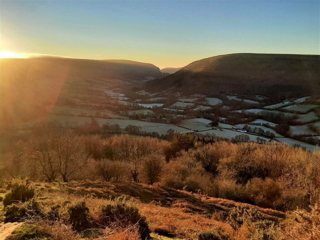
From the moment you leave the A465 in Llanvihangel Crucorney and enter the Vale of Ewyas, you get a sense that your adventure has already started.
Leaving the traffic behind, you now find yourself on a peaceful single track road that winds its way through the verdant beauty of the River Honddu (Welsh: Afon Honddu) valley.
Approaching the walk’s starting point in the village of Llanthony, the valley sides steepen, adding a whole new dramatic dimension to the already magical scenery.
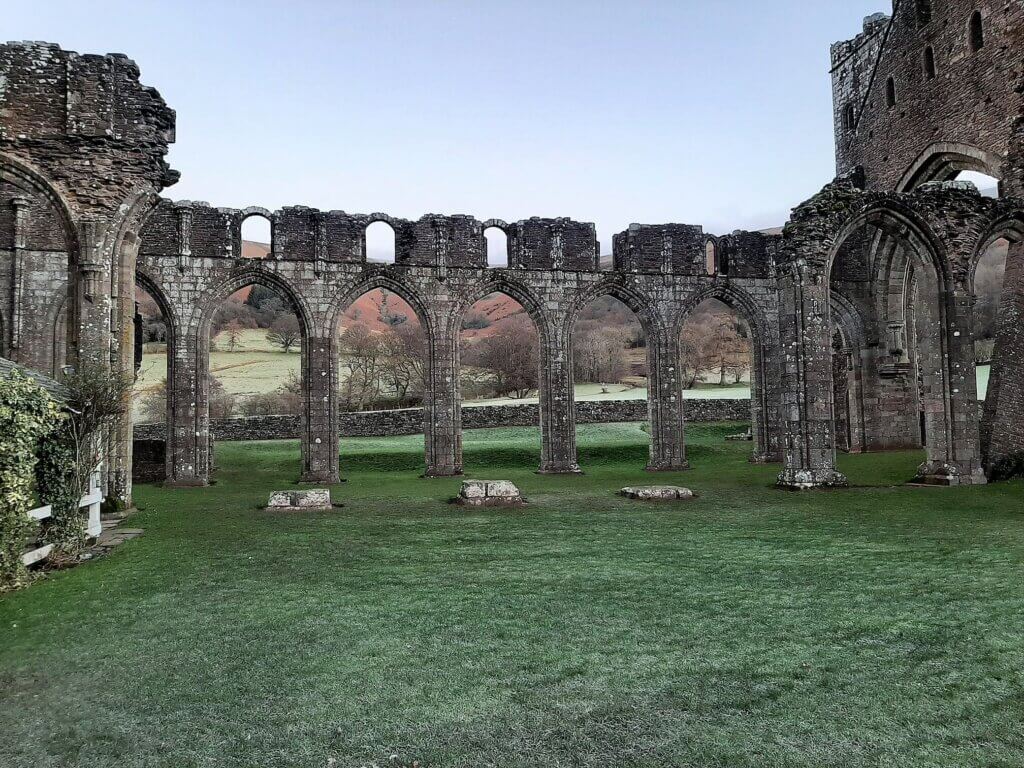
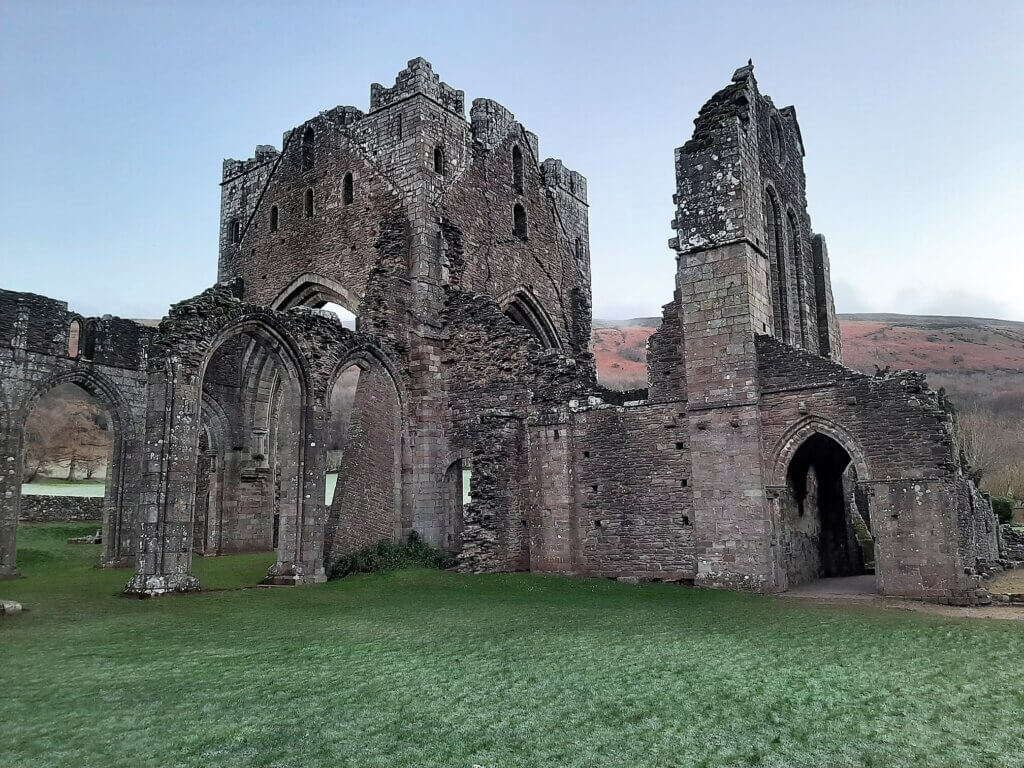
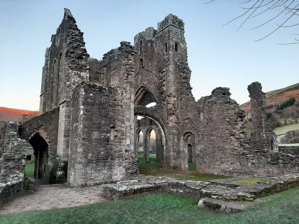
The Vale of Ewyas or Llanthony Valley, as it is sometimes referred, is not only known as a location of outstanding natural beauty but also for the partly ruined Llanthony Priory, dating back to around 1100.
Where is the Vale of Ewyas?
The Vale of Ewyas is the steep-sided and secluded valley of the River Honddu, in the Black Mountains, in the eastern section of the Brecon Beacons National Park.
Where to Park for the Vale of Ewyas Horseshoe Walk?
There is a free car park that sits immediately adjacent to Llanthony Priory which is conveniently located a short distance from the walk’s starting point.
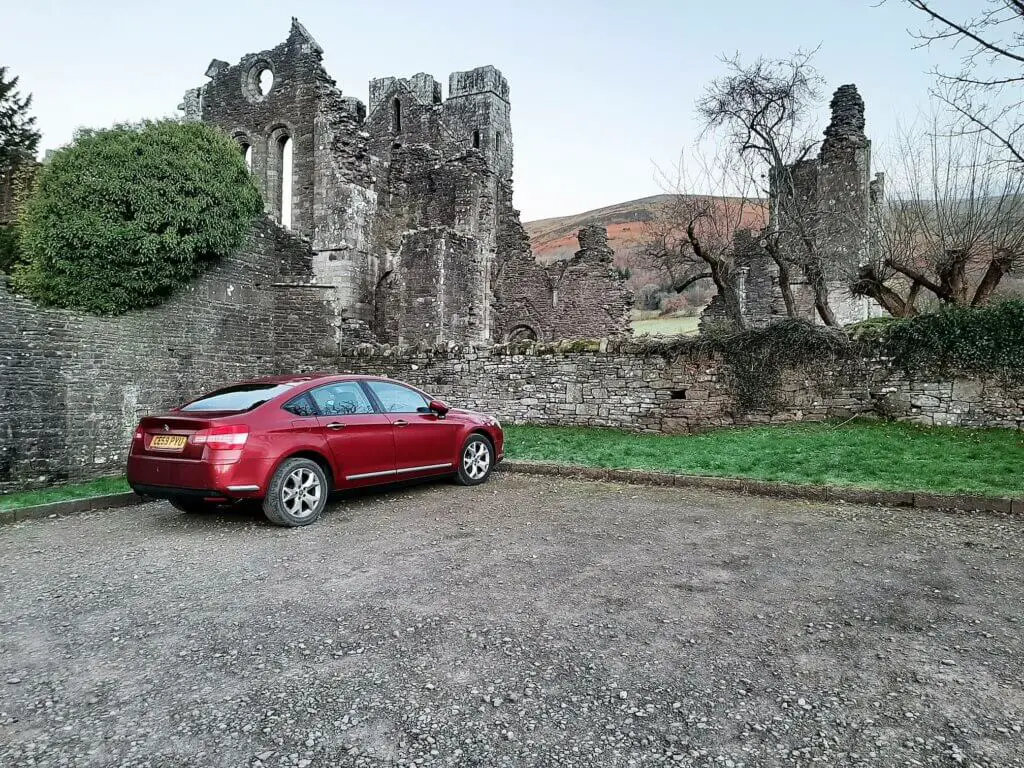
- Llanthony Priory postcode (nearest) – NP7 7NN
- Grid Reference: SO288278
- Google Maps Link
How to get to Llanthony Priory?
The only way to really get to Llanthony Priory is by car owing to its remote location. Whether you are approaching from the north or south, the best way to get there is via the A465 turning north on the B4423 at Llanvihangel Crucorney.
Follow this idyllic, single track country road for 6.4 miles and Llanthony Priory will be on your right hand side. Alternatively, type ‘Llanthony Priory Hotel’ into Google maps on your phone and allow technology to guide you there!
Vale of Ewyas Horseshoe Walk Description
Llanthony Priory to Hatterrall Ridge (Offa’s Dyke Path) – 1.37 miles (2.2 km)
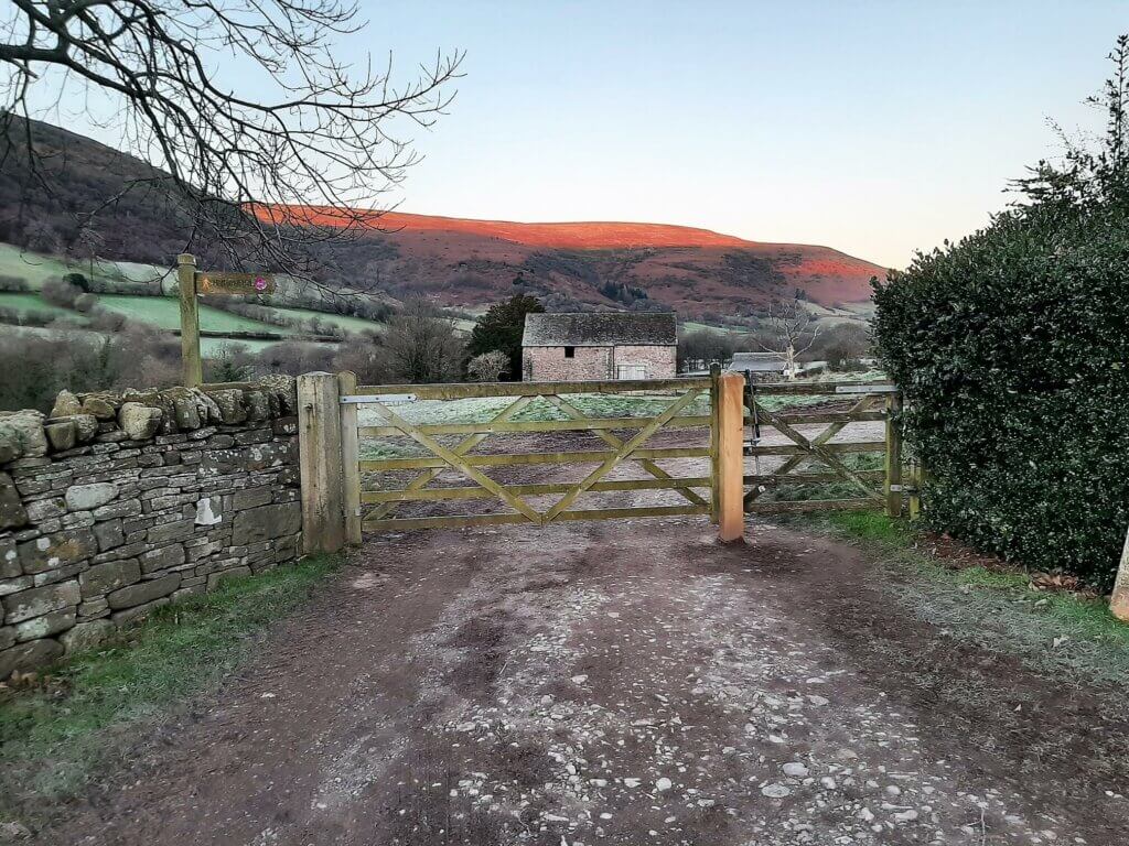
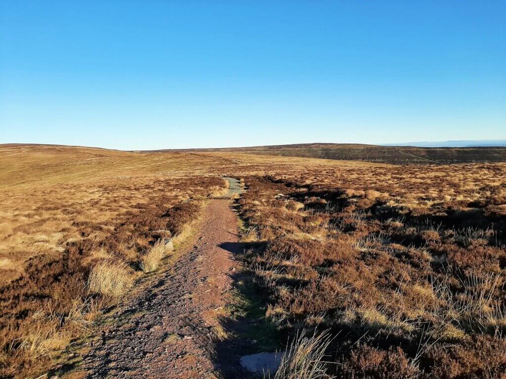
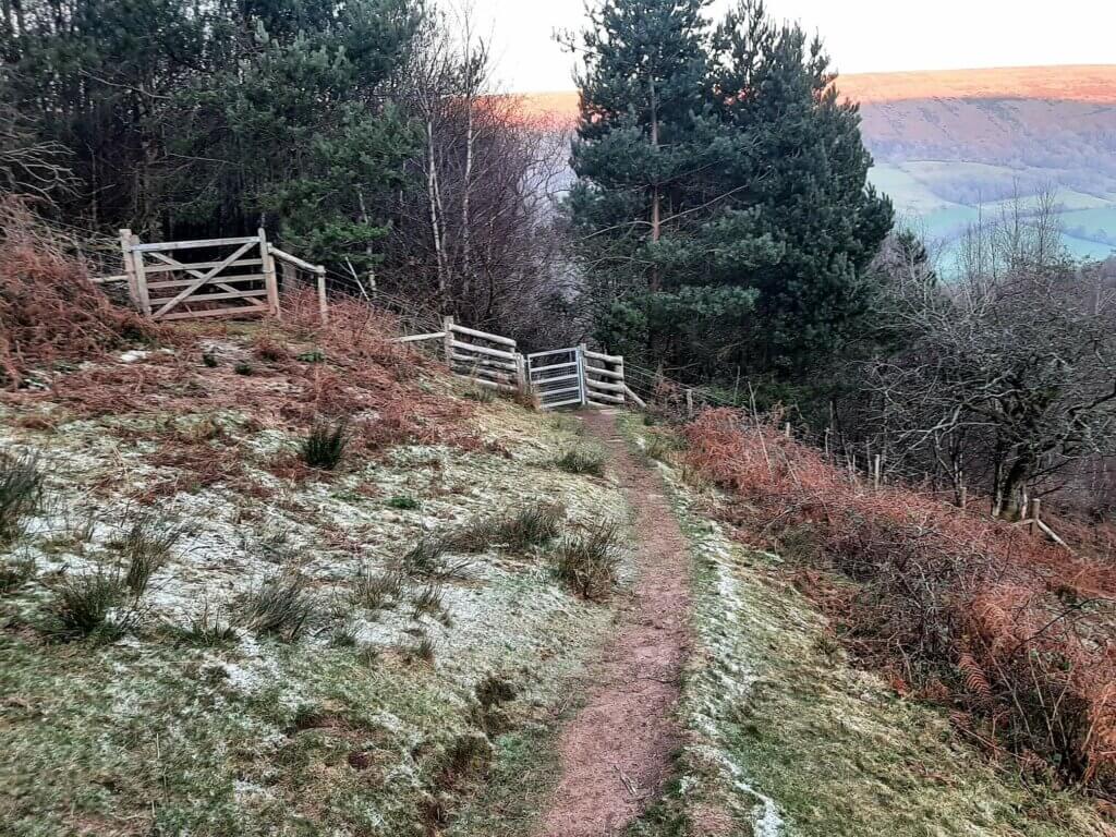
From the car park, head back in the direction of the entrance, passing through the gate adjacent to the parking area for Cross Farm. Turn right, head through another gate and follow the dirt track for approximately 200 metres.
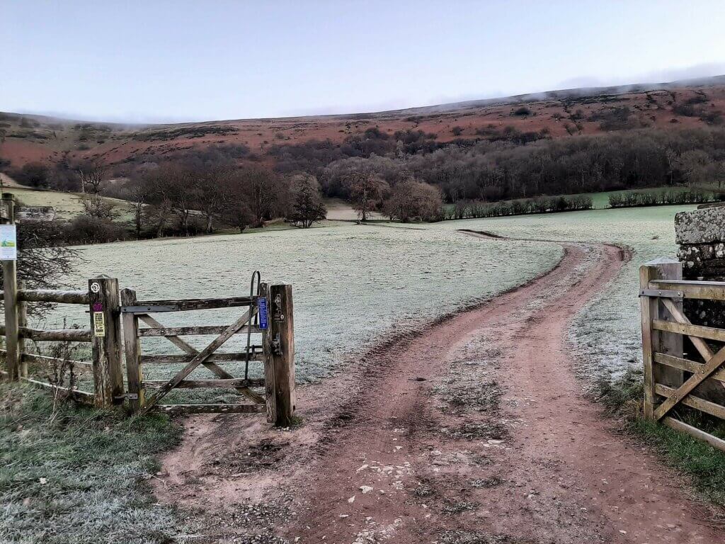
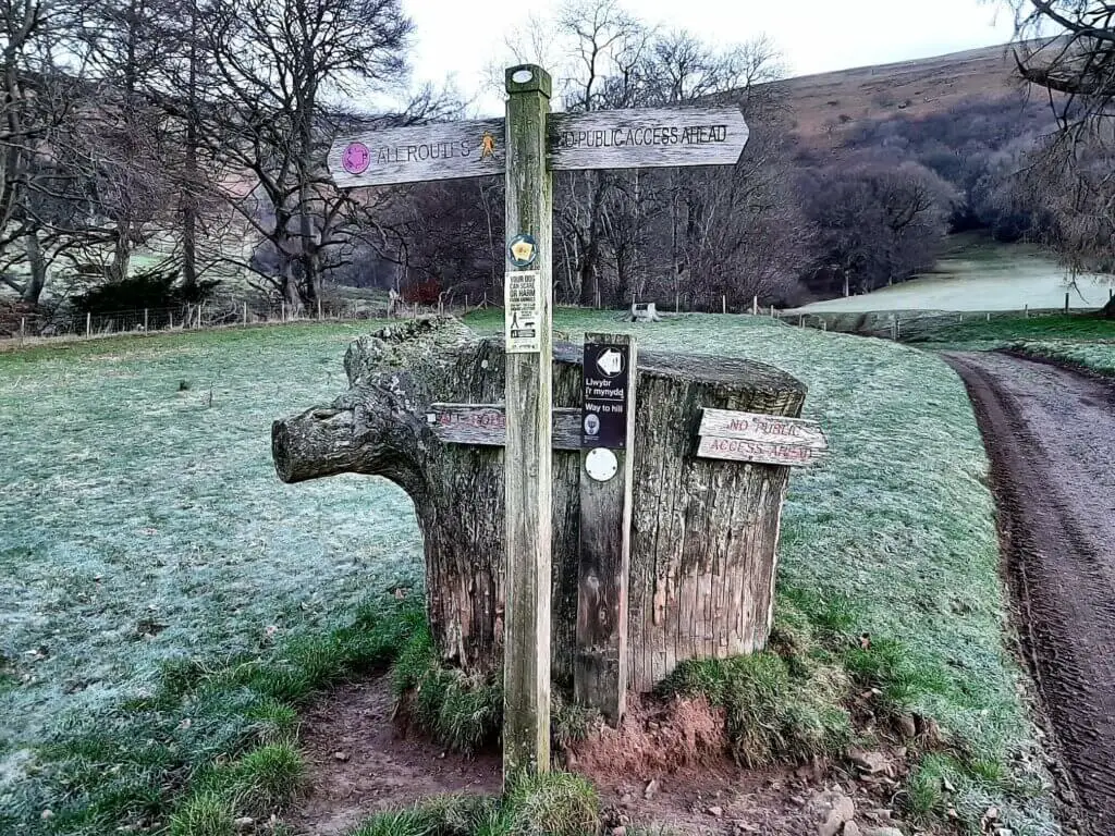
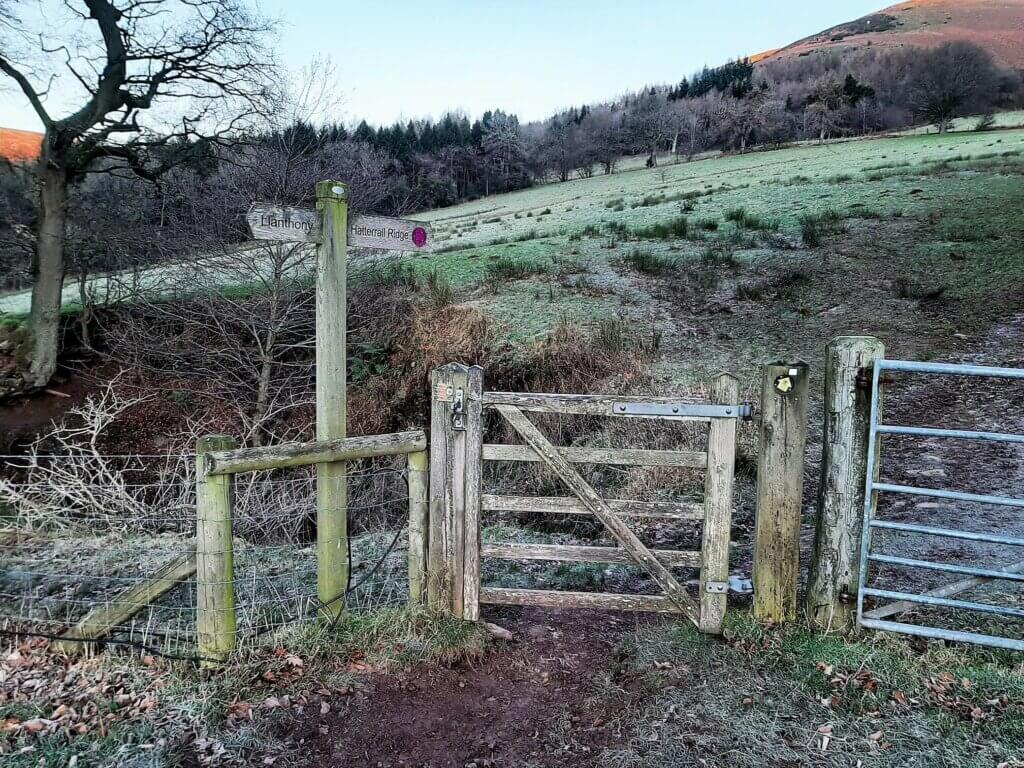
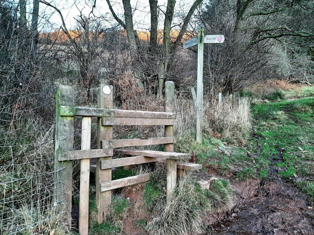
Turn left, signposted ‘All Routes’ and then proceed through the gate signposted ‘Hatterrall Ridge’. Now, follow the trail as it ascends gently across two fields, separated by a missing gate (14.1.22), arriving at the first of three wooden stiles.
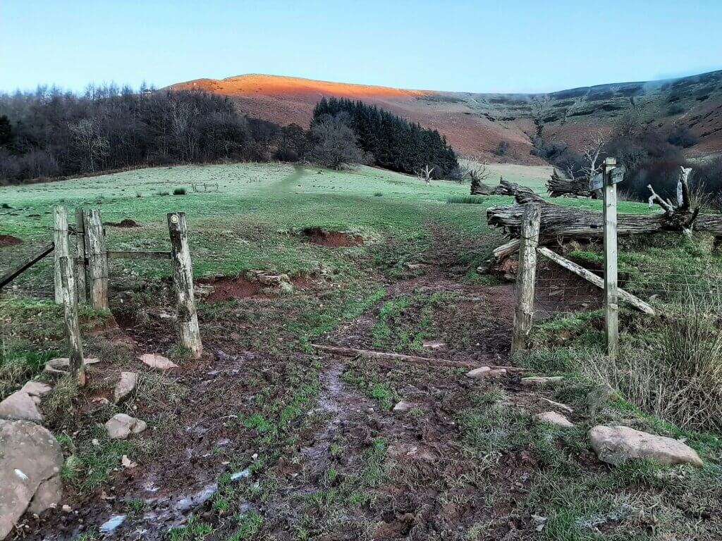
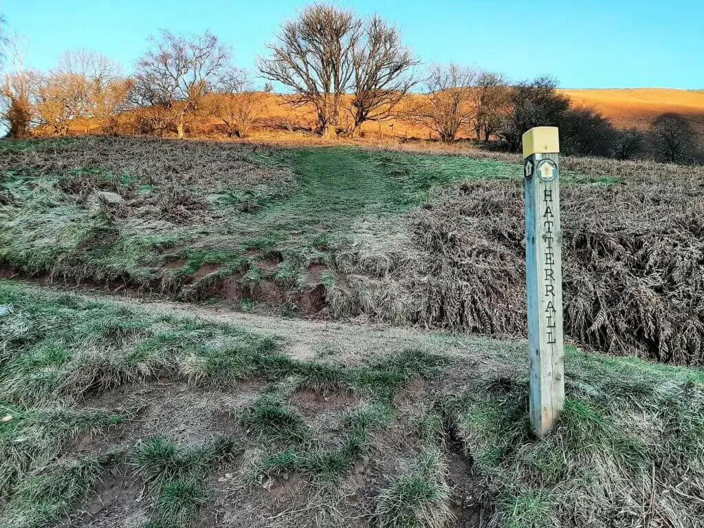
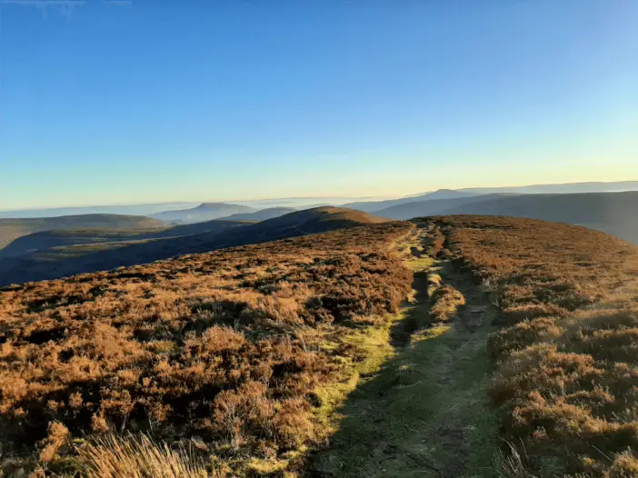
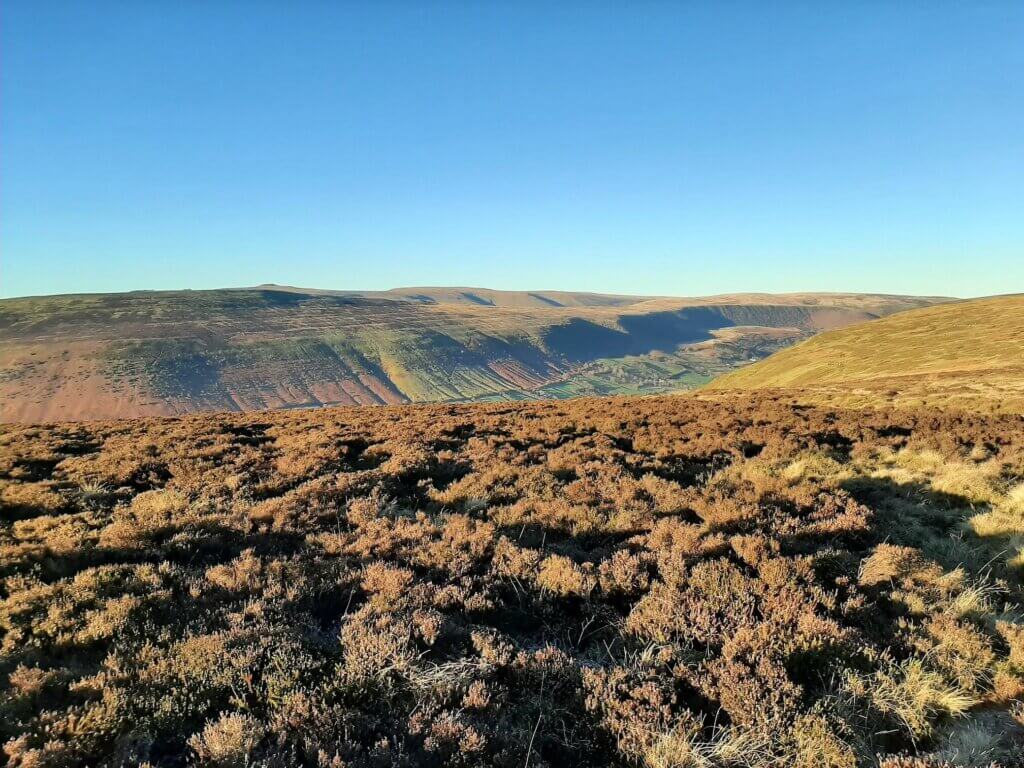
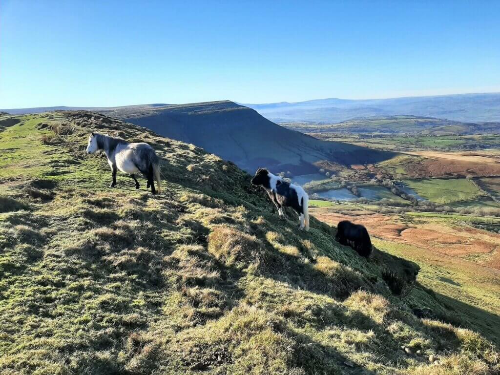
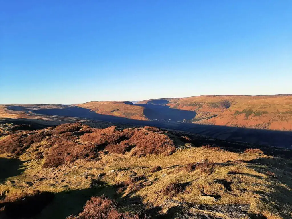
It’s at this point that the climb steepens considerably as you make your way to the top of Hatterrall Ridge. Along this stretch be sure to stop and savour the glorious southerly views of the Ewyas Valley towards Llanthony Priory and beyond.
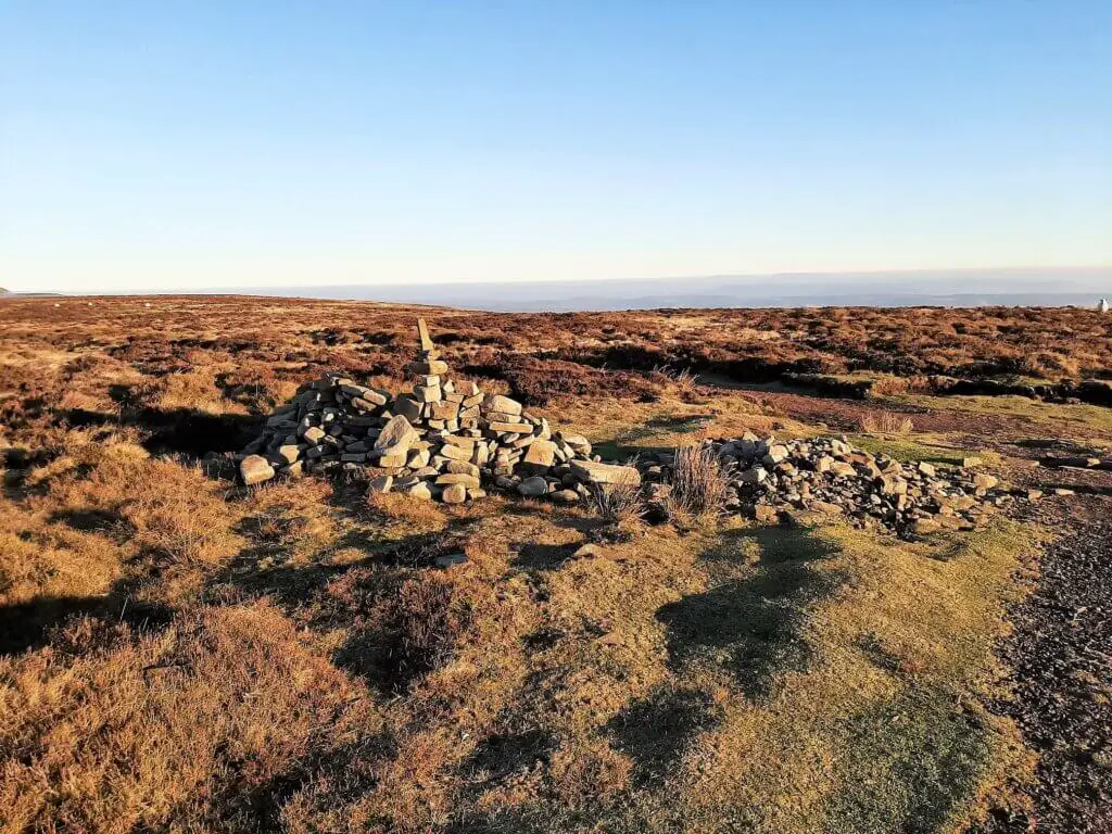
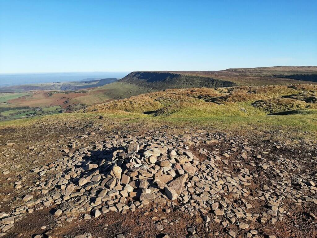
As you progress, the gradient flattens out as you make your way across the broad ridge ultimately reaching the junction of Offa’s Dyke Path, marked with a stone cairn.
Junction of Offa’s Dyke Path to Hay Bluff – 5.47 miles (8.8 km)
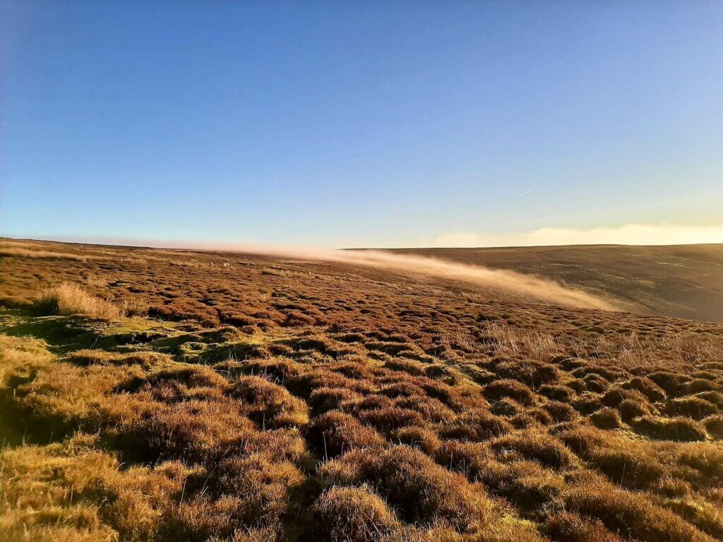
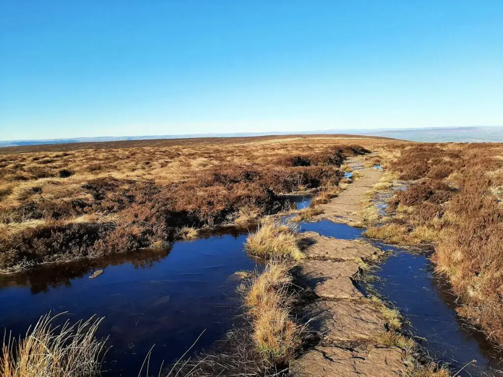
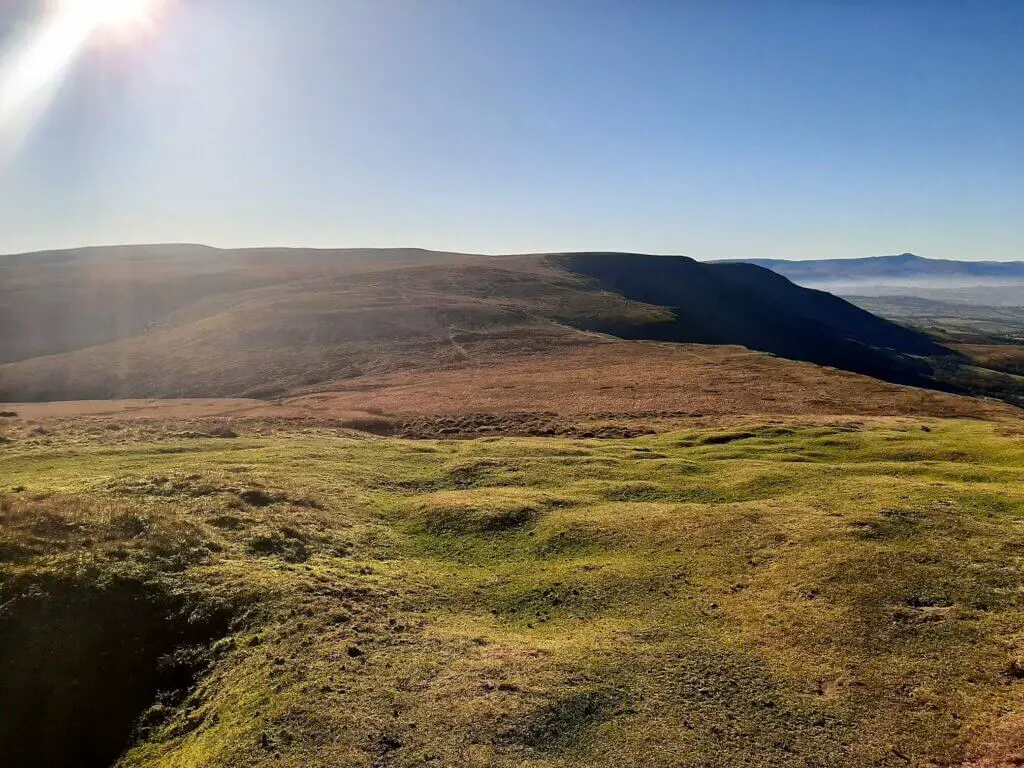
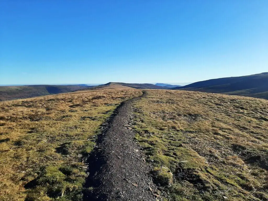
With the toughest section of the entire Llanthony Priory circular walk behind you, it’s time to enjoy this long gently undulating northerly section of the walk along Hatterrall Ridge towards Hay Bluff.
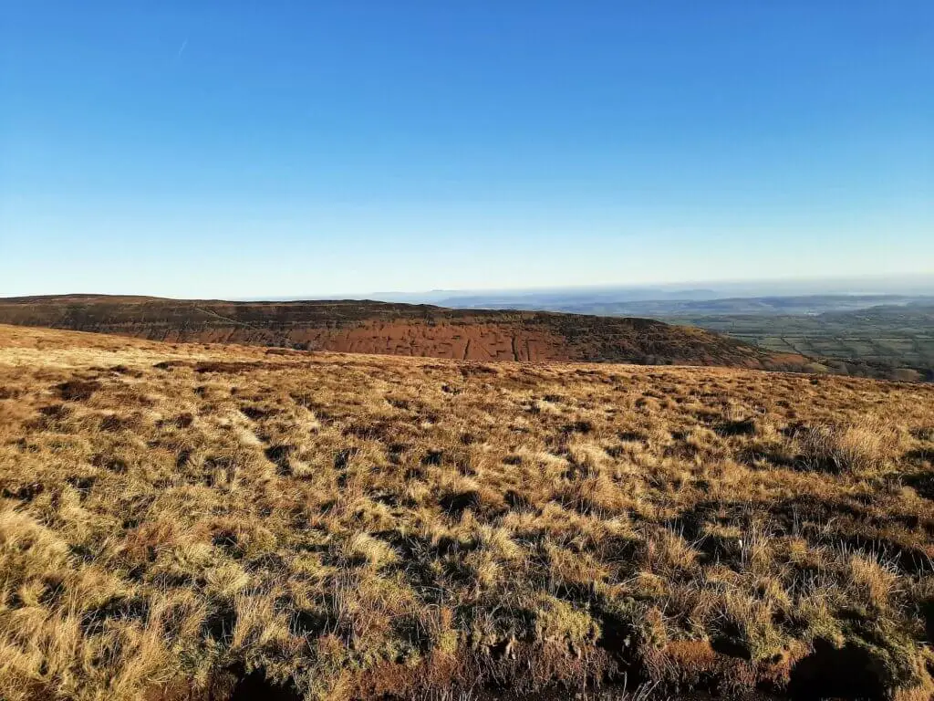
This ridge marks the boundary between the Brecon Beacons National Park (Wales) to the west and Herefordshire (England) to the east, with the Offa’s Dyke Path hugging the border for the majority of this section.
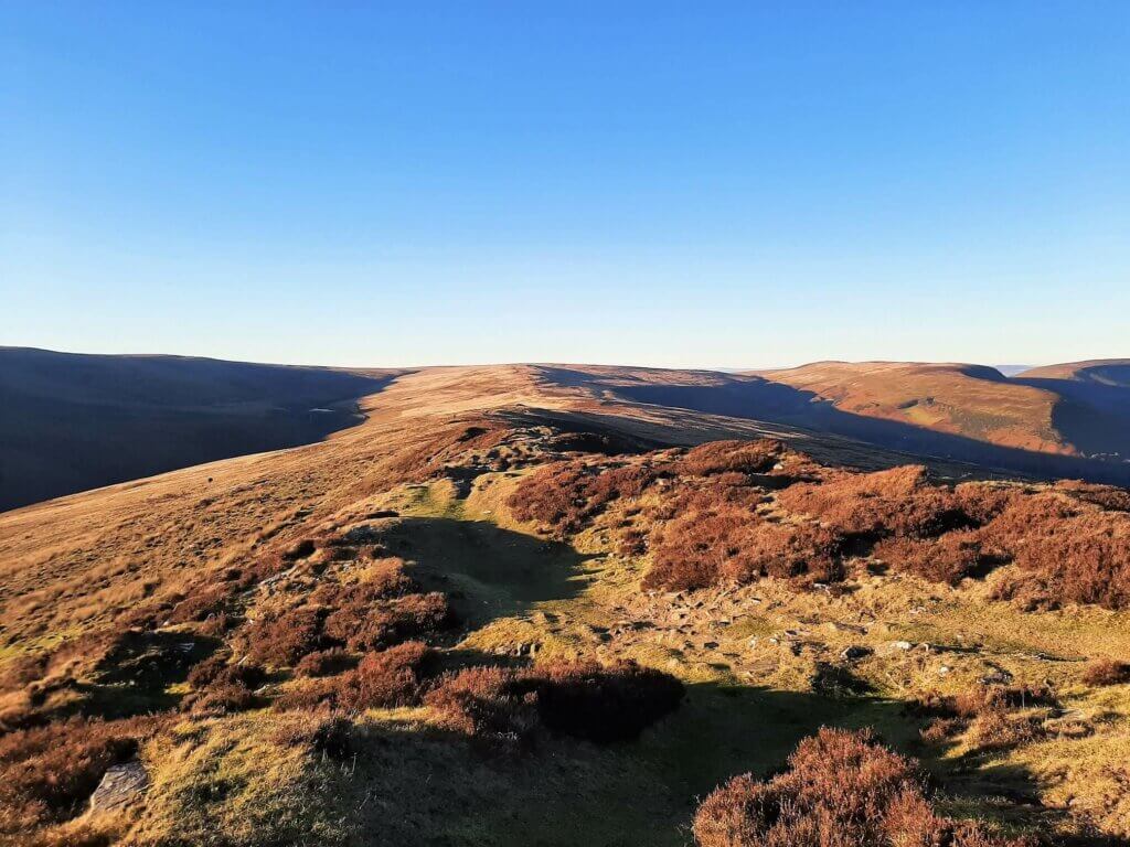
As you make your way northwards, the distinctive Cat’s Back ridge leading to Black Hill can be seen across the Olchon Valley to the east.
Whilst off to the north west you should also get to enjoy sweeping views into the once glaciated Ewyas Valley.
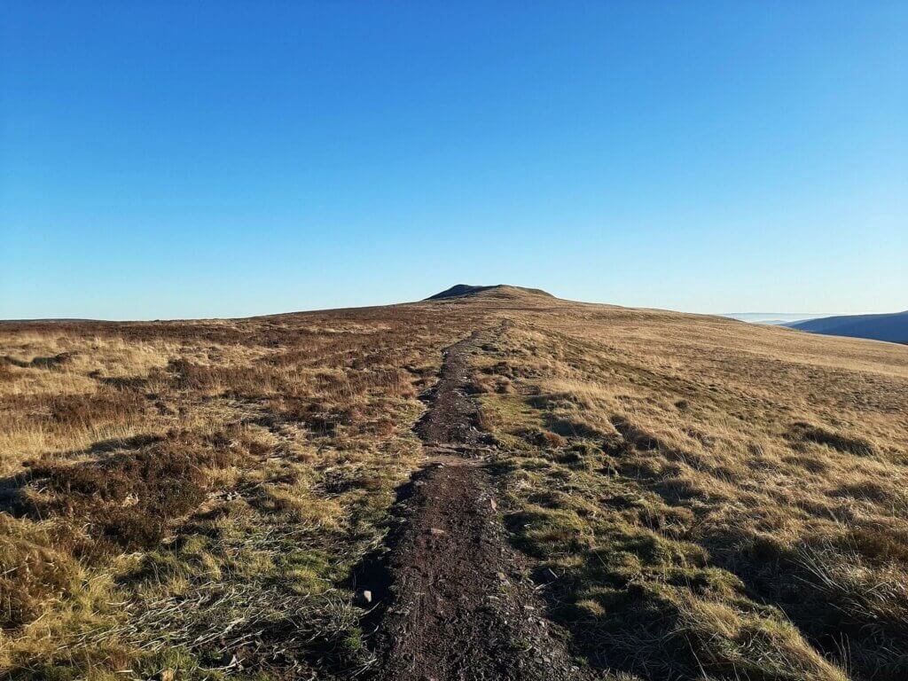
Further along, you will cross the peak of Black Mountain (Twyn Llech), the highest point along Hatterrall Ridge at 703 metres. This is a fairly nondescript summit, sitting within the broad ridge and marked by only a small grouping of stones.
Did you know? Black Mountain is a peak within the Black Mountains, located in the eastern section of the Brecon Beacons National Park; not to be confused with the Black Mountain range (Welsh: Y Mynydd Du), located in the western section of the Brecon Beacons National Park
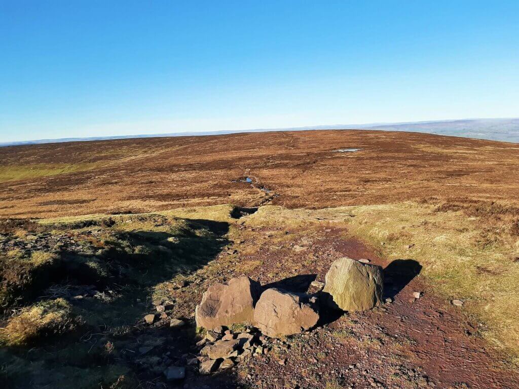
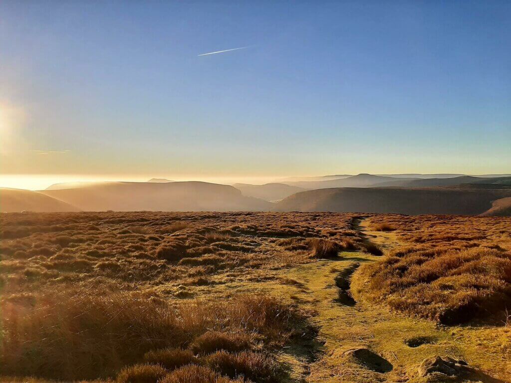
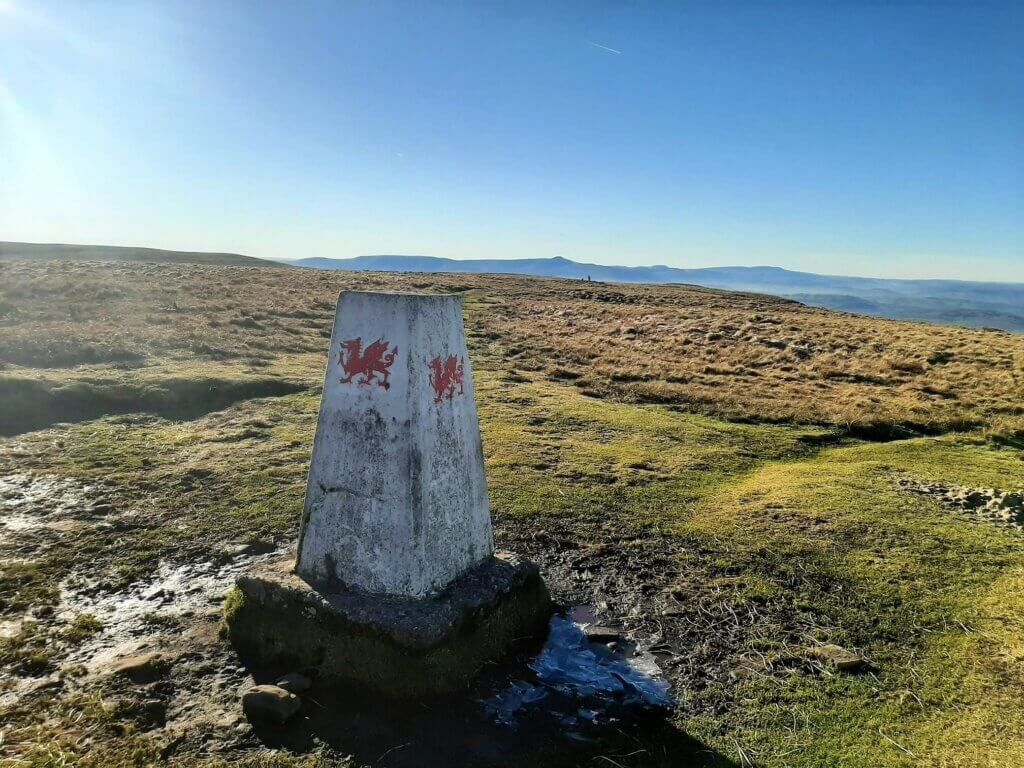
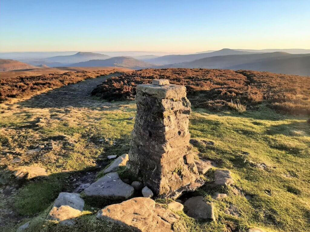
Shortly after Black Mountain there is a short descent in the trail, after which Offa’s Dyke Path veers off to the right. However, you continue straight ahead and in just under 1 km you will arrive at the trig point indicating the 677-metre summit of Hay Bluff.
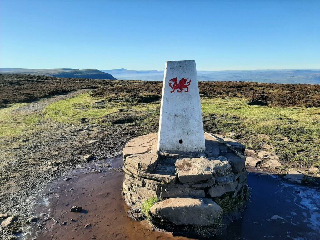
Located immediately adjacent to the steep mountain escarpment, the views from Hay Bluff are worth taking a well-earned break to enjoy. To the north, fabulous views are on offer to the Wye Valley and the hills and mountains of mid-Wales.
Out to the west, far-reaching views can be had across the northern reaches of the Brecon Beacons National Park.
Hay Bluff to Rhos Dirion – 3.23 miles (5.2 km)
The next stage of the Vale of Ewyas horseshoe walk leads you in a south westerly direction across the head of the valley.
You first descend into the valley at Gospel Pass, the highest road pass in Wales, before the gentle climb to the summit of Twmpa (Lord Hereford’s Knob).
From the 690-metre summit, there are wonderful views back towards the Hay Bluff escarpment as it slides dramatically into the valley below. Additionally, and subject to weather, you may also get to enjoy the far off peak of Pen y Fan to the south west.
Continuing to the south west, the trail drops into a shallow valley before the gradual ascent to the 713 metre peak of Rhos Dirion, marked with a trig point.
Rhos Dirion to Junction of the Beacons Way – 5.97 miles (9.6 km)
From the summit of Rhos Dirion, a glance to the south east and you can see the long, broad, flattish ridge stretching out ahead of you.
If you are feeling a little tired at this point, it’s probably a good idea to have a rest and get some energy on board as you still have the best part of 7.5 miles to go!
The first part of this section may well be a little samey to some, owing to its flat and nondescript nature.
However, as you make the gentle climb towards the 679 metre summit of Chwarel y Fan, the ridge narrows significantly adding both variety as well as greatly improved views towards both the Ewyas Valley and Grwyne Fawr Valley.
Furthermore, from this location you can now catch a glimpse of the Grwyne Fawr Reservoir to the north west, as well as the Mynydd Du forest that adorns the valley sides to the south west.
Also, out to the west sits the distinctive, flat-topped summit of Waun Fach, the highest peak in the Black Mountains.
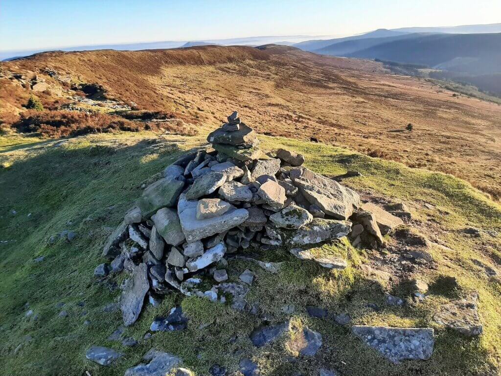
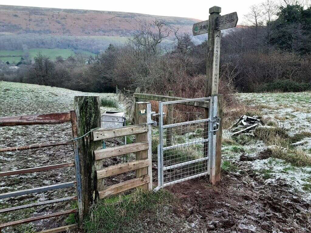
It is now a nice pleasant descent to the final trig point indicating the peak of Bal Mawr at 607 metres. From here, the descent steepens and the trail swings to the south east before arriving at a stone marker signifying the junction of the Beacons Way.
Junction of the Beacons Way to Llanthony Priory – 1.43 miles (2.3 km)
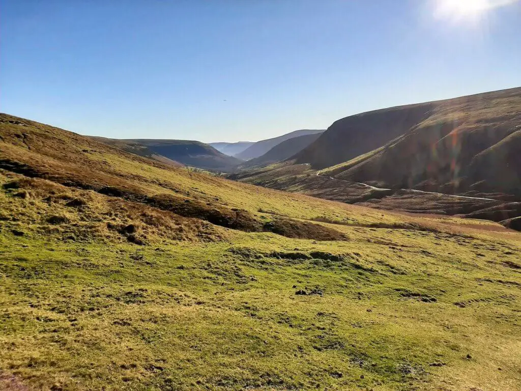
Turn left at the marker, following the gently descending trail. After approximately 500 metres, the path breaks to the right, steepens considerably and follows the Cwm Bwchel (stream) into the valley via a narrow, muddy and rocky path.
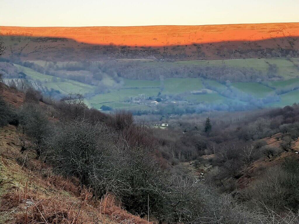
You will now be able to see Llanthony Priory in the valley below, offering reassurance that this long and challenging hike will soon be ending.
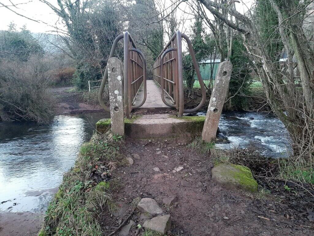
You eventually reach the first of 8 gates, many with accompanying signs leading you seamlessly back towards Llanthony.
Here you cross the River Honddu via a footbridge, pass through Treats campsite and within minutes you will arrive back at the starting point alongside Llanthony Priory.
Vale of Ewyas Horseshoe Walk – Our Thoughts
When I decided to undertake the Vale of Ewyas horseshoe walk, I knew that I was going to be exposed to more wonders of the Black Mountains. But above all, I was totally aware of just how challenging this walk was going to be!
The only real tough ascent of note is the initial climb from Llanthony Priory to the top of Hatterrall Ridge. After that, there are just a couple of modest climbs to the peaks of Twmpa and Rhos Dirion.
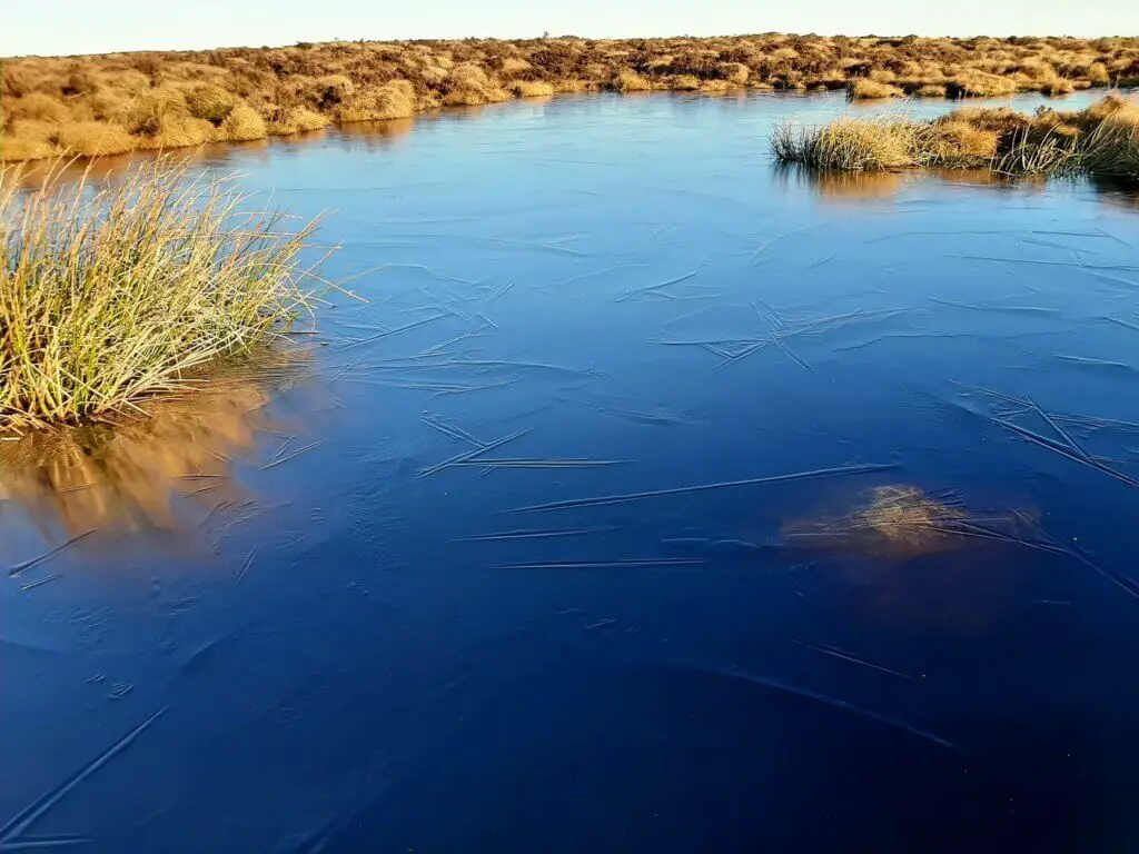
Between, it’s just a lot of gently undulating terrain which can be boggy in places, especially following heavy rainfall.
The final descent to Llanthony from the junction of Beacons Way has to be carefully negotiated as it is narrow, steep and rocky in places. Combined with incredibly tired legs, slips and trips can easily occur!
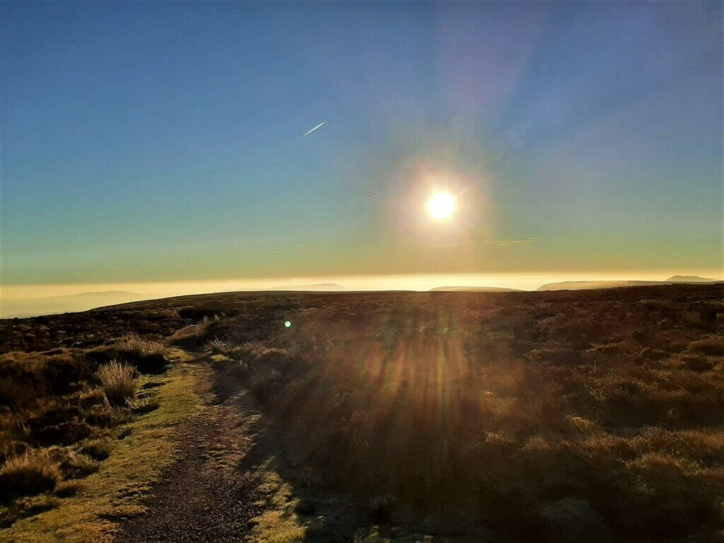
This is a long day hike and needs to be planned accordingly. If you are undertaking this walk in winter, you need to start early so as not to run out of daylight. I set off from Llanthony Priory at 0815 on a January morning and by the time I returned at 1645, light was fading fast.
Also, bringing the correct nutrition and an appropriate quantity of water is also crucially important on hikes, especially of this length.
I experienced this hike in just about the most perfect weather possible; unbroken sunshine and hardly a breath of wind and it was still tough.
Undertaking this hike in wet and/or windy conditions would, in my opinion, make this a rather unpleasant affair, adding significant time to the overall hike.
I would highly recommend the Vale of Ewyas horseshoe walk but please do not attempt this if you are not in pretty good physical shape. Additionally, pick your weather wisely!
Oh, almost forgot, make sure you spare yourself a few minutes to have a wander around the beautiful remains of Llanthony Priory. Not only is it free to access but located immediately alongside the car park. So, you really have no excuse!
Vale of Ewyas Horseshoe Walk – Q & As
How long does the Vale of Ewyas horseshoe walk take?
It took me 8.5 hours to complete the walk. When I did stop, my breaks were not particularly long, so this walk could have easily taken an extra 30-60 minutes.
How far is the Vale of Ewyas horseshoe walk?
17.47 miles (28.1 km)
How difficult is the Vale of Ewyas horseshoe walk?
I would consider this to be a challenging walk owing more to the overall distance than the difficulty and number of ascents and descents.
What other Llanthony Priory walks are there?
Perhaps you are not ready for the epic 17+ mile Vale of Ewyas horseshoe walk. Well, you will be happy to know that there are plenty of alternative Llanthony walking routes to keep you entertained.
If you head over to Outdoor Active, our hiking App of choice, you will see a myriad of walking trails fanning out from Llanthony. If you wish to take out one of the premium membership options with Outdoor Active, be sure to grab a €10 discount by using the following code: ROAMINGSPICES101.
If you fancy walking experiences a little further afield but still within this easterly section of the Brecon Beacons National Park, be sure to check out our selection of Black Mountains walks.
Have you experienced the Vale of Ewyas Horseshoe Walk?
If you have, please share your experience with us and our readers. If you have any questions that we have not answered here, please let us know and we will get back to you just as quickly as we can.
Like Our Article? Please Pin it!
Leave a Reply