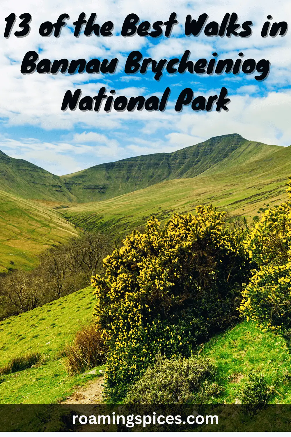
Bannau Brycheiniog (Brecon Beacons) National Park
Looking for a selection of the best walks in Bannau Brycheiniog National Park? These 13 walks have all been experienced by us and are so diverse, offering a broad spectrum view of all the wonders of this Welsh national park
Selection of the Best Walks in Bannau Brycheiniog National Park
There are a few things that make up a fantastic hike. A few of these are under the hiker’s control, like equipment and preparation, good company, and delicious (and nutritious) snacks.
Some of the most valuable and rewarding things, though, come from the locations we choose to visit. Things like the views. And the wildlife. The sounds of a bubbling stream.
Some locations offer such an abundance of these things they deserve taking note of – and Wales has some of the most breathtaking hikes in the world. Today we’re looking at 13 of the best walks in The Bannau Brycheiniog National Park – one of the UK’s most bountiful treasures for avid hikers.
Strap up your boots, get your walking poles ready, and join us in exploring one of the most beautiful regions of Wales…
Introduction to Bannau Brycheiniog National Park
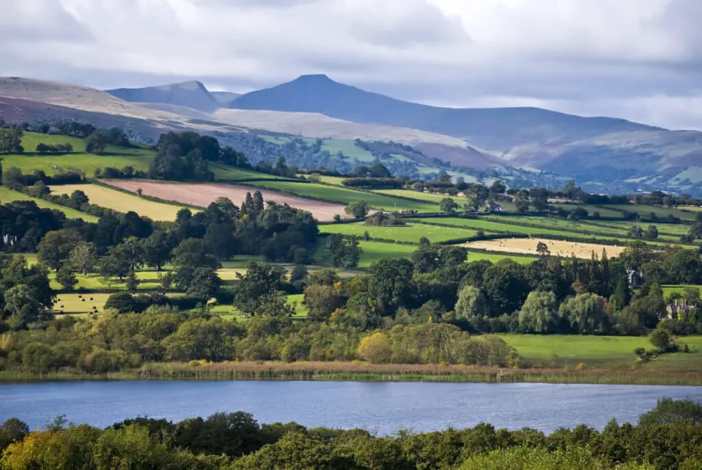
South Wales, also known affectionately as ‘The Valleys’ by locals, is a rich historically textural part of the United Kingdom. It gets its colloquial name for the undulating peaks and troughs of its landscapes, which are widely regarded as some of the most beautiful landscapes in the UK.
It’s this breathtaking natural setting that plays host to the Bannau Brycheiniog National Park. Bannau Brycheiniog is a mountain range, which includes the highest mountain in Wales – Pen y Fan (more on that later…).
They’re sometimes referred to as the ‘Central Beacons’, and it’s thought they got their name from the practice of lighting ‘beacon’ fires along stretches of the mountainside to warn of incoming invaders (those familiar with the Lord Of The Rings film series may already have an idea of what this would look like!)
Bannau Brycheiniog only makes up a part of the more expansive Bannau Brycheiniog National Park. The Park also includes the Black Mountains to the East and the Great Forest (or Fforest Fawr in Welsh).
Bannau Brycheiniog National Park – A Potted History
The park was established in 1957, the third of the three Welsh parks after Snowdonia in 1951 and the Pembrokeshire Coast in 1952, and the 10th overall in the UK. While the Beacons’ key features are naturally formed (the valleys, rolling hills and mountains), much of what we recognise as the National Park today owes itself to manmade intervention.
From prehistoric land-clearing, with the dispersion of standing stones, hillforts and burial chambers, to Roman camps and medieval lake dwellings, a hike through the Bannau Brycheiniog National Park is a true walk through history.
There’s a unique feeling of time and place in the Park, with each hike its chapter in a millennia-long history, the valleys themselves a living timeline wrought from rock.
Best Walks in Bannau Brycheiniog National Park
A large part of the joy of the Park lies in the sheer number of hikes you can take. There’s something for everyone here, from famous, well-trodden paths to bespoke routes (although only plan your route if you’re a very confident hiker…).
We’ve assembled 13 of what we feel are the best walks in Bannau Brycheiniog National Park from our own experience, which provide a diverse range of experiences across the Park’s 1,344km2.
1. Brecon Beacons Horseshoe Ridge Walk
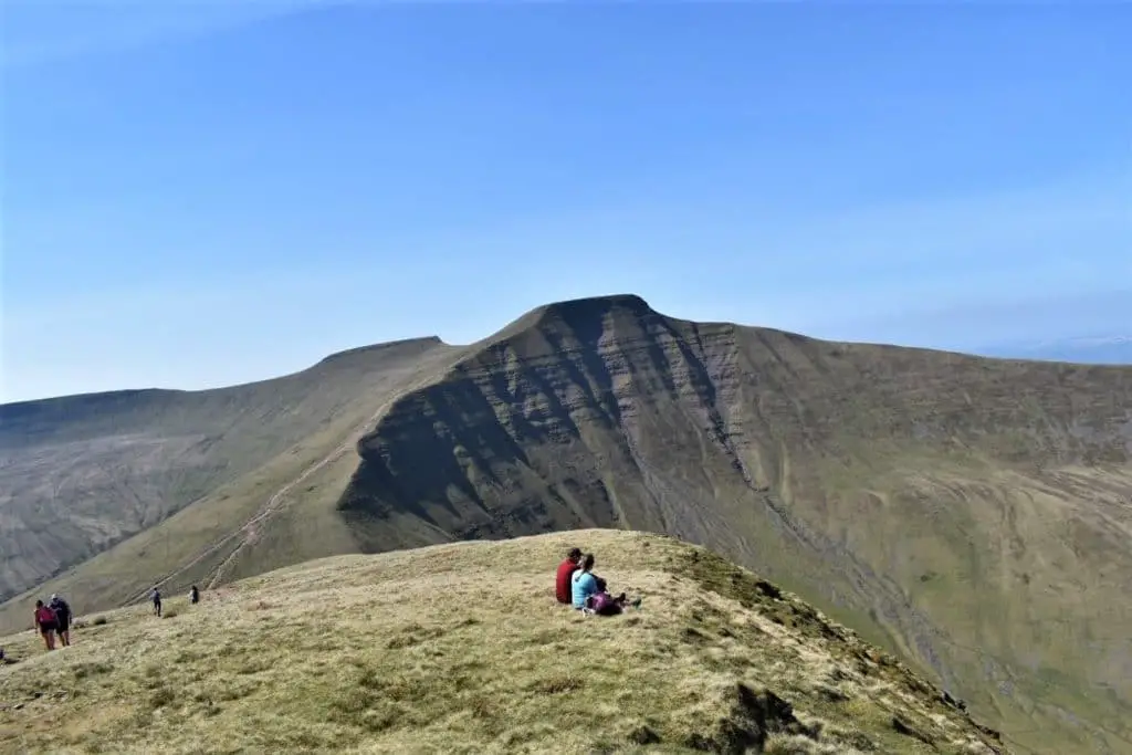
The Horseshoe Ridge Walk is a true mountain hike, full of idyllic views across four tabletop peaks in the National Park. It’s not the easiest hike, so possibly not one for the youngest adventurers, but if you’re up for the challenge, this one is memorable.
- Walk distance: 14.63 km (9.09 miles) – of which about 1200m are on tarmac or concrete.
- Difficulty: Challenging.
- Time: 5-7 hours.
- Map: OS Explorer Map: OL12 (Brecon Beacons National Park – Western & Central Areas).
- Starting Grid reference: SO 036 170.
- Parking: Neuadd car park in the Taf Fechan Forest – CF48 2UT (head for the Neuadd Reservoir).
Summary
This classic horseshoe walk around a steep-sided glacial valley is amongst the best ridge walks in Wales, and it’s one of the best in Bannau Brycheiniog National Park.
The route takes you across the peaks of four central mountains in the Park (Corn Du, Pen y Fan, Cribyn, Fan y Big), showing off the stunning grassy glacial landscapes.
After a walk from the car park, a steep climb up Craig Fan Ddu Ridge gets steeper as it goes, so don’t be fooled. Make sure to pace yourself! From there, the route winds along the four tabletop peaks, making a walk you’ll never forget, but that might leave you aching!
“Experience four of the best walks to Bannau Brycheiniog waterfalls”
On a clear day, route finding is easy as the whole horseshoe can be seen once you’ve managed the first ascent – this walk is a brilliant way to take in some of the best views of the National Park, and the UK has to offer.
The Horseshoe Ridge is a fantastic hike for those looking for a real challenge. This is a long, tiring walk with several steep ascents, so consider that before setting off. You’ll need to bring clothing for all kinds of weather as it can change abruptly, and there is no shelter – that means waterproofs just in case! Be sure to bring plenty of water and some energy-boosting snacks.
Read about our experience of the Brecon Beacons Horseshoe Ridge Walk.
2. Pen y Fan Walk From Nant Cwm Llwch Car Park (Cwm Llwch horseshoe walk)
There are lots of different walks and ways to take in Pen y Fan, the highest mountain peak in South Wales. While some are more popular, this one is our favourite, as it takes you through a picturesque track with some fascinating historical sights (not to mention the incredible views!)This is one of the best ways to experience a combination of the stunning Corn Du and Pen y Fan peaks, along with some beautiful and tranquil lake views.
- Walk distance: 5.15 miles (8.29 km)
- Difficulty: Moderate.
- Time: 3.5-4.
- Map: OS Explorer Map: OL12 (Brecon Beacons National Park – Western & Central Areas).
- Starting Grid reference: SO 006 244.
- Parking: The car park is approximately 7 miles (11km) north of the Storey Arms Outdoor Education Centre. Follow the A470 north and turn right in the village of Libanus, just before you reach the Tai’r Bull pub. From there, it’s roughly 2 miles (3 km) from this turn-off to the Nant Cwm Llwch car park!
Summary
There are a few different versions of the Pen y Fan walk, which takes you up to the peaks of Pen y Fan and Corn Du, but this is our favourite, and we wouldn’t hesitate to say we think it’s one of the best walks in Bannau Brycheiniog National Park.
Although similar to the published Cwm Llwch Horseshoe Walk on the National Trust website, our version of this Pen y Fan horseshoe walk is abbreviated, which avoids road walking.
This is an excellent route for walkers looking for peace, too, particularly if you leave early in the morning, as it misses out on the more popular sections of the Pen y Fan trails, and you may even get some sections of the track to yourself.
The route takes you past the Tommy Jones memorial in remembrance of 5-year-old Tommy, who tragically lost his life in 1900, having become lost on Bannau Brycheiniog. You’ll also pass the now-disused Cwar Mawr Quarry site, where roof tiles were cut in the 18th century.
This can be a challenging walk in places, as you’ll pick out your route on some sections of the descent, requiring a confident walking ability. The climbs on this route are slightly longer than other options due to a lower starting elevation. Remember how quickly the weather can change on the Beacons too, and pack sensibly.
For pictures and our first-hand account of the walk, please read about our experience of this Pen y Fan walk.
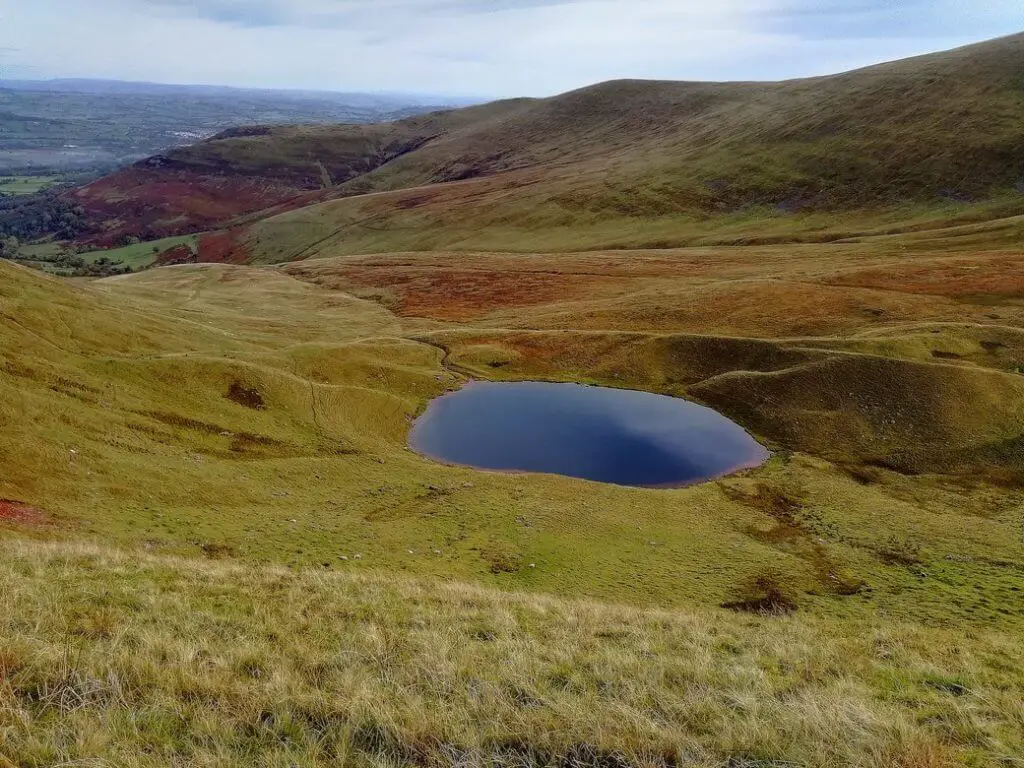
3. Llyn y Fan Fach and Llyn y Fan Fawr Circular Walk
This challenging 9-mile hike takes you past two incredible glacial lakes through a remote section of Bannau Brycheiniog National Park. The Llyn y Fan Fach and Llyn y Fan Fawr Circular Walk is a great way to experience this side of the Park, a stunning example of the power of nature left untouched.
- Walk distance: 15km – 9 miles
- Difficulty: Moderate – Challenging.
- Time: 5-6 hours
- Map: OS Explorer OL12: Brecon Beacons National Park (Western Area)
- Starting Grid reference: SN 799 238.
- Parking: The Llyn y Fan Fach car park postcode is SA19 9UN, but it’s incredibly remote, so relying on a sat nav isn’t a great plan. Print out a copy of the map and get someone to aid you with directions. There are also limited spaces in the car park, so arrive early!
Summary
This quiet, tranquil, challenging hike also passes by Llyn y Fan Fach and Llyn Y Fan Fawr, two beautiful lakes surrounded by natural amphitheatre-like escarpments. Depending on the time of year you visit, you may even catch a glimpse of some snow and ice – while this ramps up the hike’s difficulty, it can also add to the wonder of the views…
This hike is excellent if you appreciate solitude and enjoy getting away from the crowds. It’s best to wait for a clear day for this one, as the views are not to be missed and can be spoiled by fog. Luckily there are a couple of shelters along the way if you get unfortunate with the weather!
The walk combines views of lakes, mountain ridges, and waterfalls, and its remote location makes it the perfect place for a quiet and contemplative hike – although some steep climbs make for a 9-mile hike that’s not for beginners or the faint-hearted!
Read our full blog post for more on this beautiful glacial lake route.
4. Blorenge Walk
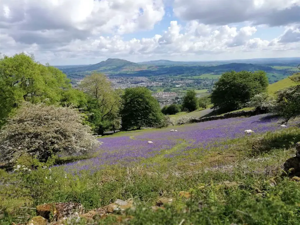
The Blorenge Mountain is located in the southeastern corner of Bannau Brycheiniog National Park in the Welsh county of Monmouthshire. It sits between the towns of Abergavenny to the north and Blaenavon to the south. This walk is the perfect way to experience the mountain and take in some of the best views of the Black Mountains and the Beacons.
- Walk distance: 7 miles
- Difficulty: Easy-Moderate.
- Time: 4-5 hours
- Map: OS Explorer Map OL13: Brecon Beacons National Park (Eastern Area)
- Starting Grid reference: SO 254 107.
- Parking: There are a couple of options for parking, but we like to use the Keeper’s Pond car park, postcode NP4 9SR.
Summary
With great views from the moment you get out of your car (owing to the starting elevation of 482m!), this charming hike offers views of some of the most unique areas of the National Park, including the Usk Valley.
The wooded easterly slopes where the Punchbowl is located are a haven for wildlife, highlighting the majesty of nature in this part of the country (it’s the perfect spot for a lunch break!)
With some incredible views of bluebell fields, if you visit at the right time of year, along with sheep and lambs, this hike was made for Springtime. It offers an incredible chance to take in some of South Wales’ most picturesque scenery, and it’s not too challenging – meaning younger walkers can come along for the experience.
For more information on the Blorenge walk, read our account.
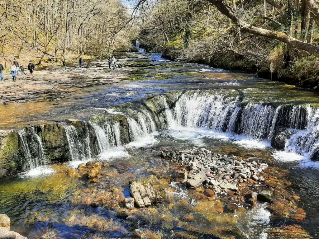
5. Talybont Waterfalls Walk
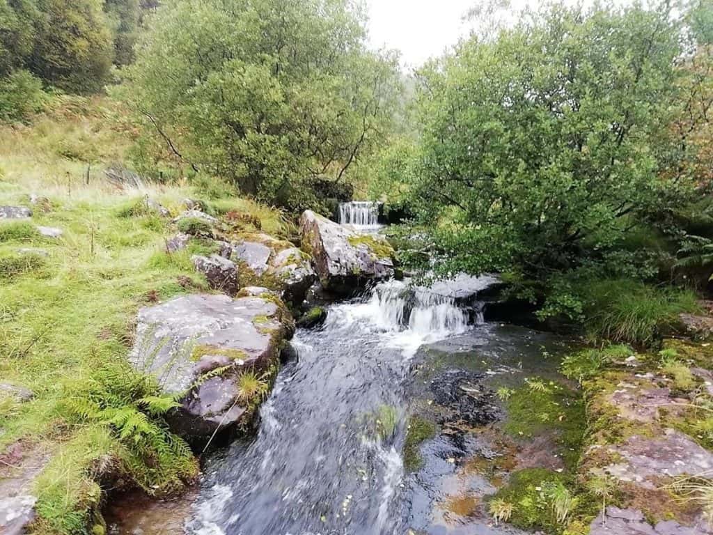
Waterfalls are some of our – and many other hikers’ – favourite natural features, and the Talybont Waterfalls Walk is not only one of the best walks in Bannau Brycheiniog National Park, but it also features some astonishing views of these incredible forces of nature. This is a moderately challenging hike, combining a glacial ridge walk with a valley descent (where the waterfalls are located.)
- Walk distance: 7.7km – 4.8 miles
- Difficulty: Moderate – Challenging
- Time: 3 hours +
- Map: OS Explorer Map OL13: Brecon Beacons National Park (Eastern Area)
- Starting Grid reference: SO 056 175.
- Parking: For Sat Nav users, the Talybont Waterfalls postcode is CF48 2UT, and we opted for the Blaen y Glyn Uchaf car park. The walk starts at the entrance to this car park.
Summary
This walk starts with a view of two small waterfalls – perfect for inspiring you and a fitting teller of what’s to come. A large portion of the Talybont Waterfalls walk is spent ascending and walking along a glacial ridge, which provides stunning views of the valley below.
There are several eye-catching sights to take on during the route, particularly the crash site of a WW2 bomber. The crash is still there, and you can witness the wreckage for yourself, along with a memorial plaque. It’s a powerful moment amplified by the Romantic and sublime surroundings.
The waterfalls themselves are utterly beautiful. The second part of the walk descends into woodland, and babbling brooks cascade into full waterfalls along the Caerfanell River. This is a lovely place to stop and take in this destination’s most peaceful and tranquil scenery.
For more information, some of our photos, and a few other tips, take a look at our full blog post on the Talybont Waterfalls Walk.
6. Skirrid Mountain Walk
This walk is perfect for those who enjoy their hikes when they take them through varying scenery and landscapes. During the Skirrid Mountain Walk, you’ll journey through woodlands, and venture onto open mountainsides, making you feel like a true adventurer…
- Walk distance: 5.5km – 3.4 miles
- Difficulty: Moderate
- Time: Up to 2 hours
- Map: OS Explorer Map OL13: Brecon Beacons National Park (Eastern Area)
- Starting Grid reference: SO 328 164
- Parking: The Skirrid car park is situated just off the B4521 (Old Ross Road) just 1.5 miles (2.4 km) east of Abergavenny on the left-hand side – Full address: Llanddewi Skirrid, Abergavenny, NP7 8AP
Summary
Although there is a moderate 15-20 minute climb, this is a generally quite gentle hike, which offers some beautiful scenery of the Caer Wood, which marks the first section of the route, the Pant Skirrid Wood, and of course, from the mountain itself. You’ll be able to take in sights, including Sugarloaf Mountain.
Skirrid comes from the mountain’s Welsh name, Ysgyryd Fawr – Ysgyryd meaning ‘shake’ or ‘tremble’ and Fawr meaning ‘large’. The mountain is aptly named, with a considerable landslide visible on the northernmost slopes of the mountain.
The ascent to the summit is steep but mercifully short, and for those looking for a diverse hike which isn’t going to knock out an entire day, this is perfect. This hike is brilliant for contemplation or stirring up creativity and inspiration – and it can be completed before lunchtime!
Read our full blog post on the Skirrid Mountain Walk for more information and photos of the incredible sights.
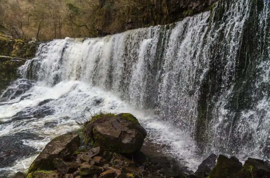
7. Henrhyd Falls & Nant Llech Walk
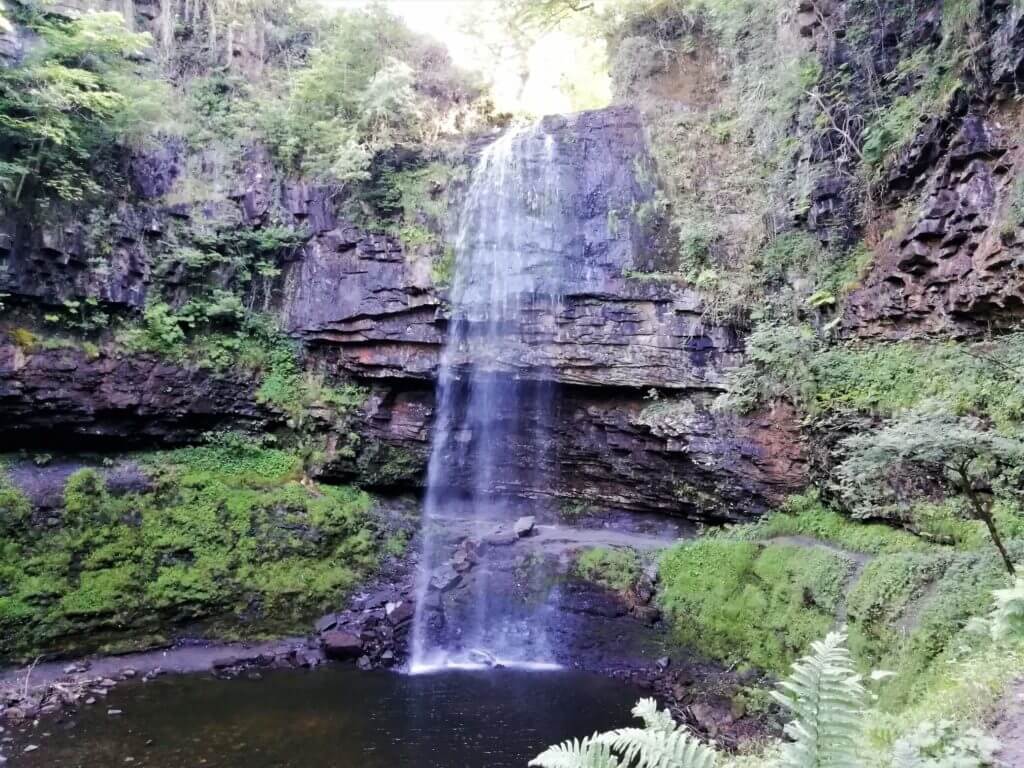
Another short but utterly beautiful waterfall hike. This efficient but jam-packed route will take you past the highest waterfall in South Wales – which is well worth a visit all on its own – as well as the bucolic Nant Llech River valley; this can all be completed in under 2 hours!
Movie fans may also delight that this hike will take you to a well-known cinematic filming location…
- Walk distance: 6.5km – just over 4 miles
- Difficulty: Easy – Moderate
- Time: Up to 2 hours
- Map: OS Explorer Map: OL12 (Brecon Beacons National Park – Western & Central Areas).
- Starting Grid reference: SN 853 121.
- Parking: For this one, you’ll want to head to the National Trust car park at Henrhyd falls – the postcode is SA10 9PG, and a sat nav should take you within cat-swinging distance of the car park itself.
Summary
This short but idyllic waterfall trail is a lovely combination of dense, magical woodland and iconic waterfalls. We don’t say iconic lightly; if you’re familiar with Christopher Nolan’s Batman trilogy, you might recognise Henrhyd Falls as the entrance to the Batcave from the 2012 The Dark Knight Rises!
Cinephile trivia aside, this walk is a sure delight for all hikers, and its short time is a bonus for those looking for a quick fix of stunning British sightseeing.
This isn’t necessarily a hike for those who like to carve their own trails through rugged landscapes battling nature. There are marked paths for this one, but that’s no bad thing, as it allows you to take in the lovely countryside and wildlife as you go.
If you’re just keen to visit Henrhyd Falls, this walk will only take you about half an hour at the most – the full route to Nant Llech (which is well worth the effort) ups the time to about two and a half hours with the option of making the route circular or doubling back along the stunning Nant Llech River.
We won’t spoil too much of this one, as it needs to be seen in person. You’ll likely catch trout jumping up the river, and the plethora of wildlife and birds make this a brilliant hike for those looking to connect with nature.
For more information, please visit our blog post on the Henrhyd Falls and Nant Llech Walk.
8. Mynydd Llangorse Walk
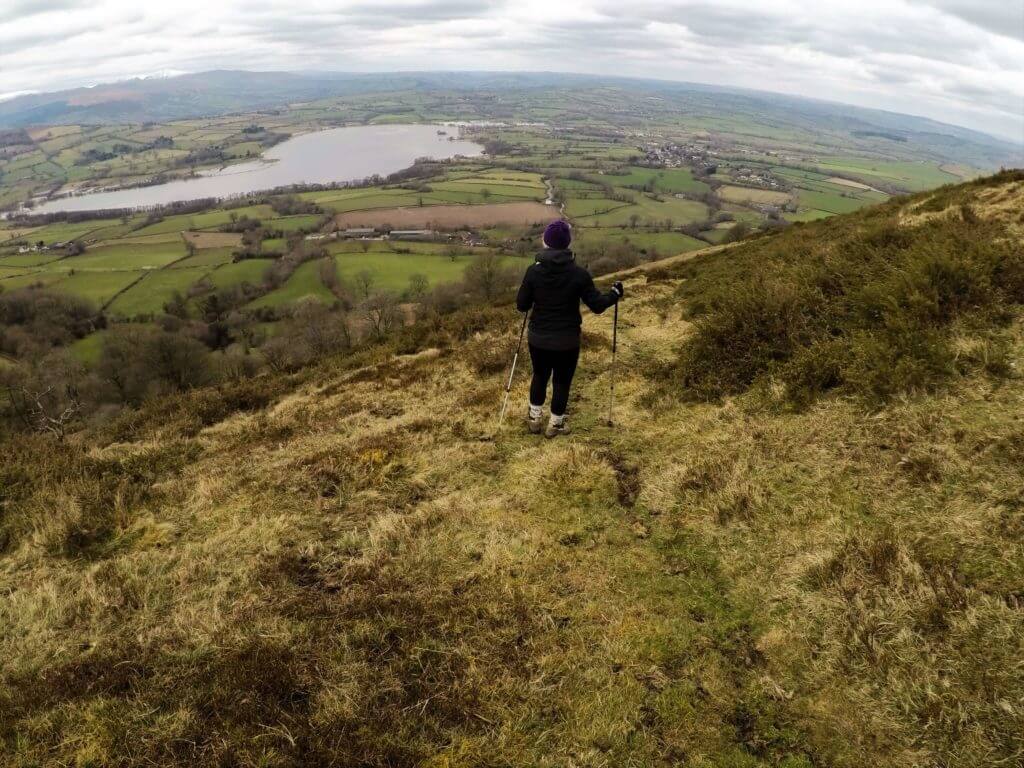
Another shorter one, but don’t be fooled by its length. The Mynydd Llangorse walk is diverse and robust, making it a great quick fix for hikers. It offers a diverse range of Usk Valley, the Black Mountains, and Llangorse Lake views.
- Walk distance: 8.4 – 5.2 miles
- Difficulty: Moderate
- Time: Up to 2 hours
- Map: OS Explorer Map OL13: Brecon Beacons National Park (Eastern Area)
- Starting Grid reference: SO 147 267.
- Parking: An excellent place to park is the Llangorse Multi Activity Centre, a couple of kilometres outside Llangorse – postcode LD3 7UH.
Summary
We originally discovered this charming hike when we visited Llangorse Lake one Easter Sunday – we had intended to head out on the Llangorse Lake Trail, a much shorter 3.5km hike. Still, when we found the lake path impassable due to flooding, some ladies recommended this trail at a local caravan park.
They weren’t wrong to recommend it, and it turned out that by happy accident, we had stumbled across one of the best walks in Bannau Brycheiniog.
This walk starts very gently, with a slightly steeper gradient emerging as you head towards the Mynydd Llangorse trig point. You’ll be greeted with sweeping views of the Usk Valley and the Black Mountains as you make your way along this ridge, and it’s hard to understate how dramatic this is on a clear day.
There are a few different options for navigating this route, and we didn’t go for the ‘official’ route due to the flooding. The return route we opted for took about 2 hours, making it perfect for an afternoon stroll.
Despite its short length, there are a few patches of sharp incline, so we’d recommend only attempting this walk if you’re in good physical shape.
If you’re embarking on this one, look out for the renovated Shepherd’s Hut and the plaque in the garden. It tells an inspiring and memorable tale, which we won’t spoil here – but to find out more, either head out on the trail or look at our more detailed blog post on the Mynydd Llangorse walk.
9. Four Waterfalls Walk
This well-known, memorable hike offers some of the best sights nature – and Bannau Brycheiniog – has to offer. The area this hike takes you through is known as ‘waterfall country’ for a good reason, and the four waterfalls walk is arguably the best way to take it in.
- Walk distance: 9km – 5.5 miles
- Difficulty: Easy – Moderate
- Time: 3-4 hours +
- Map: OS Explorer Map OL13: Brecon Beacons National Park (Eastern Area)
- Starting Grid reference: SN 925 124.
- Parking: Couple of options – we went for Cwm Porth Car Park, Waterfall Centre, Cwm Porth, Ystradfellte, Aberdare CF44 9JF
Summary
This beautiful walk starts along the River Mellte, with the first waterfall after the main section of the trail about 30-40 minutes in. This walk was voted 40th in ITV’s top 100 of Britain’s favourite walks, and for a good reason – the trail isn’t too challenging and is clearly marked, but it takes you past some of the most incredible waterfalls the UK has to offer.
The first is Sgwd Clun-Gwyn, ‘fall of the white meadow’, followed by Sgwd y Pannwr, ‘fall of the fuller’, Sgwd Isaf Clun-Gwyn, ‘lower fall of the white meadow’, and Sgwd yr Eira, ‘falls of snow’. Each is unique and beautiful, framed by the magnificent surrounding scenery.
Our experience of this walk was one of slips into muddy puddles, rain, and not-so-waterproofs. Despite this, and the uninspiring weather, we had a fantastic time; even these challenges couldn’t mar the experience of this incredible walk. To learn more, visit our blog post on the Four Waterfalls Walk.
If cascading water floats your boat (pardon the pun!) as much as it does ours, you will undoubtedly want to check out a selection of other walks to Bannau Brycheiniog waterfalls, of which there are many.
10. Sugarloaf Mountain Walk
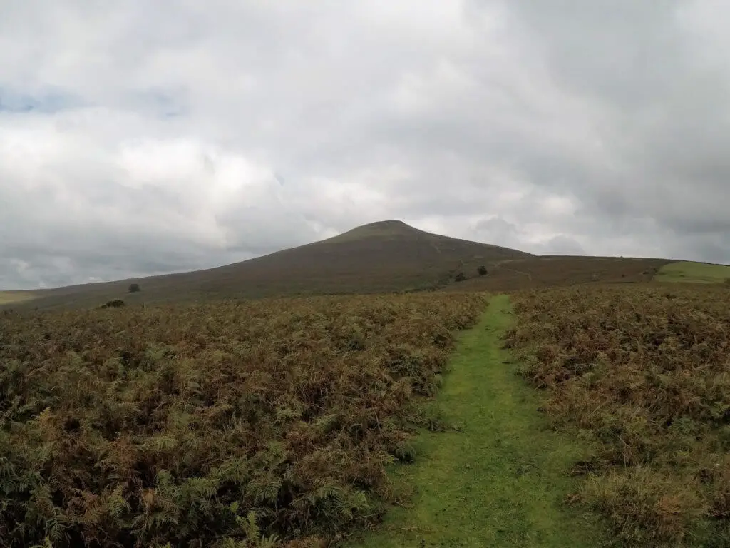
The charmingly named Sugarloaf Mountain is one of the defining features of Bannau Brycheiniog, and you’ll be able to see it from the views on several of the other walks we’ve covered here.
With this in mind, it makes sense to take on the mountain itself, and the Sugarloaf Mountain walk doesn’t disappoint – it’s one of the best walks in Bannau Brycheiniog by far.
- Walk distance: 6.4km – 4 miles
- Difficulty: Moderate
- Time: 3-4 hours
- Map: OS Explorer Map OL13: Brecon Beacons National Park (Eastern Area)
- Starting Grid reference: SO 268 166.
- Parking: Use Llanwenarth car park for this one – postcode NP7 7LA
Summary
Often mistaken to be an inactive volcano due to its unique conical shape, Sugarloaf Mountain is an iconic peak in the Black Mountains. This walk will take you through picturesque oak woodlands, sharply inclined open moorland, and the summit, offering incomparable views.
It takes about 2 hours to reach the peak, and the route there is almost as incredible as the views at the top. The woodlands at the start of the walk have a mystical quality, to the extent that Didem and I half expected a few fairies to make an appearance!
Breaking out of the woods, the incline up the valley before the mountain itself is by far the most challenging part of the walk, but even this isn’t too much to handle, providing you’re relatively fit. Once you’ve made it past this hurdle, you’ll have the view of the mountain to spur you on, and the ridge to the top isn’t too difficult at all.
Be sure to bring a picnic with you for this one, as the summit of Sugarloaf is the perfect place to sit back and take in some of the best views of the area – an idyllic place to enjoy a few traditional Welsh Cakes (or bakestones, as many Welsh people refer to them…)
Just be careful not to leave your food unguarded – the local sheep aren’t wary of travellers as they’re so used to them, and a tuna sandwich in tinfoil can be a tempting morsel…
Be sure to arrive and park up for this one early. It’s a popular walk, so arriving at 09:00 is a great idea, as by the time you get back down – as we experienced first-hand – people will be fighting for spaces!
For more on the Sugarloaf Mountain walk, please visit our blog post and video of the climb.
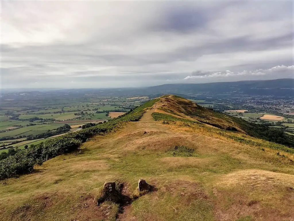
11. Waun Fach Walk (via the Dragon’s Back)
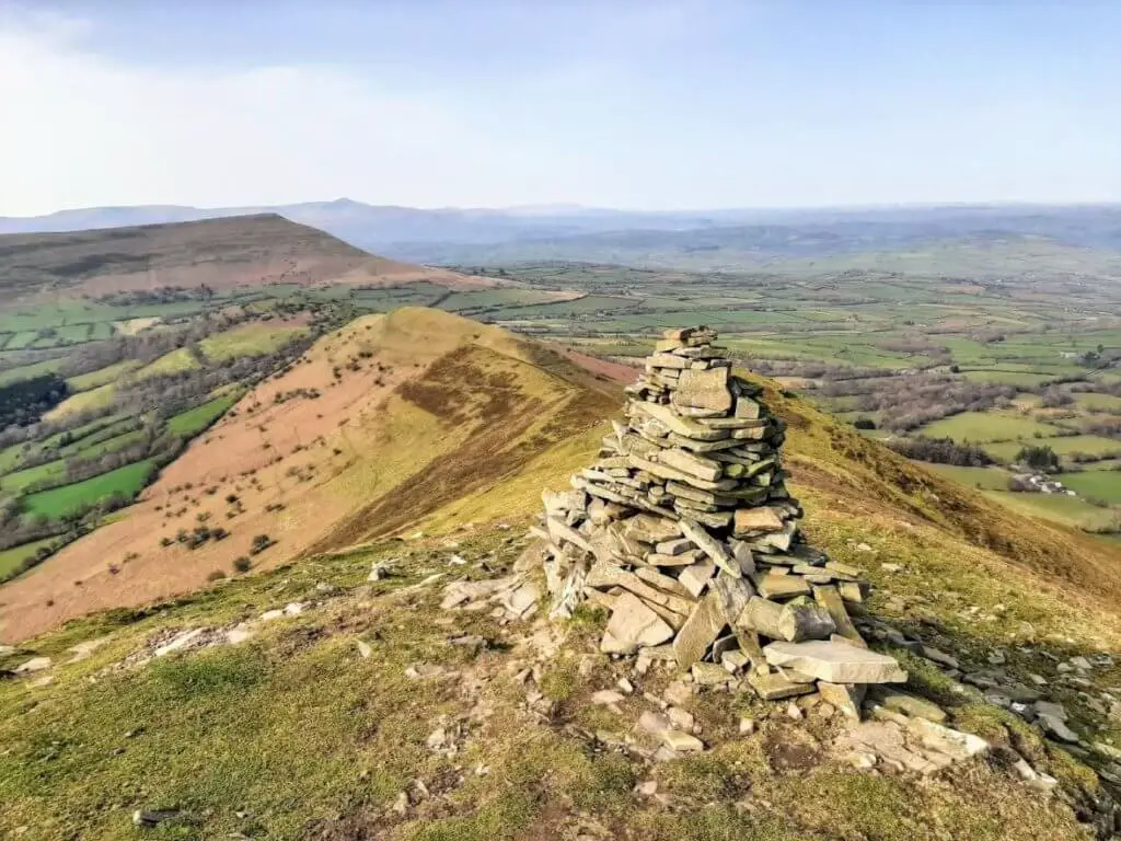
This relatively challenging circular trail via a ridge known as the Dragon’s Back takes you to the highest peak in the Black Mountains – Waun Fach. Throughout the 7+ mile route, you are blessed with sweeping, majestic views along valleys and across the Brecon Beacons National Park peaks and beyond.
- Walk distance: 7.70 miles (12.4 km)
- Difficulty: Moderate/Challenging.
- Time: 4 – 4.5 hours.
- Map: OS Explorer Map OL13: Brecon Beacons National Park (Eastern Area)
- Starting Grid reference: SO 173 296.
- Parking: Car park at The Dragons Back Pub & Bunkhouse. This is located on the A479 in the village of Pengenffordd between Talgarth and Crickhowell, in the northeast of Bannau Brycheiniog National Park. There is a modest £2 fee to park for the day.
Summary
This hike does have a bit of everything – a good challenge, some history and wondrous views.
Shortly after leaving the Dragon’s Back car park, you will find yourself atop a 450-metre hill with historical significance.
Here you will discover the remains of Castell Dinas, a Norman Castle, but there once also stood an Iron Age fort. When standing at this location, it instantly dawns on you why it was chosen as a place of ancient fortification in two historical periods!
It is then on to the long, continuous climb along the Dragon’s Back to the summit plateau. From here, the climb flattens out, allowing you to catch your breath and soak in the superb views as you climb gently to the summit of Waun Fach.
It is now all downhill as the trail meanders westwards to the lower peak of Pen Trumau and then onwards to the valley below.
Discover my first-hand account of the incredible Waun Fach Walk.
12. Elidir Trail (+ Sgwd Einion Gam Falls)
If you like waterfalls, you are going to love the Elidir Trail. Located at the head of the Neath Valley in the southern section of Bannau Brycheiniog National Park, this exquisite trail leads you along two rivers taking in five beautiful waterfalls.
- Walk distance: 7.95 miles (12.8 km)
- Difficulty: Moderate.
- Time: 5 – 5.5 hours.
- Map: OS Explorer Map: OL12 (Brecon Beacons National Park – Western & Central Areas).
- Starting Grid reference: SN 900 076.
- Parking: Four High Street parking spots are alongside the Angel Hotel. Failing that, try and find a spot on Pontneathvaughan Rd, in front of the Angel Hotel.
Summary
Once you head through the gate into ‘Waterfall Country’ you will find yourself in a serene wood as you follow the trail that hugs the bank of the Afon Nedd Fechan (River Neath).
The Elidir Trail then branches off along the Afon Pyrddin, leading you to the picturesque Sgwd Gwladus (Lady Falls). This is one of several Bannau Brycheiniog National Park waterfalls you can walk behind if you dare!
Next, it’s off to the Sgwd Einion Gam (Fall of Crooked Einion). This section of the walk is not strictly part of the Elidir Trail but, in our opinion, is the very best part of this walk!
There is no well-marked trail to get you there. At least two crossings of the Afon Pyrddin are required, and a rather treacherous steep path must also be negotiated. The effort is worth it, though, as the secluded, 26-metre-high waterfall is beautiful.
From here, it’s a case of retracing your steps back to the Afon Nedd Fechan and heading north, where three further falls await you and all close to one another.
First is the Sgwd-y-Bedol (Horseshoe Falls), followed shortly by Sgwd Ddwli Isaf (Lower Gushing Falls) and Sgwd Ddwli Uchaf (Upper Gushing Falls).
It’s then on to Pont Melin-Fach, the northernmost point of the Elidir Trail and a great break spot. Once suitably rested, head south and back to the starting point at Pontneddfechan.
If you want to learn more about this walking route, look at the write-up of our day’s experience on the Elidir Trail.
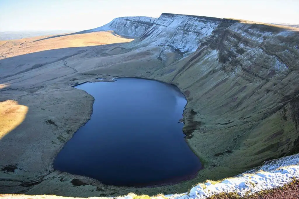
13. Craig Cerrig Gleisiad Walk
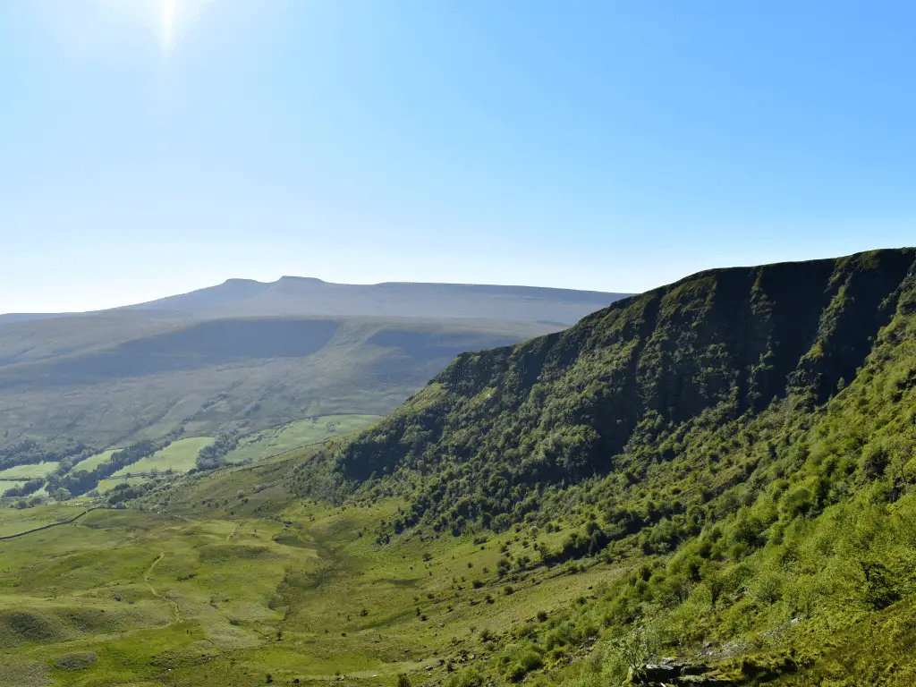
Less than two miles north of Storey Arms, the starting point for the uninspiring, over-trafficked route up Pen y Fan is the Craig Cerrig Gleisiad walk parking area.
This is a short, circular walk up and around this glacial valley’s craggy, towering cliffs, affording you perfect views towards the distinctive peaks of Pen y Fan and Corn Du.
What’s more, there are rarely issues with parking here, in stark contrast to those often experienced by walkers heading up Pen y Fan. Arrive early, and you may complete the walk without seeing a soul!
- Walk distance: 2.7 miles (4.3 km)
- Difficulty: Moderate
- Time: 2 – 2.5 hours.
- Map: OS Explorer Map: OL12 (Brecon Beacons National Park – Western & Central Areas).
- Starting Grid reference: SN 971 222.
- Parking: Lay-by on the western side of the A470, 1.8 miles (2.9 km) north of the Storey Arms Outdoor Education Centre. The nearest postcode is LD3 8NL.
Summary
From the layby, take the tree-lined path alongside the information board until you reach a stone wall and wooden gate. Head through the gap in the wall, and you are instantly greeted by the rugged, sheer cliffs of Craig Cerrig Gleisiad that slide into the grassy amphitheatre-shaped valley below.
After no more than 20 metres, cross the tiny stream just off to your left and commence the steep climb to the top of the north-facing cliffs of Craig Cerrig Gleisiad.
Once at the top, you will need a few moments to draw some air back into those lungs. This is an excellent opportunity to absorb the fantastic views surrounding you, from the broad valley below to the towering peaks sitting a short distance to the east.
Follow the path as it sweeps north around the top of the ridge until you reach a wooden stile on your left-hand side. Cross over and follow the path a short distance to a trig point indicating the summit of Fan Frynych. Return to and over the stile, taking the path directly before you.
This slowly meanders its way back towards the serene valley floor. Here, you will not escape the wondrous and varied bird song accompanying you back to your starting point.
Read about our experience of the idyllic Craig Cerrig Gleisiad walk.
Best Bannau Brycheiniog Walks – Final Thoughts
As with any hike, all of the above trails require a bit of due diligence and planning, but they are undoubtedly a great assortment of the best walks in Bannau Brycheiniog National Park. This is a spectacular part of Wales, the UK, and indeed the world and it’s perfect fodder for keen hikers.
Check out our blog posts below for great walks in other UK National Parks. Please share your thoughts in the comment box below if you’ve walked any of these paths – we’d love to hear from you!
Discover some of the best walks in other UK National Parks
- Dartmoor National Park
- Exmoor National Park
- New Forest National Park
- Peak District National Park
- Snowdonia National Park
Like Our Article? Please Pin it!
Leave a Reply