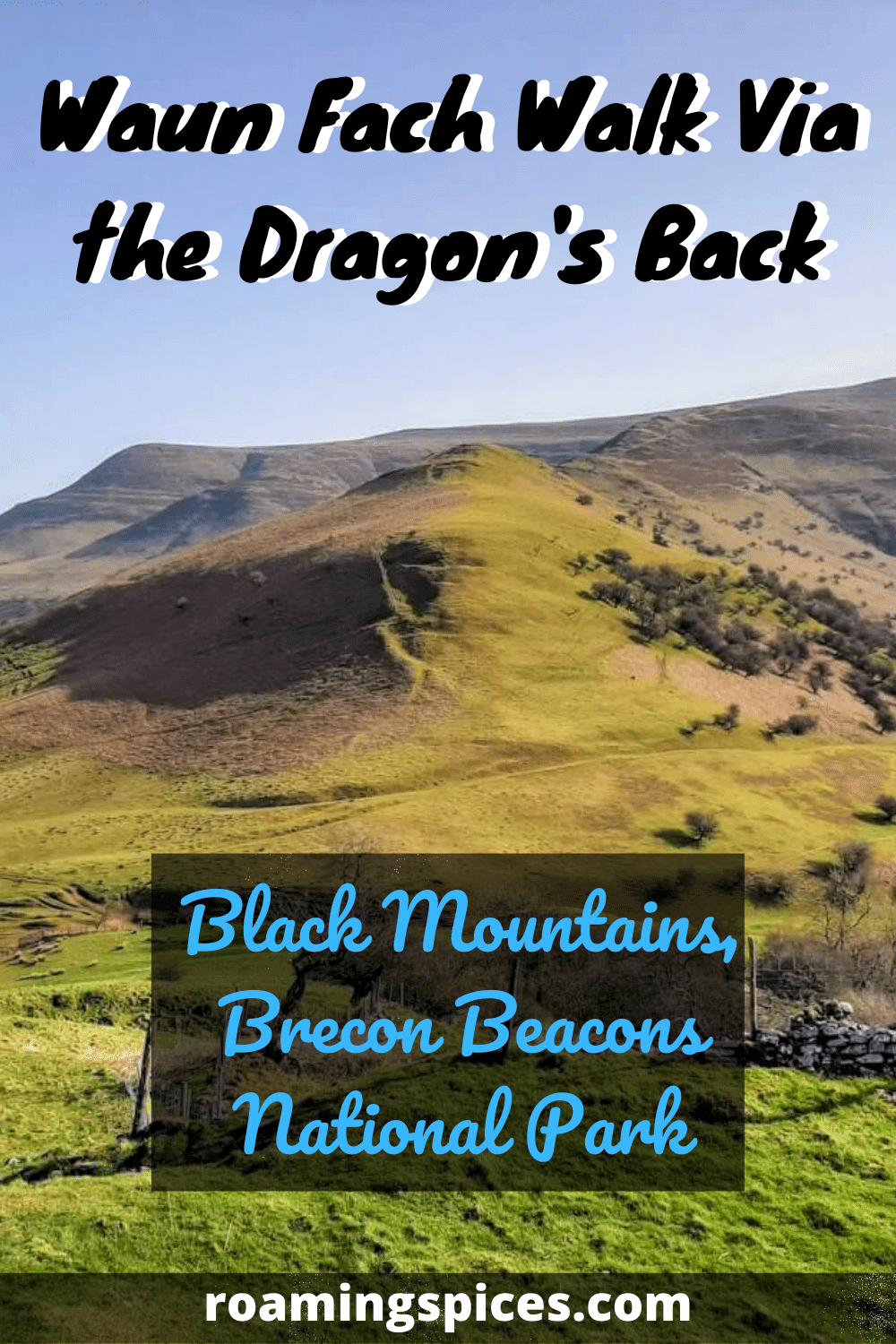
Black Mountains, Brecon Beacons National Park
The Waun Fach walk is a 7 mile (12 km) circular trail via a ridge known as the Dragon’s Back, leading to the highest peak in the Black Mountains. Enjoy sweeping, majestic views across the peaks of the Brecon Beacons National Park and beyond
Dragon’s Back walk to Waun Fach
Introduction
The Black Mountains are located in the eastern section of the Brecon Beacons National Park. They cover parts of the Welsh counties of Powys and Monmouthshire and also extend into the English county of Herefordshire.
The challenging Waun Fach walk leads you to the ruins of Castell Dinas, a Norman castle built at the same location as an Iron age fort. From there, it is on up the dramatic ridge known as the Dragon’s Back, ultimately leading to Waun Fach, the highest point in the Black Mountains.
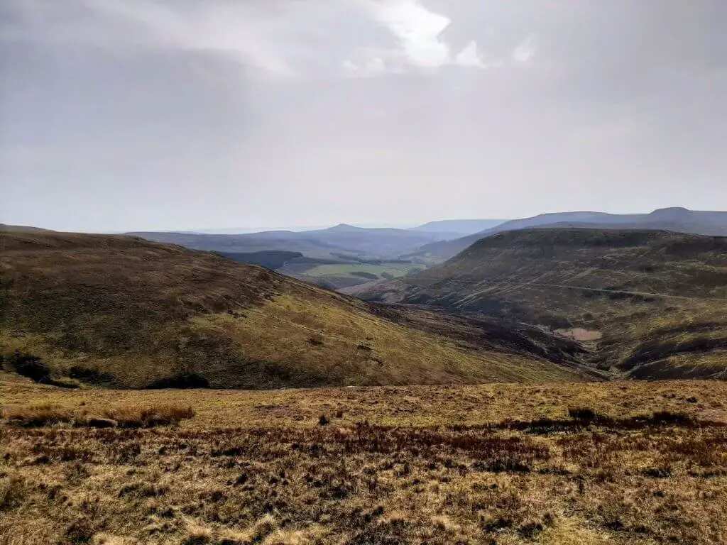
Wherever you look, the views on offer are commanding whether taking in the numerous summits of the Black Mountains and Brecon Beacons or the sweeping verdant, tree-lined valleys flowing like a green sea between the baron peaks.
How to get there and where to park?
The starting location that I used was the Waun Fach car park at The Dragons Back Pub & Bunkhouse. This is located on the A479 in the village of Pengenffordd between Talgarth and Crickhowell, in the northeast section of the Brecon Beacons National Park.
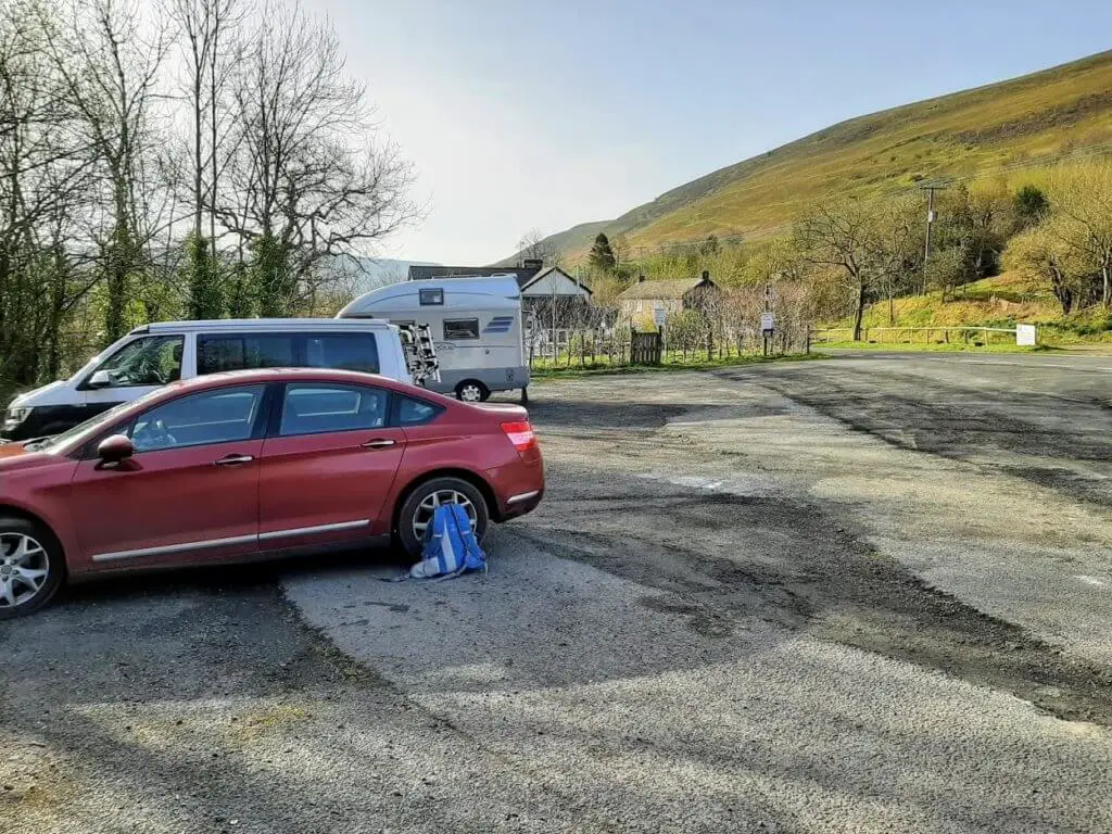
You do not have to visit the pub to park in the car park which would have been difficult anyway as the pub was closed when I visited, due to Covid restrictions. However, there is a £2 cash only fee for parking which you need to drop into a box at the side of the car park.
To find the location with the utmost ease, check out the map below, click the direction link, enter your starting location and allow Google to guide you effortlessly to the walk start point.
Waun Fach Walk – Step by Step
Take the path from the car park signposted ‘Castell Dinas’, head left and follow the gravel path that runs parallel to the A479. Soon you will reach a small road where you will turn right up the hill.
Upon reaching a wooden stile on your right-hand side, cross into the field and aim directly ahead of you up the steep incline to the ridge where you will discover the remains of Castell Dinas.
Castell Dinas (Dinas Castle)
Castell Dinas offers a fascinating stop off on the walk owing to the location’s important archaeological background. An Iron Age fort once stood upon this hill and more recently a Norman Castle believed to be the highest located Norman castle in Wales.

When standing at this imposing location at a height of 1,476 feet (450 metres), it is of little surprise why this hill was selected as a place of ancient fortification on two separate occasions!
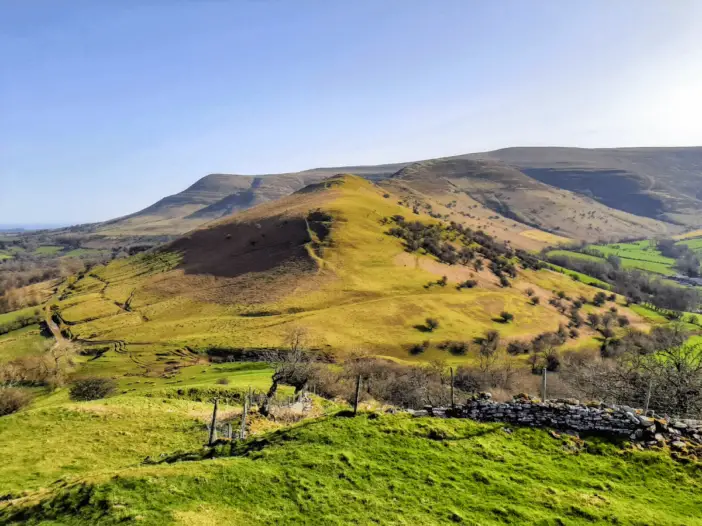
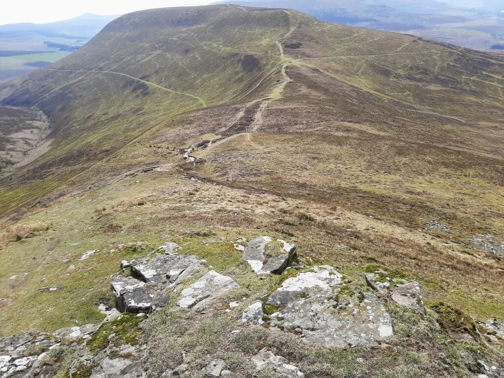
The Dragon’s Back (Y Grib)
From Castell Dinas, you have a wonderful northeasterly view along the ridge of the Dragon’s Back giving a good sense of what the next stage of the Waun Fach walk has in store for you.
Drop down the north-easterly slope from Castell Dinas, cross the wooden style in the mini valley at the bottom and commence the first of three moderately steep inclines along the Dragon’s Back.

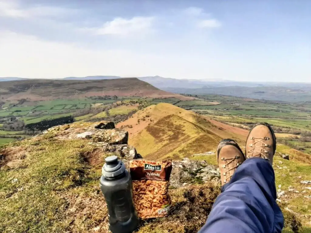
Thankfully, the steep sections as you are climbing Waun Fach are separated by relatively flat stretches, giving you ample opportunity to get some air back into those lungs between climbs!
As you make your way along the Dragon’s Back walk, the views become ever more impressive.
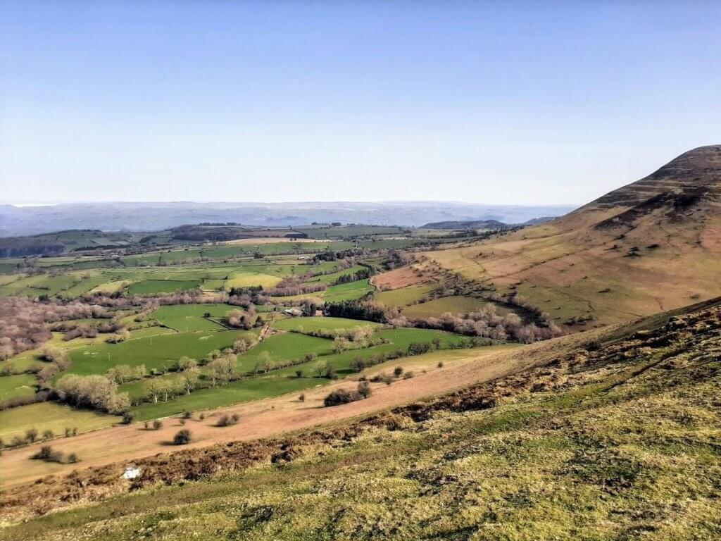
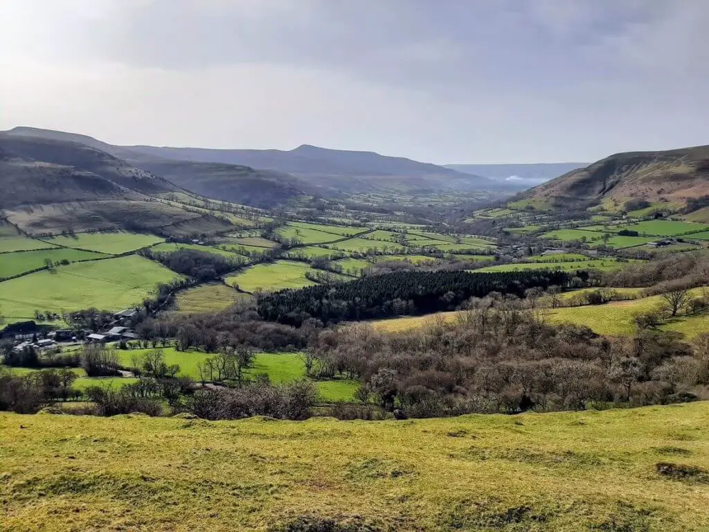
To the south, the broad Rhiangoll valley opens up to display a patchwork-like network of tree-lined fields as far as the eye can see; to the north, the Wye Valley leads your gaze to the hills of central Wales; and to the west, the dramatic northern escarpment of Mynydd Troed slides away allowing the distant summit of Pen y Fan to show itself.
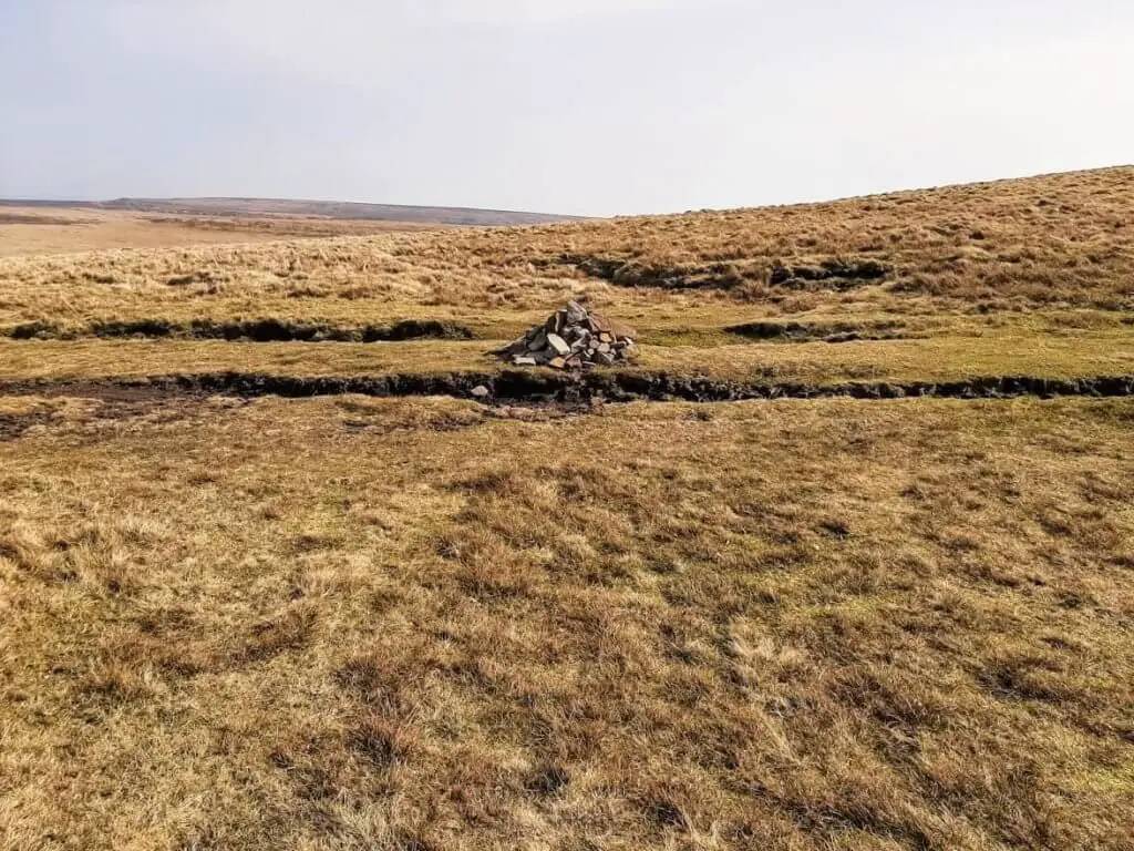
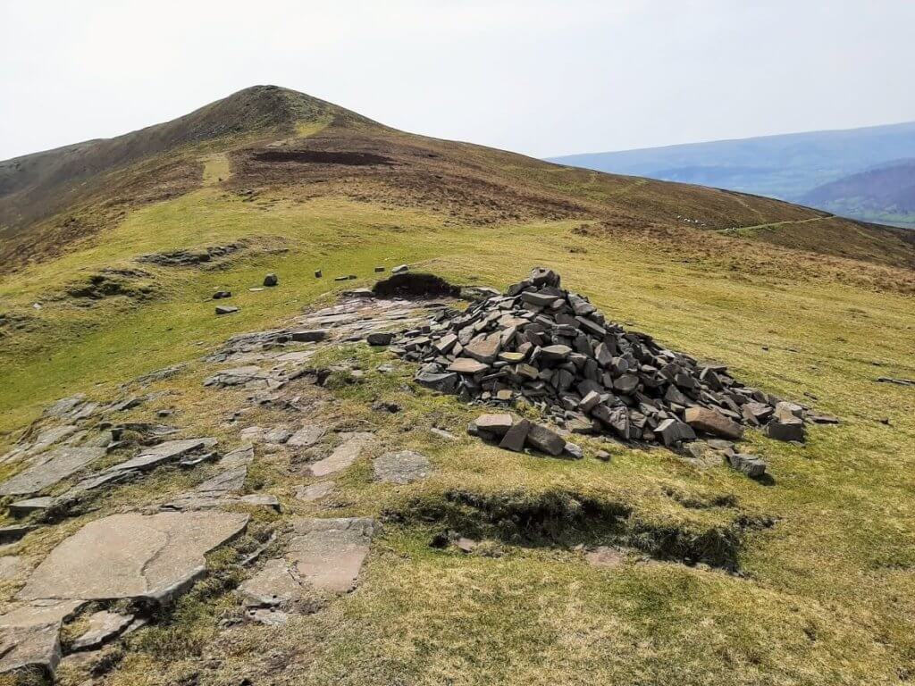
Pen Y Manllwyn
Once you reach a pointed stone cairn, you have all but conquered the Dragon’s Back! Now, keep your eyes trained on the plateau directly ahead of you as this is your next destination.
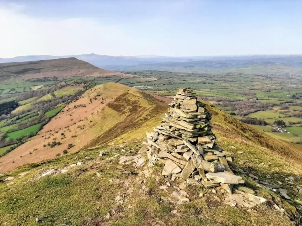
The Waun Fach walk now leads you across a broad plateau before climbing steeply once again to the summit of Pen y Manllwyn.
You will know that you have reached Pen y Manllwyn as a stone cairn marks the location, as well as there being a well-defined trail leading north to south along the plateau’s ridge.

You will be happy to know that once you have reached this point, the toughest section of the walk is behind you.
Waun Fach
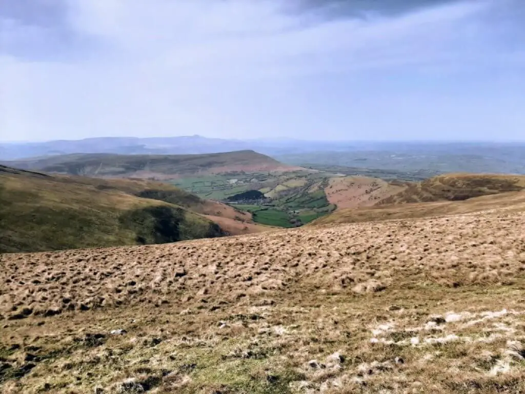
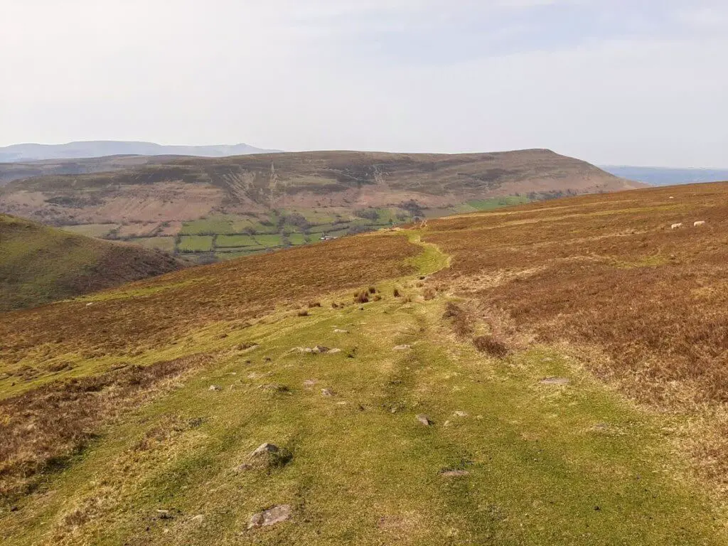
It is now just a flattish path followed by a gentle incline to the next plateau and the summit of Waun Fach.

This section of the Waun Fach circular walk also gives you the opportunity to enjoy the splendour of the westerly views down the valley from where you have come and thus appreciate your hiking achievement so far.
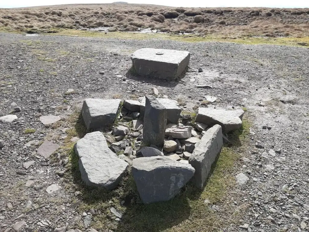
The modest trig point indicating the summit of Waun Fach sits upon a broad rounded plateau, hardly making this the most commanding or exciting of mountain summits. What’s more, it is certainly not befitting of the second highest peak in southern Britain (811 metres), after Pen y Fan!
Pen Trumau
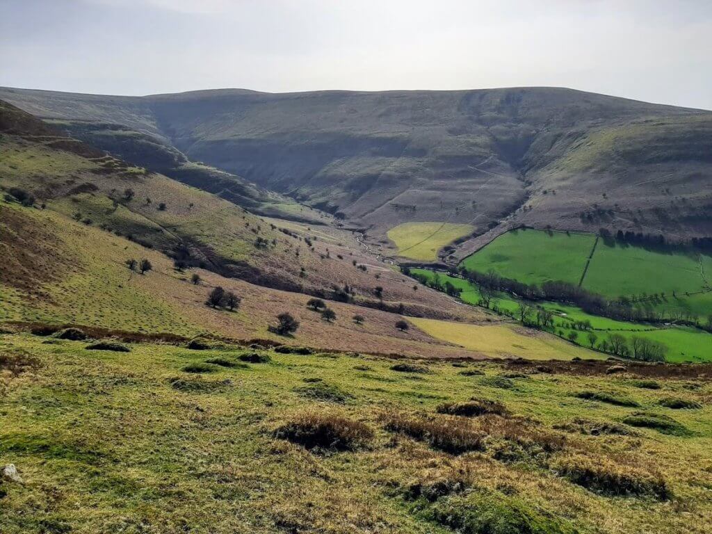
From the summit of Waun Fach, take the path that leads in a south-westerly direction at first, becoming southerly as the trail sweeps left around the top of the Grwyne Fechan valley.

This gently descending section of the Waun Fach walking route soon brings you to the lower summit known as Pen Trumau, again marked by a stone cairn.
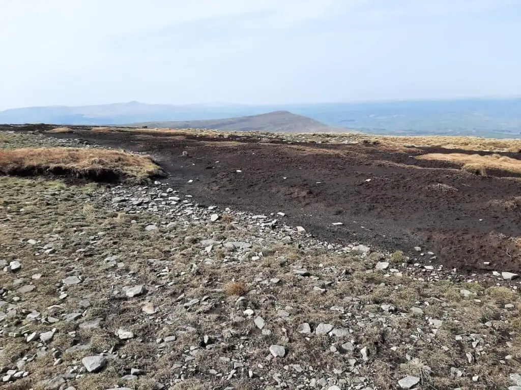
You will certainly know that you have arrived at this point as you can not fail to notice the vast area of exposed peat that sits just to the right of the path. This was uncovered by a fire on Pen Trumau back in 1976.
From here you can now catch sight of Mynydd Llangorse, just beyond the Mynydd Troed ridge to the south-west. More impressively, the south-easterly flowing Grwyne Fechan valley opens up beautifully to highlight the distinctive conical-shaped Sugarloaf Mountain, sitting proudly on the horizon.
Waun Fach Walk – Homeward Bound
From Pen Trumau, there is a short but steep descent to yet another stone cairn marking the meeting point for a number of trails. Choose the path that cuts back to your right across the open moorland.
Then, in approximately 200 metres, take the grassy trail as it veers off to the left, in a westerly direction. In a short while, the open moorland path on this stretch of the Waun Fach hike transitions to a narrow, rocky trail dropping sharply into the valley.
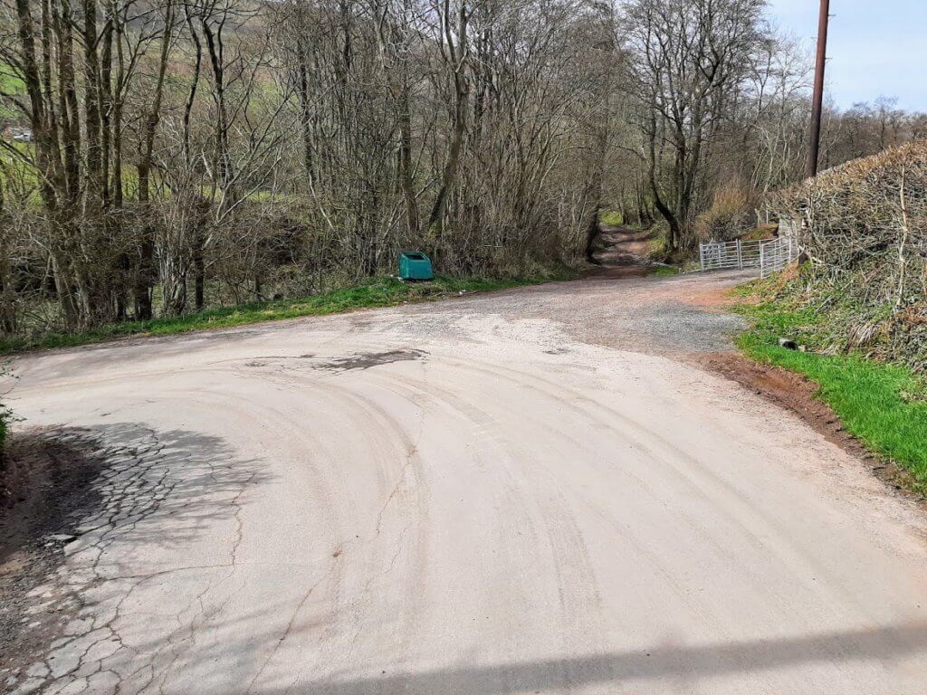
Upon reaching a metal gate, pass through, ensuring that you close the gate securely behind you. In around 500 metres you will reach a small country road where you will turn right. Continue along this road and when you reach the second sharp left bend, you will notice a dirt track directly ahead of you.
Take this track and in approximately 800 metres you will find yourself back at your starting point and the Waun Fach walk is complete!
Waun Fach Walk – Our Thoughts
This hike was everything I had hoped for and more. It was certainly a challenge with the long staged climb along the Dragon’s Back.
This was then nicely complemented by the gentle terrain of the summit plateau as well as the gradual sweeping descent on the homeward section.
In terms of scenery, you really had a bit of everything from dramatic mountain peaks to expansive glacial valleys.
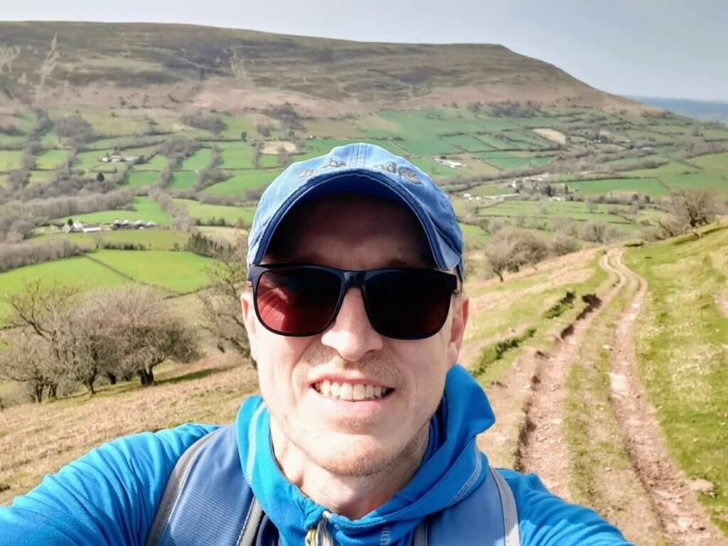
I undertook this walk just after 0900 on a weekday morning at the end of March. At this time, there was one other vehicle in the car park.
Upon returning, the car park was full. Owing to the limited number of spaces available, I would strongly recommend that you arrive early to ensure that you secure a space.
I thoroughly enjoyed the Waun Fach walk and would wholeheartedly recommend it to anyone looking for a challenging circular hike in this beautiful section of the Brecon Beacons National Park.
Waun Fach Walk FAQs
How long is the Waun Fach walk?
This circular walking route measured 7.70 miles (12.4 km) using the Outdooractive App.
How difficult is the walk?
I would consider this to be a moderate to challenging walk owing to the initial climb and the overall length of the hike.
How long does the walk take?
I completed the Waun Fach walk in 4 hours 8 minutes including breaks.
Have you completed the Waun Fach walk via the Dragon’s Back? If so, we would love to hear your thoughts about the hike in the comment box below.
If you are yet to experience this hike and have any questions, also let us know…
Like Our Article? Please Pin it!
Stunning photos Gavin, and what a beautiful day. Gorgeous Wales, there’s nowhere quite like it.
Thanks Karin. I thoroughly enjoyed this hike and the scenery was certainly spectacular! Having the mountain to myself for long periods also helped enhance the experience!
Hi Gavin,
Just followed your route and had an amazing walk but I think I went wrong at the end, would you be able to provide more detail about the last leg please?! I took the sharp right at the last cairn after the saddle and walked to the open moorland and I think (?) I took the correct steep path down into the valley. I came to a lot of metal gates and got very lost at that point! I walked into a farm, went back on myself a bit and ended up trekking through a load of sheep filled fields before climbing over a barbed wire fence to get to the road. Couldn’t find the track/gate that appears at the end of your video. Please could you clarify it would be much appreciated!!
Hi Laurie, Sorry you lost your way. Did you follow the exact route that I embedded on the blog post using the OutdoorActive app because this is the precise route I followed? If you click on the following link, you may just be able to pinpoint where you ventured off track:
https://www.outdooractive.com/en/route/hiking-route/united-kingdom/waun-fach-walk-via-the-dragon-s-back-y-grib-/205504250/?utm_medium=referral&utm_source=embed&utm_campaign=embed-plugin-referral&utm_term=https%3A%2F%2Froamingspices.com%2F#dm=1
I am thinking that you drifted left of the described trail on the way into the valley and ended up at one of the two farms – Blaenffinnant Farm or Pen-y-werlod Farm. These can both be seen if you zoom into the map. Hope this will clear things up for you.
Best wishes
Gavin
This is lovely walking route, and very well written up! My favourite part was looking at the ruins of Castell Dinas. Least favourite part is the stream walking off the access land in descent – in the winter it’s very wet!