Exmoor National Park, Devon
The Dunkery Beacon Walk is a short, gentle hike across open moorland to the top of Exmoor’s highest peak where you will be blessed with splendid vistas in all directions on a clear day
Dunkery Beacon Hike
When we decided to head to Exmoor for a three-day break, I knew that the Dunkery Beacon Walk had to be one of our chosen hikes. The last time I had climbed Exmoor’s highest peak was in the late 1980s when I was undertaking my Duke of Edinburgh bronze expedition.
So, it was nothing more than a good old bit of nostalgia that was taking me back to the highest point in Exmoor. Well, that and the potential of some superb views if the weather was favourable.
How to Get There and Where to Park?
If you are arriving via the A39, you will take a turning heading south, approximately 1.5 miles (2.5 km) east of the village of Porlock. Dunkery Beacon is well signposted so you shouldn’t have any problem finding the parking area.
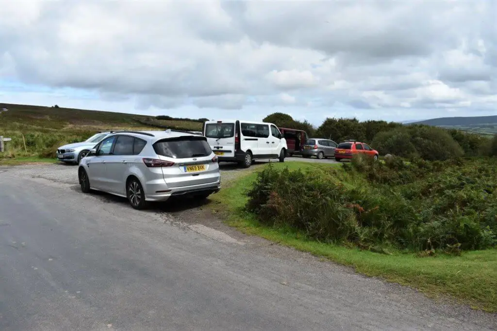
However, the easiest option is to simply put ‘Dunkery Beacon Parking’ into Google Maps. This will lead you to the Dunkery Gate car park which is the most convenient location for this Dunkery Beacon Walk.
This is a popular location for visitors to Exmoor and the two small parking areas either side of the small River Avill are only big enough for approximately 15 cars. It is, therefore, advisable to get there early if visiting during holidays or on the weekend.
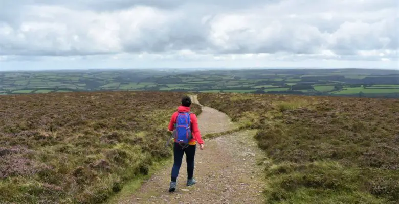
Dunkery Beacon Walk
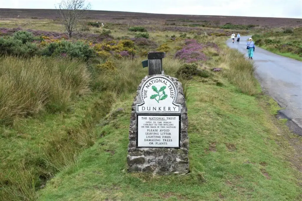
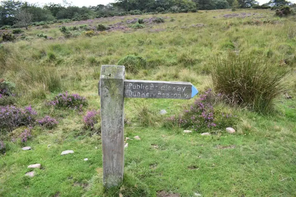
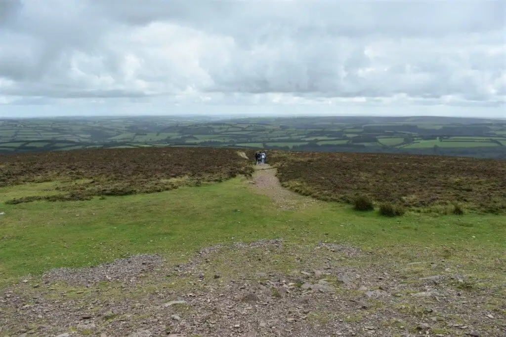
If you want to take the trail directly to Dunkery Beacon, ignore the path immediately adjacent to the stone National Trust sign, close to the car park. Instead, head up the road a short distance and take the next path on your left, marked by a wooden Dunkery Beacon sign.
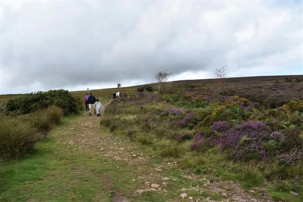
The trail is approximately 0.5 miles in length from the road to the summit. The path takes you in a north-westerly direction, is fairly straight, has a gentle gradient and is firm underfoot.
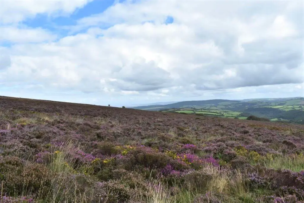
As you make your way up Dunkery Hill, you can’t help but notice the abundance of wild heather that literally blankets the hillside. During the summer months, this gives off a wonderful deep purple colour, adding a vibrant flavour to your surroundings.
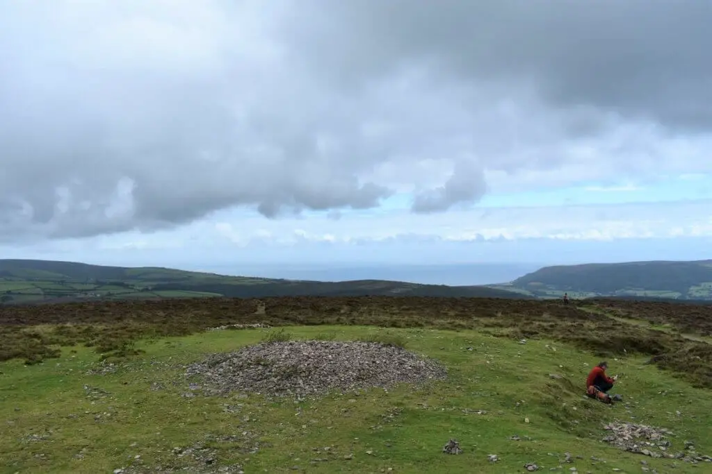
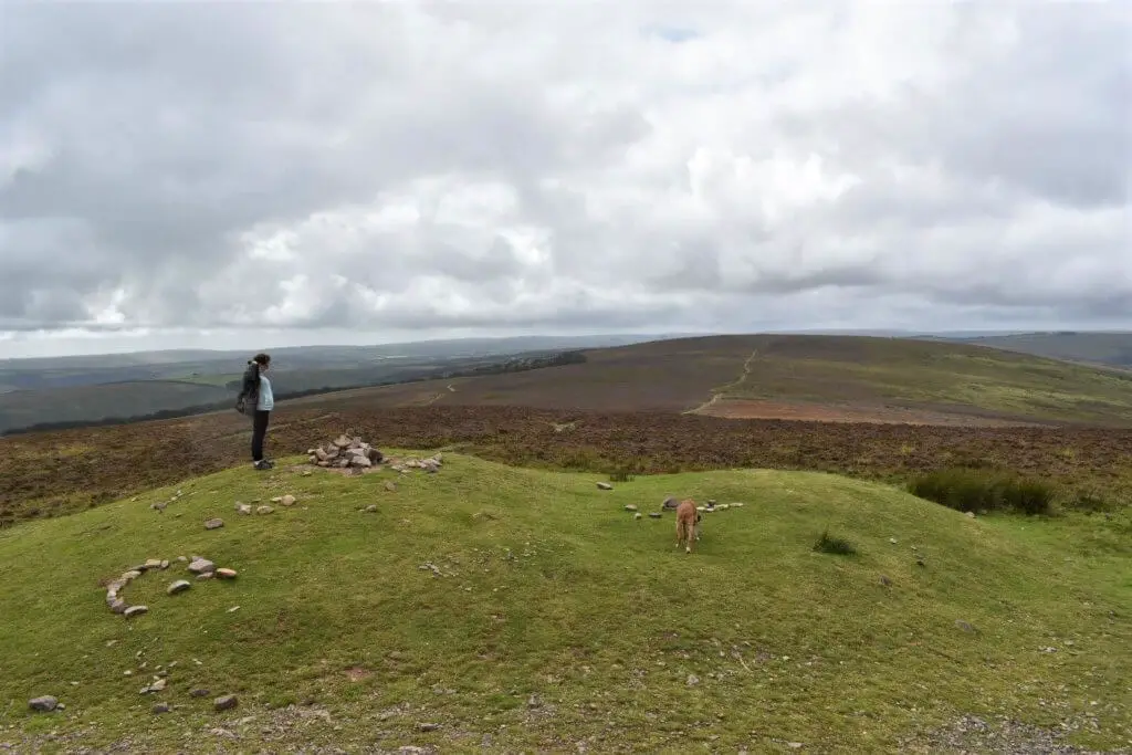
The Dunkery Beacon walk leads you to a large stone cairn at the summit displaying a plaque with the following inscription:
‘Erected in 1935 to commemorate the handing over to the National Trust for places of historic interest or natural beauty of Dunkery Hill for the benefit of the nation by Sir Thomas Acland BT Colonel Wiggin and Allan Hughes ESQ’.
When you read inscriptions such as this, it really makes you realise just how fortunate we are to have areas of beauty like this to roam as and when we want.
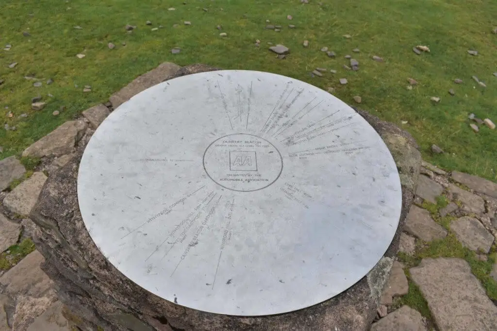
A short distance from the summit cairn is a compass points of interest marker. I always find it fascinating to discover what is located in different directions and at what distances.
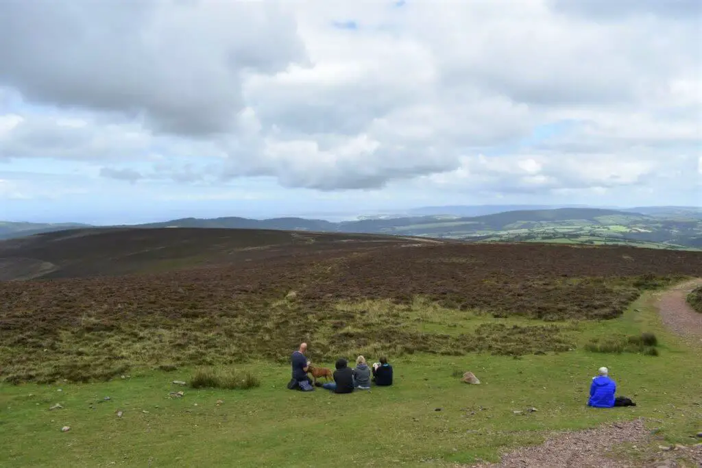
Views from Dunkery Beacon
The summit of Dunkery Beacon stands at 520 metres (1705 feet) and really does offer a perfect vantage point for views in all directions. I know that it is not always easy but try to pick a clear weather day to truly appreciate the vistas at your disposal.
If you do manage to enjoy the Dunkery Beacon walk on a clear day, you are in for a treat. To the north, you can see as far as Pen-y-Fan, the highest peak in the Brecon Beacons.
To the northeast, the two Severn Bridges are visible as are the peaks of Dartmoor and Bodmin Moor to the south-west.
Once you have had your fill of the wonderful views, it is simply a case of retracing your steps to the parking area.
Dunkery Beacon Walk – Our Thoughts
This is more of a pleasant stroll than a hike of any sort. It is approximately 1 mile (1.6 km) in length and should take no longer than 1 hour to complete. That said, it is more of a place to go to feast on some potentially superb views and grab some fresh air.
If you are a family with small children, this would be an ideal walk as it is neither long nor challenging.
Other Dunkery Beacon Walking Routes
Are you on the lookout for some slightly more challenging Dunkery Beacon walks?
If you are, you may wish to check out the Dunkery Beacon circular walk from Wheddon Cross or the Dunkery and Horner Wood circular walk.
Dunkery Beacon Flora & Fauna
Dunkery Beacon is part of the North Exmoor Site of Special Scientific Interest (SSSI), part of the Dunkery & Horner Woods National Nature Reserve and part of the Exmoor Coastal Heaths Special Area of Conservation.
Dunkery Hill is home to a wide range of flora. As well as the Ling and Bell heather, you will also find the following species in both this location as well as in the surrounding woodland: mosses, liverworts, ferns, sessile oak, bracken, ash, rowan, lichens, gorse and hazel.
There is also an abundance of birdlife and keen twitchers may well catch sight of the following species: lesser spotted woodpeckers, dippers, pied flycatchers, skylarks, wood warblers, redstarts, snipe, and kestrels.
You may well also spot an Exmoor pony or two. This is a horse breed native to the UK and many still roam as semi-feral livestock in Exmoor National Park.
Some Other Top Exmoor Walks
During our three day visit to the area, we also managed to pack in two further Exmoor National Park walks – Valley of the Rocks and the Watersmeet Trail. These were both amazing walks and definitely get the thumbs up from us!
We have also compiled an article highlighting some of the best walks in Exmoor, definitely one to check out especially if you are spending a bit of time in this exquisite national park.
Like Our Article? Please Pin it!
![]()
Thank you for your article on Dunkery Beacon, I enjoyed reading it. We are heading to Wootton Courtenay in early April and intend to walk up to the cairn and enjoy the views with the dog……
Hi Amanda, thanks for your comment. It is a lovely spot especially if you pick a good weather day. Of course, you can drive to the parking area that I described in our blog post or if you fancy a somewhat longer stroll, there is a trail from Wootton Courtenay. I don’t know how familiar you are with the area but if you are not, download one of the hiking apps (we use OutdoorActive). The trails are clearly marked with a dotted line so it is very easy to stay on track. Enjoy your trip to Exmoor!