Exmoor National Park, Devon
The Valley of the Rocks Walk leads you through this dramatic section of coastline on Exmoor’s rugged northern edge. Experience the breathtaking clifftop path, U-shaped dry valley and of course the craggy rock outcrops that give the valley its name
The Valley of the Rocks, Devon
In July 2020, we moved to a new property in mainland Wales’ southernmost community of Rhoose Point. From our southerly facing upstairs windows, we are fortunate to have uninterrupted views across the Bristol Channel to the northern coastline of Somerset and Devon.
These wonderful views inspired us to take a three-day break in coastal Exmoor leading us to select a few hikes from the almost endless selection on offer. The Valley of the Rocks walk was the first hike to really grab our attention owing to its spectacular location and dramatic geological features.
This was instantly pencilled in as our first activity for our visit to Exmoor.
Where is the Valley of the Rocks?
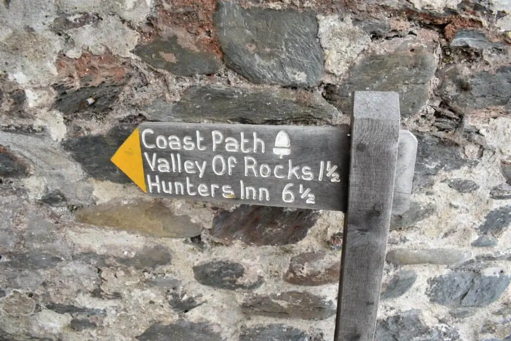
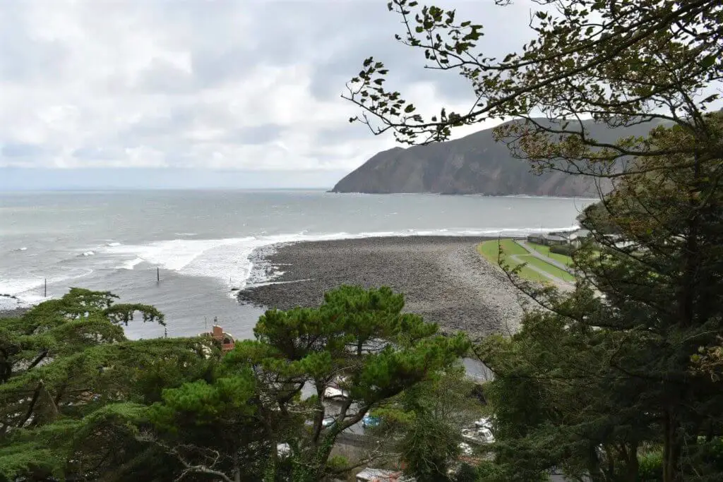
The Valley of the Rocks is located approximately 0.5 miles (0.8 km) west of the small coastal town of Lynmouth on the North Devon coast. Check out the Valley of the Rocks map below for the exact location:
How to Get There?
Whether you are approaching the area from the east or the west, the A39 is really the only option. This road will lead you directly into Lynmouth. The A39 offers only a single carriageway in either direction meaning progress is often slow, especially during holidays and weekends.
Where to Park?
If you are not staying in Lynmouth and therefore looking for parking, there are a number of options available to you. There are free parking spaces available along Riverside Road and the Esplanade but these are restricted to a maximum of two hours. You may struggle to complete the walk in this time.
The most suitable paid parking option is the Esplanade car park which is just a short distance from the start point. Check out other paid parking options in Lynmouth.
The Valley of the Rocks Walk – Step by Step
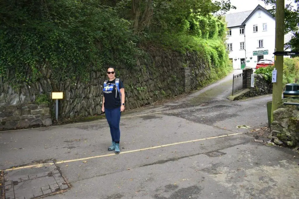
We decided to stay in the Lyn Valley Guest House which is ideally located, just a few hundred metres from our starting point along the seafront in Lynmouth.
The starting location chosen by us is not an official start point for the Valley of the Rocks circular walk. It just happened to be close to our B&B and therefore made perfect sense!
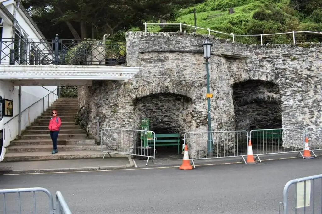
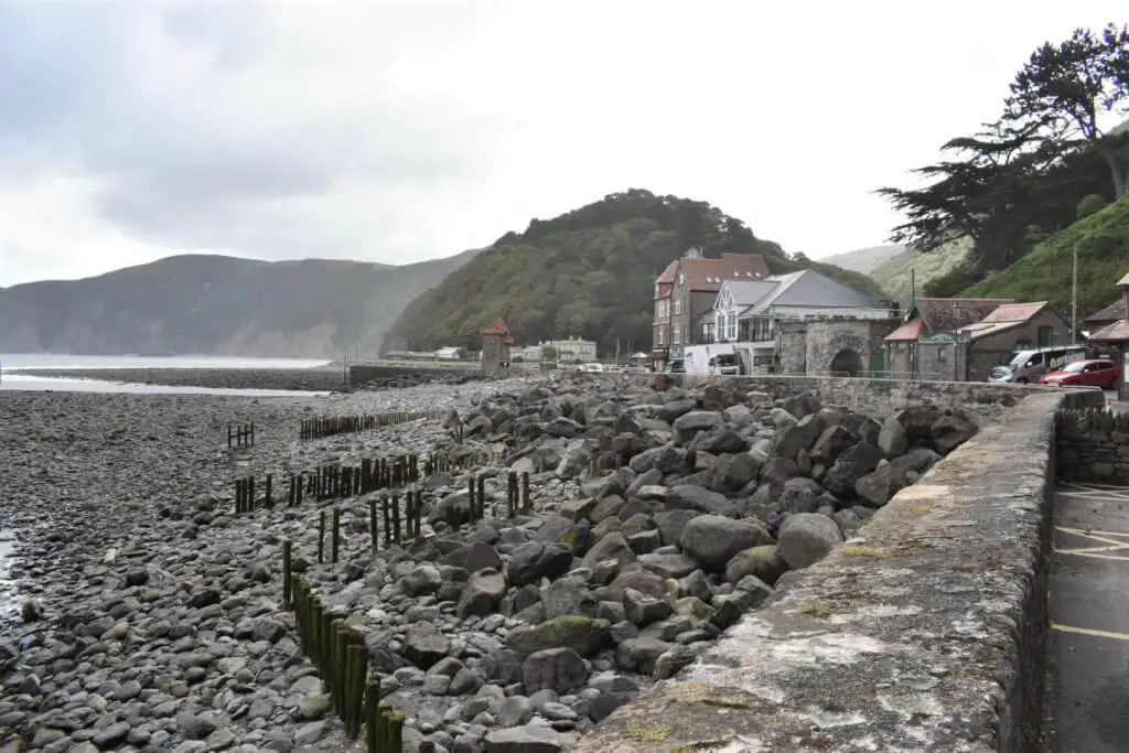
Head along Riverside Road and as you approach the sea wall the road turns sharply to the left and in doing so becomes the Esplanade. A short distance down on your left-hand side you will spot steps leading up from the road. This is the start of the walk.
If you manage to grab a space in the Esplanade car park, the steps will be on your right-hand side.
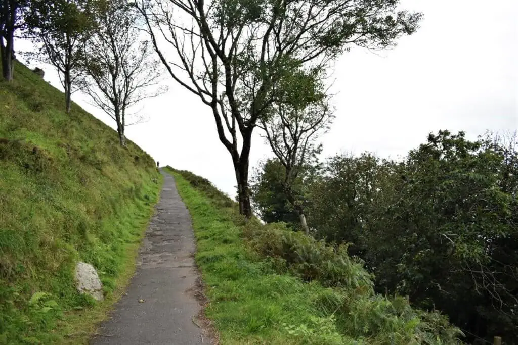
The path zig-zags its way up the steep cliff face thus flattening out the gradient somewhat. But don’t be mistaken this is still a steep climb nonetheless! For those in reasonable physical shape, you should find yourself at the top in 10-15 minutes.
If you are either not willing or able to make this climb, there is always the Lynton & Lynmouth Cliff Railway to take the strain.
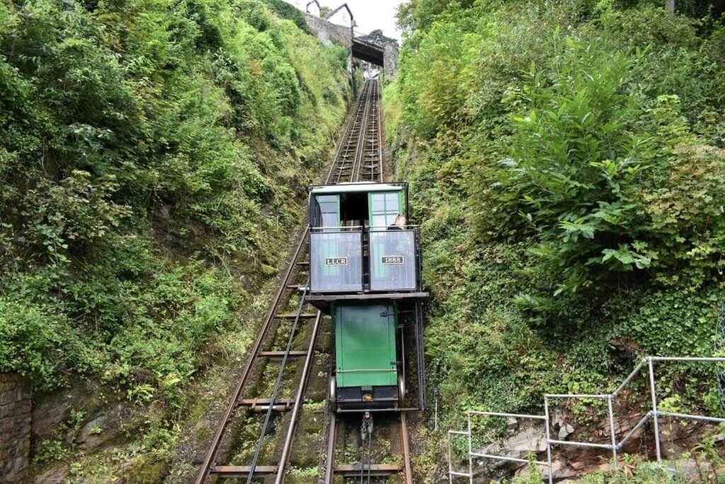
Here you will be riding on a piece of Britain’s historic past which was opened in 1890 and is the highest and steepest totally water powered railway in the world. What’s more, you will find yourself atop the 500 foot (150 metre) cliffs in just a few minutes.
Poems Walk Coastal Path
Once you have reached the top of the cliff, turn right on to North Walk. Now is a good time to catch your breath and admire the majestic views across Lynmouth Bay.
Almost immediately, you will notice a selection of poems attached to poles and boards to your right. There was also a makeshift sign indicating that this was a stretch of road known as “Poems Walk Coastal Path”.
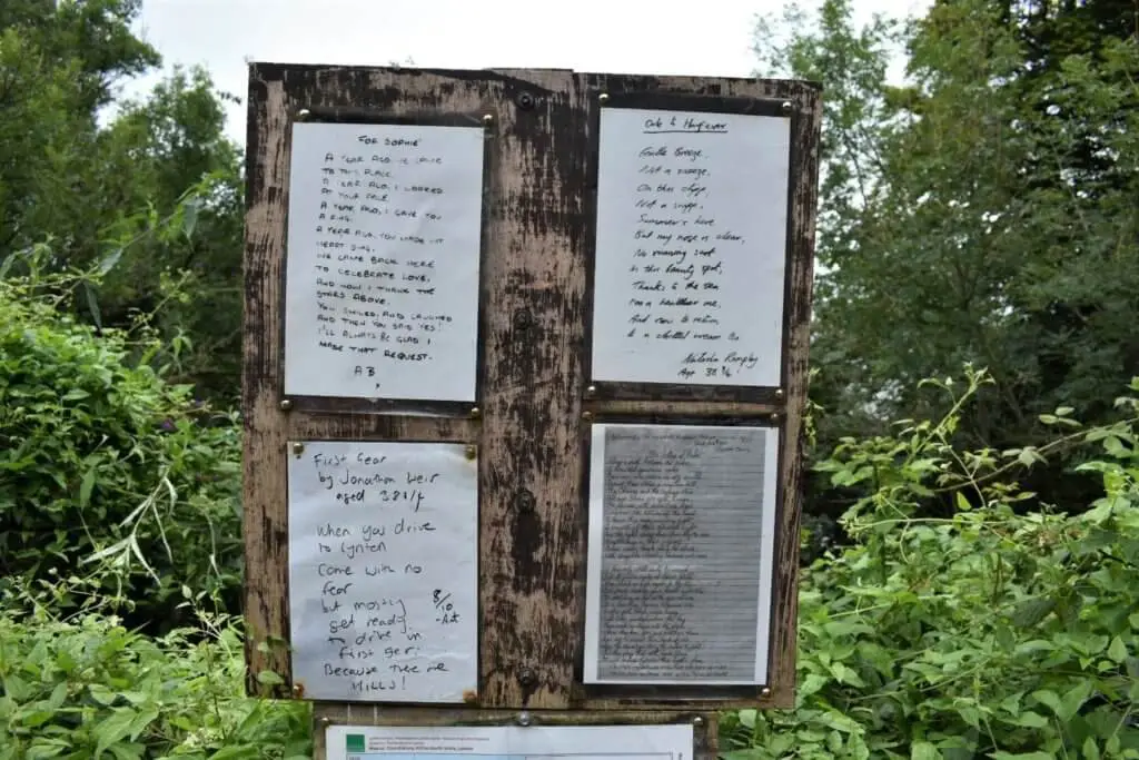
I don’t know why this location became an area for locals and visitors to display their poetry prowess but I would sure like to know. Nevertheless, it was fun reading a selection of these poems and the ways in which this beautiful location made people feel.
As you progress along North Walk you will pass a selection of clifftop hotels before entering a small section of wood with a gate at its far end.
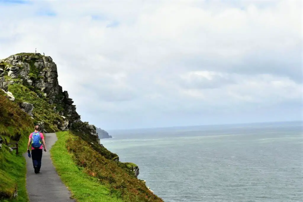
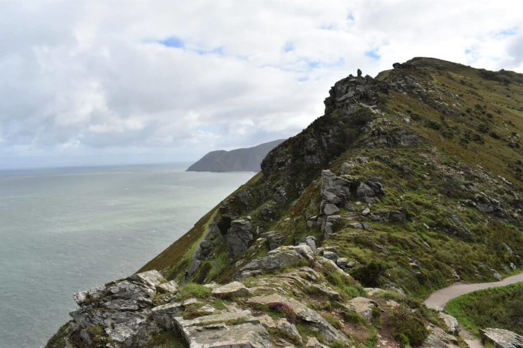
Dramatic South West Coast Path Awaits
Once you pass through this gate the whole dynamic of the Valley of the Rocks Walk changes. Suddenly, the trees that have part shielded your view along North Walk come to an end. You are now well and truly exposed to the elements as well as a simply magnificent unbroken view across the Bristol Channel.
To the left of the trail, the grass clad slope rises steeply towards the summit of Hollerday Hill. Just a couple of metres off to your right, the cliff slides away abruptly towards the sea below.
Did you know? You may well see some Valley of the Rocks goats while enjoying this walk. The herd that resides in the valley today were introduced from the Cheviot Hills in Northumberland in 1976.
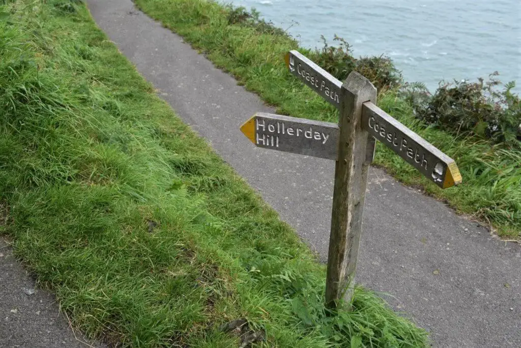
Continuing along the coastal path, the craggy rocks that give the valley its name come into sight high up to your left. Thankfully, you can if you choose to get up amongst these rocks by taking the path that veers off to the left, signposted Hollerday Hill.
Even if you do not fancy climbing to the top of Hollerday Hill, you only need to venture up this path for a few minutes to be afforded even better views.
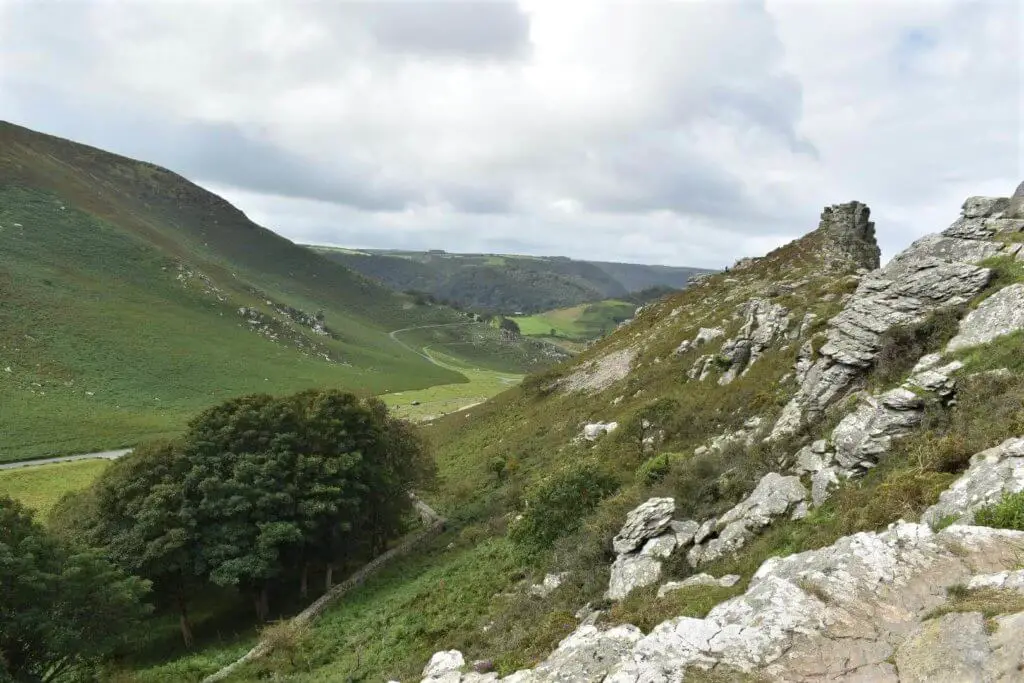
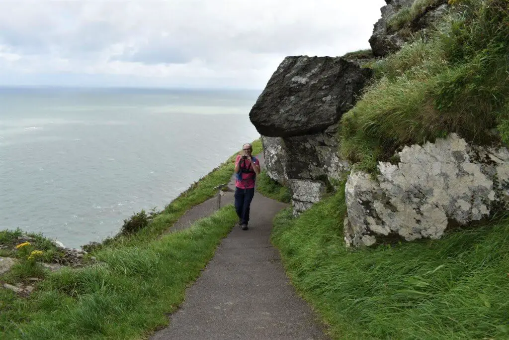
As you pick your way between the jagged rock formations, you now get to enjoy sweeping views up the entire length of the Valley of the Rocks.
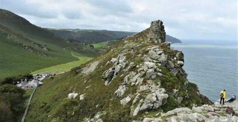
Castle Rock
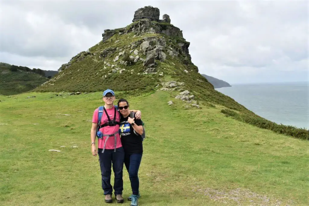
Retrace your steps and rejoin the coastal path, heading west once more. As the path sweeps to the left, the last rocky outcrop of the Valley of the Rocks appears before you, rising dramatically above the sea far below.
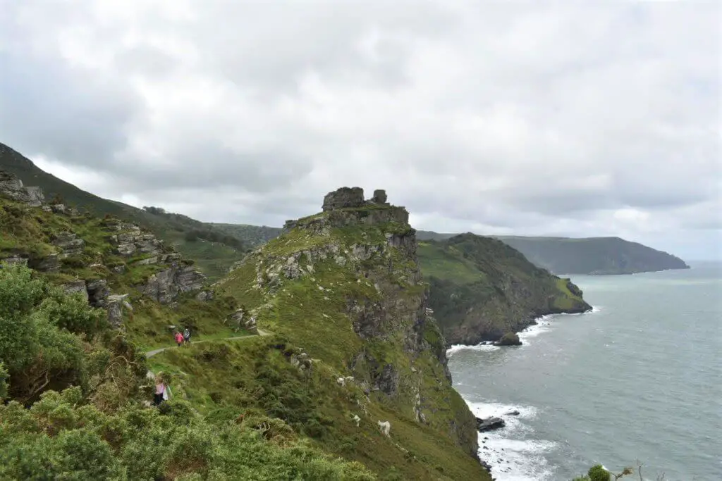
This formation goes by the name of “Castle Rock”, owing to the turret-like arrangement across its peak.
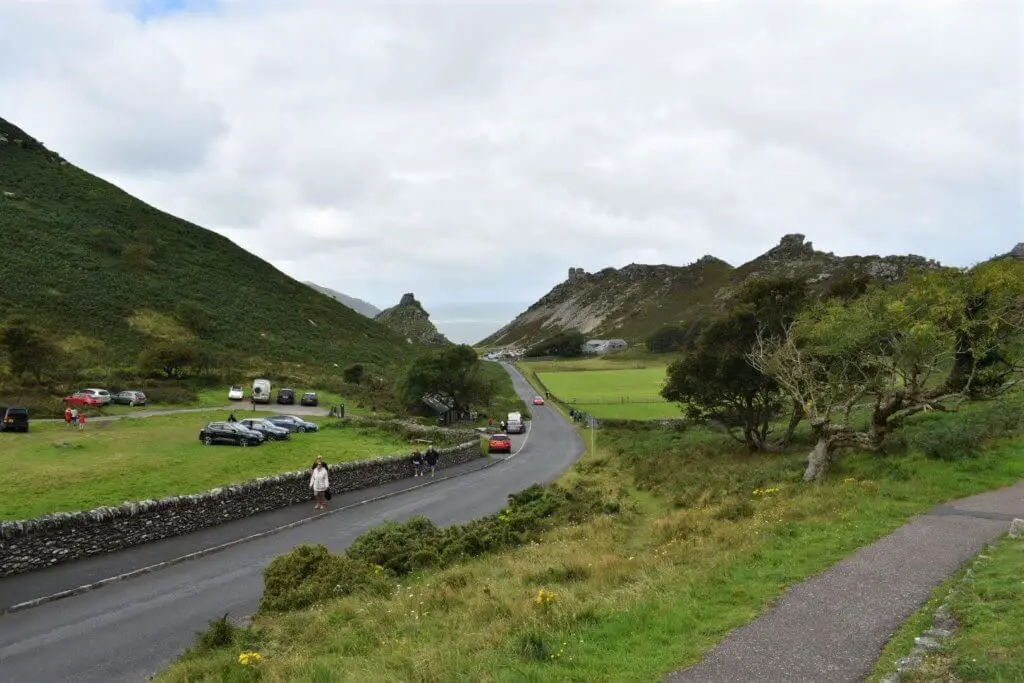
The Return Section
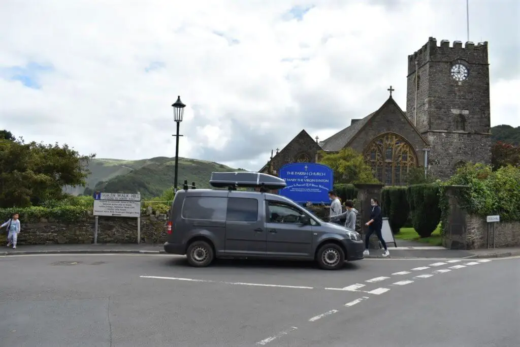
As you approach Castle Rock, the path breaks away from the coast and into the U- shaped valley. You will now see a small road ahead of you heading east along the valley floor. It is now simply a case of following this road all the way back into Lynton.
You will enter Lynton on Longmead Road which then becomes Lee road, as you make your way along these quaint residential streets.
Immediately after passing the Valley of the Rocks Hotel, turn left onto North Walk Hill. Take the second turning on your right and rejoin the zig-zag cliff path upon which you started your walk.
Shortly you will find yourself back on Lynmouth’s Esplanade and your Valley of the Rocks Walk will be complete!
The Valley of the Rocks Walk – Our Thoughts
This was an easy but incredibly rewarding hike. The coastal section is especially stunning, with the steep cliffs, rocky outcrops and panoramic views on offer.
It is well worth taking the path that forks left signposted “Hollerday Hill” as this leads you up from the coastal path to a point where you can enjoy superb views along the coastline and inland valley all at once.
If you want to be wowed by nature, this is definitely a walk that you need to add to your “to-do” list. But don’t just take our word for it, check out the huge number of positive reviews on TripAdvisor.
The Valley of the Rocks Walk FAQs
How far is the Valley of the Rocks circular walk?
The walk described here is 4.99 km (3.10 miles) in length measured on our Viewranger App.
How difficult is the walk?
Apart from the initial climb which is somewhat strenuous, this is a relatively easy walk that is suitable for most adults and children.
How long does the walk take?
It should take approximately 2-2.5 hours. Plan a little longer if you fancy stopping for a cream tea though!
What other walk options are there?
If the Valley of the Rocks Walk that we have described here is not for you, why not try one of the following variations instead:
Is there a Valley of the Rocks car park?
Yes, right in the valley itself alongside the cafe.
How was the Valley of the Rocks formed?
The Valley of the Rocks was formed as the result of coastal erosion of a former extension of the valley of the East Lyn River. The valley slowly receded, shifting the river to its current location, where it now meets the sea at Lynmouth. The Valley of the Rocks is the old valley from where the East Lyn River used to flow.
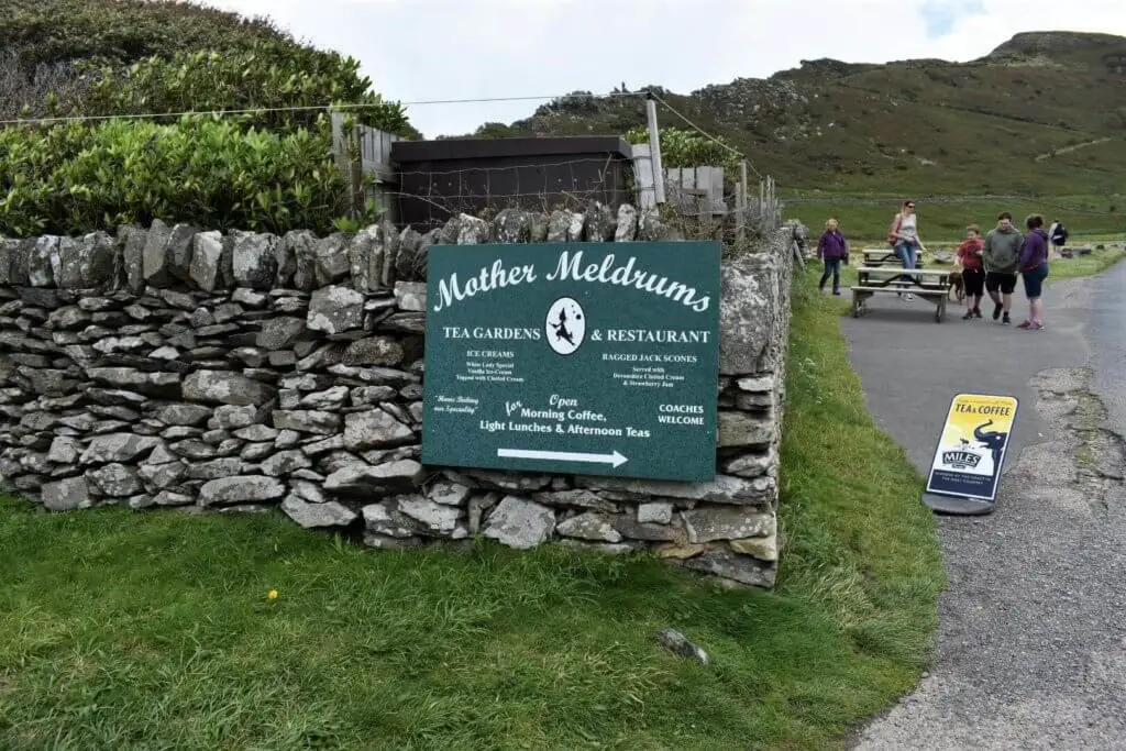
Is there a Valley of the Rocks cafe?
There certainly is! It is located just off the road that passes through the valley and goes by the name of Mother Meldrums Tea Gardens & Restaurant. We can not personally vouch for this Cafe as we did not visit but this TripAdvisor page will give you a good idea of what others are saying.
Looking for other walks in Exmoor?
Exmoor is truly a walkers’ paradise with trails galore to choose from. Although we can by no means vouch for them all, we can certainly recommend the two others that we have experienced.
Try the short walk to Exmoor’s highest point, Dunkery Beacon, to enjoy the splendid views on offer (weather depending). Also, enjoy the beautiful Watersmeet Trail that leads you up the picturesque East Lyn river gorge to Watersmeet House.
We are certain that neither will disappoint!
Like Our Article? Please Pin it!
Leave a Reply