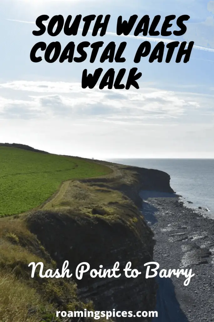
South Wales Coastal Path
The Wales Coastal Path is 870 miles long and wraps around the entire coastline of the country, from Chester in the north to Chepstow in the south. The 14-mile section from Nash Point to Barry on the south coast offers steep rugged cliffs, peaceful secluded coves and stunning views across the Bristol Channel, making this a must-experience hike for all outdoor lovers
Walking the South Wales Coastal Path
I have been lucky to have lived in the Vale of Glamorgan for a large slice of my life, so the Glamorgan Heritage Coast has been my playground ever since I was a kid.
Although countless trips to various locations across this stretch of coastline have been enjoyed over the years, never had I actually walked any significant section of it.
The Glamorgan Heritage Coast stretches all the way from Porthcawl in the west to Aberthaw in the east, with Nash Point at its midpoint.
Part 1 – Nash Point to Llantwit Major Beach
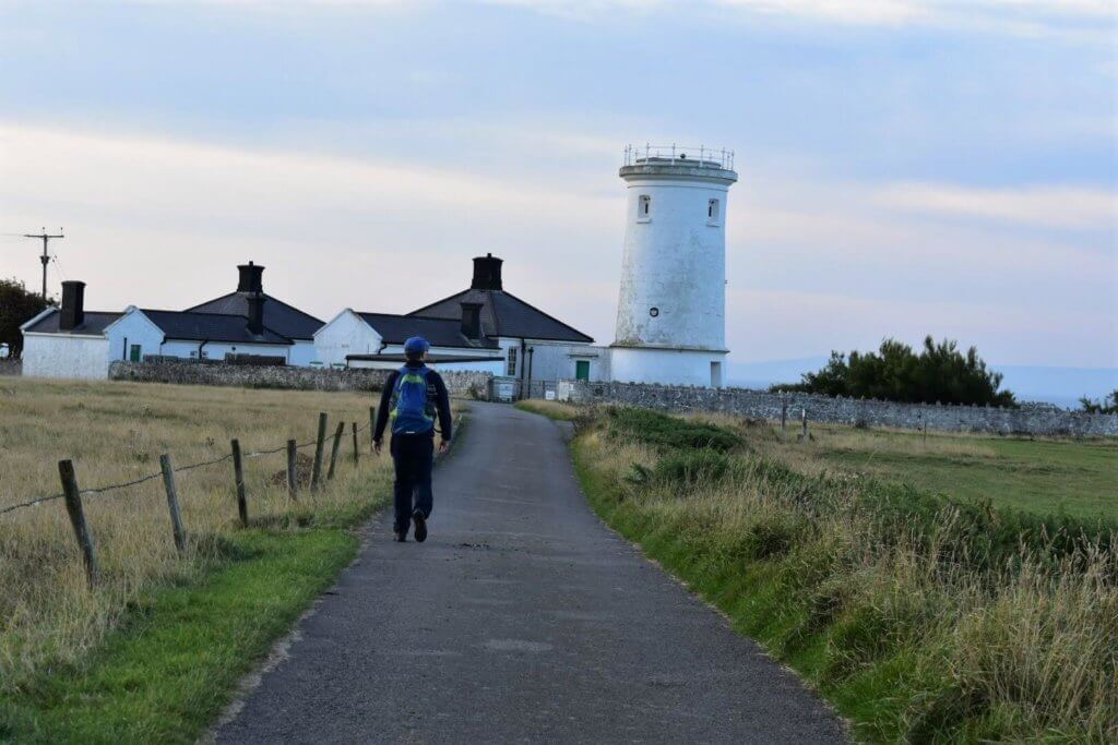
On a bright, promising August morning, my wife Didem, dropped me at the Idyllic cliff top location of Nash Point for the start of my Welsh Coastal Path adventure to Barry.
Off I go…
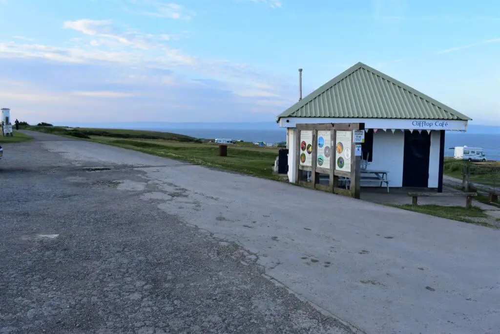
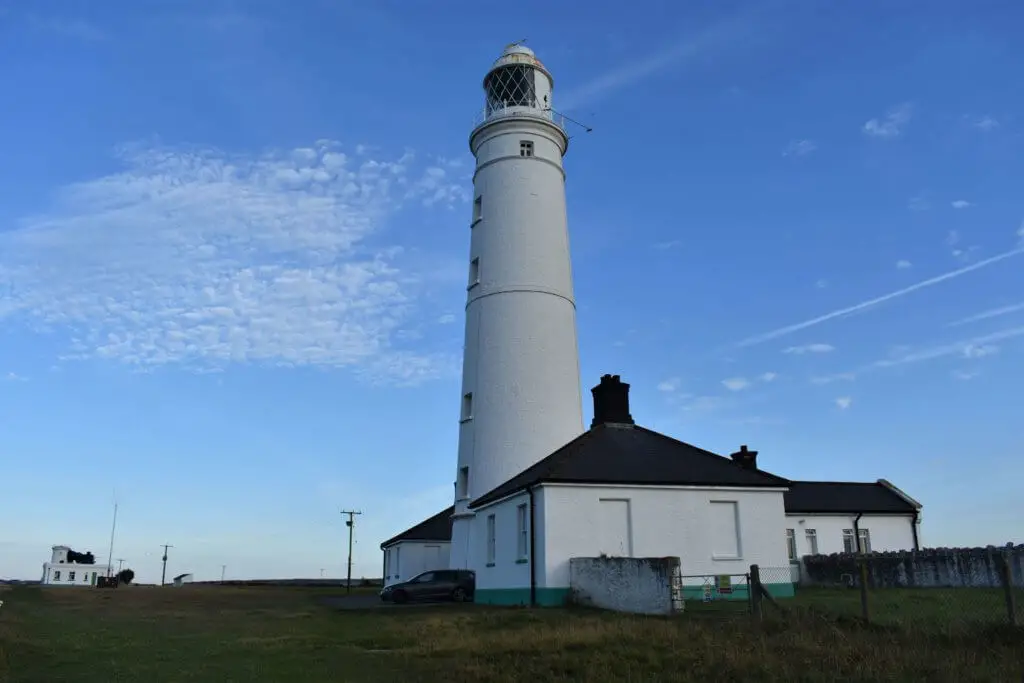
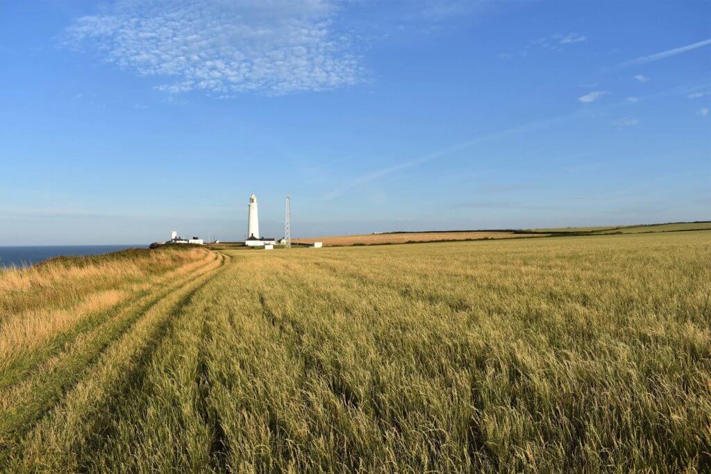
From the Clifftop Cafe, head east along the small paved road, shortly reaching the first of the two iconic Nash Point lighthouses; the low (west) tower and the high (east tower).
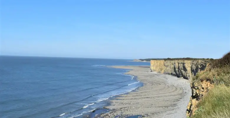
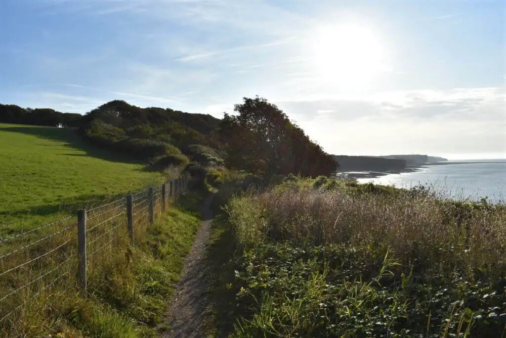
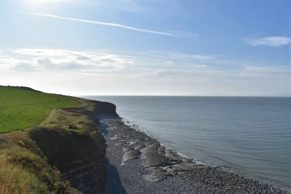
Once past the lighthouses and across a stone style you are on to the coastal path proper, where it is now just you, a grass trail underfoot and the dramatic jagged cliffs of the Glamorgan Heritage Coast just metres off to your right.
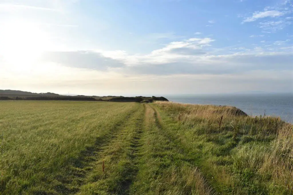
Along this initial stage, with not a single tree or bush to shield the trail from the cliff top, you are blessed with unbroken panoramic views across the Bristol Channel, to the northern coastline of Somerset and Devon.
After a couple of kilometres, the trail enters a small wooded area and almost immediately the path descends and breaks out on St Donat’s Bay, alongside the turreted stone wall that marks the southern boundary of the grounds of Atlantic College.
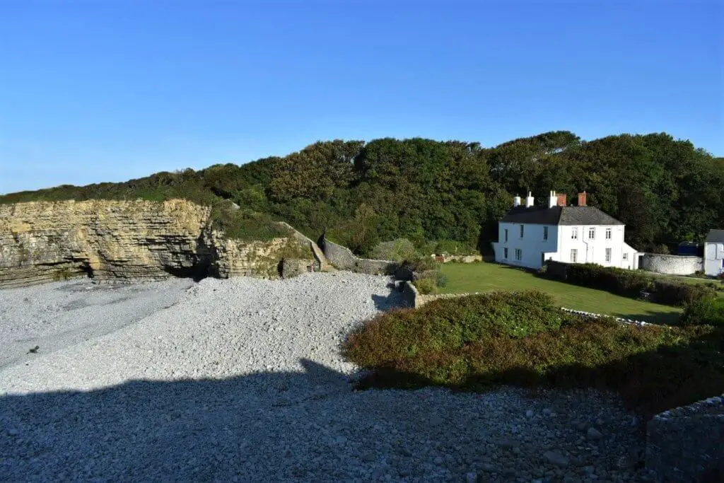
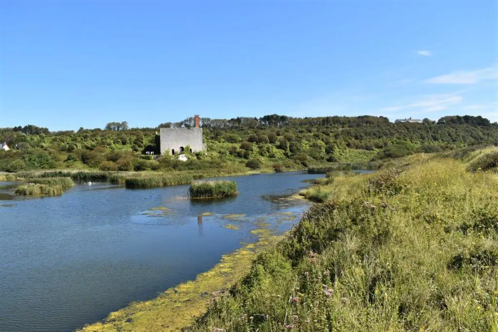
The next point of interest is a little over a kilometre further along the coast as the path descends from the clifftop once more and into the picturesque, pebble adorned cove at Tresilian Bay.
Here sits Tresilian House, a property that has always intrigued me, owing to both its scale and its beautifully manicured lawn that adjoins the picture-perfect bay. I have always wondered who lives there and whether they realised just how lucky they were to live in such a wondrous location?
From Tresilian Bay, it is just a short one-kilometre hop along the open clifftops before once again meeting the shoreline at Llantwit Major Beach.
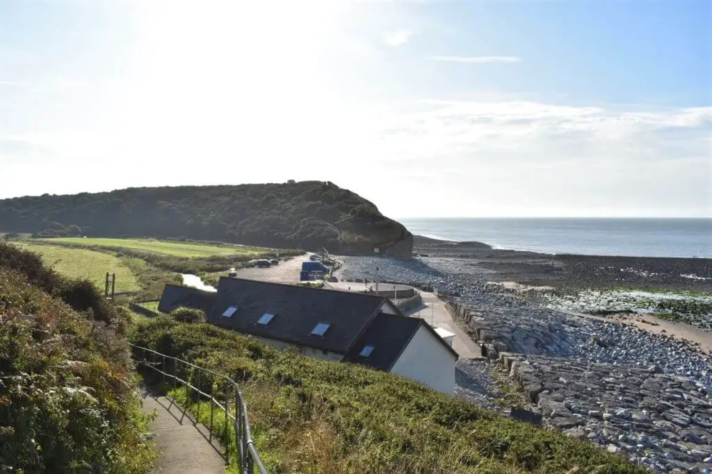
This is a popular spot for families and surfers alike. You will also find a really good cafe here that remains open most of the year, so if you are feeling a little peckish, it’s time to fill your boots!
If you are new to the area and have time on your hands a visit to the quaint, nearby town of Llantwit Major is well worthwhile. This sweet little town is not only steeped in history but also offers a decent range of independent shops and traditional pubs located at the heart of the old town. If you are interested in soaking up some local history, a visit to St Illtud’s church and the Galilee Chapel will not disappoint.
Part 2 – Llantwit Major Beach to Aberthaw
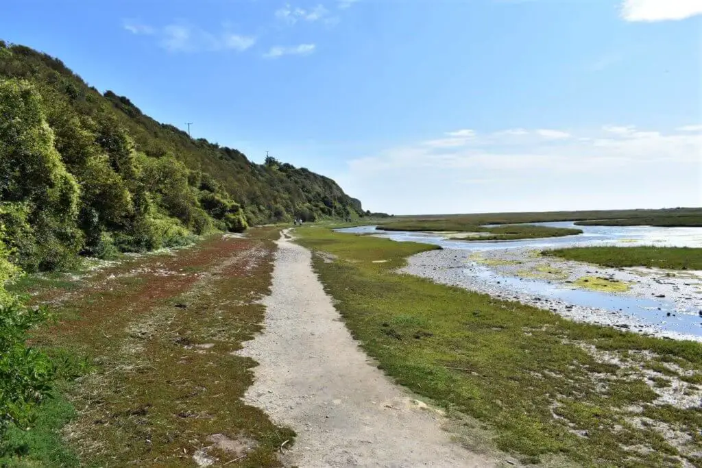
This long stretch of the Wales Coastal Path takes you all the way to the eastern edge of the Glamorgan Heritage Coast at Aberthaw. From the beach, there is a short but fairly steep climb to retake your position atop the rugged cliffs.
Here you may fancy a short diversion from the coastal path to check out the Cwm Colhuw Nature Reserve, where the scrub and hedgerows offer excellent nesting opportunities for a variety of birds.
These include the Bullfinch, Goldfinch, Grasshopper Warbler, Linnet and Yellowhammer as well as summer migrating birds such as Willow Warbler and Whitethroat. Kestrels use the cliffs of the Glamorgan Heritage Coast for breeding and use the grasslands of the nature reserve for hunting. Additionally, the Peregrine Falcon is also regularly seen in the locality.
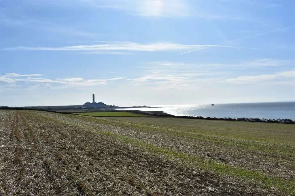
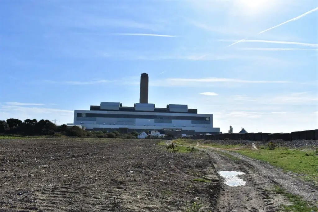
Once back on the coastal path, your eyes will now inevitably be drawn to the towering chimney stack that hugs the coastline many miles away. This is the Aberthaw power station and is the one substantial blot on the landscape that is sadly unavoidable when hiking this section of the South Wales Coastal Path.
Thankfully, this monstrosity is no longer operational and closed officially on 31 March 2020 and is currently in its decommissioning process. We can only hope that in the not too distant future, the coastline upon which it sits, will be returned to its former glory once again.
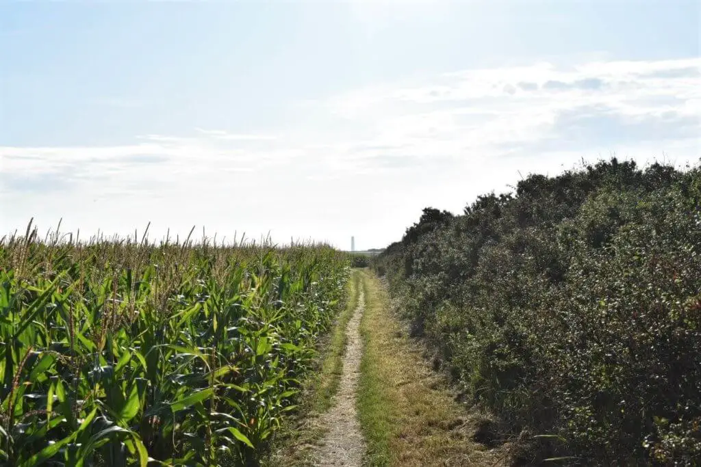
During this long section of the coastal walk, the path continues to hug the cliff top and leads you through field after field. It was during this section of the walk that I caught up with two fellow hikers and we decided to join company up until their turning point at the Aberthaw power station.
Dave and Martin were good friends who shared a love of hiking but Dave had a disability that many, including myself, would think would put an end to such a hobby. He was completely blind!
When Dave first mentioned his blindness to me, I thought he was joking. He moved so freely and confidently, it was as if he was being guided by perfect vision. As we walked and talked, Martin would occasionally give Dave an update as to the nature of the upcoming terrain, so that he could adjust his speed and stride length accordingly. I was not only amazed at Dave’s astounding ability to hike as he did but also by the nature of the pair’s bond and such a natural level of communication.
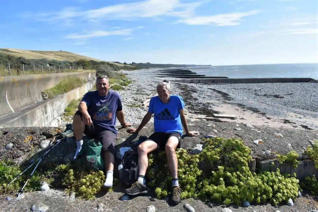
It was a genuine treat to spend this time with a person who had an incredibly positive outlook on life when such a fundamental tool for living his life had long since been taken from him. I learned a lesson that afternoon that will stay with me for a long time!
Once we had reached the power station we sat and ate lunch, before saying our farewells.
Part 3 – Aberthaw to Barry
A short distance from the power station, you will enter the Aberthaw Biodiversity Area, containing the Aberthaw Nature Reserve and the now derelict lime works.
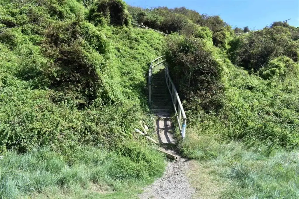
Take the path that runs along the shoreline for a few hundred metres until you spot some steps on your left that lead you to the top of the cliffs once more.
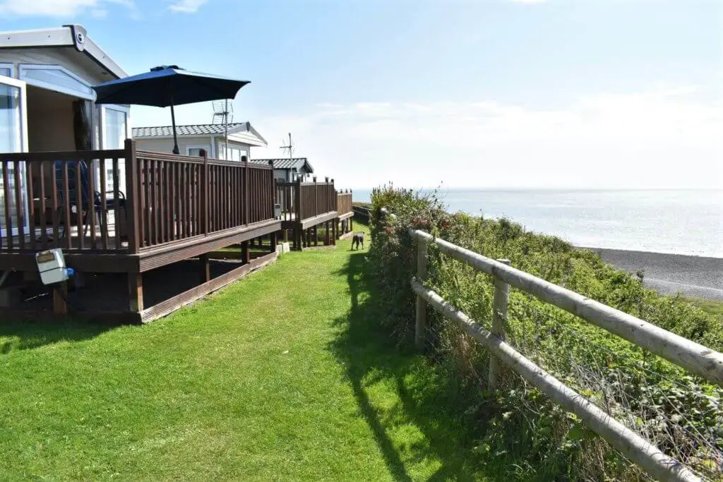
You will now find yourself entering the Fontygary Caravan and Leisure Park. Now, walking through a static caravan park is probably not your idea of a picturesque, cliff top walk along the South Wales Coastal Path. To be honest, it’s not mine either!
However, the trail does literally stick to the cliff edge, with just a wooden fence to keep you safe, so the super views remain constant, even through this built-up section of the walk. Thankfully, within 15-20 minutes, you will find yourself back out on the grassy, open clifftop.
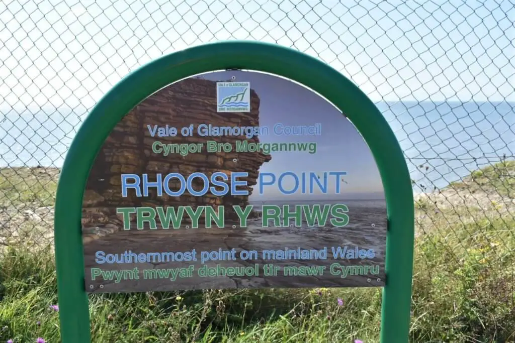
A short distance further on, you will venture into the most southerly settlement in mainland Wales, known as Rhoose Point. Here former quarries have evolved into a large, modern housing estate with coastal nature reserve, boasting a number of ponds making this a haven for birdlife.
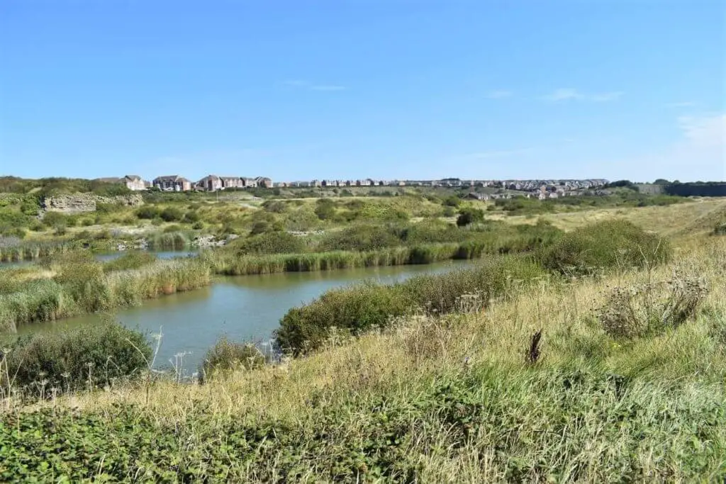
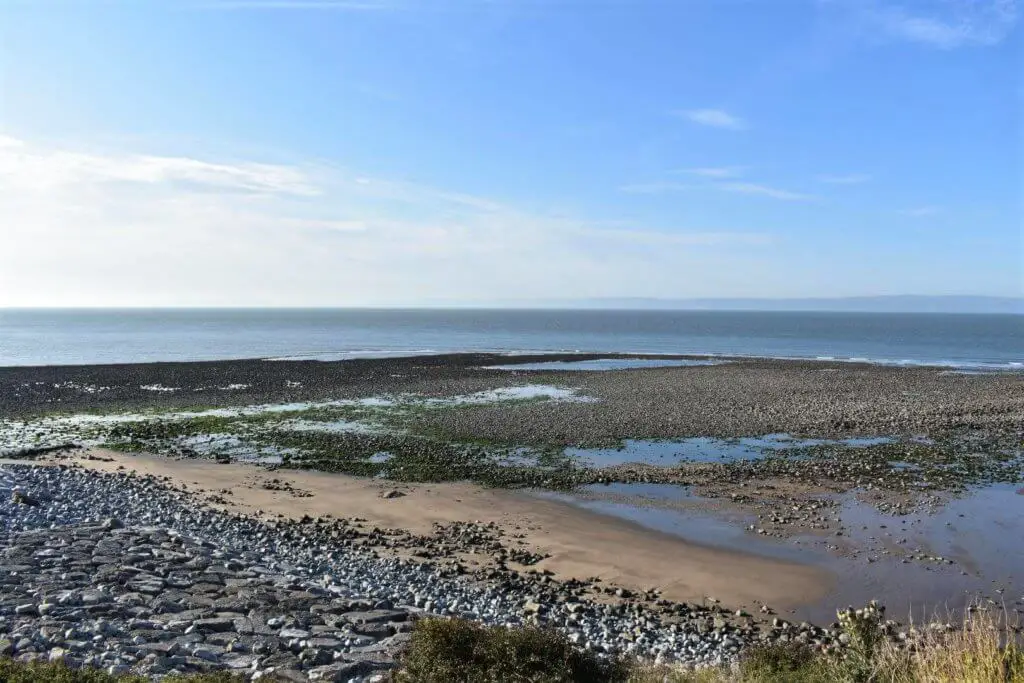
You will also find breaches in the limestone cliffs, allowing a safe thoroughfare to the shoreline where no sand will be found but instead a series of wave-cut platforms and rock pools.
A quick jaunt along the coast and you will find yourself in Porthkerry Leisure Park, the second static caravan and leisure facility along this stretch of coastline. Pass swiftly through and into a large field to its east.
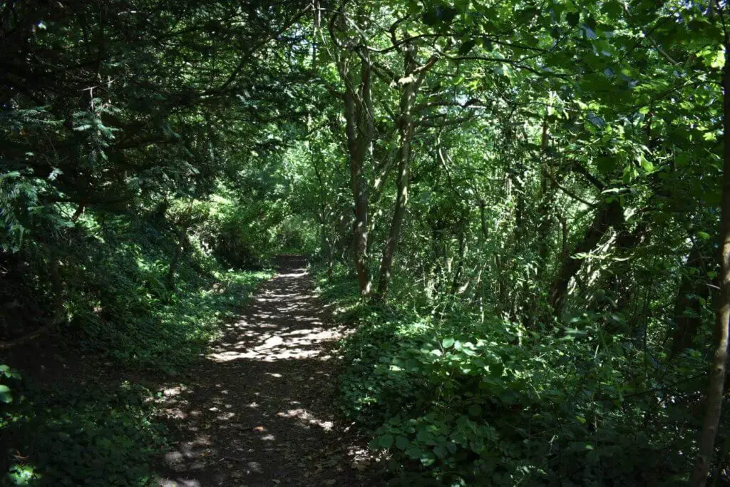
Head towards the field’s southern side and you will spot a path leading into the woodland. A short stroll down through this thickly shrouded wood and you break out on to the pebble beach marking the southern extent of Porthkerry Park.
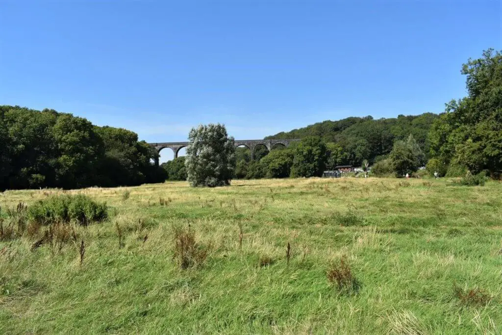
This is a popular spot for visitors, situated on the outskirts of Barry and boasts 220 acres of woods and meadowland in a glorious sheltered valley. If you have time on your side and some energy to burn, a detour to explore Porthkerry Park is well worthwhile. If you fancy a sit-down and some light refreshment, Marco’s Cafe is a great place to stop.
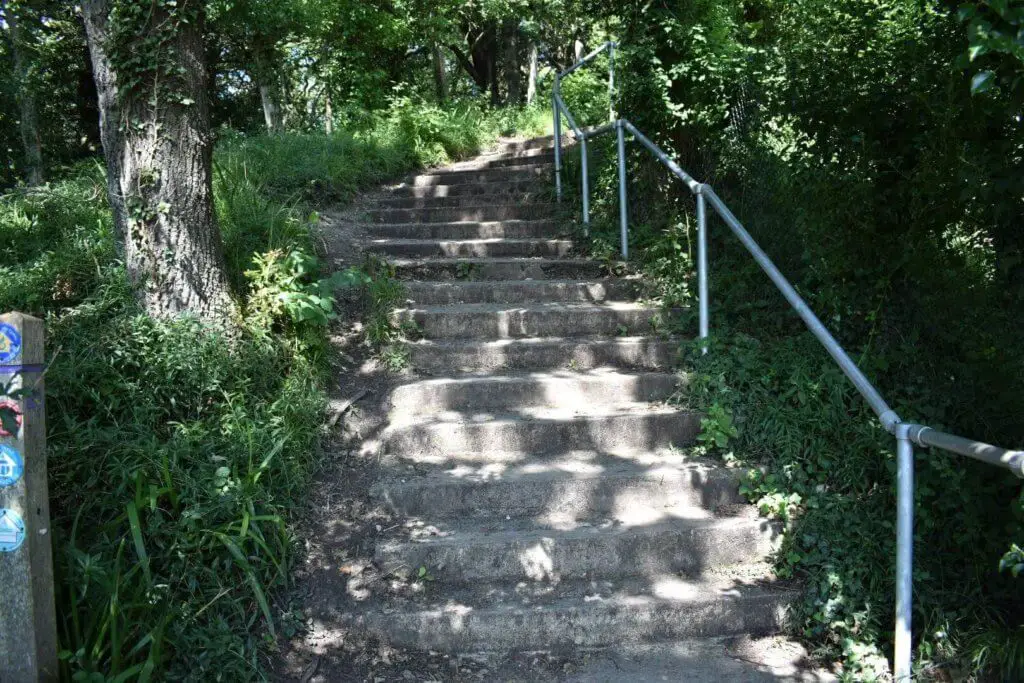
Continue along the path that runs parallel to the shoreline until you reach the 133 steps that lead you up the steep incline into Cliff Wood and back onto the cliff top.
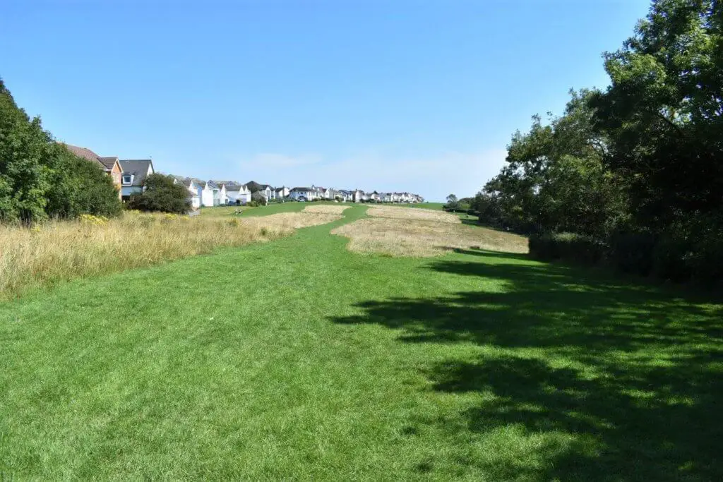
Following this short stint along this wooded path, you will enter a large open grassed recreation area that acts as a buffer between the houses along Marine Drive and the tree-clad cliff top.
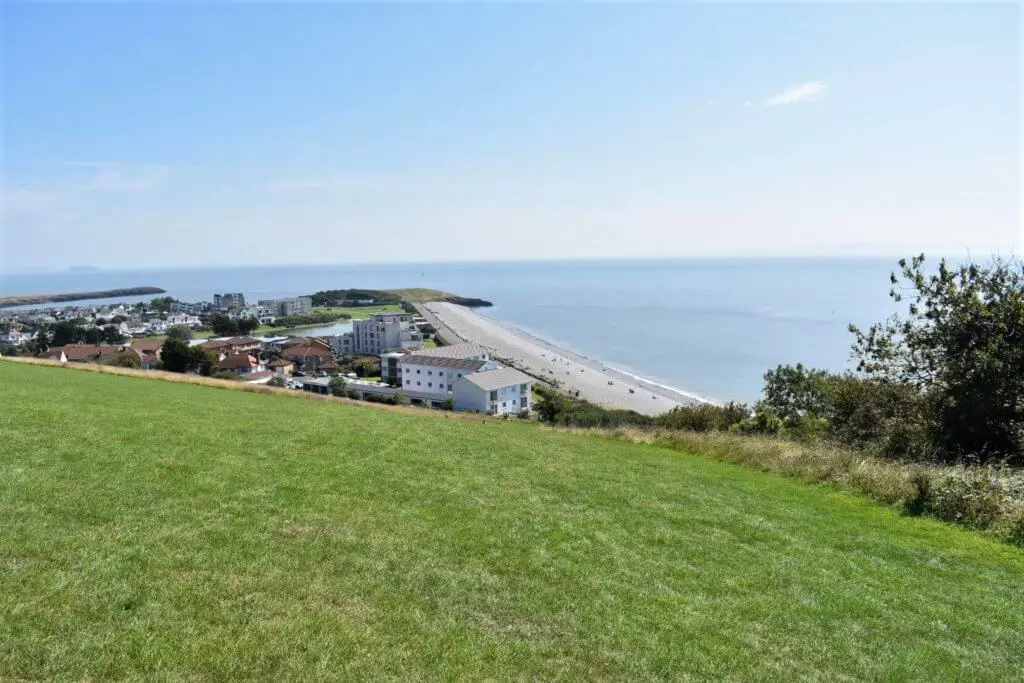
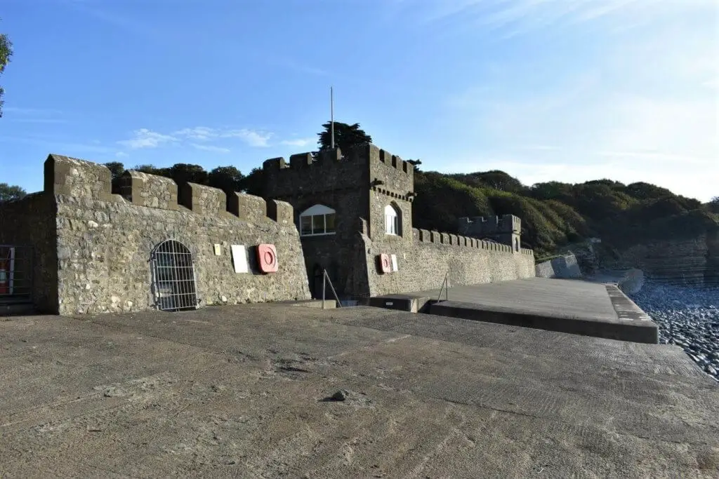
Continue along this grassy expanse and soon you will find yourself descending sharply as the Pebble Beach at the Knap in Barry opens up before you. A couple of minutes later, your 14 mile (23 km) Wales Coastal Path walk from Nash Point will be complete!
South Wales Coastal Path Walk from Nash Point to Barry – My Thoughts
At approximately 14 miles (23 km) in length, this is certainly a hefty jaunt along the South Wales Coastal Path. That said, it is relatively flat so nothing unduly taxing for the relatively fit hiker.
Some might say that this hike is a bit samey as you are pretty much walking along the coastal path with fields to the north and water to the south. Frankly, I loved it! However, the first half, from Nash Point to Aberthaw, was definitely my favourite part.
The big, ugly coal-fired power station at Aberthaw is hardly the most pleasing object that you will ever set your eyes on while walking such beautiful coastline. Fingers crossed for a swift demolition of this eyesore, now that it is no longer operational.
Having to make your way through two static caravan parks is also a bit of a dampener following the mainly untouched stretch of the Glamorgan Heritage Coast that went before. But with Porthkerry Park following not long after, you will soon forget these less impressive sections of the walk.
All in all, I thoroughly enjoyed it and now look forward to exploring the length of coast that runs from Nash Point to Porthcawl.
South Wales Coastal Path Walk from Nash Point to Barry – Q&As
How do I get to Nash Point?
As this is a long, one-way hike, driving to Nash Point and leaving your car is clearly not an option. It is possible to get to Marcross on a bus and this will get you to within one mile of the starting point. The other option, of course, is to find a kind soul to drive you there.
How far is the hike from Nash Point to Barry?
Approximately 14 miles (23 km)
How long does the hike take?
It took me 6 hours and 38 minutes to complete the hike but this did include a number of short breaks plus 30 minutes for lunch.
How difficult is the hike?
If you are reasonably fit, this should not be a huge challenge for you. Yes, it is 14 miles (23 km) in length which of course is a long hike but with few sizable elevation changes, there is nothing unduly taxing for those limbs.
What do I need to take on the hike?
To start with, a good pair of hiking shoes/boots is recommended and being in Wales, your waterproofs, regardless of what time of year it is.
Of course, ensure that you pack a decent quantity of food and plenty of water. It is typically advised to carry a minimum of half a litre of water for each hour that you are hiking. Check out our article for further details about what to eat before, during and after a hike.
Always carry a mobile phone with you just in case and make sure that you tell someone where you are going and what time you expect to arrive at your destination.
Like Our Article? Please Pin it!
Loved this thank you