Bryce Canyon National Park
The Navajo Loop and Queen’s Garden Trail is Bryce Canyon’s most popular hike. Wander among the world-famous hoodoos and the Park’s only slot canyon on this spectacular 3-mile trail
Mark and I first enjoyed the magic of Bryce Canyon on our 3rd USA road trip in 2009. On that occasion, we enjoyed the Navajo Loop Trail and were blown away by the beauty of the place.
Upon planning the 2022 road trip, we promptly added Bryce Canyon to our destination list as we not only not wanted to witness its magnificence once more but also share the experience with Paul and Simon.
The Navajo Loop Queens Garden trail is in Bryce Canyon National Park in southwestern Utah. This map highlights the exact location of the path.
A large parking area is a short distance from the trailhead highlighted on this map with an orange ‘P’.
How to get to the trailhead?
Whether you are heading to Bryce Canyon National Park from the north or south, you will approach via U.S. Route 89 (US 89).
Leave US 89, heading east on State Route 12 for 13.6 miles and then turn right, tracking south on Utah State Route 63 (SR-63).
Continue for 4.9 miles, turning left onto Sunset Point Road, which leads to the parking lot.
Parking Lot Location Details
- Latitude, Longitude (decimal): 37.623693, -112.167807
- What3Words
- Google Map
Bryce Canyon Shuttle
Once you arrive at Bryce Canyon, you can park your car and board the Bryce Canyon Shuttle. The shuttle is an excellent way of reaching the park’s most popular overlooks, amenities and trails without the concern of finding a parking spot.
The shuttle operates from April to Mid-October and is free for those who have paid the Park entrance fee. The best locations to leave your vehicle are the Shuttle Station in Bryce Canyon City (Stop 1) or the Visitor Center (Stop 6).
Sunset Point (Stop 11) is the best drop-off point for the hike described here, or Sunrise Point (Stop 13) should you wish to do the hike in reverse.
Visit the Bryce Canyon Shuttle page for further information and a map of all the stop-off points.
Before describing the Navajo Loop and Queen’s Garden combination Trail, I have summarised the trails that make up this fantastic hike.
Queen’s Garden Trail
The Queen’s Garden Trail is a 1.6 mile (2.57 km) out-and-back hike starting at Sunrise Point along the Rim Trail, leading down 98 metres (320 feet) into Bryce Canyon.
The trail drops relatively steeply along a sloping ridgeline offering numerous spots to enjoy the beautiful views across Bryce Canyon.
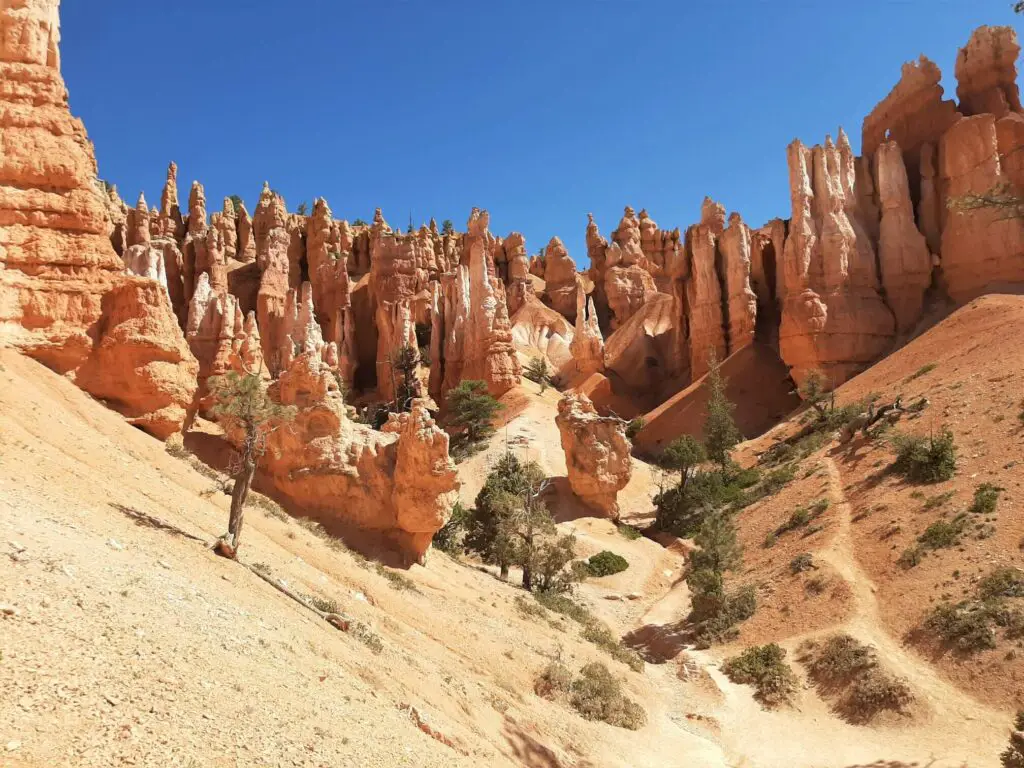
As you descend towards the canyon floor, you will encounter several small tunnels, fascinating hoodoos and pinnacle-filled ravines.
After 0.8 miles (1.3 km), there is a short spur off to the right, signposted “Queen’s Garden”, where you will find an amphitheatre of impressive hoodoos, including one that loosely depicts Queen Victoria.
Retrace your steps to Sunrise Point to complete the trail.
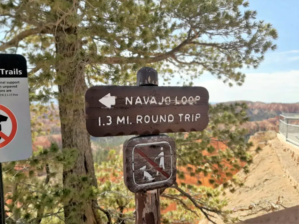
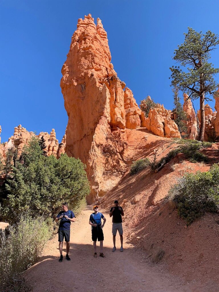
As the name suggests, the Navajo Loop Trail is a circular route starting at Sunset Point along the Rim Trail. The Navajo Loop trail length is 1.37 miles (2.2 km) with a maximum elevation change of 129 metres (423 feet).
This trail may only be short, but it certainly makes up for what it lacks in the distance with its enchanting scenery.
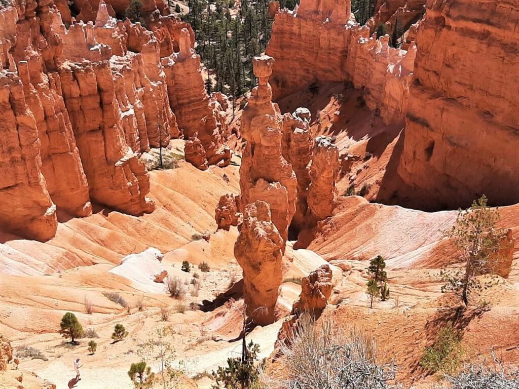
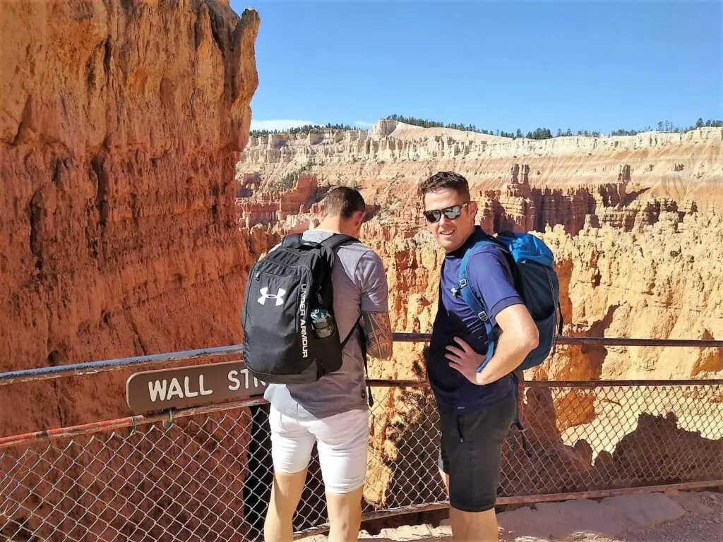
On one side of the loop is the dramatic slot canyon known as Wall Street, while the other offers the towering hoodoo known as Thor’s Hammer and the Two Bridges rock formation spanning a canyon.
Remember, whichever direction you choose, you will always have a hefty climb back to the starting point.
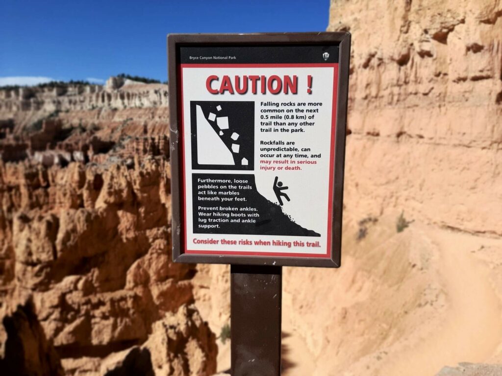
Please note: The Wall Street side of the loop closes when freezing overnight temperatures combine with precipitation, dramatically boosting the risk of substantial rockfalls.
As a result, this side of the trail is closed between November and April.
The specific times of the closures vary yearly, so check the National Park Service website before arriving.
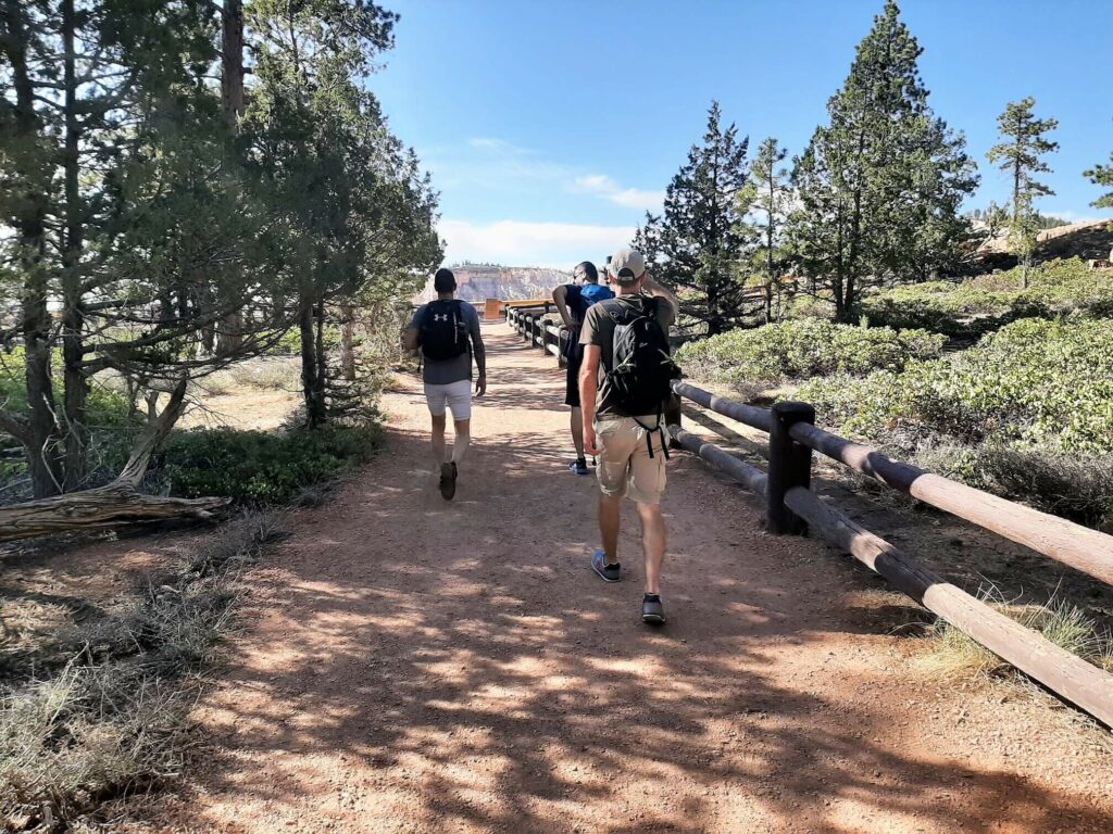
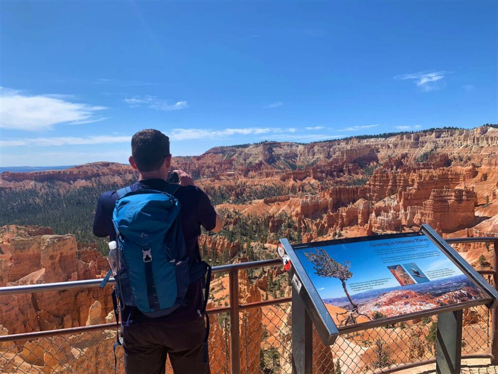
From the parking lot, take the path adjacent to the shuttle stop, and you will arrive at Sunset Point in no time.
Here you will get your first taste of the breathtaking, panoramic views across the maze of orange fins, hoodoos and spires for which Bryce Canyon is famous.
Sunset point is also where the Bryce Canyon Navajo Loop and Queens Garden trail combination hike starts. That said, Sunrise Point would be the starting point if you approach the hike in a clockwise direction.
Within 100 metres of the start, you have a choice to make. Turn left to descend via Thor’s Hammer and Two Bridges or right for Wall Street.
Both options are fantastic, so take your pick. We chose the Wall Street option.
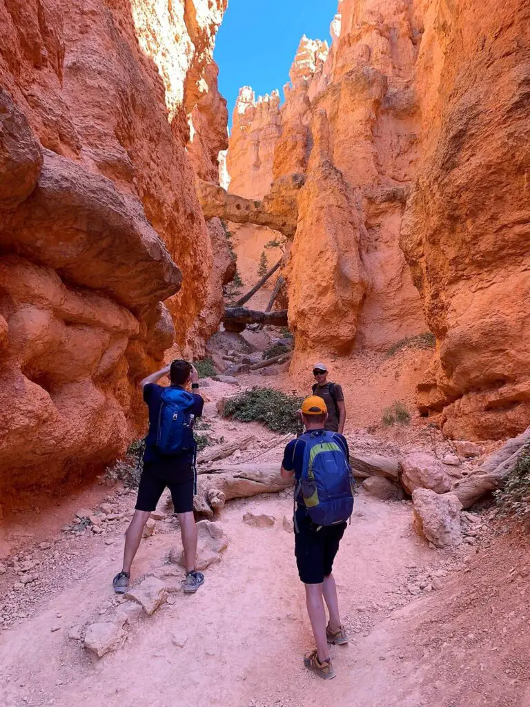
Wall Street
You will now find yourself standing at the top of a breathtaking, steep descent, gazing down into the narrow canyon. Thankfully, a series of switchbacks have been cut into the rock to make this section of the hike more manageable.
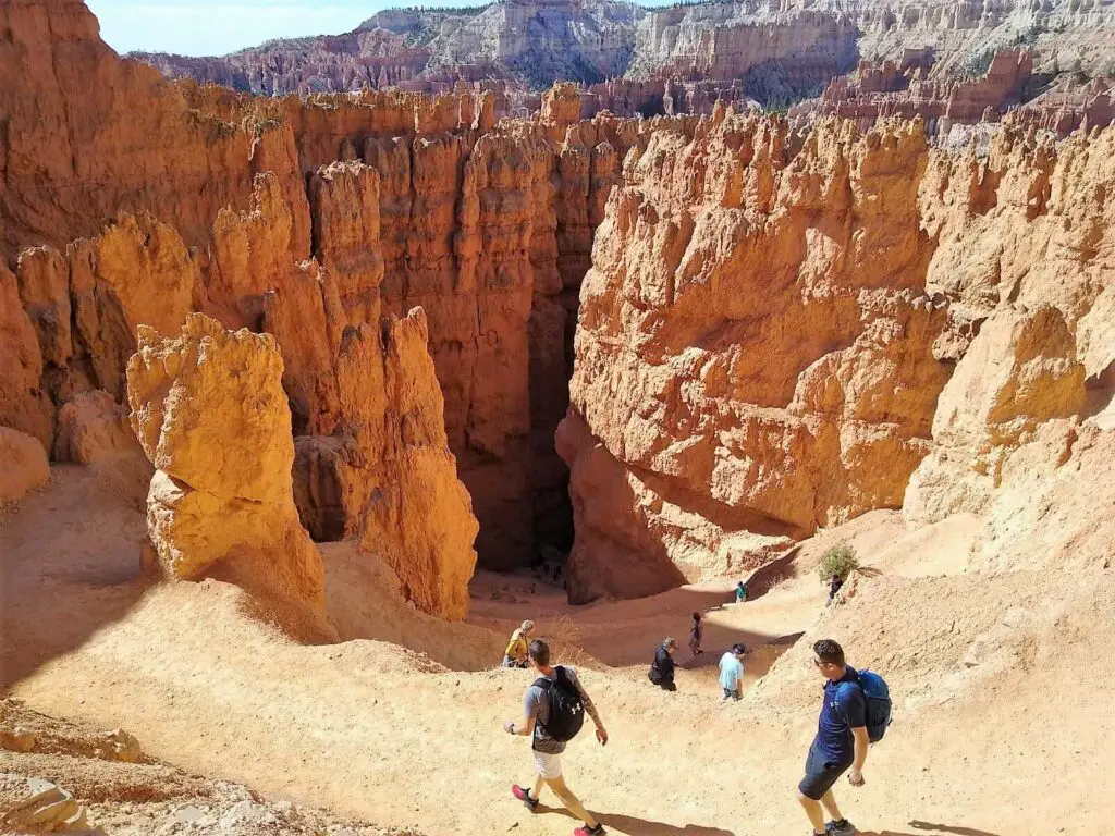
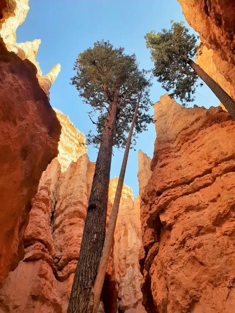
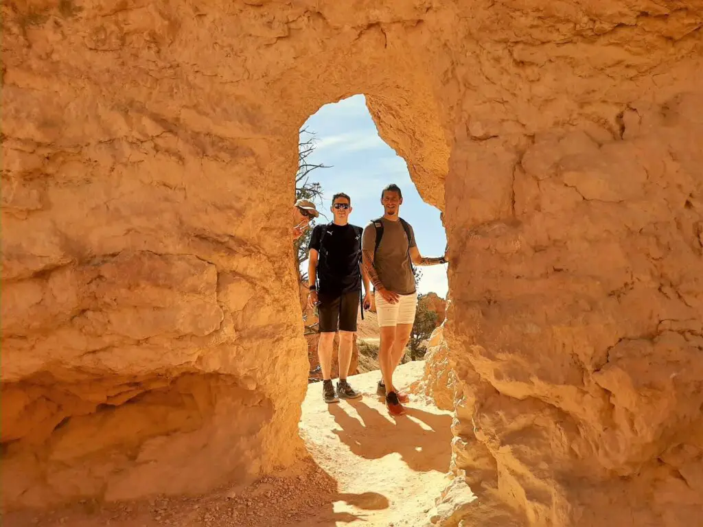
The drop into the canyon is both quick and dramatic, and when the switchbacks end and the path straightens, you enter the National Park’s only slot canyon, known as Wall Street.
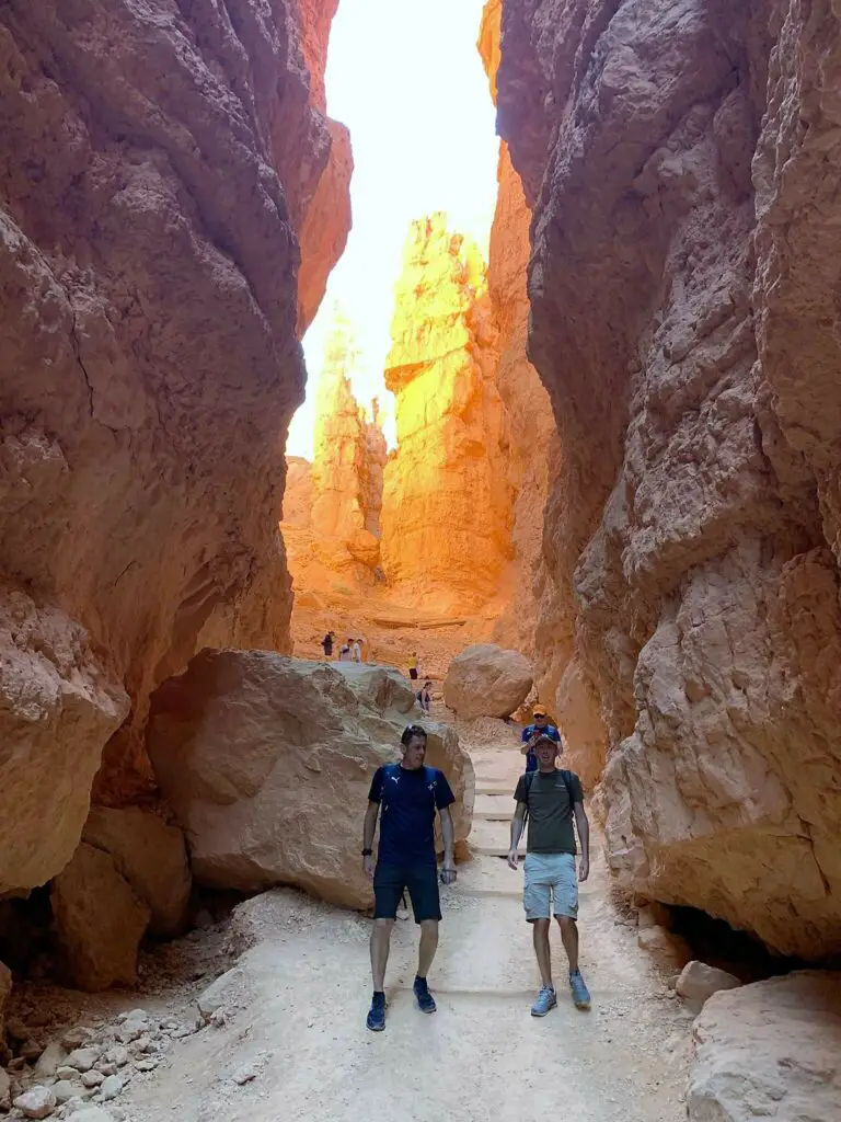
But here, you will not find towering skyscrapers like those located at its namesake in New York’s financial district. Instead, you will discover soaring walls of dazzling red rock through which the trail passes.
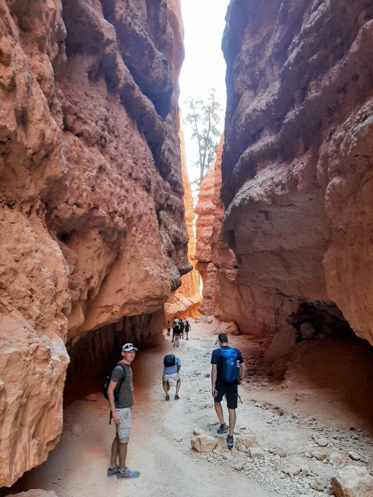
Continuing through the canyon, you will surely be mesmerised by the lofty arrow-straight Douglas Firs that have somehow found a home in this most inhospitable of locations.
Once the trail emerges from the steep canyon-sided Wall Street, the surroundings open up somewhat, and the now reasonably flat trail meanders amongst an abundance of trees that dot the landscape.
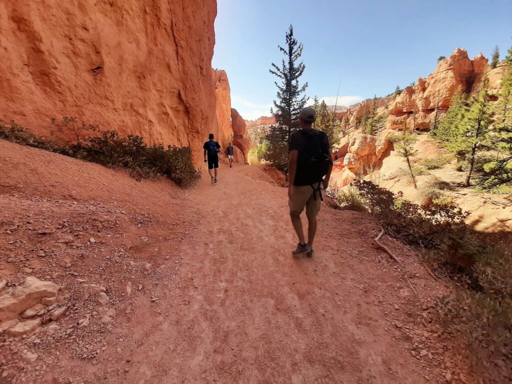
Joining the Queens Garden Trail
Approximately 1.2 km (0.7 miles) from the trailhead at Sunset Point, you reach the intersection of the Navajo Loop Trail and the track linking to the Queens Garden Trail.
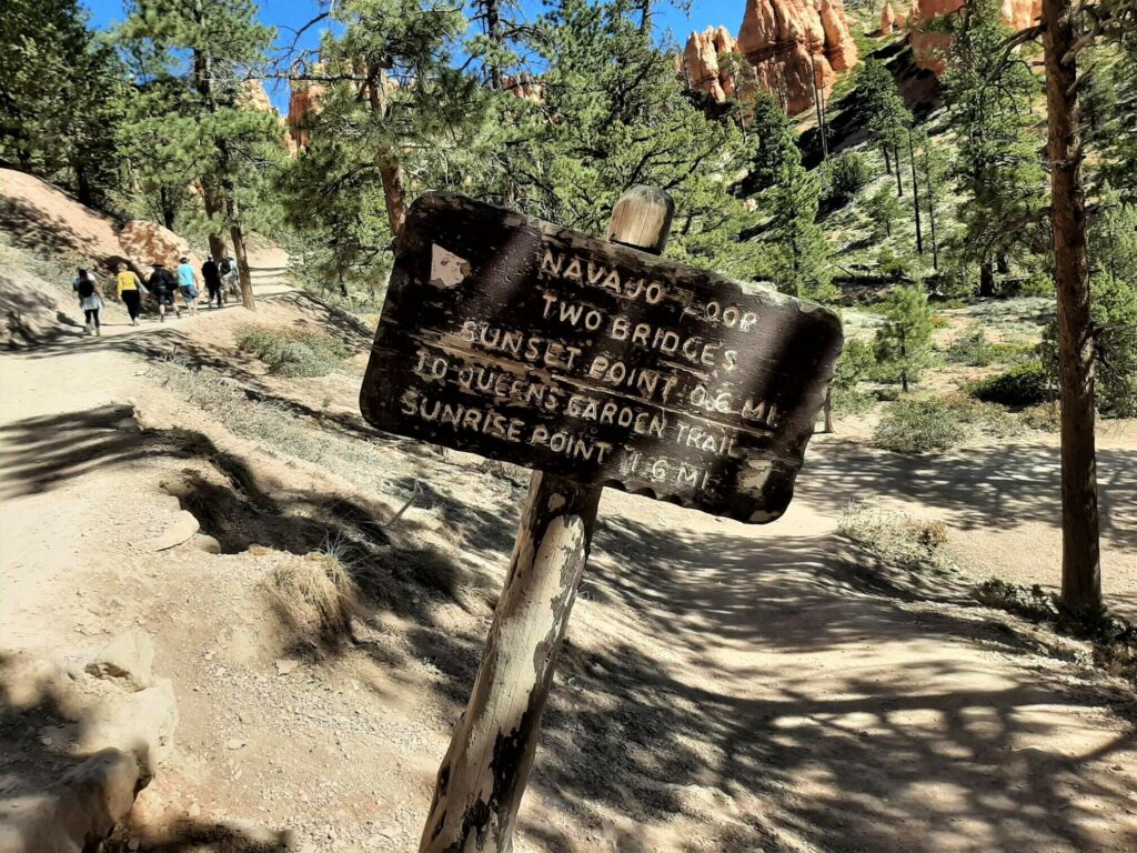
If you wish to complete the Navajo Loop Trail, keep left at the sign or take the right turn to continue onto the Queens Garden Trail for the combination loop.
We decided to take the Navajo Loop Trail just as far as Two Bridges before backtracking and joining the path leading to the Queens Garden Trail.
This 1.2 km (0.7 miles) section of the hike to Queens Garden is relatively flat and passes predominantly through pine forests.
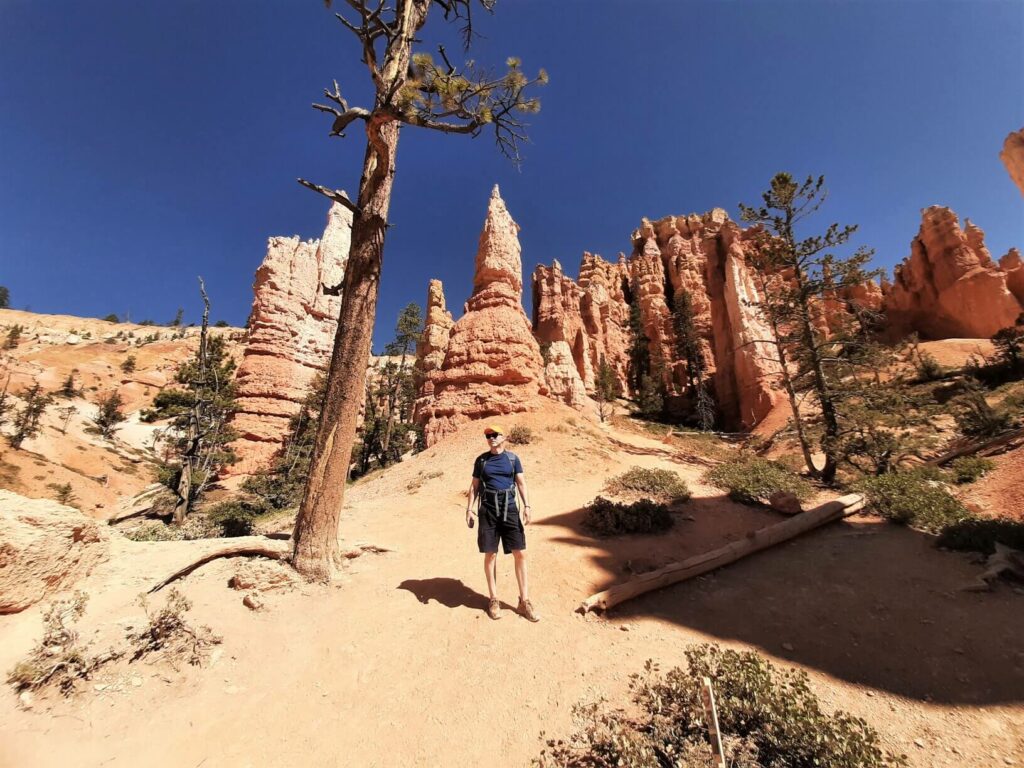
Then the trail leads back towards the bewitching red rock fins and hoodoos, culminating in the majesty of Queen Garden itself.
Returning to Sunset Point
Once you have passed Queen’s Garden, the gradient increases, and the trail twists its way out of the canyon to Sunrise Point. From here, turn left and follow the Rim Trail for approximately 750 metres back to Sunset Point.
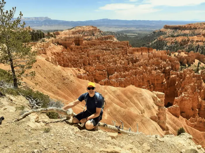
Bryce Canyon is one of the best locations worldwide to witness the magical geological features known as hoodoos. When I first stepped out onto the Rim Trail to enjoy the spectacular view of this phenomenon back in 2009, I always promised myself that I would one day return.
Taking in the panoramic view across Bryce Canyon is one thing, but getting up close and personal with the canyon’s unique rock formations is far more memorable.
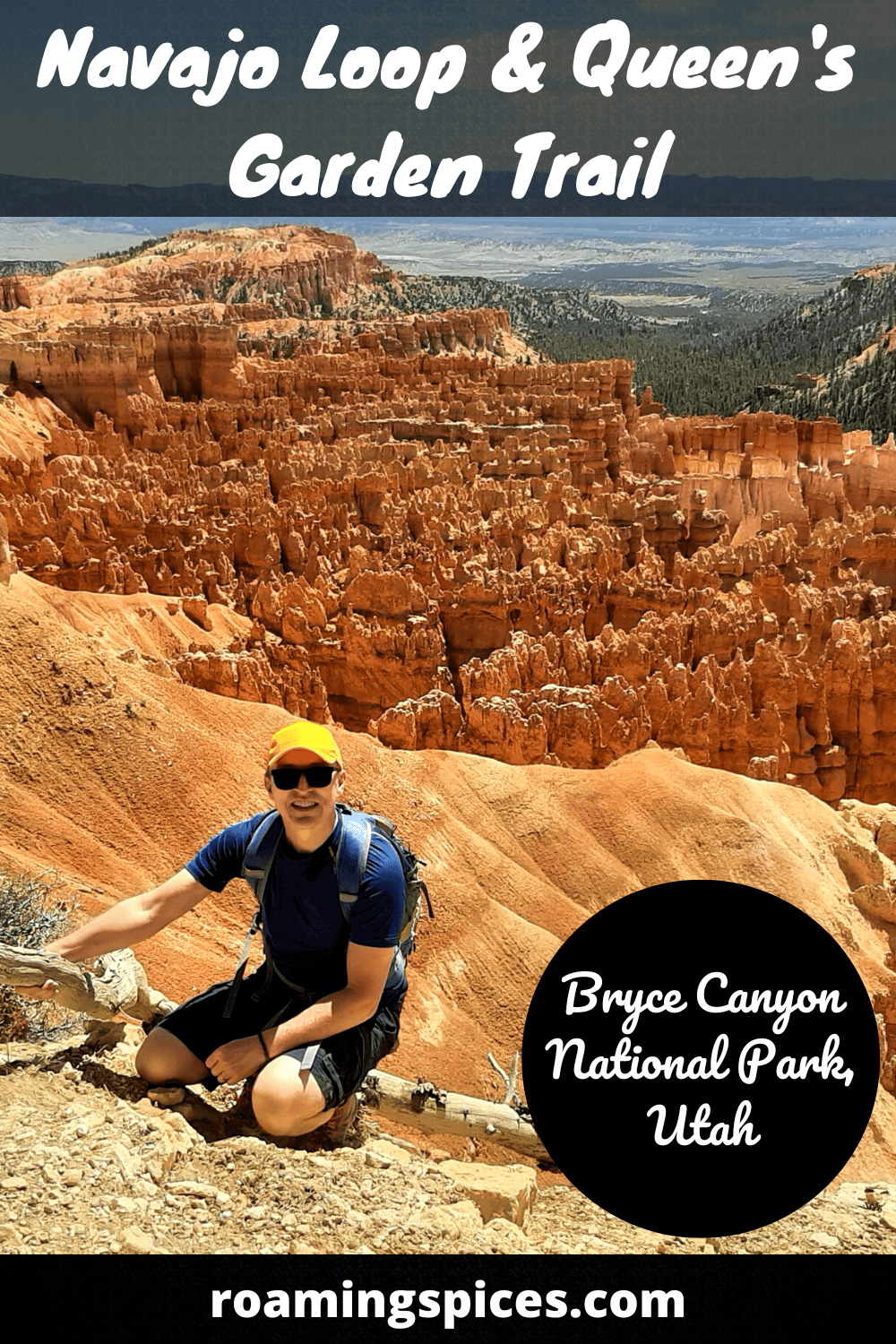
The combination trail is perfect for experiencing Bryce’s soaring canyon walls, magnificent hoodoo, fin and spire formations on a moderately challenging 4.6 km (2.86 mile) hike. You will not be disappointed!
If you have limited time in Bryce Canyon, make sure this trail is on your to-do list!
How long is the hike?
This combination trail is 4.6 km (2.86 miles) in length.
What is the hike time?
You should be able to complete the hike in 2-3 hours.
Is this a challenging hike?
It is a moderately challenging hike. Whether you approach it clockwise or counterclockwise, there remains a significant climb back to the Rim Trail from the canyon floor.
When is the best time of year to visit Bryce Canyon?
Unlike some national parks in the USA, snow doesn’t close Bryce Canyon. As it happens, plenty of visitors choose to arrive in the winter.
The snow-capped red-rock hoodoos and spires are undoubtedly a sight to behold.
However, if you’re planning on hiking into Bryce Canyon, I suggest arriving in the late spring or early autumn. Visiting during these months helps to avoid the summer heat and crowds.
It is worthwhile noting that the Wall Street side of the Navajo Loop closes every year once precipitation and freezing overnight temperatures combine and increase the risk of rockfalls in this area. However, the Two Bridges side of the Navajo Loop remains open year-round.
Are dogs allowed in Bryce Canyon?
Pets are permitted in the National Park but only at specific locations. Check out the Pets page on the National Park website for details.
What is Bryce Canyon famous for?
It is, without doubt, the fantastical red rock fins, hoodoos and spires that draw visitors to the National Park from all over the world.
Nowhere on earth are these rock formations so abundant as they are in the northern part of Bryce Canyon National Park, Utah.
Can you drive your car through Bryce Canyon?
Yes. You can witness a wide range of the National Park’s exquisite scenery from the scenic Highway 63 that runs north/south through the Park. This includes all of the Park’s major overlooks that are accessible with only a short walk from your vehicle.
Does Bryce Canyon require reservations?
No. Visitors do not need reservations to enter Bryce Canyon National Park. However, it is always worth checking the permits and reservations page of the National Park Service website before visiting.
When does Bryce Canyon open?
The National Park is open 24 hours a day throughout the year.
Useful Tips & Information
Arrive Early – This will help avoid crowds, especially if you are visiting during the busier summer months. Moreover, you can complete the hike before the summer sun takes hold.
Bring plenty of water – It is always better to have too much water than too little. Discover how much water you should bring on a hike.
Take it slowly – Sections of Bryce Canyon sit at over 2400 metres (8000 ft+). It is, therefore, common for visitors to feel out of breath, particularly when hiking.
The final ascent from the amphitheatre following the Navajo Loop and Queen’s Garden Trail can be difficult, so anticipate numerous stops to take a breather during this climb.
Bring a coat – Even when visiting during the summer, it can be cold early in the morning and late in the afternoon.
Distance from Bryce Canyon to other popular destinations:
- Antelope Canyon (Arizona): 159.4 miles (256.5 km)
- Arches National Park (Utah): 255 miles (410.3 km)
- Canyonlands (Island in the Sky) (Utah): 269 miles (432.9 km)
- Capitol Reef National Park (Utah): 120 miles (193.1 km)
- Grand Canyon National Park (North Rim) (Arizona): 159 miles (255.9 km)
- Grand Canyon National Park (South Rim) (Arizona): 290 miles (466.7 km)
- Las Vegas (Nevada): 262 miles (421.6 km)
- Monument Valley (Arizona/Utah): 278 miles (447.4 km)
- Zion National Park (Utah): 74.7 miles (120.2 km)
Have you experienced this trail?
If you have, please share your experience with our readers and us. If you have any questions that we still need to answer, please let us know, and we will get back to you just as quickly as we can.
Like Our Article? Please Pin it!
Leave a Reply