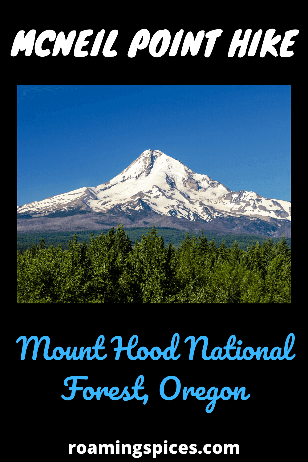
Mount Hood National Forest, Oregon
The McNeil Point hike is a challenging trail in Mount Hood National Forest, Oregon. Enjoy this 9 mile return hike, taking in the splendour of this stunning location, with the imposing Mount Hood as the centrepiece
The Challenging McNeil Point Day Hike
Anyone looking for a challenging day hike with amazing views near Portland, Oregon should consider a McNeil Point hike. Actually, you should simply stop your search and just do this amazing hike in Mt. Hood National Forest. I’ve hiked all over the Pacific Northwest, including breathtaking places like Mount Rainier and Crater Lake National Parks, and this was my favorite day hike.
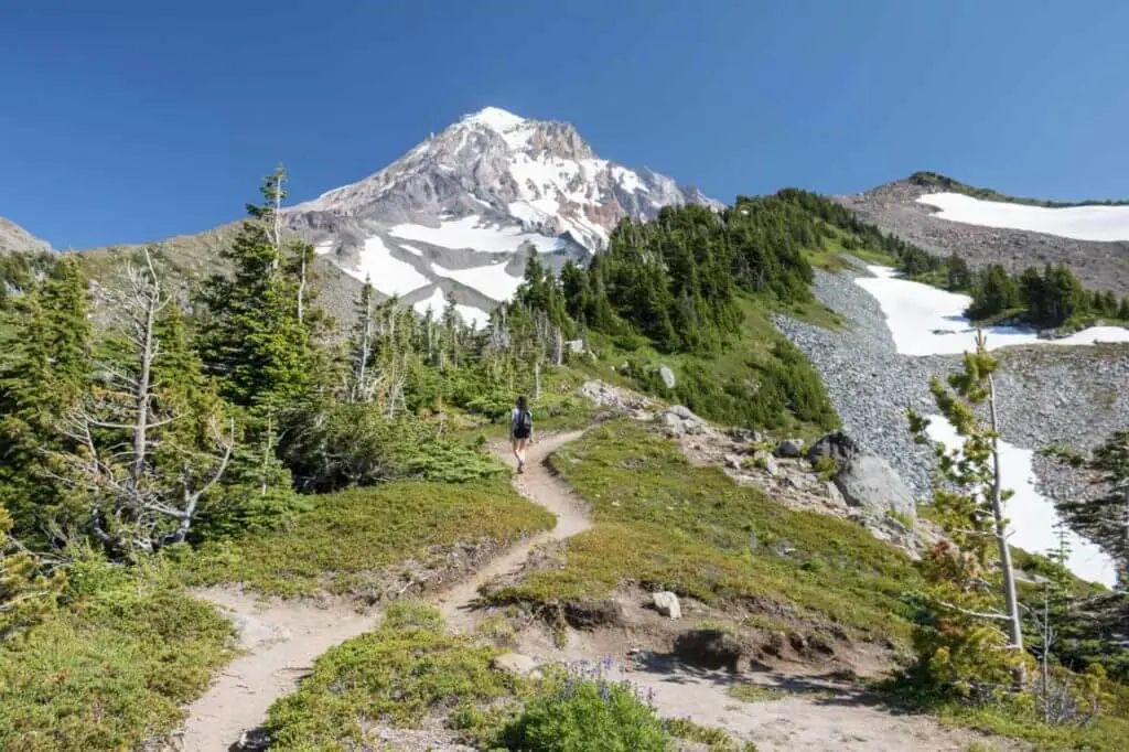
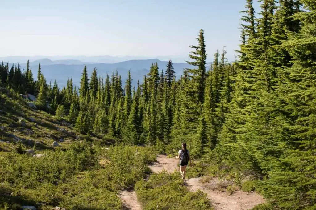
The McNeil Point Trail will take you through pristine forests, across wildflower-filled meadows and well above the treeline. Once you’ve left the forest behind, panoramic views start opening up. The trailhead is located at a relatively high elevation as it is, but you will climb much higher on this hike.
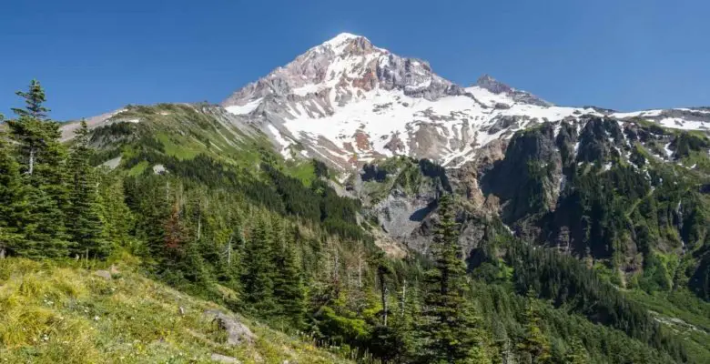
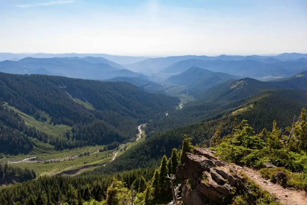
Eventually, epic vistas take in Mt. Hood itself, which appears so close you might touch it, and other Pacific Northwest volcanoes like Mount St. Helens, nearby Mount Adams and distant Mount Rainier.
Hiking the McNeil Point Trail
The McNeil Point hike is not easy, though. It’s classified as difficult, an out-and-back hike of more than 9 miles and with about 2,200 feet of elevation gain.
I recommend starting early, especially when hiking on a weekend day in summer, since the trailhead parking lot tends to fill up that time of year. When I hiked this trail, on a Saturday in late-July, there were literally dozens of cars parked at the designated parking area and along the road toward it.
It’s a super-popular backpacking hike, too — you’ll pass several backcountry campsites on your way to the final viewpoint. My impression was that about half of all hikers doing the McNeil Point trail on a weekend were overnight backpackers. Of course, things should be much quieter on a weekday.
As I said before, this was probably my favorite hike so far in the Pacific Northwest. It’s both challenging and exceptionally rewarding; it’s located under two hours from Portland yet offers stunning mountain scenery.
It May Seem Busy, But It’s Still Wilderness
In fact, you will be hiking through wilderness areas much of the way. On my way down from McNeil Point, I actually had a pretty close encounter with a black bear. This surprised me as much as it might you, considering it was a busy Saturday in summer, but this made me realize that wildlife doesn’t really care about that. If animals happen to venture into an area used heavily by humans, they’ll either meet them or run away.
“Check Out Other Top USA Hiking Trails”
That black bear did run away, though, but not before giving me a serious fright. I didn’t encounter it face to face, but the bear did run through the woods less than 30 feet along the switchback above me (where I’d been seconds before). I could feel the ground shake as it ran away! That was a serious reminder to always carry bear spray when hiking in American parks, and to have it easily accessible and know how to use it.
As much as this event triggered my nerves, in the end it only enhanced my overall McNeil Point day hike experience. Epic views, innumerable wildflowers, gorgeous scenery and a bear sighting! Hiking really doesn’t get any better than that!
McNeil Point FAQs
After seeing the McNeil Point hike pop up in various lists of the best day hikes near Portland, Oregon, I was super-excited to do it myself. However, I did have to consult several different websites to find the information I needed. Therefore, I’ve answered all the questions that I had before hiking the McNeil Point trail below—for your convenience.
What Is the McNeil Point Elevation Change?
The elevation change on the McNeil Point hike is about 2,200 feet. The highest elevation on this scenic hike is 6,100 feet, which is at McNeil Point itself. With the exception of a few rather steep sections and switchbacks, most of the trail is a fairly gradual ascent.
How Long Is the Hike?
The total distance of the McNeil Point hike varies according to the source. This is because this is a combination of a few different trails, and there are a couple of detours you can make. The most direct route up and back down, however, is approximately 9 miles in total.
What Is the Hike Difficulty?
The hike to McNeil Point is a rather long day hike—often done as an overnight backpacking trip—with a significant change in elevation. It’s classified as difficult or challenging.
The first part of the hike leads through a wonderful, dense forest. This is the easiest, smoothest part. Once you’ve cleared the woods, views open up and the trail gets occasionally steeper, with some switchbacks.
It’s possible to hike up to the first open views, which are pretty awesome already, and retrace your steps to make it a moderate hike. However, I really recommend continuing on—the views only get wider and more spectacular the higher you get.
Where Is the McNeil Point Trailhead?
The starting point of the McNeil Point hike is the Top Spur Trailhead. The direction to the McNeil Point trailhead are as follows. You can get there via the Lolo Pass Road, a sideroad of Oregon Route 26 in Zigzag. The turnoff towards Lolo Pass is about 18 miles east of Sandy and 10 miles west of Government Camp in Mt. Hood National Forest.
After about 4 miles, turn right onto Muddy Fork Road and follow this road until it becomes Road 1828. Follow this winding road for another few miles. Eventually. You’ll see a sign for the Top Spur Trail, pointing towards an unpaved gravel road (which is suitable for low-clearance 2WD cars in summer). It’s about 1.5 miles to the trailhead.
“Useful List of Hiking Tips For Beginners”
The McNeil Point hike consists of four different trails. The first short part is the Top Spur Trail, which T-bones into the Pacific Crest Trail (#2000). Turn right and continue for a couple of minutes until you reach an intersection of four trails.
Take the left-most trail, which is the Timberline Trail (#600). A few miles later, you’ll see a very noticeable sign pointing to the right and towards McNeil Point.
Are There Bears on the McNeil Point Trail?
Yes! Much of the McNeil Point hike is in the Mt. Hood National Forest wilderness. This is a pretty remote area, many miles from the nearest town and you’ll hike as far as 4 miles from the trailhead.
You need to be aware of where you are. Even if it’s busy on the trail, which happens a lot on summer weekends, you can still run into a bear—it happened to me!
There’s a healthy population of black bears in Mt. Hood National Forest. These animals, although perhaps intimidating, are generally gentle and shy. They won’t bother people if they don’t get harassed themselves. Yet, you still need to know what to do when encountering a black bear while hiking.
Additionally, mountain lions also inhabit the wilderness around Mt. Hood. Again, though, these animals are very shy and rarely seen. They will avoid areas heavily used by humans.
Is There a Fee?
Yes, you will need a NW Forest Pass to park at the Top Spur Trailhead. You can pick up a pass at the Zigzag Ranger Station, at outfitters in Government Camp and various other locations throughout Oregon and Washington. Interagency Passes are accepted as well.
What’s the Best Time for a McNeil Point Hike?
Generally speaking, you can comfortably hike the McNeil Point trail from summer through early-fall. That’s when the McNeil Point weather is at its most optimal and McNeil Point trail conditions are best.
Note that this is a high-elevation area and Lolo Pass is generally closed to traffic from late-fall to mid-spring. As such, you can literally only get to the trailhead in summer and fall.
When Do the Wildflowers Bloom on the McNeil Point Trail?
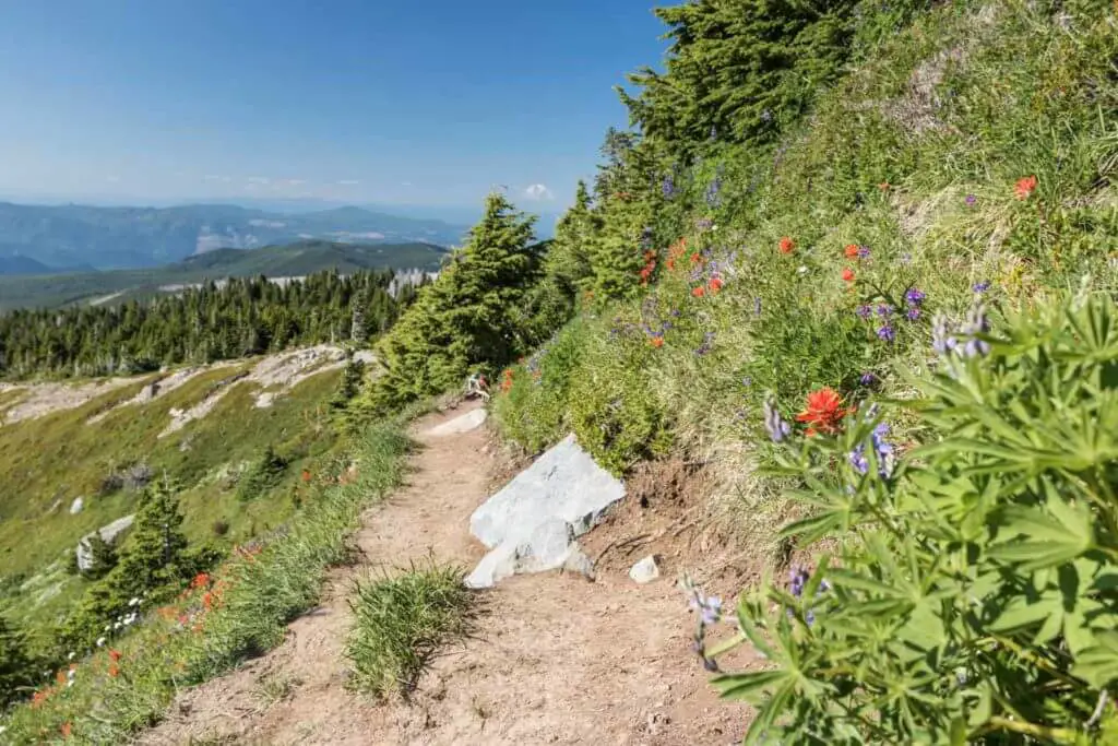
Like many other mountainous areas in the Pacific Northwest, Mt. Hood National Forest’s mountain meadows are covered in wildflowers in July and August. From countless lupines to avalanches lilies, India paintbrush and numerous other summer flowers, this is arguably the feature that attracts most hikers to the McNeil Point trail in summer – Along with the sensational vistas, of course.
Typically, the peak wildflower bloom along the McNeil Point trail is late-July and early-August. Trust me, you’ll be blown away by the variety of vibrant colors!
Like Our Article? Please Pin it!
Leave a Reply