Grand Canyon National Park, Arizona
The South Rim Trail hike leads you along the southern edge of the Grand Canyon National Park, where you will enjoy views of one of nature’s natural wonders, that are hard to surpass anywhere else in the world
Hiking the South Rim Trail
The easiest hike in Grand Canyon National Park, Arizona, the South Rim Trail is a virtually flat trail along the southern edge of the Grand Canyon, passing no fewer than a dozen named viewpoints. Part of the trail is paved and lined with information panels. It makes for a fantastic and peaceful walk along one of the world’s biggest natural wonders—literally and figuratively.
Hiking the Trail
I spent three days in Grand Canyon National Park during a 6-week national parks road trip from the U.S. East Coast to the West Coast and back. While I saw some truly jaw-dropping landscapes and unique natural feature all over America, nothing compares to the sheer spectacle that is the Grand Canyon. It’s everything you imagine it is and more.
The first time you gaze down that mile-deep chasm, see its colourful layers, mesas and cliffs, chances are your jaw will actually drop. Its immensity is difficult to comprehend, even when you’re there and looking at it.
“Want to check out some other top USA hiking trails?”
I, too, was not unmoved by the view from Mather Point in Grand Canyon Village, the very point where most visitors see the Grand Canyon for the first time. It was definitely impressive.
However, it was also ridiculously crowded. This is, after all, where all tour buses go to, the location of a campground and lodges, the main visitor centre, and even a train station. It’s the heart of mass tourism in the Grand Canyon, in other words.
So, I couldn’t wait to get out of there, find some peace and quiet, enjoy the views without being surrounded by hundreds of selfie-snapping tourists. The easiest way to quickly escape the hustle and bustle of Grand Canyon Village is the South Rim Trail, also known simply as the Rim Trail.

Guide to the South Rim Trail in Grand Canyon National Park
Technically, the Rim Trail begins at the South Kaibab Trailhead east of Grand Canyon Village. Most people, however, start at Mather Point, since it’s much easier to get to. That’s what I did as well.
From Mather Point, the trail stretches westward for about 11 miles to Hermits Rest. This may seem like a rather long hike, especially if you don’t go on regular hikes, but I can assure you that most people can do it. It’s by far the easiest of all Grand Canyon South Rim trails, a combination of paved and dirt trails, with very little elevation gain.
Most of the trail is paved, though. The only section that’s not wheelchair-accessible is between Powell Point and Monument Creek Vista, where it’s a 3-foot-wide dirt trail.
“Fancy a Real Challenge? The Bright Angel Trail Awaits”
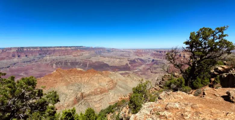
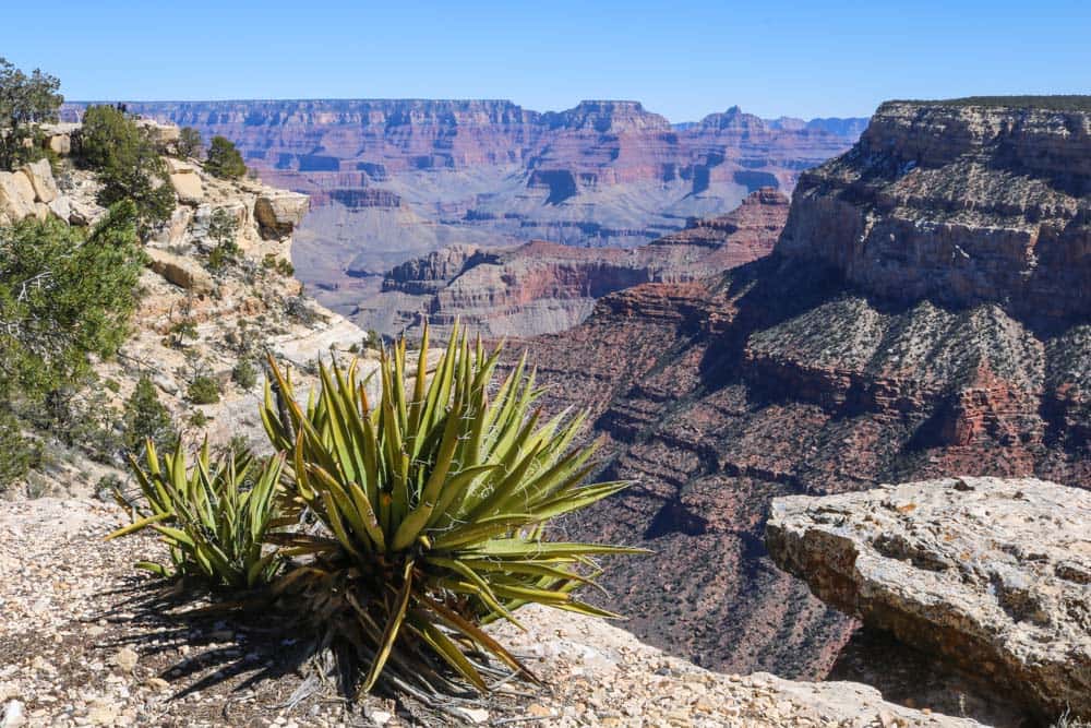
The Rim Trail hugs the very rim of the Grand Canyon, offering sensational views pretty much the entire way. The best views, in my opinion, are in the middle section of the trail, where several full panoramas await eager hikers.
You can make this a there-and-back hike, turning around wherever you want, or hike the entire thing and catch the park shuttle bus back to Grand Canyon Village. That shuttle commutes up and down Hermit Road, which parallels the South Rim Trail, all day and can drop you off and pick you up at various overlooks along the way. A scenic hike has never been this easy!
Pick Your Own Start and Finish Points
I hiked all the way from Mather Point to Hermits Rest, the end of the Rim Trail and turn-around point of the shuttle bus. Taking my time enjoying the countless amazing views and snapping way too many photos, it took me about 3.5 hours to finish it. I then hopped on the shuttle bus, which brought me back to Grand Canyon Village.
Of all the South Rim hiking trails in Grand Canyon National Park, I highly recommend you start with this one. I can’t imagine a better introduction to the Grand Canyon than this. And if you’re left wanting more, you can always stay another day and hike down into the canyon on the world-class Bright Angel and South Kaibab Trails.
Points of Interest on the Rim Trail
This is an overview of the highlights along the Rim Trail, listed in order from east to west. Some of this information comes straight from the National Park Service website.
Mather Point
Nearest viewpoint to the Grand Canyon Visitor Center and the busiest one, too.
Yavapai Point
Glass observation windows with information about the canyon’s geology, last drinking water before the end of the trail.
Park Headquarters Junction
Historic buildings, restrooms, drinking water and other amenities.
Trailview Overlook
Great views of the Bright Angel Trail snaking its way down the canyon wall.
Powell Point
Start of unpaved section.
Hopi Point
My personal favorite South Rim Trail overlook, amazing for sunset.
Mohave Point
Phenomenal views in several directions.
Monument Creek Vista
Dirt trail ends and becomes a wide multi-use paved trail.
Hermits Rest
End of the South Rim Trail, small snack bar and gift shop, water available.
Grand Canyon South Rim Trail FAQs
Summing up most of what I’ve talked about before, these FAQs will offer you answers to all common questions about this amazing trail.
Where Is the South Rim Trail?
The South Rim Trail parallels a stretch of the South Rim of the Grand Canyon in Grand Canyon National Park, Arizona. It passes through Grand Canyon Village, which is the main tourist area in the national park, home to the visitor centre, historic buildings, lodges, shops and a campground. You can get there by car, bus and even train.
How Long Is the South Rim Trail?
The total distance of the Rim Trail from the South Kaibab Trailhead to Hermits Rest is 13 miles one way. However, many people start their hike at Mather Point in Grand Canyon Village. In that case, the distance is about 11 miles. Hikers can start at various points along the way, though.
How Difficult Is This Trail?
This is the easiest of all South Rim hiking trails. With a total elevation gain of about 200 feet over 13 miles, it’s basically flat. You’ll hike along the edge of the Grand Canyon the entire time. You can turn around whenever you want or take the shuttle bus. Moreover, because a lot of it is paved, this trail is suitable for pretty much all visitors, including people with disabilities and young children.
Is Public Transportation Available?
Yes, a free park shuttle bus travels along Hermit Road, which parallels the South Rim Trail. There are several bus stops along the way, allowing you to skip sections, cut your hike short or hike the entire distance and then take the bus back to your starting point.
Is There an Entrance Fee?
The South Rim Trail is 100% free to hike, but, as is the case in most U.S. national parks, there is an entrance fee. Admission to Grand Canyon National Park includes both the South and North Rims and is valid for 7 days. Check the park’s website for current prices.
Best Time to Hike the South Rim Trail?
The South Rim of the Grand Canyon is open throughout the entire year. This means you can hike the Rim Trail all year, too. However, it’s important to be aware of weather conditions. Winter, for example, may bring snow and ice and make the trail slippery. Summer, on the other hand, comes with occasional thunderstorms and high temperatures.
Although you can undertake this hike safely in any season, provided that you’re prepared, I recommend doing it in spring or fall. These two seasons have the most comfortable temperatures, which will also allow you to hike down into the canyon if you want to. (That’s highly discouraged in the scorching hot summer.)
Is the South Rim Trail Dangerous?
This is without question the safest trail in the Grand Canyon. Yet, it’s still vital to use common sense while hiking. People die in this national park every year because they get too close to the edge and fall, get heatstroke,…
Stay on the trail, wear a hat when it’s sunny, and bring plenty of water. Never, NEVER, approach the edge of the rim! If you don’t do anything stupid, nothing will happen to you. This is also the most popular trail in the park, served by shuttle buses and is used by many people. It’s not remote in any sense and you cannot get lost here.
“New to hiking? Want a comprehensive list of tips to help you get started?”
There are a few things you can do to “hike smart”, though, which are recommended by the National Park Service:
- Check the weather forecast and change your plans if you need to.
- Avoid summer heat.
- Tell someone about your hiking itinerary.
- Drink plenty of fluids, but don’t overdo it. Eat well, bring (salty) snacks, and make sure to get enough sleep.
- Bring a trail map.
- Wear sunscreen, a hat and sunglasses.
- Bring extra clothing just in case the weather changes.
- Make sure your hiking shoes are broken in.
Where Can I Find a Grand Canyon South Rim Trail Map?
I recommend swinging by the Grand Canyon Visitor Center first thing when you arrive at the park. There, you can get updates on trail conditions, the weather forecast, a park newspaper and trail map. It also has a wealth of information about everything related to the park, including a park movie and exhibits. If you’d like to look at a South Rim Trail map right now, you can find one here.
Like Our Article? Please Pin it!


Leave a Reply