Hadrian’s Wall, Cumbria, England
Of all the multi-day hikes I’ve completed to date, the Hadrian’s Wall Path in Northern England is by far my favourite. It has everything you could possibly want from a long-distance hike, from peaceful countryside to challenging climbs, from quaint English villages to world-class history
Walking Hadrian’s Wall from Coast to Coast in 6 days
Of the 16 National Trails that crisscross England and Wales, the Hadrian’s Wall Path is probably the easiest. It’s very accessible, not too strenuous and there are villages and towns at regular distances.
Besides making sure you’re in decent physical shape, booking accommodation or campsites in advance, and occasionally packing a day’s worth of food and water, hiking Hadrian’s Wall requires minimal preparation. It’s suitable for most people who live an active lifestyle.
It’s still good to read up on it, though, before setting off on a week-long walk through one of England’s most remote regions. In this post, you’ll find everything you need to know about Hadrian’s Wall hike.
Walking the Hadrian’s Wall Trail, England
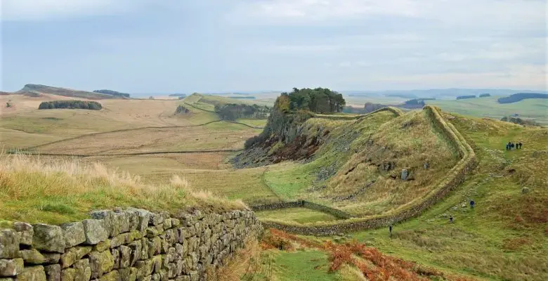
The Hadrian’s Wall Path runs across the entirety of Northern England. From the North Sea to the Irish Sea, you’ll walk through a major city, endlessly rolling farmlands, rugged outcrops and foggy bogs. The trail is 84 miles long and essentially parallels Hadrian’s Wall, a UNESCO World Heritage Site.
History of Hadrian’s Wall
Construction of Hadrian’s Wall kicked off in 122 AD, as its name suggests by orders of Roman Emperor Hadrian. It was effectively the northernmost border of the Roman Empire, running from the River Tyne in modern-day Newcastle to the Solway Firth on the Irish Sea Coast. It separated the Roman province of Britannia from the Picts and other northern Ancient Briton tribes.
First and foremost a defensive structure, Hadrian’s Wall also probably included customs and immigration checkpoints, which would have been among the first of their kind in the world.

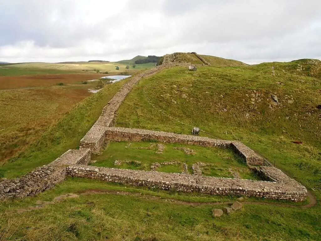
Those checkpoints were at so-called “milecastles”, constructed a Roman mile from one another. In addition to the numerous milecastles, there were also stronger forts about five Roman miles apart.
There are still several remains of Roman forts and towns along the wall, while a significant part of the wall itself has been wonderfully well preserved, too. The Hadrian’s Wall Path follows the wall, sometimes even crossing it, and takes hikers along an important part of Roman history in the U.K.
In fact, with its length of 73 miles, Hadrian’s Wall is the largest Roman archaeological site in the world. It’s a cultural icon in Britain and one of the country’s greatest ancient tourist destinations. Hadrian’s Wall Path is 84 miles long.
“Useful tips to absorb before setting out on a hike of this nature”
The Walking Route – Suggested Itinerary
Those 84 miles make the Hadrian’s Wall Trail a fantastic option for a week-long hike. While strong hikers might be able to complete it in five or even four days, I recommend taking your time and dedicating six days to it. There are plenty of sights to see along the way. You really don’t want to rush this world-class hike.
The typical 6-day Hadrian’s Wall itinerary, which is what I did as well, looks as follows. All six days make for awesome day hikes, some more beautiful than others, but all without question interesting. This is the Hadrian’s Wall walk route planner that I recommend most.
Day 1: Wallsend – Heddon-on-the-Wall (13 miles)
There’s no better place to start the Hadrian’s Wall Path than Segedunum Roman Fort in Wallsend. This is the eastern end of Hadrian’s Wall, home to one of the best-preserved Roman forts along the entire wall.
From there, you’ll walk through the heart of Newcastle-upon-Tyne and its vibrant quays and photogenic bridges. As you leave Newcastle behind, you’ll walk through suburbs, which eventually give way to fields and farmlands.
Day 2: Heddon-on-the-Wall – Chollerford (15 miles)
On day two, you’ll continue walking through farmlands most of the day. While there are few impressive sights along the way, remember that you’re in World Heritage country now. The wall may not be visible, but you’ll still notice its presence if you pay attention.
Walking along the Military Road, you should notice a distinct ditch on the northern side of the trail—it’s called the Vallum. Occasionally, there’ll be a smaller ridge to the south as well. In the middle is where Hadrian’s Wall is located. Look around and you might spot a Roman stone here and there—an indication you’re getting closer to the good stuff.
Day 3: Chollerford – Steel Rigg (12.5 miles)
Just west of Chollerford, you’ll really enter Hadrian’s Wall country and you’ll see it immediately. Just minutes from the town lies Chesters Roman Fort, a major archaeological site in Britain. The landscape, too, will change drastically now as you enter Northumberland National Park, from peaceful farmlands to rugged hills and moors.
At “Wall-mile” 35, you’ll come across one of the classic views on the Hadrian’s Wall Path, a picturesque switchback. The topography starts to pose more challenges now, but the scenery is at its greatest.
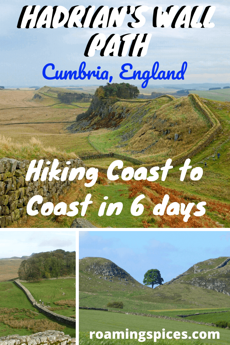
Other highlights before you arrive at Steel Rigg include Housesteads Roman Fort and Sycamore Gap, which was featured in ‘Robin Hood: Prince of Thieves’. The tree in this mini-valley is one of the most photographed in the U.K.
Spend the night at Twice Brewed Inn, a vibrant pub with rooms and my favourite accommodation on the entire trail.
Day 4: Steel Rigg – Walton (14.5 miles)
Epic views continue on day four, when you’ll hit the highest point on Hadrian’s Wall, Windshields Crags, 1131 feet above sea level. You’ll be about halfway at this point, and views extend to southern Scotland and even the endpoint of the trail, Bowness-on-Solway.
Enjoy the rugged scenery—you’ll start to descend rapidly from now on. The last part of the remaining Hadrian’s Wall (when going in a westward direction) is at Hare Hill. A great place to take a break.
Day 5: Walton – Carlisle (12 miles)
Leaving Walton behind, you’ll see the landscape change once again. You’ll clearly be walking toward, and not away from, the sea now. Hadrian’s Wall itself disappears from view, too, but there’s still evidence of its presence in the ditches and occasional stones. This is still World Heritage! The gradient of the trail levels out, the “hardest” part of the hike is over.
Day 6: Carlisle – Bowness-on-Solway (17 miles)
Although it’s the longest day’s hike of the entire Hadrian’s Wall Path, it’s also the easiest. There’s hardly any elevation change on this last day. As you walk from Carlisle to the Irish Sea Coast, you’ll be greeted by sea breezes, views of Scotland and general peacefulness. In my opinion, it’s the perfect place to end a hike like this.
Campsites Along Hadrian’s Wall
Although the number of campsites near Hadrian’s Wall has improved greatly in recent years, many of them are only open seasonally. Additionally, there are still some rather large gaps in between campsite locations, which can make planning a camping/hiking trip on the Hadrian’s Wall Path a bit challenging.
It’s definitely possible, though! You can find an overview of all Hadrian’s Wall campsites on this handy map. Check individual campsite websites for current opening times, facilities, reservations, etc. Note that wild camping is not allowed along the Hadrian’s Wall Path.
While I am a huge fan of camping, I’m not convinced that’s the best way to experience Hadrian’s Wall. I personally preferred staying in B&Bs and pubs every night during my hike. (Your body will thank you for hiking without several extra pounds of camping equipment.) The Hadrian’s Wall Path itinerary I outlined above includes all towns where you’ll find great and authentic accommodation options.
Points of Interest Along the Route
The obvious star of the show is Hadrian’s Wall itself. There are, however, also lots of other attractions on the Hadrian’s Wall Path, many of them Roman archaeological sites. There are glorious landscapes all along the trail as well, especially in the middle section.
- Old Newcastle – historic heart of Newcastle, home to the Norman Keep, Bessie Surtees House and several iconic bridges.
- Segedunum Roman Fort – located in Wallsend, this is the most completely excavated Roman fort on Hadrian’s Wall, including a barrack blocks, stables, the commander’s house and a reconstructed bathhouse.
- Chesters Roman Fort – one of the best-preserved Roman cavalry forts in Britain, this fort near Chollerford exhibits numerous Roman artifacts in the Clayton Museum.
- Roman Vindolanda – one of Britain’s most important archaeological sites, encompassing at least 8 successive Roman forts and famous for the Vindolanda tablets, which describe daily life on the frontier in great detail. Also home to the top-notch Roman Army Museum.
- Birdoswald Roman Fort – situated at the longest intact section of Hadrian’s Wall, this is a superbly preserved fort, which comprises of walls, watchtowers and Hadrian’s Wall’s best-preserved gate.
- Housesteads Roman Fort – boasting a commanding location atop a ridge, Housesteads is another amazing collection of surviving Roman ruins. It offers a fascinating insight into life on the wall, as well as breathtaking views toward the “barbarian lands” to the north.
- Tullie House Museum & Art Gallery – history and art museum dedicated to the Roman occupation of Northern England.
Walking Hadrian’s Wall FAQs
Where Is Hadrian’s Wall?
Hadrian’s Wall runs from Wallsend, near Newcastle-upon-Tyne, to Bowness-on-Solway on the Irish Sea coast. It runs through the fields, farmlands and bogs of Northumberland and Cumbria in Northern England, crossing the entire country from sea to sea at its narrowest point.
What is the Hadrian’s Wall Trail Length?
The Hadrian’s Wall Path parallels Hadrian’s Wall and is 84 miles long.
How Long to Walk Hadrian’s Wall?
Strong hikers may be able to complete this amazing long-distance hike in 4 or 5 days, but that definitely means rushing things. The optimal time for a Hadrian’s Wall trek is 6 days, which allows for beautiful and relaxed day hikes of between 12 and 17 miles a day. This gives you plenty of time to visit all the major Roman sites and museums along the way, as well as explore the vibrant cities of Newcastle and Carlisle.
What Is Hadrian’s Wall Highest Point?
The highest point on Hadrian’s Wall is 1,131 feet (345 meters) above sea level.
What Are Hadrian’s Wall Accommodation Options?
You’ll find plenty of accommodations all along Hadrian’s Wall, from B&Bs to hostels, hotels and campsites. Note, however, that sometimes accommodation is not immediately on the trail and requires hiking a short distance there and back.
It may also be good to know that many accommodation providers, especially those that aren’t close to the trail, offer a pick-up and drop-off service. Check individual websites for more information.
Hiking the Hadrian’s Wall Path is a very popular activity and the accommodations near the trail tend to fill up quickly from late-spring through early-fall. Therefore, make sure to book well in advance. This map provides a superb overview of all hotels, B&Bs, hostels, campsites, pubs, restaurants and points of interest along Hadrian’s Wall.
Where to Start the Hadrian’s Wall Hike?
While you can hike Hadrian’s Wall in both directions, I personally recommend hiking from east to west. This means starting near Newcastle, which is super-accessible, and ending at the peaceful Solway Firth—I couldn’t and can’t imagine a better place to contemplate your hike.
If time is a concern, it might be more convenient to finish your walk in Newcastle, though. That’s where the main airport in the region is. Alternatively, you can take a train down from Carlisle to Liverpool and fly back from there.
How Can I Get to the Trail?
As mentioned above, Newcastle has the only international airport in the region, with flights from and to other British cities and the European mainland. Additionally, both Newcastle and Carlisle are home to major train stations and National Express bus stations, with connections to places all over Britain.
For transportation along the Hadrian’s Wall Path, nothing compares to the seasonal AD122 Hadrian’s Wall County Bus. This super-handy bus route connects Hexham and Haltwhistle and stops at various points along the trail. It operates from Good Friday to the 1st of October—there are buses every hour for most of the day.
For a clear and invaluable overview of all the bus and train routes along Hadrian’s Wall, check this Hadrian’s Wall Country webpage.
What is the Best Time to Hike the Hadrian’s Wall Trail?
The National Trails website recommends hiking the Hadrian’s Wall Path between May and October for two reasons. One, this is the driest time of the year, which makes it both more comfortable to walk and limits erosion of the soil and the archaeology underneath. Two, this is the busy season—this is when accommodations are open and bus services operate.
That being said, however, you might want to avoid doing this hike during the school summer holiday, which is from July through early September. I hiked the Hadrian’s Wall Path in Late-September and while I experienced some of that notorious English rain, there were also some beautifully clear days with sensational views. Additionally, there were only a few other hikers on the trail and I had plenty of accommodation choices.
Therefore, I suggest planning your Hadrian’s Wall hike sometime in September. June, on the other end of summer, would be a fine alternative as well.
How Difficult is Hiking Hadrian’s Wall Trail?
Even though it’s six days of hiking across Northern England and its wind-swept ridges, desolate moors and remote farmlands, Hadrian’s Wall Path is actually not all that difficult. Anyone with a reasonable fitness level should be able to complete it without any problems.
That’s not to say it’s a walk in the park, though. Especially the middle section—days 3 and 4—comes with lots of switchbacks, rugged landscapes, and short but steep climbs and descents. In terms of trail surface, with the exception of the asphalted stretch through Newcastle, it’s mostly grass and gravel.
If you dedicate six days to this hike, you won’t hike more than 17 miles a day (and that’s the last, easiest and “flattest” day). On average, you should expect to actually walk about five to six hours each day on this long-distance trail.
What is the Signage like on Hadrian’s Wall Path Like?
This is a designated National Trail and, as such, signage is superb. At regular distances and at every intersection or crossroads, you will see the iconic acorn symbol. You’ll see this on signposts, gates and stiles. Other, more detailed, signposts might include the next destination(s) and distance(s) as well.
Am I Allowed to Take My Dog?
Although you are legally allowed to bring dogs on public rights-of-way lands in Britain, the Hadrian’s Wall Path is not a particularly dog-friendly trail. There are many stiles on the way, which may require you to lift your dog over.
What is the Best Part of the Trek?
The beauty of the Hadrian’s Wall Path lies in its variety. You’ll hike from city to town to village across some of England’s most picturesque rural landscapes and along one of its greatest archaeological treasures. It’s difficult to pick the “best part”.
Newcastle has its old architecture and iconic bridges, while the Solway Firth is gloriously quiet (except for the wind, maybe). All in all, if I had to pick my favourite section, I’d have to say the middle stretch.
Between Chollerford and Brampton where lies the most intact section of Hadrian’s Wall, as well as the most spectacular natural scenery. This is, however, also the most strenuous part of the trail—but the rewards are highest, too!
Want to Find Out What Others Think of the Hadrian’s Wall Trek?
Discover what your fellow hikers are saying about the trail before you set off. Check out the TripAdvisor page to get a really good sense of people’s experiences.
Like Our Article? Please Pin it!


Leave a Reply