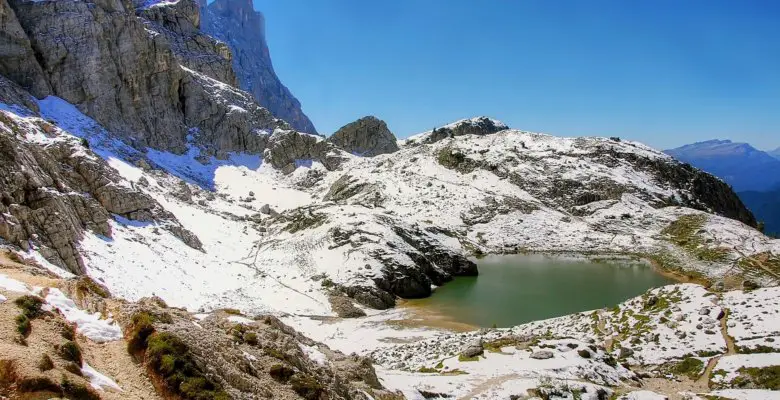
Dolomites, Italy
Discover how and why I hiked the 75 mile Alta Via #1 trail, in the Italian Dolomites, in just 4.5 days. Here’s my story…
Completing the Alta Via #1 in 4.5 Days : My Fast Pace Solo Trek in the Dolomites
Introduction – Alta Via #1
I am a 43 year old dad. I work a lot. I spend a lot of time with my family and friends. My 7 year old daughter is my life. I am Mr. Ordinary. In other words, I’m boring. I like the outdoors. I always have. I run to keep from going insane. I like to hike and ski because I have an affinity for mountains.
I’m at a point in my life where I don’t have a lot of time to do anything. Other than a yearly ski trip to the Western part of the US or British Columbia with a couple of friends, I don’t do much in the way of excitement.
In late 2018 I started to feel the urge to do something a little crazy. I felt this overwhelming desire to challenge myself. Really challenge myself. The kind of challenge that deep down in my gut I wasn’t sure I was up for. The kind of challenge that is more fantasy than reality. The idea of pushing myself physically and mentally to my limits was incredibly appealing to me. I wanted to feel ALIVE.
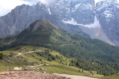
In 2016 my wife and I completed half of the Alta Via #1 trek in Italy. The Alta Via #1 is a 75 mile trekking route in the Eastern Dolomite Region of Italy. The route runs north to south starting in Pragster Wildsee and ending near Belluno. It typically takes hikers 10-15 days to complete the trek. Since that 2016 trip, I haven’t been able to shake the urge to go back.
The Dolomites had a lasting effect on me. It is truly a special place. The mountains, the people, the Rifugio’s (AKA Mountain Huts), the food, the challenging terrain, the beauty. It is the most beautiful place on Earth. I had to go back. I needed to finish the Alta Via #1. As I mentioned before, time was not my friend. I couldn’t get away for more than 5-6 days, nor did I want to.
I would miss my family and they would miss me. It was already incredibly selfish of me to even contemplate this trip, but I my obsession to complete the Alta Via #1 blinded me from reason. It prevented me from being the rational person I thought I was. I had to complete it. Not only that, but I wanted to do it solo and I wanted to do it fast. Really fast.
With no guide, I decided to attempt it in 4.5 days!
Throughout the process of planning and executing on this trip, I would constantly be asked “why?” Why do it in 4.5 days? Why not take your time and enjoy it. Why not just do a section of it? It’s a question that I deliberated on for some time. It’s hard to articulate. Hell, it’s hard to make sense of in my own head. Lack of time to get away is a big part of it.
The desire to test myself physically and mentally was also a big part of it. Perhaps the simplest explanation is a midlife crisis. That seems to make sense, but that too is only part of it. My health probably has more to do with it than some failure to come to terms with getting old. Because of some arthritic health issues I have had since my early 20’s, I constantly feel the need to prove to myself that I can endure some sort of physical challenge. I need constant validation that I am “ok.”
Ultimately, fear is my motivator. Fear that one day I won’t be able to run in a road race, ski my favorite mountain or hike my favorite trail. Fear that one day I will look back on what I have done and feel regret for not doing more. As I said, when people ask me “why,” it’s not such a simple answer.
I draw my inspiration from movies and books like “Into Thin Air,” “Into the Wild,” and “The Way.” Paul Theroux is my avorite writer. His solo adventures intrigue me. The idea of taking on a challenge solo and seeing what happens has always been appealing to me. It’s also incredibly frightening. When planning this trip, I started to realize what I was getting myself into.
Take the Rifugios for example. Rifugios are mountain huts. They are the lifeblood of Dolomite hiking. They can be found nestled high up on the highest of mountain peaks, buried deep in the low mountain valleys and everywhere in between. They are not like the mountain huts we have in the United States. The Dolomite huts have more of a Bed and Breakfast type feel.
They are typically family owned and operated and provide delicious and authentic home cooked meals. When trekking during the busy season, you have to book your Rifugios well in advance or risk not getting your choice. For planning my trek, choosing the correct Rifugios to stay at was critical to my success. Once booked, I was pretty much locked into that hut.
Sure, there was always the chance you could find a bed while on the Alta Via #1, but it’s not easy and could require you to go off course to find one. Given my itinerary, this was simply not an option. Once I set off to make it to my destination hut, I needed to make sure I made it there or I risked not having a place to sleep. It was a realization that had to accept before embarking on this challenge.
“The Do’s and Don’ts of Hiking the Alta Via 1”
Coming to terms with that was step 1 in a multi-step process for planning this adventure. I carefully planned out where I would stay. I knew the margin for error was small. I had a bail out strategy just in case. I thought I had everything meticulous planned and accounted for. I was so very wrong.
This adventure would prove to test the limits of my very self. I would experience the full array of the emotional spectrum. I would laugh. I would cry. I would bring my body to the point of physical ruin. I would test my mental toughness in a way I didn’t think was possible.
During my trek, I could never get enough water, enough food, enough sleep. I would lose 15 pounds and not even realize it. I would be in a constant race with the rise and setting of the sun. I would curse time itself. I would experience bitter defeats.
Some that at the time seemed so grand, but in retrospect were petty, stupid and sad. I would experience triumphs. I am thankful for those, because without them I would have quit. I would be inspired by the undefinable. I would face off in a battle against a herd of 50 cows… and lose.
I would be led astray by well-meaning individuals. The mountains themselves would mock and ridicule me. I would stare into space and ask myself the very question everyone was asking; “why?” I would live moment to moment and in those individual moments, I would learn things about myself I didn’t know. I would learn things about myself that made me proud to be me. I would be humbled, then humbled again.
Those lessons and those experiences, I will carry with me for the rest of my life. For 4 and 1/2 days I would take a step out of reality and into a realm of quiet chaos. It changed me. I’m not sure how or why, but I know that it did.
Here’s my story…
Alta Via #1 (Day 1): Lago Di Braies to Rifugio Sennes Hutte
I flew into Venice Marco Polo airport on a red eye on a Saturday in early September, arriving at 10:30 AM. I had a car waiting to drive me the 3 hours to the start of the hike at Lago di Braies in Pragster Wildsee. The entire drive was a downpour. The pounding rain combined with the up and downs of the mountain roads and the hairpin turns rendered me car sick.
The temperature was hovering in the mid 40’s Fahrenheit. My goal was to start my hike by 2PM knowing that I had about a 4 hour hike to my first hut. Having slept just 2 hours on the redeye flight, I struggled to make sense of the situation. My mental state seemed to match the weather. As I got closer to my destination, the rain seemed to intensify. What the hell was I getting myself into? This was a big mistake.
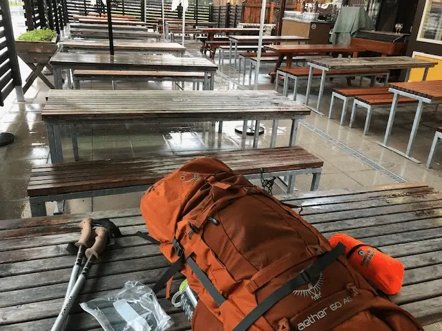
I arrived around 2:30 PM. I was already behind schedule. There was not a sole about. No one hikes in the rain here. Not many people hike at all after 2 PM. I put my pack down on a picnic table. It was one of many in an outdoor tented area. I was the only person outside. There was a small café adjacent to the outside table area.
I could make out a few people inside sipping on their espresso. I can only imagine what they thought of me as I organized my pack and put on my rain gear. The trail starts from the beautiful Lago D Braies. A hotel sits on the southern shore. I saw a couple walking towards the lake shore. They were not in hiking gear. They were clearly staying at the hotel. They shared a large umbrella as they stared out over the beautiful lake.
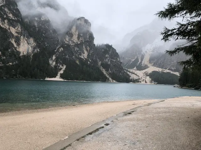
The trailhead of the Alta Via #1 sits on the Southern end of the lake. It was about a mile hike along the Western shore to get there. When I walked by the couple on route to the Alta Via #1 trailhead we made eye contact. What was the look they gave me? Surprise? Curiosity?
No, It was pity. It was going to be a long afternoon. When I got to the trailhead I stopped and looked around. I couldn’t believe I was here. I was actually going to do this. I turned and took the first step of my adventure.
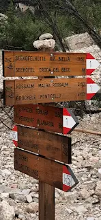
The trail from the Lago di Braies gains altitude and it gains it quickly. After about 20 minutes I settled into a comfortable, if not a little too fast, hiking speed. My training leading up to this point kicked in, and I continued to trek up and up. Occasionally, I would look back at the lake to track my progress.
The lake appeared smaller and smaller as I gained altitude and soon I left the lake completely behind. About an hour in, I noticed a change in the weather. Not rain anymore, Sleet? I never accounted for this. The trail became icy. My focus narrowed. I continued up and up.
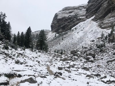
At about the 2 mile mark you reach a plateau that seems to invite you further into the mountains. At this point the sleet had turned completely to snow. I set off into a new landscape, whitewashed and unforgiving. The ground was covered in white as far as see. There was no one hiking. Not a sole. I could see the faint outline line of the trail weave through some rocks and up to a ridge. I trudged onward.
My boots were already completely soaked through. At the time I saw this as a real problem, but I knew that I only had about 1.5 miles left to reach the next hut. I took solace in that. The hiking became more challenging as the trail became slushy. Visibility diminished. When I planned this trek, I had read about how great September was to trek in the Dolomites.
“Discover the vast and varied benefits of hiking”
Sunny they said. Not as much rain they said. I never foresaw this. I never foresaw snow. I guess I should have. It certainly makes sense. Soon I reached a section that switched back and forth its way up a steep rock face. It had guided cables bolted into the rock to aid the hiker. I was glad to have these cables given the conditions.
As reached the top of this section, the sky seemed to open up and the sun tried to pry its way through the clouds. The effect on the scenery was stunning. The brief warmth gave me a jolt of energy. It was short lived. After 5 minutes the sun was gone, replaced by thick clouds. I didn’t let it bother me because I knew I was close to the Rifugio Biella.
I just had to reach the pass. 15 minutes later I arrived the Sora Forno Pass. I don’t know if it was adrenaline or excitement, but I had just climbed roughly 3200 FT in elevation in 2 and 1/2 hours. I was way ahead of schedule. 3200 Ft is not a huge elevation gain by Dolomites standards, but you hit it all at once, which makes it seem like it’s harder.
For comparison sake, Mount Washington (the highest mountain in New England) has an elevation gain of 4200 feet. It takes the average person 4-5 hours to summit Mt Washington. The trek to the Sora Forno Pass took me about 2hr 15 min in the rain and snow.
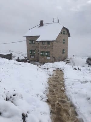
Once you reach the pass, Rif Biella sits off to the South at the bottom of a steep slope. The hike down to the hut was slippery, so I navigated slowly. When I reached the gravel road I felt a waive of relief, but I wasn’t done yet. I still had a 30-40 minute hike to Rifugio Sennes Hutte, but that hike was relatively flat and not particularly challenging.
Rif Biella was a ghost town. I didn’t see a single person. I suppose it’s not a big surprise given the weather. The last time I was here there were people all around the hut enjoying the view, eating food at the outside tables and relaxing?
The scene I was staring at was quite different, another odd contrast. I trekked on, alone. I fell into a quiet solitude and soon I was lost in my own thoughts. Was I really here? Am I really doing this? 30 minutes later the hike brings you over a rise where you get your first peak at Rif Sennes. I was jolted from my isolation. I was here. My destination. I made it.
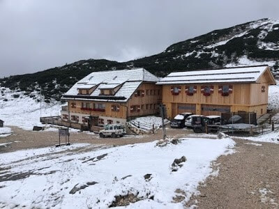
As I approached Rif Sennes, I finally felt like my adventure had started. It was a relief. I couldn’t wait to eat something and then go to sleep. I arrived at the hut around 6:15PM. It was not busy. I imagine a lot of people cancelled their trip here due to the weather. They have a designated dry room with boot heaters. Now that’s luxury! I shed my wet gear and hung it up. I placed my boots on the heat blowers.
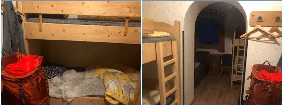
I brought my pack to my room and changed into warm, dry, comfortable clothes. Then I went to dinner. As I sat at the table, the reality of the trip set in. It was a good feeling. There were 3 Germans sitting at my table. They were just about done with their first course. They were in their 20’s. I usually would strike up conversation, but I was too tired, too jet lagged and too worn out to bother.
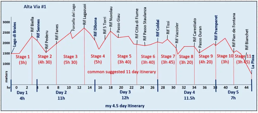
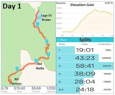
I had minestrone soup and pasta with meat sauce. I decided to skip dessert and go to bed. My half day hike was supposed to take me 4 hours. It took me 3 hours and 15 minutes. I gained about 3200 FT in elevation and walked 6 miles. So far, so good. Day 1 was complete. Tomorrow is a new day.
Alta Via #1 (Day 2): Rifugio Sennes Hutte to Rifugio Dibona
Despite my level of exhaustion, I didn’t sleep more than 4 hours. That wouldn’t have been so bad if I had slept more than the 2 hours on the redeye the night before. There wasn’t much I could do about it now. I wish I could blame it on my roommates, but I couldn’t. I shared a 10 person room with two people.
They came to bed around 10PM and didn’t make much noise. The room was segmented into two sections and I had a whole side to myself. This is a rare occurrence. These huts, especially during the peak hiking season, are booked solid.
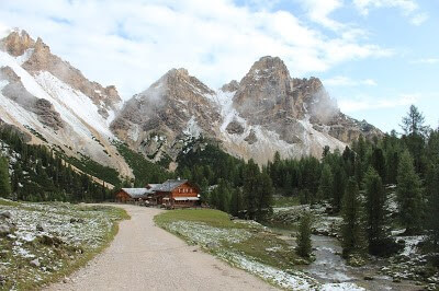
On my previous trip to the Dolomites I had had the luxury of staying in private rooms. For that, you need two people and you need to book a long time in advance. Tonight, the snow was responsible for the lack of people. The rest of the nights on my trek the rooms would be filled to capacity.
I was up at 6AM. I was the first person up in the hut. I was even up before the owners. Breakfast was typically served around 7 or 7:30AM. I tried to be quiet as I collected my pack and gear and headed downstairs to the dry room. There was a bathroom next to the dry room so I changed in there.
The hut was silent, dark. I was still fighting off the sting of jet lag. Disoriented, I labored into my clothes and organized my pack. I seemed to be moving in slow motion. I was disappointed to find that my boots were still wet. Soaked would be a more accurate description. I guess the boot dryers were not as powerful as I had hoped. Either that or my shoes were far more wet then I realized.
I had thought they were waterproof. I guess not. The morning was clear, but cool in the high 40’s. I had the foresight to bring toe warmers. It was left over ski gear from the winter. I found myself utilizing a lot of ski and running gear. It’s the same concept. Lightweight, quick dry, layers. I brought a package of Nuun electrolyte tablets.
In retrospect I believe these played an important role for me on this trip. They also contained caffeine. I would drink one every morning and if I felt like I needed a replenishment, I would take one after lunch. Along with the Nuun I brought two packages of energy gels, which I typically used when I ran in longer road races.
They would also play and important role by providing me with some impromptu carbohydrates when I needed them most. I usually used them toward the end of the day when my gas tank was low. From a psychological standpoint, they were extremely helpful to have.
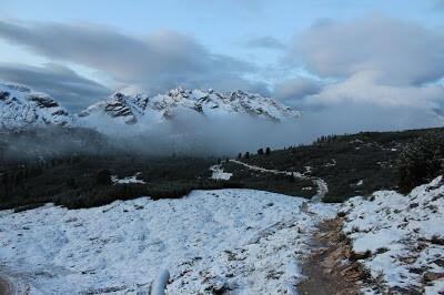
With my pack situated, I exited the hut and entered into the Dolomite dawn. Standing outside the hut, completely alone, I felt a level of peacefulness I came to look forward to. This was the start of a theme on my trek. Dawn was my favorite part of the day. The fresh air, the solidarity. It was so peaceful.
A quiet beauty. Every morning I would rise with the sun. It was spiritual. Perhaps this is the feeling of mindfulness people that meditate often talk about. It was surreal. My senses attuned, I was eager to start my day. So I did. I took a step, then two. It would be a day of many steps, but it would be my easiest full day of my trip.
I didn’t know this at the time, but in retrospect, it scares me to think about. I started the morning wearing a fleece vest, a hat and gloves. The first part of my hike was a two hour trek to Rifugio Pederu. I walked down the gravel road not even bothering to look back at Rifugio Sennes. I had to set my mind to the future.
To the next hut. The snow from the night before seemed to have dissipated from the gravel road. A thin layer of icy slush was still present on the grass and rocks. The first mile was an easy stroll through the highlands. It gave me a chance to set my mind and fall into a rhythm. I had brought about 10 balance bars with me for the trek.
They would be my breakfast most mornings and I had one for breakfast as I walked down the path. The only sounds were my feet and my trekking poles hitting the ground. It was a comforting sound. A sign of progress. One step closer to my goal.
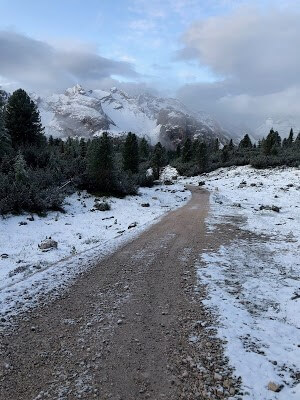
I focused on my breathing and soon that was all I could hear. Focused and determined, I let my mind wander as I walked. Today would be my first real test. I would be gaining a lot of altitude. There were also some significant descents, which should not be taken lightly. The hike to Rif Pederu was the latter.
I soon reached an old army road that switched back and forth beneath a large rock wall. It was steep with loose rocks. The kind of steep that you have to use energy and strength to slow yourself down. The kind of loose rocks that you can sprain an ankle on. I slipped a few times trying to keep my balance.
I tended to take the downhill sections a bit too fast. Part of it was my skiing instincts kicking in, but I could make a solid argument that going faster on the descents actually saves energy. I’m not sure I would win that argument, but there’s something to be said about letting yourself go vs. straining yourself to slow down. This downhill section lasts a little over a mile.
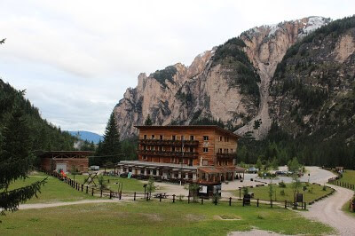
It took me an hour to reach Rif Pederu. I was an hour ahead of schedule. At this lower altitude, there was no snow. Instead, I found the color green encircling the hut. I took a moment here to shed some layers and drink some water. I knew the next section would be my first altitude gain of the day.
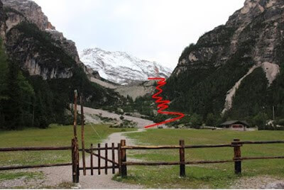
From the hut you can see the path you will take. The path splits the “Iron Fork” Mountains to the West and the Lavinore Mountains to the East. The trail snakes its way through a rocky shrub landscape before reaching an exposed ridge. It was about 7:45 AM. I still haven’t seen a single hiker so far on the trek.
I headed through the gate and started my climb. I set a very face pace. This was not intentional. In fact, this was a very bad strategy. Just like starting a road race too fast, I ran the risk of running out of gas at the end of the trek. A much smarter idea would be to set a slower pace and save energy for later. For whatever reason, that didn’t happen and I tackled this section with reckless abandon.
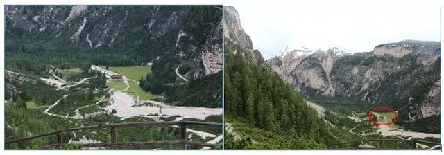
I wasn’t long before Rifugio Pederu looked like a postage stamp. I reached the highest point of the ridge, said goodbye to Rif Pederu and headed deeper into the mountains. Next stop Rifugio Fanes. I remember from my previous hike that the Fanes Hut was one of my favorites. What I didn’t remember was how much altitude gain it would take to get there.
The terrain was different here. A weaving narrow path through knee high shrubs and rocks. Every time I thought I was getting close to the hut the trail would slant upwards. It was subtle, but unmistakable. The last 30 minutes dragged for me.
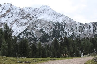
Eventually I reached a road and I knew I was close. A single cow welcomed me, the bell around its neck playing the familiar sound I remember so vividly from my previous time in the Dolomites. There were far fewer cows this time. Many had already moved on to lower altitudes, to greener pastures. This one was still holding strong. It was a welcome sight.
I saw Rif Fanes as a milestone for my hike. A key destination. From there I knew the hike would get difficult. In many ways I saw it as the starting point for my trek. Another mile and I reached the hut. It only took me 1 HR and 40 minutes to get there from Rif Pederu.
It seemed longer. It was supposed to take 2 HR, so once again I was ahead of schedule. At this point I was optimistic that I could continue to make good time on this trek. I was optimistic that perhaps the hike wasn’t going to be as hard as I originally thought it would be. I could not have been more wrong.
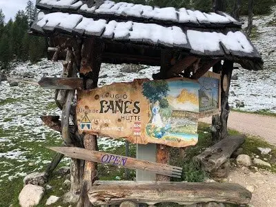
Arriving at Rifugio Fanes was a little like arriving into a fairytale. It had a particular air of charm. I think it’s important to note that at about this spot, I saw the first hiker on my trip. It was just shy of 10AM on day 2 and I finally started seeing hikers.
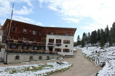
I stopped at Rif Fanes to restock on food and water. When I arrived, the staff was cleaning the hut. I was simply on a different schedule than anyone else in the Dolomites. They were very nice though. They made me a sandwich to go, I refilled my water and bought a chocolate wafer. That’s all the huts sold for snacks. Chocolate bars. They were not like chocolate bars in the US. They were lighter and not as sweet.
They were the go to Dolomite hiking snack. They marketed them like the US markets energy bars. There were a variety of flavors. I got the white chocolate almond bar. I took 5 minutes to gather myself and then I was off. From the Fanes Hut you take a steep staircase like trail South East of the hut. After about 15 minutes I reached the Limo Pass.
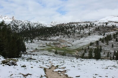
Looking back from the top of the pass the valley spreads out before you. I had a nice camera with me. I wore it on a strap around my neck. It would prove to be a nuisance while hiking, but I thought it was important to be able to capture what my eyes were seeing. Of course, it never did. I took a lot of pictures with my iPhone too, but that’s because it was quick and easy.
For the scenes I really wanted to capture, I would go through the process of taking out my camera and snapping off a few shots. This was one of those times. In truth, I would take out my camera often. Like I said, the camera never did justice to what my eyes saw, but I tried. I secured the camera away and headed onward.
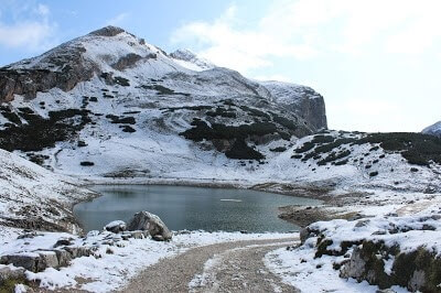
The next two miles I will refer to as the “calm before the storm.” It was a long relatively flat path through cow pastures with stunning mountain backdrops. A small lake appears left of the trail. I am back at an altitude where snow permeates the ground. I take this opportunity to eat my lunch, a ham and cheese sandwich on a large crusty roll.
This would be a recurring practice of mine on this trek. I never stopped hiking for more than 10 minutes. Time was too precious. Better to each lunch during some of the flat sections of the hike. As I made my way down the trail I started to see a few more hikers about. This was oddly comforting.
I didn’t feel as isolated as I had on Day 1 and the first few hours of day 2. I knew I only had about 2 miles of easy hiking on this flat expanse before the day changed drastically. I relaxed, took in the scenery and prepared myself for the next stage.
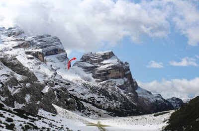
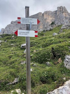
It wasn’t long before my next challenge presented itself on the horizon. Perhaps there was no more memorable part of the Alta Via #1 from 3 years ago; the Forcello del Lago. The Lago Pass loomed over the landscape as if daring people to climb to it. The “V” shape, a gateway, an invitation, a challenge. For those not willing to take on the Pass you can continue straight and by-pass it.
It will add considerable time to your trek as you have to go around the mountains instead of through. You will also miss out on one of the most challenging and rewarding sections of the Alta Via #1. I came to an intersection and stopped briefly to chat with a young couple that seemed to be contemplating whether or not they should take on this challenge. They sounded French, but I didn’t ask.
They told me that 20 people or so had started the hike in the last 20 minutes. They were also trying to complete the Alta Via #1. They seemed timid, unsure. I explained that the hike up was challenging, but they could do it at a slow pace with no problem. They were worried about the backside. The hike down from the other side.
It was a treacherous set of very steep switchbacks that zig-zagged its way down the backside of the mountain. I told them that much of it was reinforced by a man made trail and I didn’t think it was too bad. The real wild card was the snow.
Even I was a little worried about that. If there was this much snow down here, what will it be like up there? And what about ice? Snow was one thing, but ice, that was a whole other issue. I said farewell to the couple, took the trail to the left and started the long trek up to the pass.
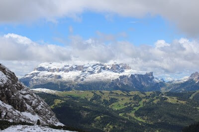
Altitude is gained quickly and from half way up you are treated to an incredible view of the surrounding landscape. The contrast of the green lowlands with the snow filled alpine was captivating. I took a minute and continued my trek up.
I remember this section being difficult, but it was more difficult than I remembered. I must have passed 15 people on the way up. I managed to catch the hikers that had probably started their treks around 9AM and planned on finishing at Rif Lagazuoi. They would probably get there around 3 or 4PM.
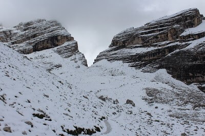
Everyone I passed was friendly. Everyone eagerly awaiting the satisfaction of reaching the pass. I briefly spoke with a couple hikers coming down. They were going the opposite way. I asked about the conditions on the other side. They told me there was about 10 centimeters of snow and that the footing was fine. That was promising.
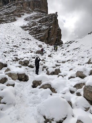
The top section of the trek up was a winter wonderland. A few inches of snow lay on top of the large boulders that seemed to litter the top section of this hike. Eager to get to the pass, I trekked on. The hike up to the pass from the road took me about 2 hours. It was an exhausting 2 hours. The Lago Pass sits at an altitude of 8441 FT. The total climb to the Pass is roughly 1500 feet in elevation. Add in the snow and you turn a challenging hike into a difficult one.
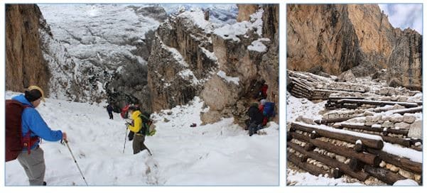
There were a lot of people at the top, some eating lunch, some taking pictures. Most taking a break after the hike up. Everyone was dreading the hike down. Lagazuoi Lake sits at the bottom of the trail. It’s quite beautiful. It’s shiny surface the end zone at the end of a long drive. The finish line at the end of a long race.
A destination. A target. The lake can represent any of these things, but to me it was just a bad reminder. A reminder that once you reach it at 7152 FT, you then have to hike up to Rif Lagazuoi, the highest elevation point of the Alta Via #1 at 9029 FT. A daunting thought and one that put my mood on edge.
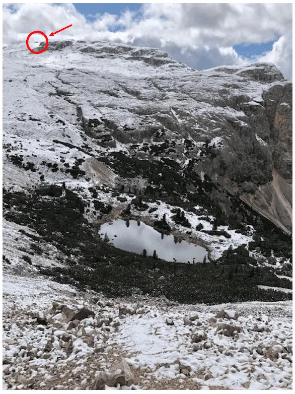
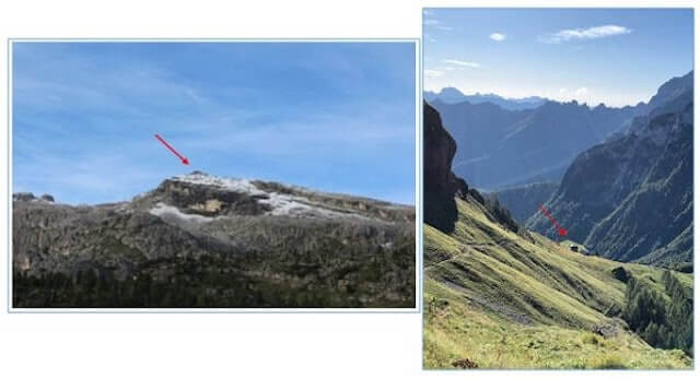
In the picture above, you can actually see the hut at the top of the mountain. I tiny speck on the distant horizon. Standing at the top of the pass, I tried not to think about the idea of a treacherous hike down, only to go back up to a higher point than where I stood at that very moment. Not only that, but my destination was Rifugio Dibona, which was another 2 hours past Rif Lagazuoi on a hillside in the valley.
Up, down, up, down, up, down. I shook off the thought and started my trek down the backside in what would be the worst hiking conditions on the trip. The snow the hikers I met on my way up the pass spoke of was no longer snow. It was slick slush and ice.
I quickly reached a traffic jam of mostly middle-aged and retiree hikers that had signed up for more than they bargained for. You know things are bad when people resort to sliding down a trail on their butts. I probably passed 25 people on my way down. Some, I would imagine, would be working their way down for a very long time.
Trekking poles were key for this type of challenge and many didn’t have them. I passed a husband and wife yelling at each other. I don’t think I have ever seen that out here before. The husband kept telling his wife to not worry because even if she fell, she wouldn’t die. Apparently, she didn’t find that helpful because she started screaming at him. I passed two Israeli men in their late 20’s.
Clearly, they didn’t have much experience with snow. I, on the other hand, have done a lot of hiking in this type of terrain, often with my ski boots on. That’s not to say it wasn’t tough. It was very challenging. I had to use a lot of energy concentrating on each step, each foot hold. I was happy when I reached the lake. Unfortunately, this moment on the trip would mark the start of my first real struggle.
I had already struggled with the concept of hiking down to the lake, only to hike all the way to the highest point of the Alta Via #1. Well, my mental state had suffered as a result. I became sluggish. My mind struggled with the challenge.
My pace slowed. The trail snakes its way up and up as far as the eye can see. I found myself stopping every 10 minutes or so, which is very unlike me. I would only stop for a minute or two, but I just couldn’t get into a rhythm.
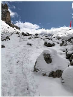
About a 1/4 of the way up the same two Israelis I had passed on the way down to Lagazuoi Lake were about to pass me on the way up to Rif Lagazuoi. They stopped to chat. This seemed to brighten my mood. We chatted for a few minutes.
They asked me about the Rocky Mountains. I asked them about where Israelis typically hike. They enjoyed hiking in Europe. They didn’t have a hut booked for the night, which was not the best plan I had ever heard of, but they didn’t seem to mind.
They were going to hike up to Rif Lagazuoi and take the tram down the backside of the mountain. From there they would stay somewhere in the valley on the road. For the next hour or so, I would pass them for a while, then they would pass me. At one point they asked me to take a picture of them. Normally, I wouldn’t find this noteworthy, but they proceeded to take their shirts off… odd.
They then asked me to photo them while they covered themselves in snow. Like I said, they weren’t used to snow. While it was definitely strange, there was something charming about the scene. The sun was shining. They were loving life. They were loving this experience. Even though I was in a bit of a rut, I could appreciate that. I smiled. I pressed on. I would never see them again.
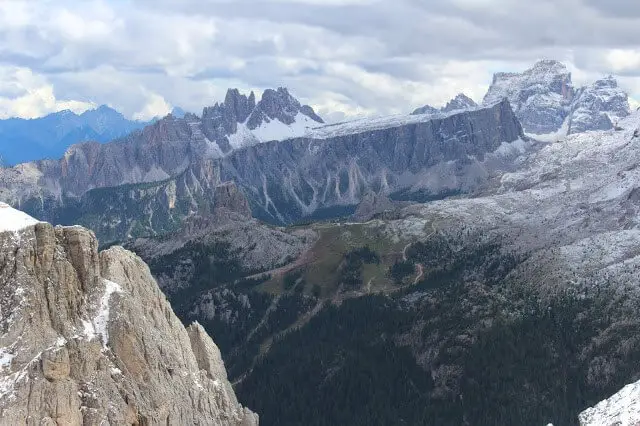
I don’t know how long it took me to get to the Lagazuoi Pass, but when I did, I felt a wave of relief. It was a good feeling, but my hike for the day was not over. Not even close. The visibility from the Pass was amazing, so I took a minute to take some pictures of the surrounding area. From where I was, it was another 20 minutes to get up to Rif Lagazuoi.
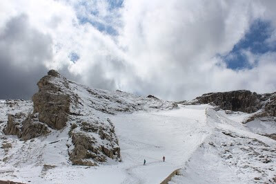
There was a switchback trail that rain adjacent to some very interesting and historical wartime tunnels. There were man made tunnels running all through the Dolomite Region. Remnants from the war. You could actually tour these tunnels.
If you aren’t staying at Rif Lagazuoi, then there is no reason to hike up to it. Some people do it to take pictures or take the tram down, but since I have been there before I didn’t bother. If you were to stay at Rif Lagazuoi, the next day you would have to back track down that same switchback trail to where I was now to further your progress on the Alta Via #1.
My next hut, Rifugio Dibona was a solid two-hour hike from where I was. It would be a significant descent to get there, so I decided to get started. I also know by looking at a map that I had a relatively long traverse to get there.
The last time I did the Alta Via #1 I took a trail around the backside of Rif Lagazuoi, which hugged the mountain and came out on the street. After crossing the street the trail would take you up to Rifugio Averau. This time, I would be going the opposite direction to get to Rif Dibona. Both trails are considered the Alta Via #1, it simply depends on what hut you are staying at that dictates which way you go.
Both routes will reconnect at Rif Averau, but for me that would be tomorrow. You will find a few instances on the Alta Via #1 where you can take an alternate routes. For me, this alternate route provided me with a new experience. The fact that the next 2 hours would be unchartered territory for me gave me a much needed push.
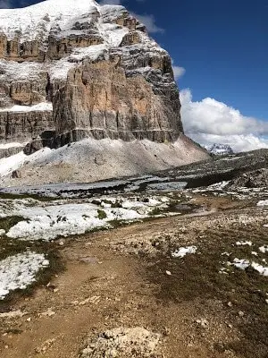
I pressed on, heading across a ridge and then down to greener pastures, rocky meadows and for the first time on my trek, mud. The snow melt from the higher altitudes had resulted in a wet muddy trail. I tried to navigate carefully.
The trail was slippery. I was beat. For the next hour I slowly made my way down to the valley. The further I descended, the greener the landscape. I reached a point at which the trail seemed to level out. I took this as a sign that the hut was close.
I was wrong. It wasn’t. The trail kept going and going. Road to trail. Trail to road. Road to woods. Wood to trail. The long traverse seemed to go on and on. My patience worn thin, I started to wonder if I had taken a wrong turn.
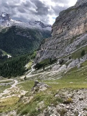
When this happens, especially late in the day, the tendency to make mistakes becomes a real concern. I over compensated for this by constantly referring to my map. Prior to the hike I had organized all my maps, highlighted all my routes using a sharpie, and put them into neatly organized waterproof covers.
The process of taking out the maps, unfolding them, staring at them while trying make sense of it, got very old very quick. When patience deteriorates, you start to second guess yourself. When you start to second guess yourself, you overthink it. I was way over thinking it.
I couldn’t for the life of me figure out why I wasn’t there yet. The reality was that I still had a long way to go. The whole process slowed my pace significantly. It wasn’t long before I saw a sign for Rif Dibona. I could see Cinque Terre (5 Towers) on the distant horizon. I knew that I would pass right by Cinque Terre tomorrow.
I knew it was on the other side of the road. A road that I knew I had to cross the next day. I also knew that Rif Dibona was on this side of the road. I just didn’t know where. I felt comfortable knowing that if worst came to worst, I could find the road and I would be fine.
The reality was that I never should have had any of these thoughts. The reality was that I was tired. I was impatient. Eventually I came to the realization that the only thing I could do was to keep going, so that is what I did. On and on I went. I saw another sign for Rif Dibona. I got excited. 10 Rif Dibona signs later, I was not. Up to the point of Rif Lagazuoi, I was ahead of schedule. Now, I felt like I was falling behind.
The long traverse brought me to a heavily wooded area. Another place on the Alta Via #1 that seemed enchanted. Mossy green covered rocks and green vines entwined with wild flowers. I hated it. I exited the wooded area and traversed across a rock fall. Wide open.
I could still see the 5 Towers on the horizon, which gave me a little comfort. Not comfort actually, more like sanity. Soon I came to narrow road that seemed to go uphill. I wanted to sit down and never get up. I couldn’t understand why this section was taking me so long. I tackled the hill one step at a time.
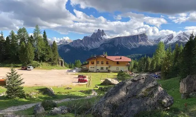
When I crested the hill, the landscape opened up and there, sitting on plateau, was Rif Dibona. I felt the weight of a thousand emotions roll off of me. I made it. Day 2 was over. It took me 1 hour longer than it should have to reach the hut from Rif Lagazuoi (3 hours instead of 2) but the reality was that I had still made great time for the day.
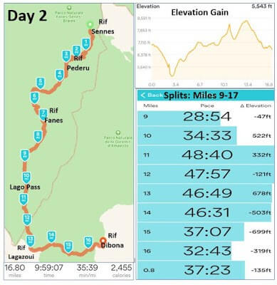
I arrived at the hut around 5PM. Today, I had hiked roughly 17 miles and gained 5600 FT in elevation. The day 2 trek took me 10 hours. It was the hardest and longest day of hiking I have ever completed. It would be the easiest and shortest full day hike of my trip.
I wanted to hate Rif Dibona. I was somehow irrationally angry at the hut because it took me so long to get to it. The truth was that Rif Dibona was impossible to hate. It was the epitome of charm. In retrospect getting to the hut by 5PM was a luxury. It gave me time to relax, attend to my pack, organize my belongings and sit down. I even took some time to make notes about the past two days.
I checked in, changed and headed down to the common room. I ordered a beer, the one and only beer I drank on the trip. The beer in Italy (at least in the Dolomites) is typically warm. I hate warm beer. From here on out I switched to red wine. Just a glass at dinner. I met an American named Mark from California.
He was in his mid 60’s and he was hiking the Alta Via #1 with his son and daughter. We talked about our itinerary and his experience. We talked about skiing and golf. I sat with him and his kids at dinner. They did not understand why I was doing what I was doing.
They were doing the same trek, but in 15 days. I was doing it in 4.5. We had totally different goals and a totally different mindset. His whole family was gluten free. I would have guessed that ordering food in the huts would be challenging for them, but all the huts had gluten free options. Go figure.
I had delicious spinach raviolis for my first course, pork chop with spinach for my second course and lemon cake for desert. After dinner I went to bed. I slept on a top bunk for the first time on the trip. I shared a room with 8 others. I put my headphones on and attempted to go to sleep.
Alta Via 1 (Day 3): Rifugio Dibona to Rifugio Coldai
It is a struggle to write about my experience on day 3. It was a day filled with visceral memories. A day I will never forget. On day 3 I would ignite emotions long dormant and experience feelings born anew. I would redefine my interpretation of the word struggle and I would savor my only true taste of fear on this trek.
The day started poorly, once again I didn’t sleep well. I probably slept 4 hours, maybe 5. It was not ideal. I was in a room of 8 and on the top bunk. I haven’t slept on a top bunk since I was 7. I was still the first person to awake in the hut. Using my cell phone flashlight to guide me, I carried my pack down the stairs.
There was a bathroom near the exit of the hut. I organized myself, changed and headed outside. Dawn. I felt the same calming quiet I did the day before. It enveloped me. It relaxed me. It rejuvenated me. I drank some water laced with Nuun, opened a balance bar, and I headed down the road.
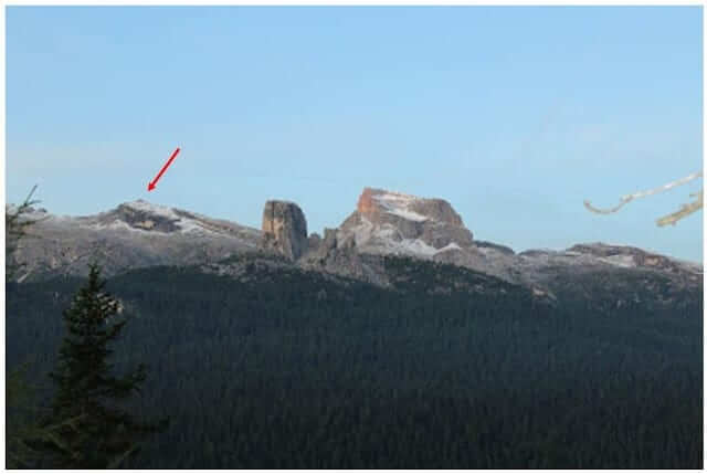
I knew the first part of my trek was a short descent down to the road and then a big climb up to Rifugio Cinque Terre. In the low light of dawn the Cinque Terre rock structure loomed over the horizon. I know the 5 Towers Hut is nestled right up against the structure. If you look closely in the photo above, you can even see Rifugio Nuvolau on the distant mountain top. An incredible sight, the hut was a beacon summoning me forth.
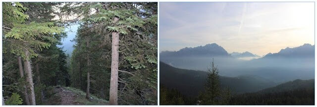
The trail down to the road would have been a nice stroll if the ground was dry, but it wasn’t. The tree roots and the wet dirt combined to make a rather treacherous hike down. It brought me out of my sleepy state as I tried to carefully navigate the mud.
I felt the soreness of my legs with every step. I slipped many times on my trek down, but I managed to keep my feet under me. It was not a very enjoyable section. Eventually, the trail leveled out and I started to hear the sounds of cars.
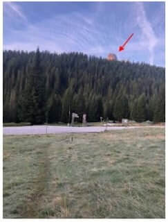
I reached the road. Straight across the road I saw some trail signs. Excellent. I crossed, found my path and set forth. I knew I was in for some significant altitude gain. I was ready for it though and I settled into a comfortable pace. The path starts on a gravel road before branching off into a wooded path.
Instead of switching back and forth, the wide path climbs straight up like a staircase without stairs. I much prefer this type of trail. It brightened my mood and I fell into a rhythm. I didn’t stop. The pain in my legs subsided, now just a dull throb. I kept my pace and gained a lot of altitude quickly. I felt great.
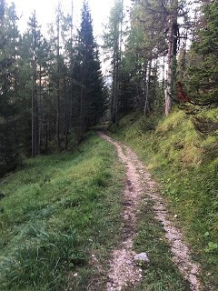
I was loving this section. It only got better. The trees started thinning out and I knew I was getting closer. This part of the hike was all new to me. The trail opened up to a wide expanse of mountains. It was the backside of the mountain I just hiked up. It was an unexpected sight. I took some photos of the scenery and moved on. The path cut back to the opposite direction and continued up.

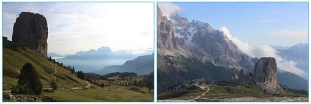
I came to a ridge and there was Cinque Terre (5 Towers) in all its glory. It’s amazing to think that just yesterday, this giant rock structure was a distant object. A blur on the horizon. Now, it was a mile away, prominent and massive. (See pic above)
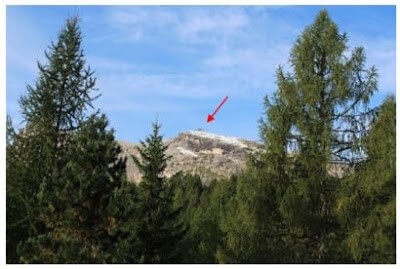
To my left was yet another view of Rifugio Nuvolau (pic above) sitting on the summit of an oddly shaped mountain. The trees framed the scene perfectly as if inviting me to stop and look. The hut looked closer than it had this morning when I saw it from near Rif Dibona, but it still looked untouchable, distant.
I had stayed at the hut 3 years ago. A memorable experience to say the least. This was a completely different vantage point. It was amazing to see it perched up on the mountain side from this angle.
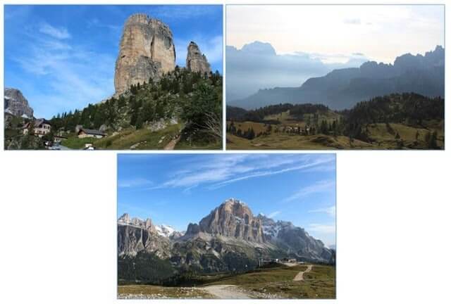
Another 30 minutes and I reached the base of the 5 Towers and Rif Cinque Terre. More great views. More pictures. From where I stood, the Towers were massive. They seemed as if they were reaching up to the sky, to the clouds and beyond. I drank some water and ate the rest of my chocolate. From here the trail takes you up and behind the Hut and onto a road.
When I say road, I mean it loosely. Some cars do drive on these “roads” but it’s mostly to transport goods and supplies to the huts. This road was in rough shape. A steep climb brings you up to a ridge. To the right was Rif Scotoni. A chairlift runs up to that hut. To the left, off in the distance was Rif Averau.
I was looking forward to Rif Averau because I remember eating lunch there and I really liked it. When I arrived it was too early for lunch, but I refilled my water and bought a coffee flavored chocolate bar. From here, the typical route was to climb the ridge up to Rif Nuvolau.
From Rif Nuvolau you trek off the backside and encounter one of the few Via Ferrata sections on the Alta Via #1. I did this route the last time I hiked the Alta Via #1, but the conditions were much better then. Most people will wear the via ferrata gear (harness and clips) to attempt it. In my opinion it is not necessary in good conditions. But in bad conditions, I wouldn’t attempt it without the gear.
Because of all the snow, I decided to take the alternate route. If you are interested in learning about the 2 via ferrata sections off the back side of Nuvolau, read my blog from 3 years ago. It was an amazing section of hiking, perhaps one of my favorite hiking experiences ever.
The top section of via ferrata consists of some metal cables and a ladder that is placed in a rather precarious spot. Although I really wanted to experience it again, I didn’t have the gear, and I needed to be smart. With all the snow and ice, I had already heard that the conditions were slippery. I wasn’t about to find out. So, I took the alternate route down to Passo Giau.
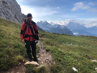
The hike down was another big descent. It was a pretty forgetful section. I met a couple in their late 50s from Colorado. They asked me to take a picture of them and they took a picture of me. The last section before Passo Giau was a maze like section of giant rocks.
It was hard to find the trail, so you had to pay close attention. By now the trail had wrapped back around the mountain that Rif Nuvolau sat atop. It provided a good vantage point of the hike of the backside of the mountain, the section I by-passed. I enjoyed looking up and seeing what I had trekked 3 years ago. It looked ominous and challenging. I really wish I could have done it today.
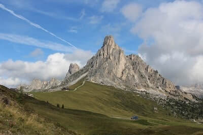
As I continued down the path, I started to encounter a lot of hikers travelling in the other direction. Groups of hikers. Some with guides, some without. I saw a group of Asian hikers. Two of the women wore masks over their faces. I found this to be particularly odd.
I struggled with the concept. I understand why people where masks in the city or in busy highly populated areas, but we were in the Dolomite Mountains. Dolomite germs was not on my list of concerns. Maybe I’m missing something?
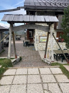
While my mind worked hard to make sense of the masks, I saw Passo Giau in the distance. It sat on a major road. By major I mean a 2 lane road. One lane going east, one lane going west. I guess you could call it major for the Dolomites region.
Passo Giau is basically a little hotel and restaurant. For some reason it’s not a Rifugio. I have no idea why. They did sell food, so I made a quick stop to refill my water and buy another ham and cheese sandwich.
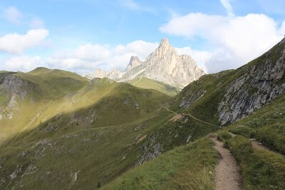
I crossed the street and headed onward. I was very excited because the next section was perhaps my favorite section from when I hiked the Alta Via #1 3 years ago. The landscape here changes to one of green pastures and lush mountain valleys.
The hike takes you on a long traverse along a ridge with a nice view of the green rocky countryside. The ridge meanders down and around before gradually ascending. I knew that was in for a big ascent soon. I remembered it from 3 years ago.
The hike up to Forcella Giau (Giau Pass) brought you to 7743 Ft. It was a steep, short hike with lots of vertical gain in a short distance. Looking up I could see that a lot people were currently attempting it. I decided there was no better time than the present and headed up. My pace had certainly slowed from the AM, but I was still going strong. I rested a couple times, but managed to make it to the top in good time.
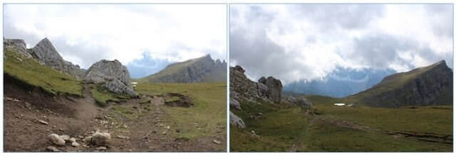
From the Pass you are treated to more magnificent views. I didn’t dwell too long because I was here! It was one of my favorite places on earth. When I die, I would like some of my ashes to be sprinkled here. Not all of course, there are 9 other spots as well.
Is it too much to ask to have my ashes sprinkled at my 10 favorite places on Earth? Perhaps that’s another story for another time. I named this place “The Plateau” mainly because it seems to fit, but perhaps “Oasis” is more fitting.
It was a large flat expanse filled with every shade of green known to man. A lake sits in the middle of the landscape as if someone placed it there for aesthetic purposes. Its mirror like surface reflecting and amplifying its surroundings. The distant mountains serve as walls to keep the oasis enclosed in beauty, a secret paradise hidden in the mountains.
I took my time hiking through this inspiring place. Even my tight schedule couldn’t keep me from relishing every single second I had here. The hiking was easy. I took out my sandwich and ate as I slowly walked through heaven.
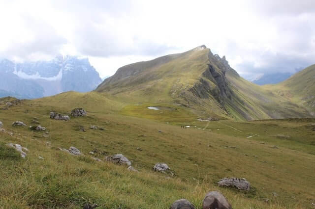
When I got close to the lake, I sat down and finished my sandwich. It was sunny with a light breeze. It was the perfect weather in the perfect place. I thought about how lucky I was to be here, about how lucky I was to have a supportive wife that encouraged me to attempt this. I was so appreciative of this opportunity.
I felt truly blessed. The spirit of the place rejuvenated me. A young English couple passed by and we exchanged pleasantries. I sat there for probably 10 minutes. It wasn’t long enough, but I had a long way to go. I trekked on. A small stream follows the path as it leaves the Oasis and starts to head upward.
A half mile later and I had officially exited The Plateau. I was sad to see this section of the trek end, but I had to keep going.
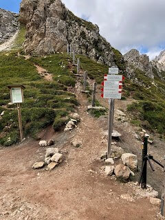
The trail turns to the South and so does the start of a long high traverse. There’s a subtle altitude gain as the trail takes you up to the Forcella Ambrizzola (Ambrizzola Pass). Just as I was starting the long traverse, I saw the English couple again. They were sitting on some rocks and eating their lunch. I stopped and talked with them.
They too had really enjoyed that section. I asked them where they were going. They told me Rif Citta di Fiume. That was the next hut on the trek. I had ended my trek 3 years ago at the hut after Rif Citta di Fiume. I couldn’t believe that I was almost to the halfway mark of the Alta Via #1. I wished them luck and said goodbye.
It wasn’t long before I reached another pass, the Forcella Col Duro. From the Cold Duro Pass you could make out a small town to the East. I wasn’t going that way. Instead, the trail takes you South along another high traverse that pops you out at yet another pass; Forcella Roan.
Navigating 3 passes in such a short period of time gives you the feeling of weaving in, out, and through mountains. Each pass a crossroads. Each crossroad a gateway to another place. It was a surreal feeling. Powerful.
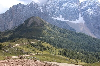
From the Roan Pass the trail descends down a steep, rocky cow pasture to a road that will take you to Citta Di Fiume. The decent wasn’t too challenging. A few cows were lazily eating grass and wagging their tails. I passed a few hikers, but the trail was otherwise quiet. I didn’t particularly like the road section. It was probably about 2 miles long. There was a lot of up and down. Walking on the cement, especially on the down sections, was not particularly fun.
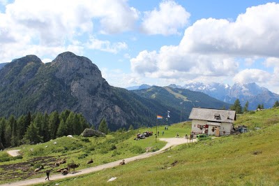
This section dragged on until eventually I saw Rif Citta Di Fiume in the distance. I didn’t stop at the hut. Instead I continued on to Rifugio Passo Staulanza; the halfway mark of the Alta Via #1. It was also the end point of my first Alta Via #1 trek. From there it would all be a new adventure. I couldn’t wait.
The guide book says it should take 2 hours to get to Rif Passo Staulanza, but I must have had a surge of adrenaline, because I did it in 1 hour and 15 minutes. The hike was relatively uneventful. A deep wooded section gives way to a long baron section that crosses a huge rock fall.

From the exposed rocky ridge you could see for miles into the valley. It was a beautiful day. It was 60 degrees and sunny. It was the warmest I have been on the trip so far. That combined with the brisk pace I set led to an uncomfortable level of sweating. Sweat creates issues, issues I didn’t want to deal with.
I had had the foresight of putting “glide” on my feet in an attempt to avoid blisters. It worked for the most part. My feet still got destroyed, but I didn’t have any blisters. Another small victory. I did however develop blisters on my hands from my trekking poles. It was very unpleasant.
The other problem with sweat is that it ruins your clothes. I had limited resources, and because of the mild temperatures at night and the lack of time, washing and drying my clothes at the huts had not worked very well.
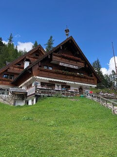
I love Rif Staulanza. It’s an amazing hut. It sits on a road and is a good bail out point if you ever get injured or need to get out of the Dolomites. The food at the hut is amazing and the people are nice. I refilled my water here. I sat down on the grass and studied my maps. From here on out it was unchartered territory.
I knew that the next step was to head down the street. I knew it because I had just read it, but I managed to make a mistake anyway. While hiking I saw a sign on the side of the road saying Rif Coldai (my destination) with an arrow pointing left. There was a guardrail lining the road.
The sign was inside the guardrail and there was a subtle path going down through the woods off the left side of the road. Like I said, I knew from reading the guide that I should walk down the road, so ignored the sign and walked down the road. After about a mile, I started getting antsy. I thought the trail should have showed up by now.
It didn’t. I made a big mistake and backtracked a mile back to the sign, headed down the subtle path and followed for about a mile. It brought me to the same road I started hiking down, but further south. The winding road snaked its way down into the valley as far as my eyes could see. I knew that was the wrong way. I just wasted a good 25 minutes, but I knew what I needed to do.
I followed the road back the way I came. It was up hill, which was not exactly what I needed at the moment. I knew if I followed the road far enough it would bring me back to Rif Passo Staulanza in a few miles, but my hope was that the trail I was looking for was about half way. It was. In retrospect it was a dumb mistake. It cost me a good 40 minutes and precious energy.

The trail was an old rocky, dusty road. I walked down it for about 2 miles before it branched off to the Southwest and downhill. I knew I was in for some elevation gain, so the fact that it went downhill didn’t fill me with joy. I wasn’t sure how long the trek was from Rif Passo Staulanza to Rif Coldai.
For some reason I thought it was 2 hours. I am usually meticulous about knowing this information, but the combination of my exhaustion from the hike so far and the frustration at wasting 40 minutes threw me off my game. I followed the winding road and eventually saw a small shabby building up ahead; Malga Vescova. It looked like a worn-down farmhouse. I was at a crossroads. One road went left, the other right. The farmhouse was off to the right, to the West.
An older Italian man was walking up from the road to my left. He was not a hiker. I decided to ask him. He was clearly a local. I asked him which direction to Rifugio Coldai. He had a hard time understanding me. He spoke no English. I think he thought I was lost. I wasn’t really, I was just trying to find some information about how far the hut was.
He understood “Coldai” and pointed to the South West in the direction of the farmhouse. I asked him how long. Nothing. I asked him how many Kilometers. He seemed to get my meaning. He told me 2 hours. Using my hands I asked if it was a lot of elevation gain. Using his hands, he showed me up, then down, then up again.
No surprise there. He told me to follow him. This, I knew, was not a good idea, but I did anyway. I wanted to be polite. When we got to the farmhouse he asked me if I wanted to get a coffee with him. I declined the nice gesture. It didn’t look like the type of place that would have a café.
Maybe it was his neighbor? Perhaps they just drop in on each other for coffee. I’m not sure, but he kindly nodded to me and pointed up the road indicating the direction he wanted me to go. I said thank you and headed on.
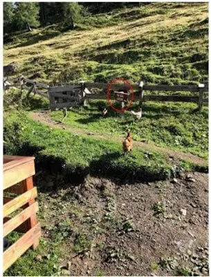
As I passed the farmhouse some chickens caught my eye. That’s when I saw a sign and a gateway heading behind the building. It seemed strange that the Alta Via #1 would go through this person’s backyard/farm, but it did. The trail sign read “Rifugio Coldai” with an arrow pointing up the hill.
The hill was very steep and the narrow trail cut a zig zag through the hill and out of site. There were probably 30 cows on the hillside, many of them literally on the trail. Normally, I would try to avoid them, but that was going to be impossible here.
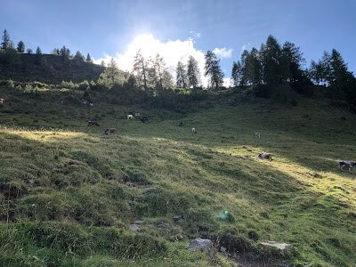
My ascent was rather slow, a sure sign that I was exhausted. When I reached the first bunch of cows, I made a lot of noise to get them to move. They wouldn’t. I tried to navigate around them, but going off trail here was a good way to sprain an ankle.
The cows eventually moved, but there was a few times I had to pass in between a group of them. It was an uncomfortable feeling. I especially didn’t like the ones with the horns. I looked back at the road and saw the nice old man walking, hands clasped behind his back.
Clearly he didn’t know about the path behind the house. If he did, he didn’t want to take it. He definitely saw me making my way through the cows. He probably thought I was some idiot American. Maybe I was. I looked at the road, then at the man and thought to myself that the road would surely take longer than this path. It had to be a shortcut. Maybe I could get to Rif Coldai quicker than 2 hours?
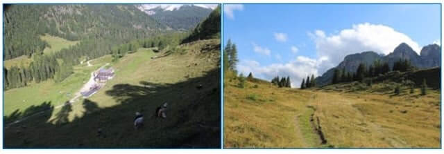
I left the cows and farm behind me and trekked across a wide grass field with large trees on both sides. I was on this trail for about 2 miles before I found another road, perhaps the same road the old man would be walking down in about 20 minutes. The man had said up, down, up.
I was now on the down section. I would be lying if I said I wasn’t excited. I couldn’t wait to get to the hut. I was completely spent. The road was well travelled. Hikers and non-hikers were about. I saw 3 or 4 little huts and cabins around. I wonder if people lived here? There was a chairlift off in the distance. This was the closest thing to a village I had encountered so far on the Alta Via #1. Unfortunately, none of the huts were Rifugio Coldai.
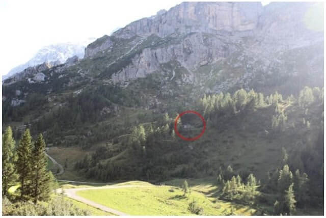
I asked one of the people walking on the road about Rif Coldai. He pointed down the road to a sign. From the sign I could see a road climbing up a mountain. That must be the “up.” The man must have understood what I was thinking. He said Rifugio Coldai and pointed up the mountain. Here is where I suffered a very big mental blow.
I followed his hand and looked to where he pointed. I could see a building high up the mountain side off to the right. The hut looked small, but that must be Rif Coldai? He told me 45 minutes. It looked more like 20 minutes, but perhaps he was just estimating. I said thank you and headed down to the trail sign and then headed up. I was moving slow, but the thought that I was close to finishing the day gave me the energy I needed to continue.
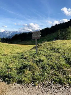
It all went downhill (ironically) from here. I started my trek up a switchback trail of loose rocks. It was around 4PM. The trail kept going and going. I kept waiting for it to cut back to the right to where the hut the gentlemen had pointed out to me had been. It didn’t.
It just kept going on and on. There were times when I questioned if I had missed the turn. Surely, I must have passed it by now. Why is the trail going the opposite direction? At this point my mind was deteriorating. I was sluggish. If I’m being honest, reality started to slip. When I get like this, physically and mentally exhausted, I go into what I call “zombie walk mode.”
Basically, it’s one step in front of the other. Not much thought. No enjoyment. Just a desire to take one more step so I can get one step closer. This went on and on. I had to stop a lot. I would go 50 feet then stop. Then 30, then 20. Soon I felt like was stopping every 10 steps. I took a long break, maybe 10 minutes. I justified it as a way to recharge my battery for my final push.

At about that time, the trail started getting very difficult. It was some of the steepest hiking of the trip. Not only that, but the trail was faint. You had to look very closely for the markings. This is not something I was used to on the Alta Via #1. The trail is usually prominent, easy to follow. Not this one.
A few times I missed the trail marking and ended up slightly off trail where the rocks were loose and the trail even steeper. I always managed to find my way back. I took another 10 minute break. This time to refresh my mind. I finally conceded to the fact that the hut I thought the man pointed out was not my destination.
It was more likely he had just pointed “up.” To this day I’m not sure how or why I rationalized (or hoped for) the existence of this “hut.” I was at least an hour past where it had been. I pushed the thoughts away, this was not the time to dwell. Dwelling led to lack of concentration. Lack of concentration led to mistakes and this was not the time to make mistakes. I continued on.
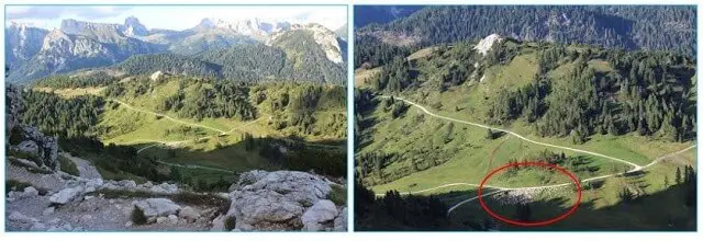
Over every rise I hoped and prayed that Rif Coldai would appear. It never did. The trail just kept going and going. My mood was no longer somber. I wasn’t angry. I was nothing. And that “nothing” scared the hell out of me. I went back into zombie walk mode. One step, two. I came over another rise, another ridge. Nothing.
No sign of the hut. I started to think dark thoughts. What if I wasn’t on the right trail after all? What if I’m stuck out here after dark? These are not good thoughts to have. I rested again, my mind struggling to make sense of the situation. I finally managed to convince myself that I was on the right path and all I had to do was keep going.
Another 30 minutes went by. Then something else happened to my mood. I started to get scared. I reached a very steep, very challenging section of the hike. The path was hard to find. I kept going off course. One time in particular I found myself in a precarious spot. The kind of spot where a wrong foothold could lead to something bad.
I managed to maneuver up to a flat spot. I sat down on a large rock to rest. I looked back from where I came and saw the actual trail. It was about 20 yards away. How did I miss that? I wanted to cry. From where I was, it was not an easy chore to get back to the trail. I would have to go down the gnarly section I just climbed up. The loose rocks, the steepness. I was completely and totally deflated.
Then something happened. I heard a noise. A voice. Multiple voices. A group of middle-aged women turned a corner about 200 yards away. They were headed towards me. They were headed towards the hut! This lifted my spirits in a way I could not explain. Up until that point, I was not thinking rationally. I was lost.
I wasn’t technically lost. It was worse, I was emotionally lost. These 4 women brought me back. They came around the corner and saw me. Based on where I was, they must have thought I was an idiot. I stood up and with a completely confident voice I said “the trail goes that way” and I pointed to where I had spotted the trail.
Of course they knew that, because they were carefully following the trail. Also, they weren’t idiots. They said thank you, then continued on. I heard one them say “off-piste” and then they all laughed. I was embarrassed. I was also ecstatic. Those who know me wouldn’t be surprised that the ecstatic feeling overruled the embarrassed. Any doubts I had had about reaching the hut had vanished.
I carefully plotted my way back down to where I had gone astray. I then followed the correct trail. It was only another 10 minutes before I crested a ridge and saw 2 metal cables heading down into the valley. That meant that the hut was nearby. The cables acted as a transport to bring supplies up to the hut. There were no roads up this hut. This was high up in the mountains, isolated. Other huts in the Dolomites operated the same way.
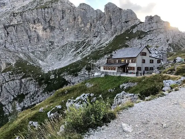
I walked for a few more minutes and I saw Rif Coldai. Relief washed over me. I almost broke out in tears. I got to the hut at 6:15 PM. I took a few minutes to reflect on my situation. I felt that tingly feeling you feel when you realize that you are ok. That you made it. It was a feeling of safety. A feeling of relief. I checked in.
I put my stuff in my room, changed and headed down to inquire about dinner. Dinner was at 7PM. That gave me about 40 minutes. I also learned that they had showers available. This was a luxury. Because water is scarce up here, they charge $6 euro for a 6 minutes shower token. I bought a token and went to the shower. It took 3 minutes for the water to heat up, so I took a 3 minute shower.
It was the best $6 euro I have ever spent. I felt a little better. I changed and went down to dinner. I was at a level of exhaustion I don’t think I have ever experienced. Last summer I ran in a 100 mile relay race in Vermont with some friends. We took turns running for 10+ hours. I wasn’t nearly as tired after that as I was now.
I needed food. I sat at a table with an older Englishman. He didn’t talk much and I was perfectly ok with that. I didn’t feel like talking. He wore a particularly pretentious sweater with the collar up and he was rude to the waitress. What a jerk. He kept telling her he was part of the Alpine Club, whatever that was.
Apparently he got some sort of discount. Good for him. I didn’t care. I just wanted something to eat. While sitting at the table my body was shaking. I wasn’t cold. My body was in shock. My legs were numb and in pain at the same time. How is that even possible? Not only that, but my stomach felt strange.
I felt malnourished. I felt like I was driving and I had less than 5 miles to go before the gas ran out. I became acutely aware that even though I was only on day 3, I may have lost a significant amount of weight. I was scared and for the first time I thought there was a good chance I wouldn’t be able to complete this trek. I made it to the hut and that was great, but that didn’t change what I went through that day.
I had serious doubts about my ability to wake up the next morning and continue on. In the back of my head I remembered that tomorrow’s hike was the longest of the trip. It just seemed an impossible task. I wasn’t up for it. Not physically, not mentally.
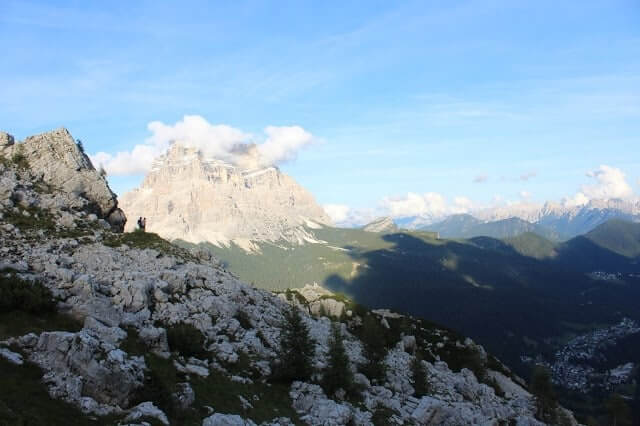
Somehow I had 4G on my cell phone at the hut so I sent a text to my wife letting her know I was ok. I carried a GPS locator with me that was able to relay a couple of preset messages using satellites. I had used that a few times on this trek to let her know I was ok. The GPS had 3 message options: 1. Everything is great. 2.
Delayed but everything is ok. 3. Send help. So far I had only sent “everything is ok.” On this night, I could send an actual text. That in itself scared me. I said I was ok, but she asked me a follow up question; “How is it going?” I froze. I couldn’t bring myself to answer any questions. I felt a sick feeling in my stomach.
I wanted to get emotional. I didn’t want to tell her about the last 5 hours. I didn’t want to tell her I felt like quitting. I sent her vague responses. I said I was tired. I said I was looking forward to tomorrow, but the truth was I started thinking about other alternatives. A way out. I knew I could hike a half day and find a road and a car.
The thought made me feel worse. I wasn’t sure I could withstand another day like I did today. I wasn’t sure my body would hold up. How was I going to hike a full day tomorrow? Hell, how was I going to walk up the stairs to bed? I finished my texting conversation. I considered it a victory that I didn’t breakdown. It was an important victory.
I decided to focus on dinner and worry about the rest in the morning. For my first course I had dumplings in broth. The dumplings were giant Italian meatballs. The broth reminded me of a miso type flavor. It was amazing. The second course was a pork chop, vegetables and fries. The fries were narrow, small and very crispy. Also delicious.
Desert was a bowl of fruit. Not a typical desert, but I welcomed the fruit and ate every last bite of it. I hadn’t had any fruit on my trek. This was a treat. I ate every single bite of all the food I got. I didn’t leave a crumb. I slowly headed up to my room, organized my pack and laid down. The room I was in had 4 bunk beds.
Two on each side of the room with a single bed in-between the bunks. 10 beds in total. I scored a bottom bunk. The space between the bunk beds and the middle bed was minimal. In fact, I could barely stand up without falling onto the bed next to me.
In some of these high altitude huts, it was common practice to jam as many people into a room as possible. I put my sleeping sheet on my bed, pulled the covers over me and put my headphones on drown out the sound.
People started entering the room and getting ready for bed. Not much to do up here, so people went to bed early. That was good. Usually, I take this time to see who was sleeping in the room. This can give you an indication of how your night will go. I can pinpoint the snorers pretty quickly.
They are trouble, but not as bad as the “strange creepy” type. I did see the English guy I sat at the dinner table with, which was not a good sign. I didn’t like him much. I guess the Alpine Club Membership didn’t give him a penthouse suite. Maybe this was the penthouse suite?
The truth is that tonight I didn’t even care. I put a clean t-shirt over my eyes to block out the scene. 10 minutes later the lights went off. It was probably 8:30 PM. I must have fallen asleep at 8:35 PM.
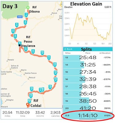
As I was falling asleep I remember feeling a small sense of pride envelop me. I was proud of my accomplishment that day. I trekked for 11.5 hours covering 20.5 miles and attained roughly 6700 feet in elevation gain. If you look at my splits (below), you will notice that I circled the last 1/2 mile of my hike.
That 1/2 mile took me 1 HR and 14 MIN to complete. In retrospect, it acts as a reminder of the reality I faced that day. It was my make or break moment on my trek. A moment that stretched out in a foggy, hazy, and confusing 1 HR and 15 MIN. It was a moment that is difficult for me to reflect on, but it showed me what I was made of.
It showed me what I was capable of. I take pride in knowing I was able to overcome it. Rif Coldai will forever have a deeper meaning for me. A symbol of my achievement. The Rif Coldai experience and the emotional war I waged on myself that day will follow me wherever I go and whatever I do.
It is a permanent part of me now. Is this what I was looking for when I set out on this adventure? I’m not sure, but I definitely found something. Something very real.
Alta Via 1 (Day 4): Rifugio Coldai to Rifugio Pramperet
It is amazing what a good night sleep can do for your mind. I awoke on Day 4 feeling like a new person. I can’t remember a time where I had such a deep, rejuvenating sleep. Ironic that it happened in the most crowded room I had stayed in to that point. Perhaps it had something to do with being so high up in the mountains.
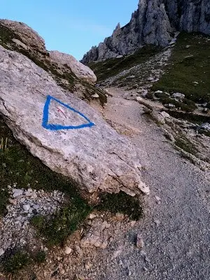
Or perhaps my body had reached a point of exhaustion where it shut down completely and fell into a coma. I like to think it was the former. It was a peaceful and beautiful place to sleep. I was the first one up in the hut for the 3rd straight morning. By day 4 I had the process of getting ready in the morning down to a science. I was out of the hut at 6:30AM.
The morning was calm, crisp and clear. It was odd that there was such little wind up at this altitude. It transformed the surreal landscape into one of peaceful magnificence. The dawn light lit the surrounding mountains encircling the hut in a glow. My body seemed to hum with anticipation. All the negative thoughts I had the night before faded.
Instead, I felt a desire to experience more. I was inspired anew. With my anticipation, my expectations soared. What a change from just 10 hours ago when I wasn’t sure I would be able to continue. I wasn’t sure how my body would respond, but mentally I was ready to give day 4 a shot.
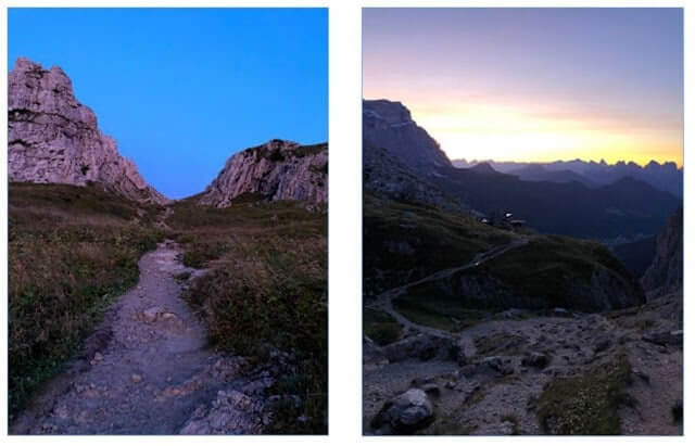
It didn’t take long for my expectations to be met. The path heads west directly behind the hut and leads up to a ridge. There is something special about starting your hike at a hut high up on the top of a mountain. No cars, no roads and at the moment, no people.
To start the hike from Rif Coldai, the place I struggled to reach the day before, and then head up even higher, even further away from civilization, was an odd feeling. I felt detached from reality. It was a great feeling. When I got to the ridge I looked back at the hut. The sun was starting to peak over the mountains.
I took a moment to reflect on my current situation. I was deep in the mountains and I was about to go deeper. Was this a dream? Maybe I haven’t woken up yet? Once again, I reflected on how incredibly lucky I was to be experiencing this. I took one final look at Rifugio Coldai, a place I will never forget, and I continued on.
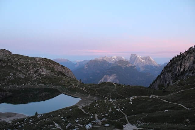
The other side of the ridge spilled out into scene that is truly too beautiful to articulate in words. Coldai Lake sat in the middle of the landscape like an infinity pool overlooking distant Dolomite peaks. It’s surface smooth and shiny. I couldn’t take my eyes off of it. I followed the path down to the lake and marveled at is existence. It seemed impossible that a lake would be up here.
It seemed impossible that I would be here with it. My goal had been to get off to a fast start, covering a lot of distance early in the day, but I simply could not leave this special place. It’s the type of place you don’t get experience often in life, if ever.
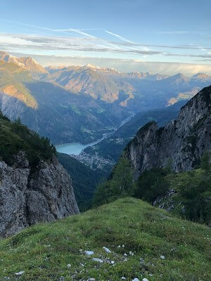
Eventually I ventured past the lake and was treated to even more scenery. The town of Alleghe sat in the valley with Alleghe Lake just past it. The cold cool blue of the lake contrasted with the surrounding mountains to create an incredible landscape to behold. I was in heaven.
Plain and simple, this was one of the most beautiful places on Earth. I got so caught up in the scenery, I didn’t even realize I was going the wrong way. I consulted my guide and back-tracked to Coldai Lake. The Alta Via #1 hugs the left side of the lake before heading south and heading up to the Col Negro Pass.
I had been heading west toward Alleghe. It didn’t cost me more than 10 minutes and soon I was back on track. For the next two miles I was on cruise control as I traversed ridges and slowly descended down from higher altitudes. I was making good time and enjoying my hike.
I knew that Rif Tissi was the next hut on my route. I arrived at a giant boulder with a painted arrow pointing up to the right for Rif Tissi. This was called the 2100 meter junction. Here you have the option of hiking up to Rif Tissi or continuing straight and reconnecting with the Alta Via #1 at a lower altitude. I wasn’t staying at Rif Tissi, so I could have bypassed the steep ascent up to the hut by going straight. It would have saved me 30 minutes.
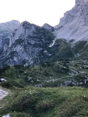
Because I have never seen Rif Tissi, I decided to tackle the uphill trek to the hut. It was a steep little stretch, but nothing too bad. When I got close I saw people funneling down from the hut to start their hikes for the day. I knew the next section of the hike was a long descent down to Rif Vazzoler.
I was looking forward to this. I knew this was my opportunity to make up time. According to the guide, my day 4 hike would be the longest of the trip. After hiking for 11.5 hours yesterday, that was almost hard to imagine. I knew my best shot at cutting time off the trek was to tackle the downhills with eagerness.
So, that’s what I did. I set a torrent pace and almost skipped my way down toward Rif Vazzoler. It was a steady downhill for almost 4 miles. As I was descending down the trail, I couldn’t help but marvel at my transformation from last night. Sure, my body was sore and each step was a reminder of that, but my mind was clear and focused and that made all the difference in the world.
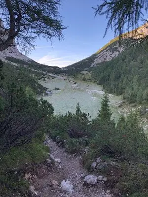
The first couple of miles was a single track trail of dirt, rocks and grass. The conditions for hiking were ideal. 55 degrees, sunny and dry. It was only 3 days ago I was trekking through snow! I passed a lot of hikers over the next hour.
Eventually the trail lead into a large grassy meadow. (Above pic) Green for as far as the eye could see. I used this flat section to drink some water and eat a snack. I was cruising along when out of the blue someone passed me. I couldn’t believe it. He was a 30 something year old man, very slight build, couldn’t have weighed more than 150 lbs.
I would eventually give him a name; Speedy German Hiker. I watched him cruise by me, step in a deep puddle like it was nothing, and disappear around the corner. He made no eye contact. He didn’t even say hello. Who was this guy? Was he a figment of my imagination? A ghost? Why did he step in that puddle?
Clearly, he thought himself too good to stay on the trail. I was almost hiking at jogging speed when he passed me! When I rounded the next corner he was gone. He vanished! It was a bizarre experience. Oddly enough, this encounter would not be the strangest on my trek today. Soon enough, I started seeing signs of civilization. Little huts, some cows, and more people.

The hike came to fork and there was a little gateway with a sign pointing to Rif Vazzoler. The gate was a means to keep animals out. They had these types of gates all over the Dolomites. Animal control. Most fences I encountered carried an electric current. This one was just a simple fence with a latch.
I remember thinking to myself that this was a sign that the hut was close. The logic being that they didn’t want the animals near the Rifugios where all the people were. It was far from logical. It was more hope than deductive reasoning.
The irony of this so called logical thought would prove to set the stage for one of the most memorable sections of my trek. I opened the gate, walked through and headed down a narrow tree lined path. Eventually the path funneled out onto a road, the kind of narrow rocky road you only find snaking its way down a mountain.
On the right side of the road was a steep embankment leading down into the valley. On the left side of the road was heavy brush and a steep incline heading up higher up into the mountains. I mention this now, because it will soon be a very important fact. I followed the road and noticed some commotion up ahead.
I saw a group of people. I heard the familiar sound of bells ringing. The Speedy German Hiker was among the crowd. Perhaps he wasn’t a ghost after all. He was the only hiker in the group. The rest were local herders, an Italian family of 5.
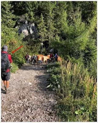
Did I mention the cows on the road? There were about 25 cows in my line of sight. There were another 25 down the road being led by who I can only imagine was the family patriarch. The sound of bells muted out all other sounds. I didn’t really know what to think, so I headed closer. The Speedy German Hiker had stopped.
He just stood there, staring at the cows. He said a few words to the herder in what sounded like German (hence his name). I don’t think it was Italian because the herder clearly didn’t know what he was saying. I spent the next 10 minutes trying to make sense of the situation.
The more I took in the scene, the more confused I got. A slow realization washed over me. I was stuck. These cows looked unpassable. The very thought of weaving my way through them not only seemed improbable, it seemed insane.
What was the protocol in this situation? Clearly, the Speedy German Hiker didn’t know either. I had no idea how far the trail followed the road. I had no idea when, where or even if the trail broke off from the road. I knew nothing.
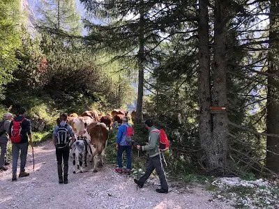
It was sunny and on this dusty dry road, I started to sweat. I shed a layer and tried to think. I was now in a t-shirt. The cows were moving down the road at an incredibly slow pace. If I had to guess, they were moving at a 45 min/ mile pace. I surmised that I couldn’t be that far from Rif Vazzoler, but I didn’t know for sure.
By this time, about 5 more hikers had caught up and joined the mix. An Italian hiker seemed to be very familiar with the situation and talked with the family of herders. I watched intently to see what would happen. Would he try to pass? The family carried wooden sticks.
When the cows meandered off the road to eat the grass growing on the sides they would hit them with a stick to keep them going. Clearly, they were moving these cows down from higher pastures. The process was painfully slow. The Italian hiker joined in on the fun. He started using his trekking poles to hit the cows to keep them on track.
Well, I didn’t see that coming. I guess he won’t be passing the cows. So much for that hope. The young cows had the hardest time staying in line and kept trying to eat grass. The herders would yell at them and hit them with the stick. One large cow, presumably the mother, would look back and make a loud horrible moo like sound.
She would do this every 2 minutes. Clearly the cow was upset. The herders would hit her with a stick in an attempt to quiet her. It didn’t work. This went on and on for what seemed like 30 minutes. I was losing time. The smell, the heat, the slowness, it all started to wear on me.
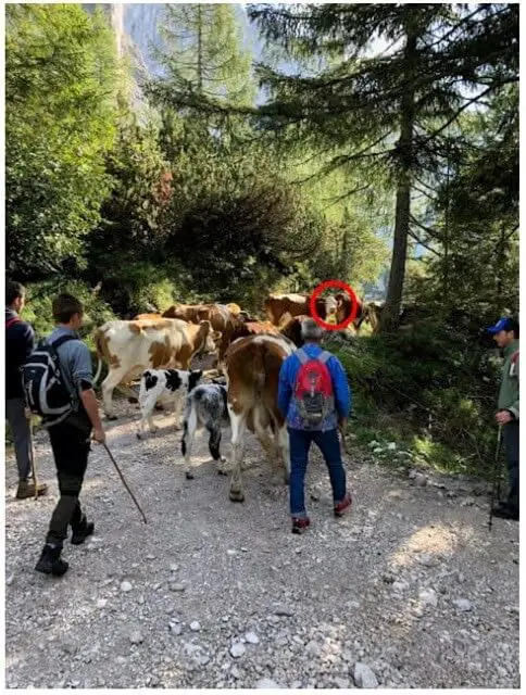
None of the hikers dared to try to pass the cows. There were too many of them. The road was too narrow. The mother cow was too mean. More and more hikers queued up as we slowly progressed down the road. I was starting to worry. This could set me back an hour. What if it set me back 2 hours, or 3?
I would not make it to Rif Pramperet (my destination) by dark. Stuck. Trapped. I sat down in defeat and drank some water. I had hoped that the road would widen or that the trail would cut off from the road. Neither of which seemed to be a possibility now. I stood up and in less than a minute I caught up to the cows.
They were moving so slow. The big cow kept turning its head back and yelling. Maybe she didn’t like me? I certainly didn’t like her. After another 10 minutes Rif Vazzoler appeared on the road. Thank god. A small victory. I still couldn’t pass the cows, but I could at least go to the hut and stock up on water and snacks.
That took about 10 minutes. Restless, I shouldered my bag and started down the path praying for a way to get by the cows. This time I reached them in 3 minutes. The road was steeper here. The cows were having a hard time. Somehow, they were going even slower. Small victories and large defeats.
The road switched back and forth as far as the eye could see. I started to panic. I had to make a decision. Do I wait and risk hiking in darkness or do I make a go at it and salvage some time? As it was, I had lost 30 minutes, maybe 45. All that hard work of making up time on the downhill section earlier was for not.
I started thinking annoying thoughts like what if I hadn’t wasted so much time at Lake Coldai? What if I started at 6:15AM instead of 6:30AM? Stupid thoughts. Pointless. Not helpful. The mother cow let out another horrific scream and that was it. I was done. The Speedy German Hiker was sitting down on the side of the road. If he couldn’t make it past these cows, what chance did I have? Only one way to find out.
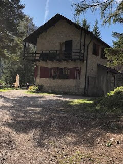
I made my way past the herders and about 5 cows. I got into the big mass of them and they started acting… strange. They were running away from me, except there was nowhere to run, no space. This freaked me out, which made me hike faster, trying to get through the throng. Bad idea.
This made the cows more frantic. As I closed in on the group of cows in the front, I saw the Matriarch of the family staring at me. I don’t speak Italian, but I didn’t have to. He was not happy. He started swinging his arms and gesturing at me. Screaming at me. Not as bad as the cow, but clearly he was angry.
He was telling me to go back. To turn around. He began to frantically gesture at me and point to back up the road from where I came. I felt sick. I stopped. I went to the side of the road and sat down. All the cows I passed walked by me as if mocking me. I swear they were smirking at me.
It was as if this was their way at getting back at humans for hitting them with sticks! They seemed to be going slower than ever. Clearly this was intentional as well. The big angry mother cow didn’t even look at me. She was a total jerk.
The next thing I know an old Italian women walked up to me. She reminded me of my grandmother. She had that disappointed look in her eyes, but she approached me in a kind way. I felt guilty. The kind of Italian guilt that is a cultural rite of passage.
She spoke zero English. She made some gestures and talked to me in fast Italian. I shook my head. English? I asked. She said, “Not calm” three or four times. I figured it out. She basically said that I made the cows nervous. No shit. I was scared as hell. I apologized to her. I was sincerely sorry.
She was so kind and understanding. She asked me if I would please not pass. I said ok. I asked her how long the road was. How many kilometers? She told me 3. That was not promising. She asked me where I was going. I told her Rif Pramperet. She did a double take. I nodded. A long way. She said, “Yes, very far.”
I asked about the trail. This, she seemed to understand. She told me using hand gestures that it branched off to the left of the road in about 1 KM. That was something. It could be worse, I guess. I did some math and figured I’d be behind these cows for another 30 minutes or so. She said her goodbyes and I sat there, defeated. I hated those fucking cows. The cacophony of bells sheared what remained of my nerves. I used to like that sound.
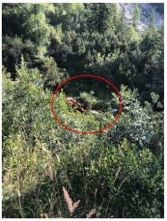
By the time I caught up to the cows for what seemed like the 10th time, there was a group of about 15 hikers. All were trying to get to the same trailhead I was. I spent some time talking with two British guys in their 20s. We were looking at a map and figuring out where the trail was and what it looked like.
You could look up into the mountains off to the East and see a faint trail cut out of the woods. There it was. Now, it was just a matter of getting there. By the time I got to the trail head, I was anxious beyond belief. I was the first person to start up the trail.
The Speedy German Hiker was close behind, but even he couldn’t catch me for the next 1 hour. I attacked this section with everything I had. It was a very difficult, steep ascent. I set my mind to it and I just went. I didn’t rest, I just kept going. I needed to make up some time. I didn’t have much in the gas tank, but I didn’t have a choice.
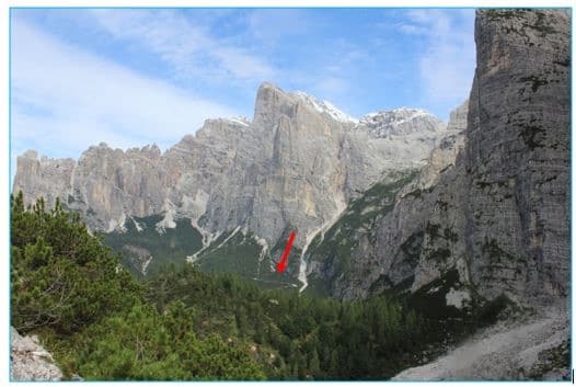
Soon enough I looked back on where I came from and there was the switchback road, clearly cut into the mountain, a giant zigzag headed into the distant valley. I imagined that angry cow screaming at the herders as they made their way further and further down.
Hopefully she will be a hamburger sometime very soon. The thought cheered me up a bit. I turned and continued on knowing full well that I will never ever forget that road and those cows. Especially the mean one.
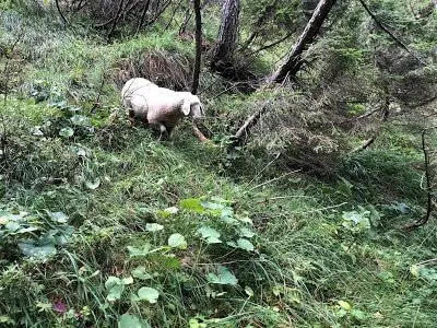
I resumed my torrid pace as the trail continued to climb up and up. I was in a trance. Focused on each step, lost in thought. I was brought back to reality when I looked up and saw a sheep two feet in front of me. I almost walked right into it. The sheep was literally on the trail. He stared into my eyes, unafraid. It took me a moment to relax.
It must have been used to people, because it acted as if seeing me was the most normal thing in the world. He was a nice sheep. Much nicer than that cow. I kept going. The trees gave way to a section of steep exposed rock face. A little stream trickled down cutting the trail in two. I took a break to catch my breath and drink some water.
My next stop was Rifugio Carestiato. I didn’t know how far from the hut I was. All I knew is that I was behind schedule. I had just spent the last hour or so pushing myself up over 1000 Ft elevation climb and I still had another mile of elevation gain to go. The higher I climbed, the more tired I got. The more tired I got, the more I started taking little breaks. I used this time to take in the scenery.
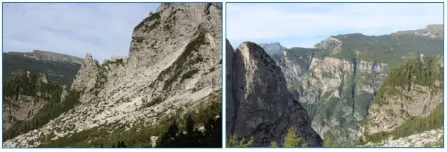
The views were amazing here. I took some pictures. Sure enough, the Speedy German Hiker arrived behind me. This time he nodded at me as he passed and continued on. I got a nod! I guess I earned a little bit of respect from him. He was a machine. I had really pushed myself for the last hour or so.
I had managed to stay ahead him, but it was only a matter of time before he passed me. As he gained distance, I noticed he reached into his pocket and put something to his mouth. Was that a cigarette? It was. You have got to be kidding me. Who is this guy? Is he human?
I always find it strange when someone doing something physical, like hiking, especially in nature, feels the need to smoke a cigarette. It just doesn’t fit. The Speedy German Hiker was an enigma. I was somewhat fascinated by him. He was such a fast hiker. You would think he was in peak physical shape. How is that possible if he smoked while hiking?
It was curious and disturbing at the same time. Curious because I wasn’t sure he was human. Disturbing because smoking a cigarette out here, in the fresh mountain air, was paradoxical. It made me cringe and laugh at the same time. I continued on.
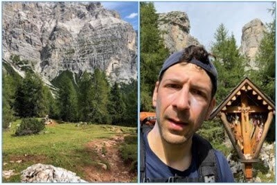
The trees started to thin as I gained more and more altitude. From reading the guide, I knew that this section of the Alta Via #1 was known for The Civetta and the Moiazza Mountains. An impressive set of mountain structures. The Civetta was shaped like a trident. These mountains dominate the landscape.
A prominent wall of jagged rock. Impossibly large, these mountains give off an aura. For me, it triggered a 5th sense, a feeling like I was being watched by them. The views got better as I tackled two mountain passes in quick succession, The Forcella Col dell’ Orso and the Forcella del Camp.
Each pass was a gateway to new subset of scenery, a new section of the Dolomites that I had yet to discover. All the while The Civetta and Moiazza loomed over it all. They owned the landscape. The rest of the scenery was just renting space. I really enjoyed this section of hiking, but I was starting to get hungry.
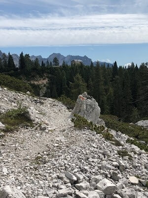
On the Alta Via #1 the huts sometimes appear out of nowhere as if magic. Other times, you can see your destination far on the horizon. I glimpsed my first view of Rif Carestiato as I rounded a corner on the path. It sat on a distant ridge. My eyes followed the landscape back from the hut, taking in the path to get there. I had a long traverse along a mountain. I set to it.
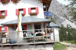
I don’t know how long it took me to get to the hut, but it seemed like a long time. I’m sure it was my eagerness to get there. The hut was perched on a ridge. Behind the hut the valley spread out below for miles and miles. There were picnic tables situated so that you could sit down, eat and enjoy the view.
The Speedy German hiker was sitting at one of the tables, staring into space. I wonder if he eats? I nodded to him and put my pack down next to an empty table. There were a few people around enjoying the scenery and chatting. I entered the hut and restocked my water, ordered two sandwiches and a chocolate bar.
This was one of the few times I had arrived at a hut during a busy time. Multiple people were around ordering food and sitting at tables. Most of them had just finished their hikes for the day. The people that worked at Rif Carestiato were very nice. I waited for my sandwiches on a bench, relishing the rest.
I took stock of my mental and physical status. Mentally, I was ok. Physically, I was starting to deteriorate. As if on cue, a young man brought out my two ham and cheese sandwiches. I brought them outside and placed them down on the picnic table. I organized my pack a bit, made some adjustments and swung the bag over my shoulder.
The Speedy German Hiker was watching me. I took some satisfaction in knowing that he must be absolutely shocked that was about to continue to hike. I had spent a big chunk of the day hiking what he hiked. Hiking at a fast speed, though not as fast as him. With a smirk on my face, I headed down the path. I ate my first sandwich as I walked.
I knew from here, there would be a pretty significant descent down to a road. At the road was another hut, Rifugio Passo Duran. The next two miles or so were pretty uneventful. I reached Rif Passo Duran around 2PM. I remember reading that Rif Pramperet was roughly 4 hours from Rif Passo Duran.
I knew that Rif Pramperet was at a higher altitude and that much of the 4 hours would be spent climbing up, but I also knew it wouldn’t be as bad as yesterday. Nothing could ever be as bad as that. I took solace in that. I started telling (or convincing) myself that I could last another 4 hours. Hell, I could last 5.
Even If I had to crawl the last mile, I could do this. If I could just get to Rif Pramperet, tomorrows hike would be easy by comparison. It was just a 7 hour trek from Rif Pramperet to the finish of the Alta Via #1. This was the first time on the entire trek that I was optimistic that I was going to finish this adventure. At Passo Duran I met a young German couple. There are a lot of German hikers around. These ones weren’t speedy.
From Rif Passo Duran, the trail heads South down the road for about 2 KM before cutting off to the left into the woods and heading up, up, up. I walked down the road with the German couple. They were headed to Rif Pramperet too. I couldn’t believe it.
This was the first time on my trip that I found someone this late in the day hiking to the same hut I was. They seemed to be happy that I was headed to the same hut. We chatted about Boston for a while. They had been before. We talked about the Alta Via #1. They were doing just a small section of the hike.
They were carrying a tent. This was the first time I have encountered someone carrying a tent on the Alta Via #1. It was very rare. They seemed to think the hike to Pramperet would take 5 hours. At least that’s what their German guidebook suggested. That was not what I wanted to hear.
I said my goodbyes, told them I would see them at dinner, and I headed up the trail. I never saw them again. They didn’t make it to the hut. They must have camped out in the woods. The next hour was a strenuous hike up into the mountains.
It wasn’t difficult by Dolomites standards, but I had already started to hit a wall. The wooded trail eventually gave way to a section of exposed rock slide. This type of terrain was pretty common on the Alta Via #1. I followed a maze like trail that climbed up, down and around giant boulders.
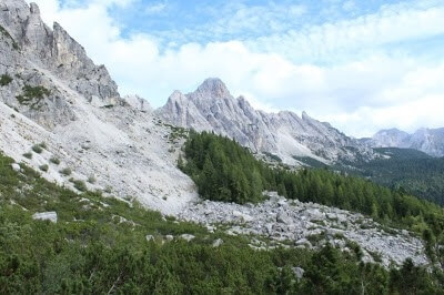
The wide expanse of rock eventually funneled into another wooded area. It seemed to form a pattern. Rockslide traverse to trees to rockslide traverse. It kept the hike interesting and I continued on. I had started to count down from the 4 hour mark. Not because I was desperate to end the hike, but because
I knew that if I could just make it to Pramperet, I could complete what I had set out to do. I could complete my adventure. 4 hours became 3 and 3 became 2.
The landscape changed and I started seeing some building structures. I took this as a sign that I was getting closer to Pramperet. In fact, I even justified in my head that it was possible I could finish the 4 hour hike in 3 hours. Wrong again. I saw a few signs for Pramperet, which was only acted as a tease.
I kept thinking to myself that the hike must go higher. I must have to gain more altitude. I kept waiting for it. After yesterday, I was conditioned to expect the worst and to be ready for anything.

It finally came in the form of a lovely white rock filled narrow path. It switched back and forth up a steep mountainside. It was unlike any other path I had been on the Alta Via #1. It looked like a path someone would create to lead up to the front door of their house. I took it as a sign that I would lead to Rif Pramperet.
Again, I was dead wrong. The path continued on and on and eventually took me up and over a ridge. I was treated to new scenery, new mountains. In the distance I could see Castello di Moschesin (Moschesin Mountain). New scenery meant a new section of my hike. It could also mean that I was getting close to Rif Pramperet.
The word “close” has different meanings to different people. For me, close was 30 minutes away. Unfortunately, I was not 30 minutes away. I was approaching the 4 hour mark (From Rif Passo Duran). Why hadn’t I arrived at Rif Pramperet yet? I had hiked at a fast pace. Even if it wasn’t as fast as I had thought, It was certainly fast enough to hit the suggested guide times.
In most cases those were rather conservative. I tried not to dwell. This section of the hike was very beautiful, so I tried to focus on that. Every time I came over a ridge, my eyes would search the horizon for a hut. My pace slowed. On one particular ridge I took a moment to rest. From behind me I heard voices and two Italian hikers approached. I was happy to see others out here this late.
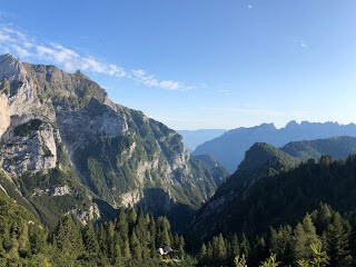
They were in their 30’s and they were going to Rif Pramperet too. I asked them if they knew how far. They told me 45 minutes. That was refreshing to hear and had it been true, would have made for a lovely end to a lovely day. They took off ahead of me and I followed.
At this point in the day, they were hiking at a faster pace than me. I guess I wasn’t going as fast as I had thought. They gained distance and disappeared over a ridge. Assuming that I only had 45 minutes to go, I started counting down the minutes in my head.
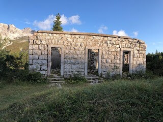
After about 45 minutes I came to Forcella del Moschesin (Moschesin Pass). There was an old wartime barracks structure here. The area was wide open and I could see a long way in every direction. I spotted the Italian hikers, maybe 5 minutes ahead. I noticed they had come to a fork in the path. To the left the trail stayed level. To the right the path went up over a ridge. It looked steep.
I watched with anticipation. Please go left. They went right and started climbing the steep section. My heart dropped. An overreaction for sure, but the thought of trekking up that steep section of trail was a blow to my mood.
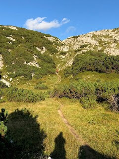
A few minutes later I stared up at the steep uphill section I was about to tackle. My motivation for climbing it was to see what was on the other side. Surely, the hut would be there. It had been 45 minutes. Much to my dismay, there was no hut on the other side. The steep hike up and over the ridge managed to completely drain my energy.
I didn’t have much left. I kept going, though at a much slower pace. After about 10 minutes I came to sign. It said “Rif Pramperet 30 minutes.” I didn’t know how I felt about that. It had already taken much longer than I thought. Another 30 minutes? I hiked for another 20 minutes when I came to another sign.
This one said “Rif Pramperet 20 minutes.” Was this a joke? Was someone messing with me? The landscape here was slowly changing from rocky to grassy. Everything was green, fertile.
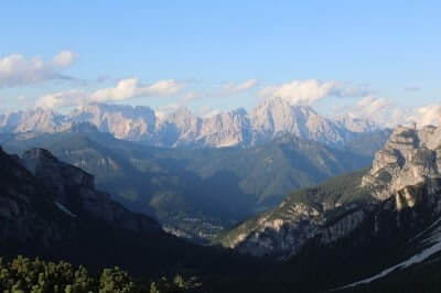
I hiked for 20 minutes and came to a new sign post that marked Rif Pramperet as “10 minutes” away. Whoever put these signs up should be shot. It’s either a cruel joke or a complete lack of competence. Needless to say, the next sign marked the hut at “5 minutes” away. Of course, I had walked for 10 minutes.
Despite the cruel joke and the damage to my psyche, I had been through far worse yesterday and the hiking here was not challenging. That was a win. The trail crossed over the side of ridge and down into a valley. Up ahead I saw a path that led across a meadow. I took it. As I walked I saw a flag rising high in the air. I was here. I made it to Rif Pramperet.
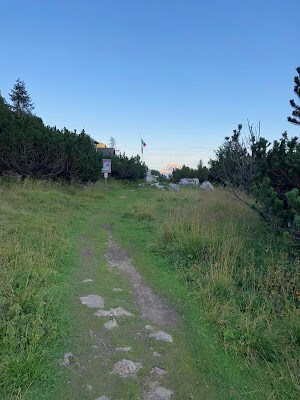
I arrived at 7:15 PM. I hiked for 12 HRs 30 Minutes, the longest day on my 4.5 day trek. On day 4 I covered 23.28 miles, the longest distance on my 4.5 day trek. My elevation gain was 7648 FT, the most on my trip. When I arrived at the hut, all I could think about was food and a shower. The hut was alive and vibrant. People were eating dinner.
There was energy in the air. The hut was small. The dining area made up most of the hut. The rooms were in a separate building off the backside of the main building. I checked in and inquired about a shower. The women, very nice, said they had showers, but she asked me to come to dinner first. Dinner had started at 7PM. I was late.
I brought my pack to my room, used the bathroom to clean up and headed to dinner. I was put at a table of 10 people. I sat next to the 2 Italian hikers that had passed me towards the end of the hike. I said hello. The owner took my order while I sat at the table.
I was weary and worn out. My body was shaking again. Shock. Deja vu. Lucky me. My body was not meant to be put through this. This was punishment for punishment sake. I have no one to blame but myself. I was the one who concocted this idea. I was the one that attempted this. Now, I am the one who has to deal with it. Fair is fair.
At the table, people were chatting loud, having fun. It felt odd. I wasn’t really in the mood for talking, but someone asked me a question. I looked up. There were a group of friends, retirement age. About 6 of them. Three men, three women. They were Canadian. They asked me where I had hiked from today.
I said “you don’t want to know.” This peaked their interest. The man sitting across from me said, “Now I definitely want to know.” I told them Rif Coldai. Their reaction was half shock, half disbelief. It caught the attention of the rest of the table and everyone’s attention focused on me. So much for not being in the mood.
They couldn’t believe I came from Coldai. The two Italian hikers proceeded to ask me some questions. How? Did I follow the Alta Via #1 or did I go a different route. They didn’t seem to think it was possible. They were very familiar with the Dolomites and knew the area well. They were hiking their own made up trail loop.
I told them that I left at 6:30 AM and that I hadn’t really stopped. The next 30 minutes was spent eating food and talking about the trek. The Canadians were fascinated with my itinerary. When they learned I was completing the Alta Via #1 in 4.5 days, they were in awe.
They were hiking the Alta Via #1 in 9 days, which is considered fast. I got to know them during dinner. They were skiers. We talked about British Columbia, may favorite place to ski. The conversation inevitably went back to my trek. To the Alta Via #1. They asked me why I was doing it in 4.5 days. I was ready for it. I replied with “midlife crisis.” They laughed.
I spoke with the Italian hikers for a while too. We talked about hiking and skiing. I asked about skiing in Italy. They told me Italy was nice, but Austria was the best place to go for challenging skiing. The two German hikers were brought up. Apparently the Italian hikers passed them and new they were supposed to stay at this hut tonight.
They were worried about them. I explained that I had spoken to them too and that they had a tent. They were probably sleeping in the tent tonight. That seemed to make everyone feel better. For dinner, my first course was spätzle. I really enjoyed it. My second course was a cheese entry with sauerkraut and vegetables.
I didn’t really like the cheese to be honest. I gave it to the Italians who loved it. Dessert was chocolate cake. Dinner was good and the company and conversation were great. At one point I brought up the last few Rif Pramperet signs and how the estimated time to the hut was way off. Everyone laughed.
Apparently this had been a topic of discussion earlier at dinner. Everyone agreed that someone did that intentionally to mess with the hikers. I had a lot of fun that night. I excused myself from the table and went to my room.
I organized my stuff and took a shower. The shower was a life saver. After my shower I paid my bill. I always paid my bill the night before. This was a little trick I learned from reading my guide. Also, no one was up at 6:15 AM, so I had to pay the night before. If you do stay for breakfast, often time’s people try to pay at the same time.
This can lead to delays. I went to my room, the worst room so far on the trek and climbed up to the top bunk. It was the worst bed on the trip too. I am 5Ft 11In and my legs were too long for the bed. My feet were right up against the frame. The mattress was terrible. The room was jam-packed with 10 people (5 bunks).
Everyone went to sleep early and at least 2 people snored all night. My noise cancelling headphones couldn’t keep the sound out. Needless to say, I had the worst night of sleep on the entire trip. I slept maybe 2 hours. This was troublesome considering what I put my body through on day 4. Tomorrow was my last day. 7 hours remained.
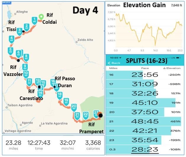
Alta Via 1 (Day 5): Rifugio Pramperet to La Pissa Bus Stop
A few people were up early on the morning of my final day. It was 6:15 AM. It was odd to see people up that early, I haven’t encountered that yet on this trip. I found out why. Apparently there was promise of a beautiful sunrise. Something to look forward to! It was a struggle for me to get ready.

I moved in a slow sluggish manner. Everything was taking twice as long as it should have. Oh well. What did I expect? I ignored it as best I could, it was my last day. At this point in the trip, it was about surviving the day and making it the finish line. To think it would be a walk in the park was naïve, silly and foolish.
By the time I was ready to start my hike, it was 6:45AM. It was the latest start of the trip. I said goodbye to a few of the Canadians sitting out on the porch enjoying the dawn air and eagerly awaiting the sunrise.

The Alta Via #1 takes you back through the same meadow I walked through to get to the hut last night. The trail breaks off from the meadow to the South and immediately heads up and into the Portella del Piazedel Mountains. The trail traverses a high ridge overlooking Rif Pramperet.
The sun was starting to rise. Dawn slowly shifted into morning. Still half in a daze from exhaustion, I ate my last remaining Balance bar for breakfast and drank some water laced with my last Nuun electrolyte tablet. I hoped that the jolt of caffeine would do something for me. Anything.
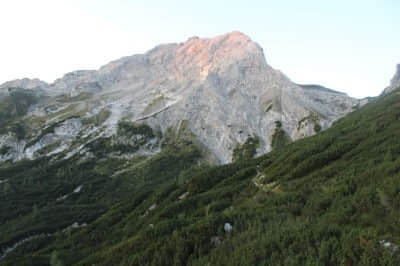
The trail gains altitude and before you know it, you are up and over the Zita Sud Pass. I didn’t know what to expect for my last day. In all honesty, I had assumed that the best of the Alta Via #1 was behind me. I reasoned that the last day was the day that took me on a long uneventful descent back to civilization.
I was completely wrong. Once over the pass, I was welcomed by one of my favorite sections of the Alta Via #1. What a pleasant surprise. The scenery did more for me than food, water or caffeine could ever do. I was instantly energized. It was as if my senses all awoke at the same time.
I could feel the blood flowing through my veins. My head cleared. I felt alive. I was surrounded by a captivating scene. Wave after wave of mountains and mountain ranges stretched as far as my eyes could see. In every direction. Mountain peaks jetted into the sky at irregular intervals. I tried to take it all in, but it was completely and totally overwhelming.
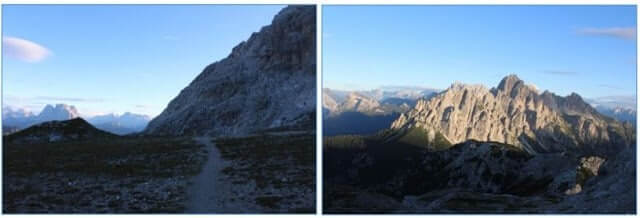
The terrain was all rock. A faint trail navigated its way through a flat moonlike surface. It slowly meandered back and forth through a dull gray expanse of slate and gravel. In the light of dawn the trail seemed to blend together with the rest of the surface making it hard to navigate. Luckily cairns lined the trail showing the way.
With each step I gained more and more altitude. I felt like I was venturing deeper and deeper into the mountains. Deeper and deeper into the unknown. The next couple of hours were probably the most enjoyable of my entire trek. That is saying a lot. I felt like I was walking from mountain peak to mountain peak.
I always seemed to be at the highest point of any of the surrounding mountains. I was completely alone. Just me and the mountains. There were some steep sections of trail, but I barely noticed. I would reach a ridge, climb along the peak of a mountain for a while and then off the backside and into a new area of mountains.
I repeated this again and again. I was literally walking across the tops of mountains. I was so lost in the enjoyment of the moment, I completely lost track of time. I took a million pictures.

I sat down, legs dangling off a cliff, and just took it all in. I had experienced many highs and lows on this trip, but this was perhaps the highest of the highs. It gave me perspective. The whole trip validated in this very moment. All the exhaustion a distant memory. I was truly living in the moment. This is why I came. I experienced a level of contentment that I don’t think I have ever experienced in nature before. I didn’t want it to end.
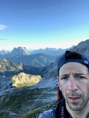
On and on I went. I knew the next hut on my trek was Rifugio Pian de Fontana. I knew I had to descend to get there. What I didn’t know is that the section to get to Rif Fontana was some of the most challenging terrain on the Alta Via #1. After walking across the tops of mountains for a couple hours, I eventually came over a ridge and saw a huge lush valley spread out before me.
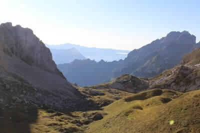
The Alta Via #1 went down, down, down. About 20 minutes into my descent I heard a strange noise. I looked up to my right and I was treated with a sight I had never seen before. There was a huge rock face, impossibly steep. A cliff would be a more accurate description.
The trail circumvented this cliff. My eyes picked up motion and there coming over and down the cliff was a group of Chamois. I didn’t know that they were Chamois at the time, I looked it up after. They are a species of goat antelope native to Europe. There were about 30 of them!
They ran gracefully down the steep rocky terrain like it was grass on a flat field. It took a while for them all to pass about 100 yards ahead of me. I watched in awe. I videoed it. After the last one passed I experienced a momentary panic. What if something was chasing them? They seemed to be running rather fast.
I put my camera away and started to walk quickly down the trail. This seemed like the type of place a mountain lion would live. Luckily, I didn’t see one of those. Another 30 minutes and the rocky terrain turned grassy.
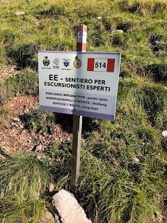
I then saw a sign I hadn’t seen before on the Alta Via #1. It was a warning of difficulty. My eyes traced the landscape down as far as they could see and there, sitting on a small plateau, was Rifugio Fontana. To get there, I had to navigate very steep, slippery terrain. On a trail this steep, you had to move painfully slow.
Each step was painful as it put a lot of stress on my legs. In some parts, usually on the switch back sections, metal cables were there for aid. I couldn’t imagine what this hike would be like in rain or snow. It was another beautiful sunny day and it was still hard. It took me about an hour to get down to the Rif Fontana. From the peak, the total descent was almost 1600 FT. That’s a long way down.
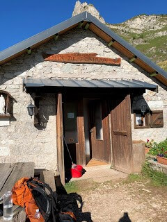
When I got to Rif Fontana, the owner was vacuuming the hut. I took my shoes off and walked in. I felt bad about interrupting her cleaning, but she didn’t seem to mind. I bought some water and a coffee flavored chocolate bar. I struck up a conversation and asked about the hike to La Pissa Bus stop. She told me it was about 4 hours. I asked about the difficulty of the hike. She told me the hardest hiking was over.
She walked to the window and pointed at some mountains off to the South. She told me the trail goes down through the woods, crosses a stream and then heads up and over the ridge. She pointed again. It looked really high up, but she insisted it was not a huge elevation gain. I liked her optimism. I said thank you and left.
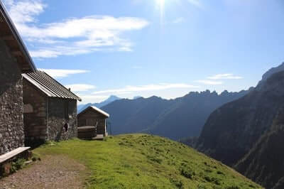
I couldn’t believe it, 4 hours left. It was hard to believe that my adventure was almost over. I had no idea what the next 4 hours would entail, but I knew that I had one more hut to pass on my trek, Rifugio Bianchet. I set that as my next goal. One step at a time. I headed down the path. I crossed the stream the women had told me about and came to a sign post. It pointed up. I embarked on my last altitude climb of the Alta Via #1.
It was bitter sweet. At this part of the day, the sun was out and it was warm bordering on hot. To my pleasant surprise the ascent up was shaded by the trees and the mountain. It was a blessing. When the trees thinned out I was treated to a beautiful view of the hut I just left about 30 minutes ago.
I hiked up to the ridge and over the Forcella la Varetta. It was the last Pass of the Alta Via #1. I was relieved to have completed my last ascent, but sad that there were no more Passes to look forward to. I will miss them. I will miss the feeling of satisfaction you get when you reach the top of one.
They symbolize so much in the Dolomites; A new view, a new section of hiking, a new adventure. You never know what will be on the other side. It is one of my favorite aspects of the trek.
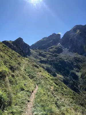
I skirted a high ridge and entered off the backside of the mountain I just climbed. Here I entered into another paradise. This was the most fertile section of hiking I had seen on the Alta Via #1. A thousand shades of green dominated the scene. The sun was shining, not a cloud in the sky. I did not expect this. It was a pleasant surprise. The trail ran along a high ridge.
The single track trail dangerously situated with a huge drop off to the right. I was inspired to take a video of this area in an attempt to capture its charm. Families of butterflies were fluttering about. Following the high ridge, the valley opened before me. My eyes tracked the faint outline of the trail as it continued to ride the high ridge. The trail spread out impossibly far and disappeared around a swale in the mountain.
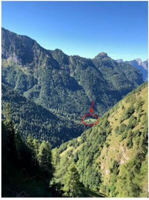
My eyes continued to follow the landscape trying to see where this trail was taking me. Way down in the valley, an impossibly far distance, sat a hut. Rif Bianchet. It looked like it would take me 3 hours to get there. Seeing the hut was both comforting and disheartening at the same time. I knew that my body was in for a hurting.
Clearly there was going to be a huge descent down to this hut. My right knee had started hurting on the hike down to Rif Fontana, so I knew it was just a matter of time before it started hurting on the way down to Rif Bianchet. I tried not to dwell on that thought and instead decided to enjoy this beautiful, unexpected landscape.
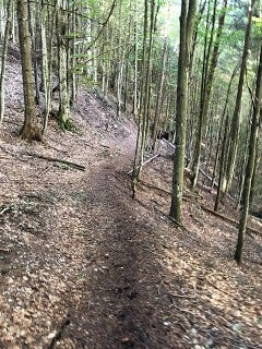
Another 20 minutes and the long traverse headed down into the trees. Again, this area was shaded, which was comforting. I didn’t see a single hiker on this section. As I headed down the terrain changed to more of a forest feel. I saw rock caves here and there and I immediately thought about what lived there. There had to be bobcats around here. It looked like the perfect place to live for them.
The hike down through the deep woods flattened out and then seemed to drag on and on. I was on the flat section for about 25 minutes before I came out into a valley and spotted Rif Bianchet. I approached the hut with mixed feelings. I was so happy to have arrived, but I already started to miss the Dolomites.
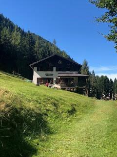
There were people outside the hut sitting at a table and playing cards. I sat down on a bench to collect my thoughts. I referred to my map and my guide book. A certain realization hit me. The hike was essentially over. The rest of the hike was a long switch back road that took me down to civilization and to a main road.
In retrospect, I look at Rif Bianchet as the end of the Alta Via #1. While not technically true, I believe the hut is the perfect ending to an epic trek. The hike down to the main road and bus stop was not fun. Sitting on the bench and feeling like I have essentially completed the Alta Via #1, my heart was not into the trek down the grueling rock filled switchback road.
Nonetheless, I continued on. My knee hurt the entire time, every step worse than the one before. The road was hot, dusty and boring. At this point, I wanted it to be done. Instead of enjoying the trek, I spent my time trying not to further injure my knee. The road was roughly 3 miles long. It was the worst 3 miles of the Alta Via #1, but I realize it was a necessary evil.
Eventually you have to get back to civilization. Perhaps that’s why I hated the hike down to the bus stop so much. It was the end. The end of 4.5 days of being completely detached from reality. The bus stop was not only the end of my trek, but the reintroduction into my normal life; Work, bills, traffic, email and responsibility. The only thing I was looking forward to was seeing my family and friends.
I missed my daughter Maddie and my wife Gwen badly. As approached the end of the trek, that’s what I thought about. I thought about the smile on my daughter’s face when she saw me. It lifted my spirits and dulled my pain.
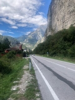
Eventually I reached the bus stop. I sat down on the road and breathed a sigh of relief. I was immediately 10 times more exhausted than I realized. The adrenaline had worn off. The drive to finish the trek had completely faded. Mentally fatigued and physically drained, I waited for my ride.
On day 5 I hiked 11.86 miles in just shy of 7 hours. I gained just 2943 FT in elevation, which is not a surprise given how I spent most of the descending elevation. From my peak elevation of the day to bus stop I descended somewhere around 8000 FT.
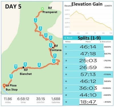
Epilogue
I used the Runkeeper app on my phone to track my trekking progress for 4.5 days. I use it frequently for running, but it also has a walking mode. It tracked my route via GPS, kept track of elevation gains and losses and tracked my split times by mile.
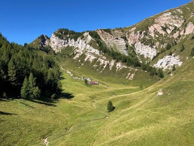
I started it each morning at the start of my hike and stopped each night when I reached my destination hut. I never paused it during my days, so it is a true representation of how long I hiked each day.
In total I trekked 77.61 miles in the Dolomites. My total hiking time clocked in at 44 hours 40 minutes and 43 seconds. My total elevation gain was 21,672 FT. For comparison sake, the elevation gain to climb Mount Everest from base camp to the peak is 11,447.
I climbed the equivalent of almost twice the elevation gain of Everest in 4.5 days. I would never suggest that the doing what I did and climbing Everest are comparable. The hiking at Everest is certainly far more challenging and dangerous. It does however give perspective on the type of hiking you encounter on the Alta Via #1.
I knew going in that this trek was going to be challenging. I knew that 4.5 days was pushing the limits of what I could do physically. In retrospect, I have to say that it was even more challenging than I thought. The hiking was tougher. The days were longer.
The physical beating my body took was worse. Most of all, it was a mental grind. One of my goals for this trip was to test myself mentally and physically. I wanted to see what I was made of. I achieved my goal. In the end I was much more proud of what I overcame mentally than anything I did physically.
In the days after my trip I spent a lot of time trying to recollect my experiences on the Alta Via #1. I tried to think through each day, each hut, each big moment, each bitter defeat. It all seemed to blend together, but certain experiences stood out. My day 1 trek through rain and snow. My day 2 struggles hiking up to Rifugio Lagazuoi.
My day 3 mental breakdown on my way up to Rif Coldai. The cows! My day 4 rejuvenation as I made peace at Coldai Lake and finally my day 5 spiritual awakening as I walked on the tops of mountains. Luckily, I had the foresight to take notes whenever I could. Sometimes I wrote them out during dinner. Other times I used my iPhone to record myself speaking as I walked.
Finally, I took a lot of pictures. The pictures helped me remember my experiences more so than anything else. They stirred up an array of emotions. Joy. Fear. Frustration. Confusion. Excitement. Sorrow. Elation. Contentment. Sadness. They were the puzzle pieces that helped me put this story together.
For that reason, I am happy I lugged that big camera around with me. I am happy I stopped so often to try and capture what I was seeing, what I was experiencing. Of course they are only photos. Just a snapshot in time. The feelings behind those photos are lost to all but me. There’s a certain sadness about that. For the reasons I explained at the beginning of my story, I was intrigued by the idea of a solo trek.
It added variables to my adventure that I would not have experienced had I been with someone else. It was a truly unique experience and I’m glad I did it. The next time I hike in the Dolomites, I won’t be solo. One day I hope to take my daughter to the Dolomites so that she can experience what I have experienced, what my wife has experienced. That will be a special day. There is one thing I know for sure. I will be back to the Dolomites.
Like Our Article? Please Pin it!
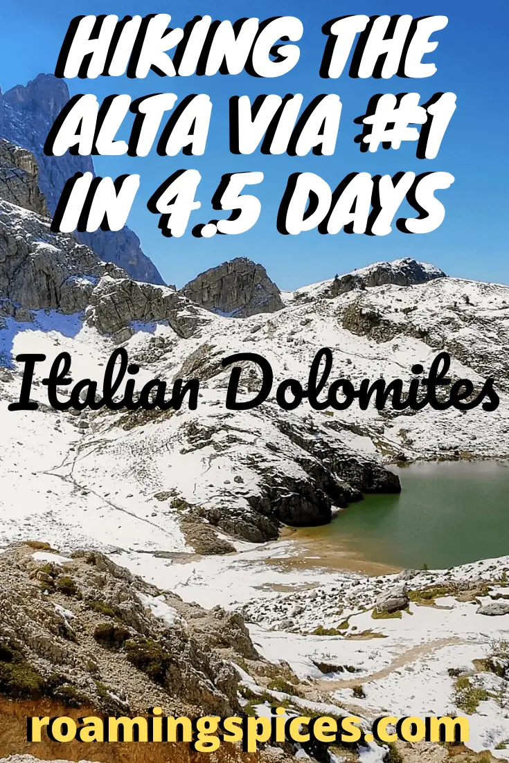

This makes me want to hike in the Dolomites… I think. 🙂
A truly inspiring and detailed story.
Solid write up of something I would not be able to do.
as i read this article i was feeling tired as if i was also taking the trek. i’ve been to the Pragser wildsee (Lago di Braeis) twice and it is beautiful.
Thanks for this report. It was helpful to me as I am thinking about a similar trip in June in the 5-6 day range.
I am curious how you got from VCE airport to the start of the hike, whether you used a service that you would recommend, and how much the cost of the transfer was. Thanks again.
Hi Wes, this post was written by a guy called Michael Maesano who offered it to me as a guest post for publishing on our site, roamingspices. Unfortunately, I am no longer in contact with Michael and therefore will not be able to get you a response to your query. You are not the first person to want further details about this hike. I can only apologise. Hope you can find the information elsewhere. Good luck! Gavin